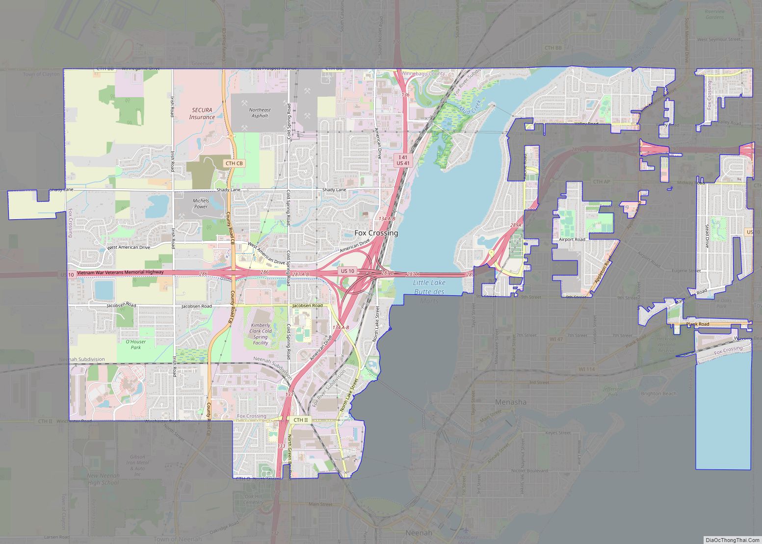
Menasha (/məˈnæʃə/) is a city in Calumet and Winnebago counties in the U.S. state of Wisconsin. The population was 18,268 at the 2020 census. Of this, 15,144 were in Winnebago County, and 2,209 were in Calumet County. The city is located mostly in Winnebago County; only a small portion is in the Town of Harrison in Calumet County. Doty Island is located partially in Menasha. The city’s name comes from the Winnebago word meaning “thorn” or “island”. In the Menominee language, it is known as Menāēhsaeh, meaning “little island”. Menasha is home to the Barlow Planetarium and Weis Earth Science Museum, both housed at the University of Wisconsin-Oshkosh, Fox Cities Campus.
| Name: | Menasha city |
|---|---|
| LSAD Code: | 25 |
| LSAD Description: | city (suffix) |
| State: | Wisconsin |
| County: | Calumet County, Winnebago County |
| Elevation: | 755 ft (230 m) |
| Total Area: | 7.78 sq mi (20.16 km²) |
| Land Area: | 6.05 sq mi (15.66 km²) |
| Water Area: | 1.74 sq mi (4.50 km²) |
| Total Population: | 18,268 |
| Population Density: | 3,021.5/sq mi (7,825.64/km²) |
| ZIP code: | 54952 |
| Area code: | 920 |
| FIPS code: | 5550825 |
| GNISfeature ID: | 1569330 |
| Website: | cityofmenasha-wi.gov |
Online Interactive Map
Click on ![]() to view map in "full screen" mode.
to view map in "full screen" mode.
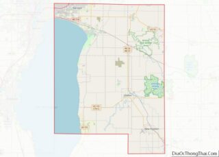
Menasha location map. Where is Menasha city?

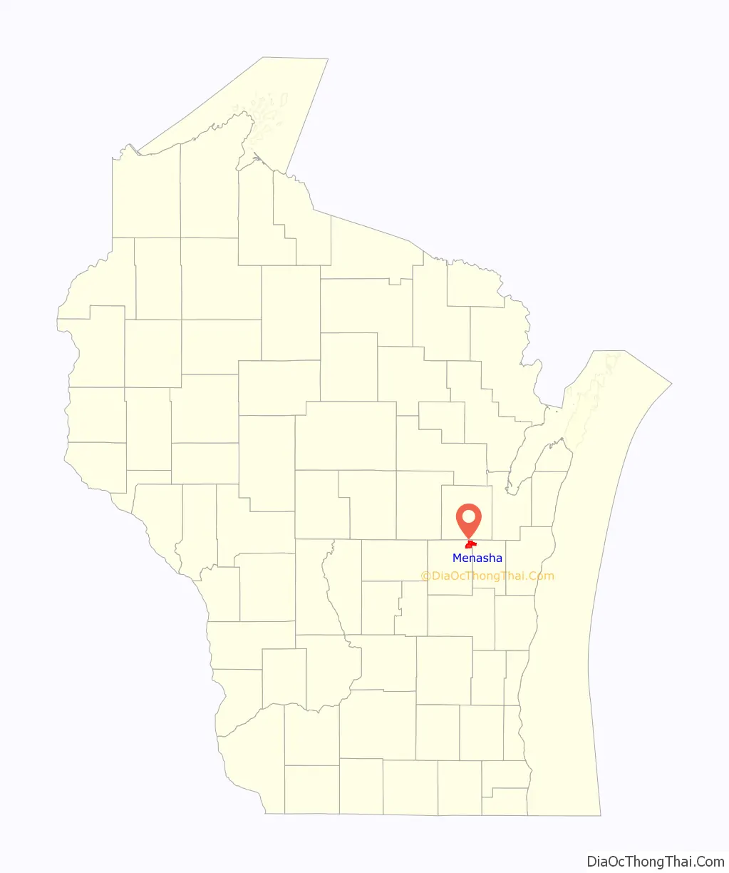
Menasha Road Map

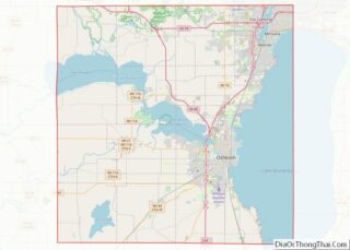
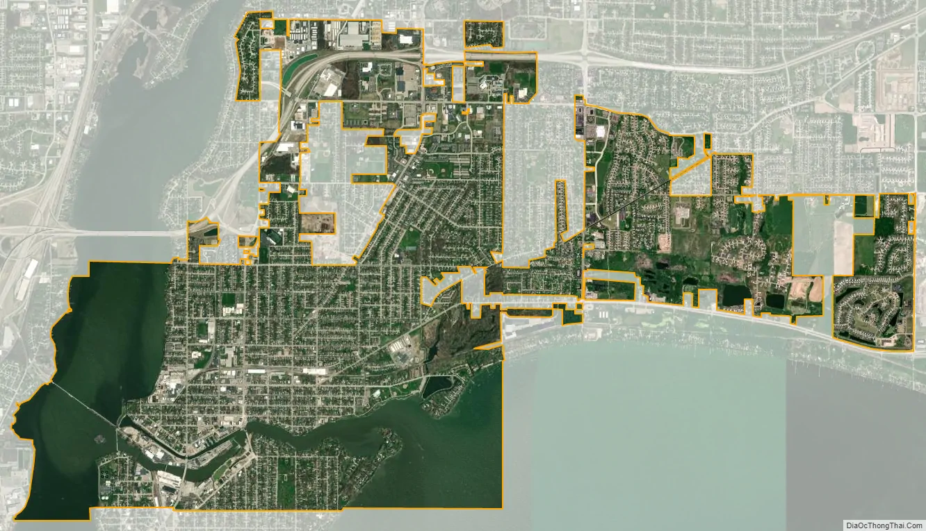
Menasha city Satellite Map
Geography
Menasha is located at 44°13′N 88°26′W / 44.217°N 88.433°W / 44.217; -88.433 (44.2129, −88.4362). According to the United States Census Bureau, the city has a total area of 7.52 square miles (19.48 km), of which, 6.03 square miles (15.62 km) is land and 1.49 square miles (3.86 km) is water.
See also
Map of Wisconsin State and its subdivision:- Adams
- Ashland
- Barron
- Bayfield
- Brown
- Buffalo
- Burnett
- Calumet
- Chippewa
- Clark
- Columbia
- Crawford
- Dane
- Dodge
- Door
- Douglas
- Dunn
- Eau Claire
- Florence
- Fond du Lac
- Forest
- Grant
- Green
- Green Lake
- Iowa
- Iron
- Jackson
- Jefferson
- Juneau
- Kenosha
- Kewaunee
- La Crosse
- Lafayette
- Lake Michigan
- Lake Superior
- Langlade
- Lincoln
- Manitowoc
- Marathon
- Marinette
- Marquette
- Menominee
- Milwaukee
- Monroe
- Oconto
- Oneida
- Outagamie
- Ozaukee
- Pepin
- Pierce
- Polk
- Portage
- Price
- Racine
- Richland
- Rock
- Rusk
- Saint Croix
- Sauk
- Sawyer
- Shawano
- Sheboygan
- Taylor
- Trempealeau
- Vernon
- Vilas
- Walworth
- Washburn
- Washington
- Waukesha
- Waupaca
- Waushara
- Winnebago
- Wood
- Alabama
- Alaska
- Arizona
- Arkansas
- California
- Colorado
- Connecticut
- Delaware
- District of Columbia
- Florida
- Georgia
- Hawaii
- Idaho
- Illinois
- Indiana
- Iowa
- Kansas
- Kentucky
- Louisiana
- Maine
- Maryland
- Massachusetts
- Michigan
- Minnesota
- Mississippi
- Missouri
- Montana
- Nebraska
- Nevada
- New Hampshire
- New Jersey
- New Mexico
- New York
- North Carolina
- North Dakota
- Ohio
- Oklahoma
- Oregon
- Pennsylvania
- Rhode Island
- South Carolina
- South Dakota
- Tennessee
- Texas
- Utah
- Vermont
- Virginia
- Washington
- West Virginia
- Wisconsin
- Wyoming