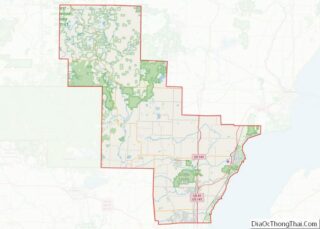
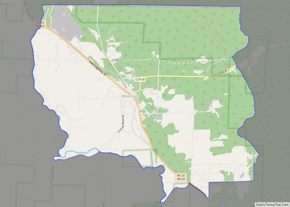
Mountain is an unincorporated census-designated place in Oconto County, Wisconsin, United States. The community is located at the intersection of Wisconsin Highway 32 and Wisconsin Highway 64, in the town of Mountain. It is located at latitude 45.185 and longitude -88.474 and elevation 971 feet (mean sea level). The postal code for Mountain is 54149. As of the 2010 census, its population is 363. Mountain has an area of 6.699 square miles (17.35 km), all of it land.
| Name: | Mountain CDP |
|---|---|
| LSAD Code: | 57 |
| LSAD Description: | CDP (suffix) |
| State: | Wisconsin |
| County: | Oconto County |
| Elevation: | 971 ft (296 m) |
| Total Area: | 6.699 sq mi (17.35 km²) |
| Land Area: | 6.699 sq mi (17.35 km²) |
| Water Area: | 0 sq mi (0 km²) |
| Total Population: | 363 |
| Population Density: | 54/sq mi (21/km²) |
| ZIP code: | 54149 |
| Area code: | 715 & 534 |
| FIPS code: | 5554625 |
| GNISfeature ID: | 1579932 |
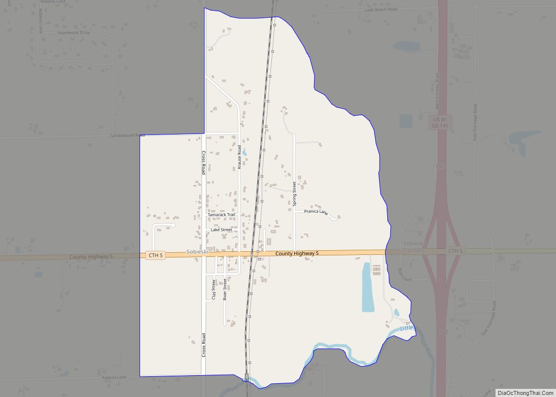
Online Interactive Map
Click on ![]() to view map in "full screen" mode.
to view map in "full screen" mode.
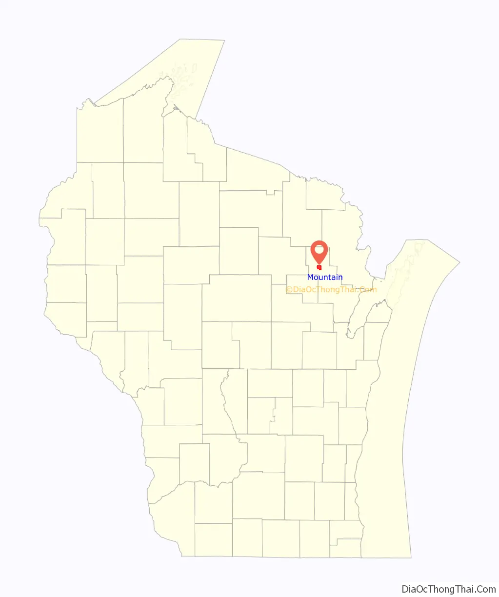
Mountain location map. Where is Mountain CDP?

History
A post office called Mountain has been in operation since 1889. Mountain was platted in 1896. The community was named from the hilly terrain in the area, which early drivers compared to climbing mountains.
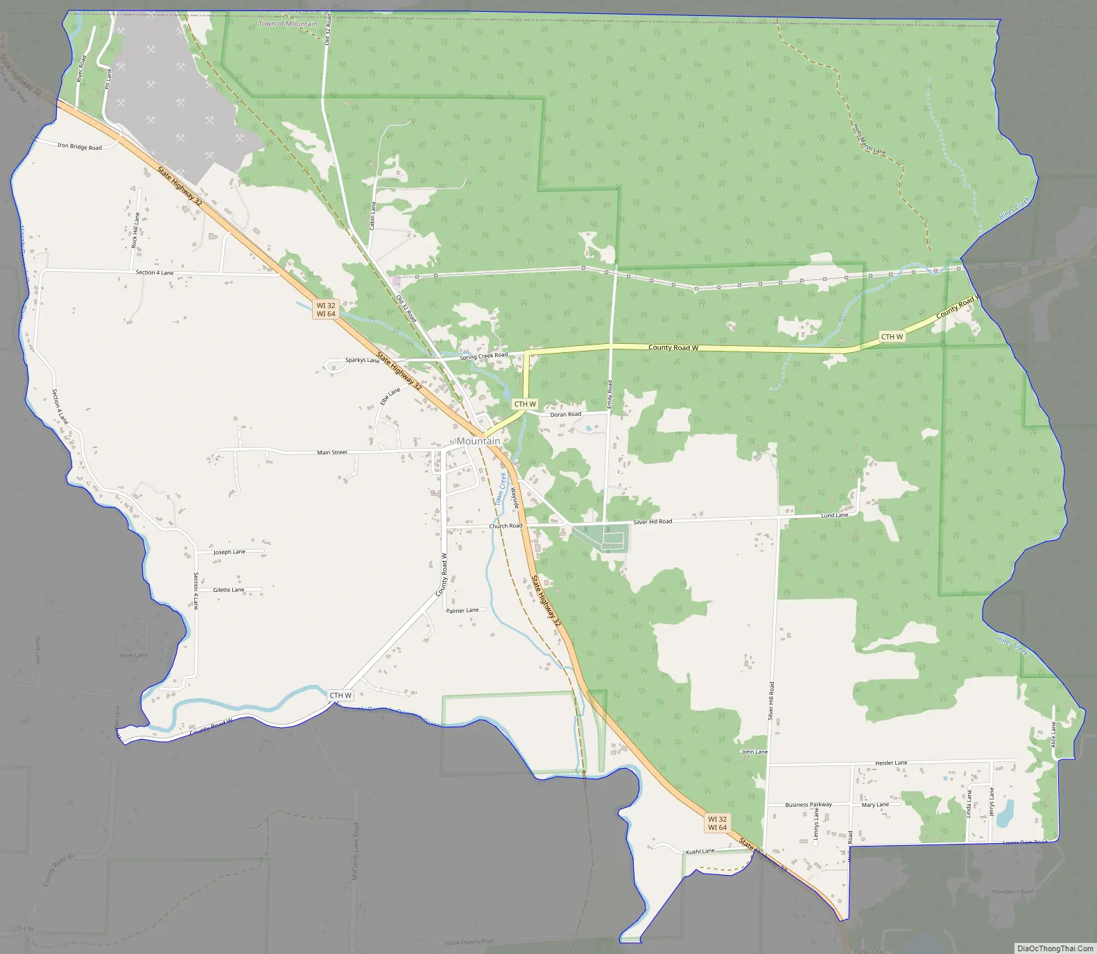
Mountain Road Map
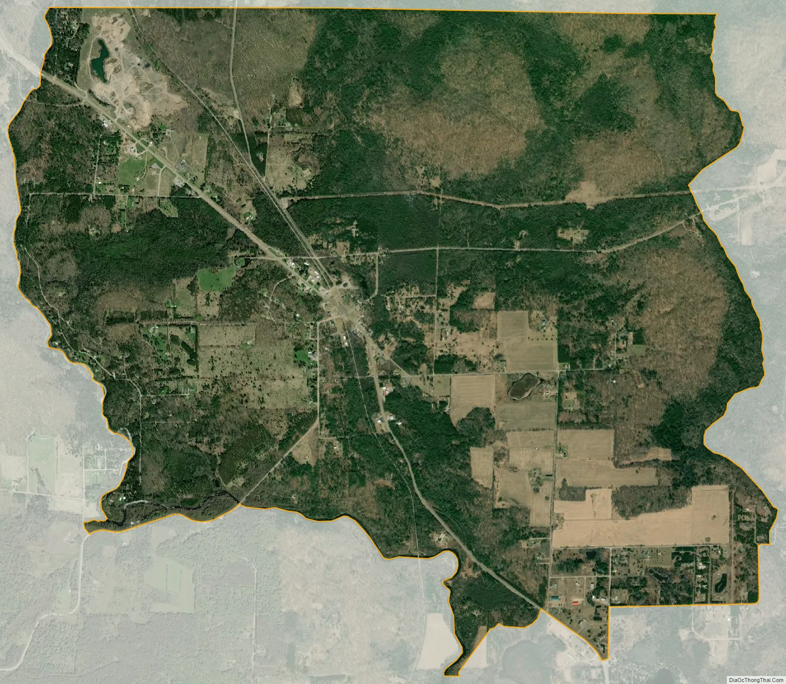
Mountain city Satellite Map
See also
Map of Wisconsin State and its subdivision:- Adams
- Ashland
- Barron
- Bayfield
- Brown
- Buffalo
- Burnett
- Calumet
- Chippewa
- Clark
- Columbia
- Crawford
- Dane
- Dodge
- Door
- Douglas
- Dunn
- Eau Claire
- Florence
- Fond du Lac
- Forest
- Grant
- Green
- Green Lake
- Iowa
- Iron
- Jackson
- Jefferson
- Juneau
- Kenosha
- Kewaunee
- La Crosse
- Lafayette
- Lake Michigan
- Lake Superior
- Langlade
- Lincoln
- Manitowoc
- Marathon
- Marinette
- Marquette
- Menominee
- Milwaukee
- Monroe
- Oconto
- Oneida
- Outagamie
- Ozaukee
- Pepin
- Pierce
- Polk
- Portage
- Price
- Racine
- Richland
- Rock
- Rusk
- Saint Croix
- Sauk
- Sawyer
- Shawano
- Sheboygan
- Taylor
- Trempealeau
- Vernon
- Vilas
- Walworth
- Washburn
- Washington
- Waukesha
- Waupaca
- Waushara
- Winnebago
- Wood
- Alabama
- Alaska
- Arizona
- Arkansas
- California
- Colorado
- Connecticut
- Delaware
- District of Columbia
- Florida
- Georgia
- Hawaii
- Idaho
- Illinois
- Indiana
- Iowa
- Kansas
- Kentucky
- Louisiana
- Maine
- Maryland
- Massachusetts
- Michigan
- Minnesota
- Mississippi
- Missouri
- Montana
- Nebraska
- Nevada
- New Hampshire
- New Jersey
- New Mexico
- New York
- North Carolina
- North Dakota
- Ohio
- Oklahoma
- Oregon
- Pennsylvania
- Rhode Island
- South Carolina
- South Dakota
- Tennessee
- Texas
- Utah
- Vermont
- Virginia
- Washington
- West Virginia
- Wisconsin
- Wyoming