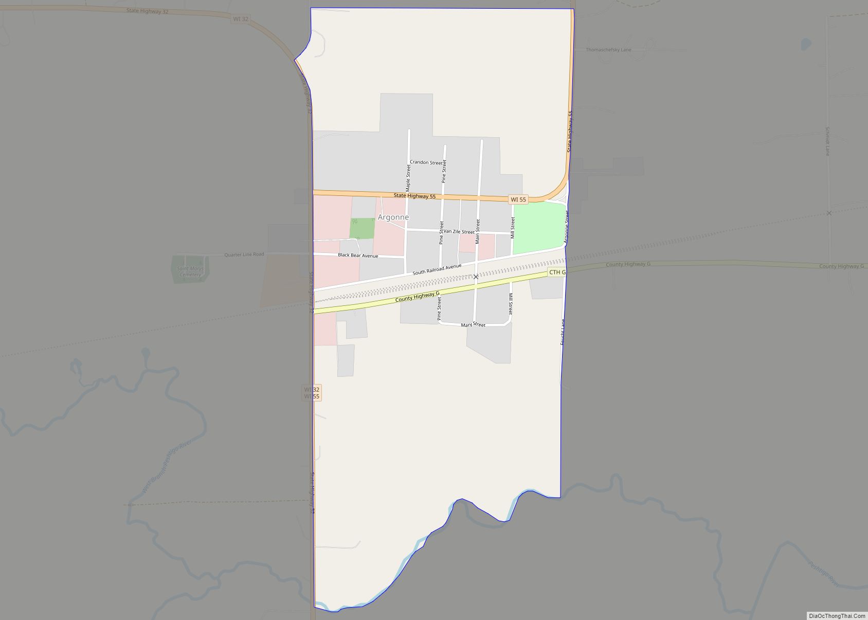
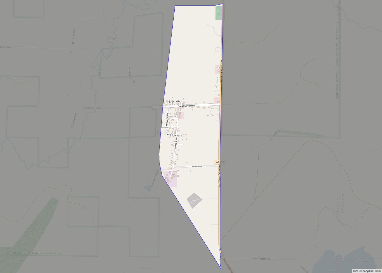
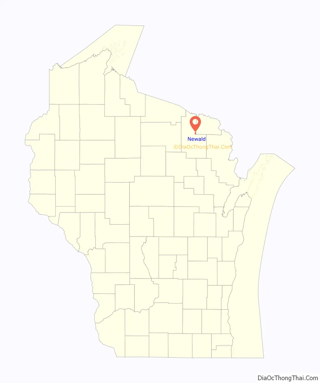
Newald (also Ross) is an unincorporated census-designated place in the town of Ross, Forest County, Wisconsin, United States. Newald is located near Wisconsin Highway 139 15 miles (24 km) northeast of Crandon. As of the 2020 census, its population was 70.
| Name: | Newald CDP |
|---|---|
| LSAD Code: | 57 |
| LSAD Description: | CDP (suffix) |
| State: | Wisconsin |
| County: | Forest County |
| Elevation: | 1,572 ft (479 m) |
| Total Area: | 0.820 sq mi (2.12 km²) |
| Land Area: | 0.820 sq mi (2.12 km²) |
| Water Area: | 0 sq mi (0 km²) |
| Total Population: | 70 |
| Population Density: | 85/sq mi (33/km²) |
| Area code: | 715 & 534 |
| FIPS code: | 5556250 |
| GNISfeature ID: | 1580002 |
Online Interactive Map
Click on ![]() to view map in "full screen" mode.
to view map in "full screen" mode.
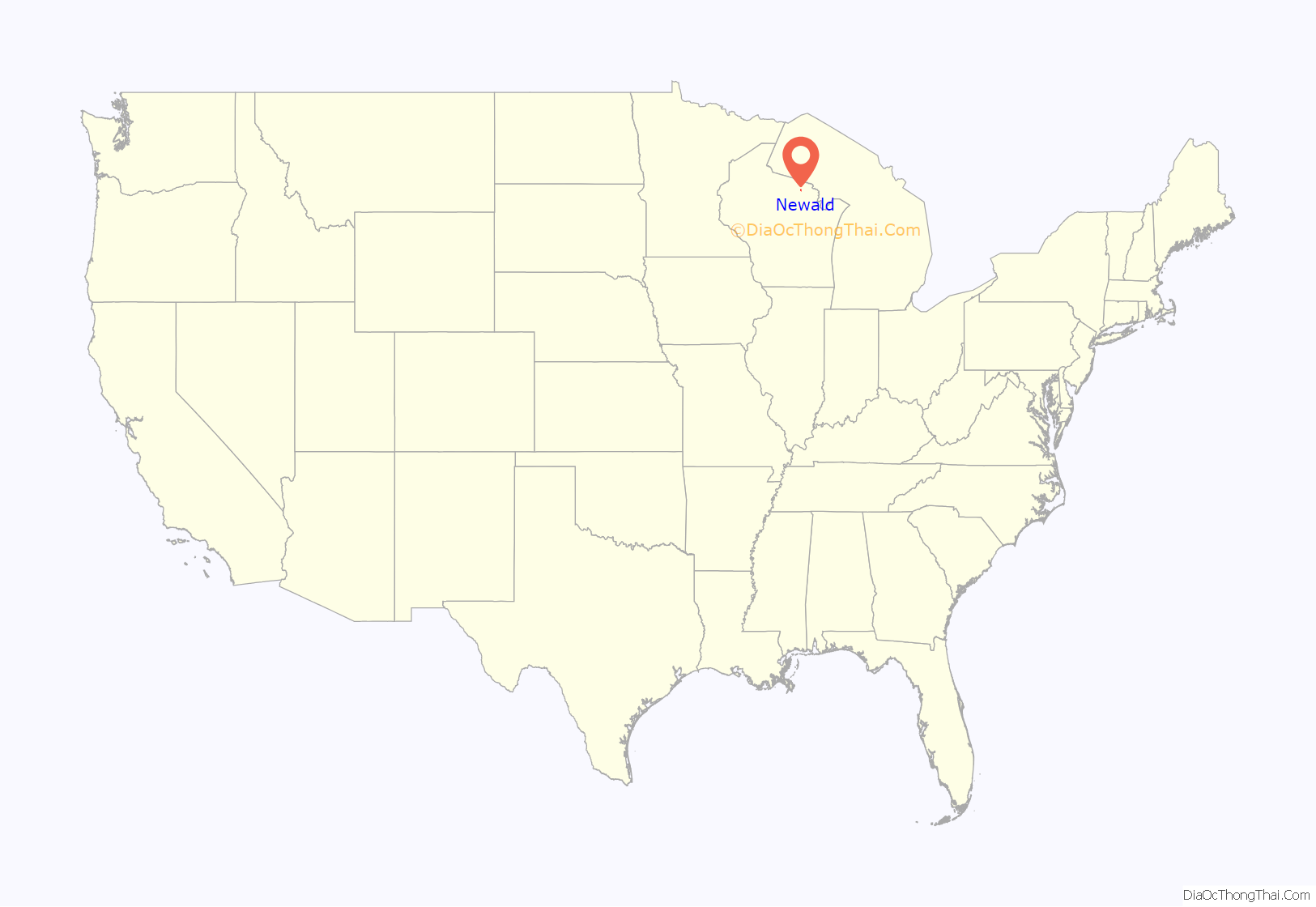
Newald location map. Where is Newald CDP?
History
Newald was originally called Ross, for Charles Ross, a pioneer settler, and under the latter name was platted in 1905. The community was renamed Newald in 1906 in honor of a local landowner. A post office was established as Newald in 1905, and remained in operation until it was discontinued in 1985.
“A car of building material, including camp supplies, teams, sleighs, etc., was loaded out from here last Tuesday, enroute for the new town of Newald, some ten to twelve miles north of Carver, and on the line from Laona to Sauders now under course of construction. Messrs. Newald [ Leopold J Newald ] and Isaacson of Gillett are the promoters of this new proposed metropolis of the north. A hotel, store, mill, blacksmith shop and of course last but not least, a saloon, are already arranged for and will be in operation at the earliest possible time. E. H. Greenthal, a young, level headed business man, well known here, will have immediate personal charge of the new town’s affairs, he accompanying the first consignment of material for this new Eldorado, Tuesday.” Source: – Gillett Times – Oconto Falls Herald January 27, 1905
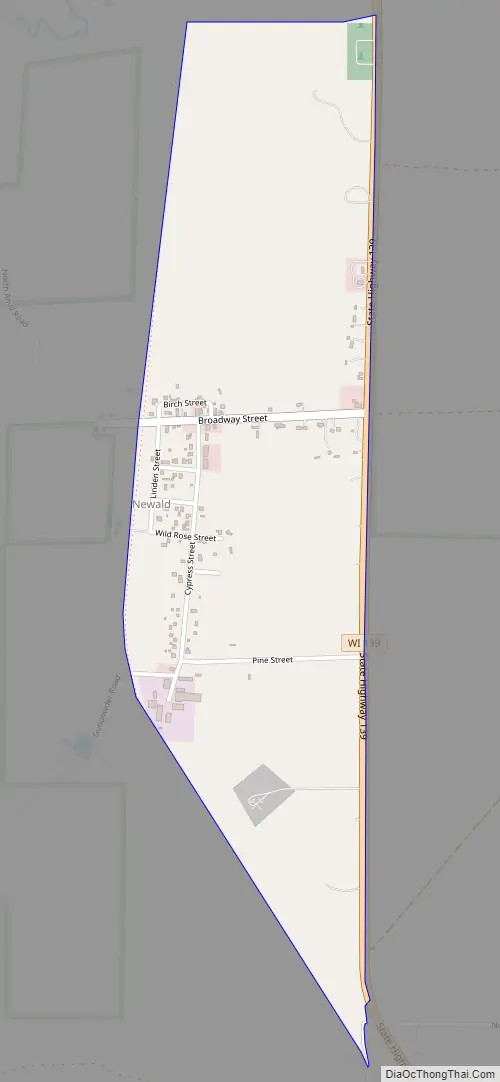
Newald Road Map
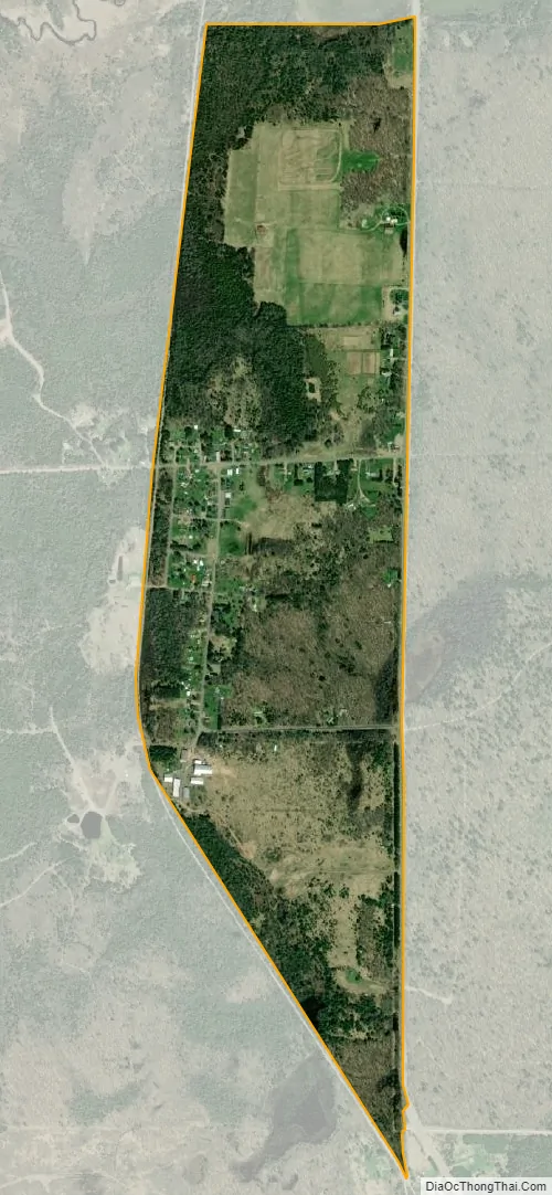
Newald city Satellite Map
See also
Map of Wisconsin State and its subdivision:- Adams
- Ashland
- Barron
- Bayfield
- Brown
- Buffalo
- Burnett
- Calumet
- Chippewa
- Clark
- Columbia
- Crawford
- Dane
- Dodge
- Door
- Douglas
- Dunn
- Eau Claire
- Florence
- Fond du Lac
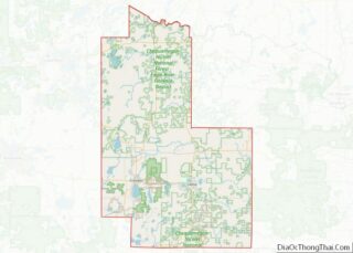
- Forest
- Grant
- Green
- Green Lake
- Iowa
- Iron
- Jackson
- Jefferson
- Juneau
- Kenosha
- Kewaunee
- La Crosse
- Lafayette
- Lake Michigan
- Lake Superior
- Langlade
- Lincoln
- Manitowoc
- Marathon
- Marinette
- Marquette
- Menominee
- Milwaukee
- Monroe
- Oconto
- Oneida
- Outagamie
- Ozaukee
- Pepin
- Pierce
- Polk
- Portage
- Price
- Racine
- Richland
- Rock
- Rusk
- Saint Croix
- Sauk
- Sawyer
- Shawano
- Sheboygan
- Taylor
- Trempealeau
- Vernon
- Vilas
- Walworth
- Washburn
- Washington
- Waukesha
- Waupaca
- Waushara
- Winnebago
- Wood
- Alabama
- Alaska
- Arizona
- Arkansas
- California
- Colorado
- Connecticut
- Delaware
- District of Columbia
- Florida
- Georgia
- Hawaii
- Idaho
- Illinois
- Indiana
- Iowa
- Kansas
- Kentucky
- Louisiana
- Maine
- Maryland
- Massachusetts
- Michigan
- Minnesota
- Mississippi
- Missouri
- Montana
- Nebraska
- Nevada
- New Hampshire
- New Jersey
- New Mexico
- New York
- North Carolina
- North Dakota
- Ohio
- Oklahoma
- Oregon
- Pennsylvania
- Rhode Island
- South Carolina
- South Dakota
- Tennessee
- Texas
- Utah
- Vermont
- Virginia
- Washington
- West Virginia
- Wisconsin
- Wyoming