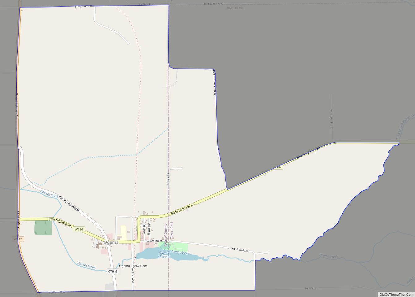
Prentice is a town in Price County, Wisconsin, United States. The population was 479 at the 2000 census. The village of Prentice and the unincorporated community of Pennington are located within the town.
| Name: | Prentice village |
|---|---|
| LSAD Code: | 47 |
| LSAD Description: | village (suffix) |
| State: | Wisconsin |
| County: | Price County |
| FIPS code: | 5565325 |
Online Interactive Map
Click on ![]() to view map in "full screen" mode.
to view map in "full screen" mode.
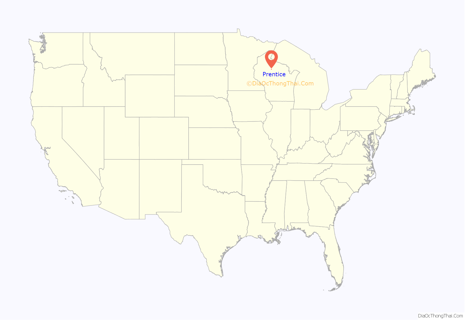
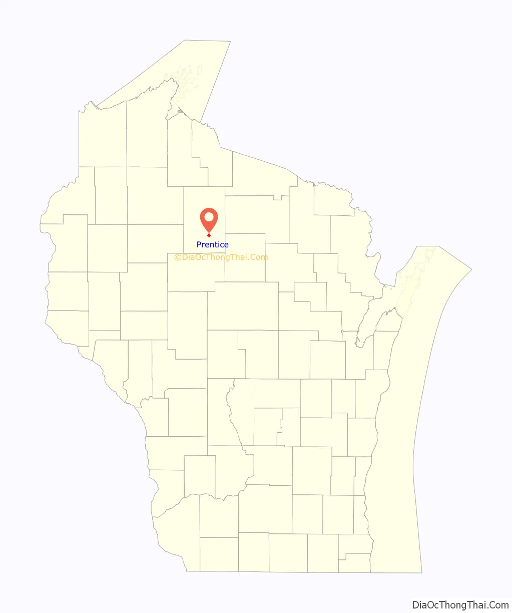
Prentice location map. Where is Prentice village?
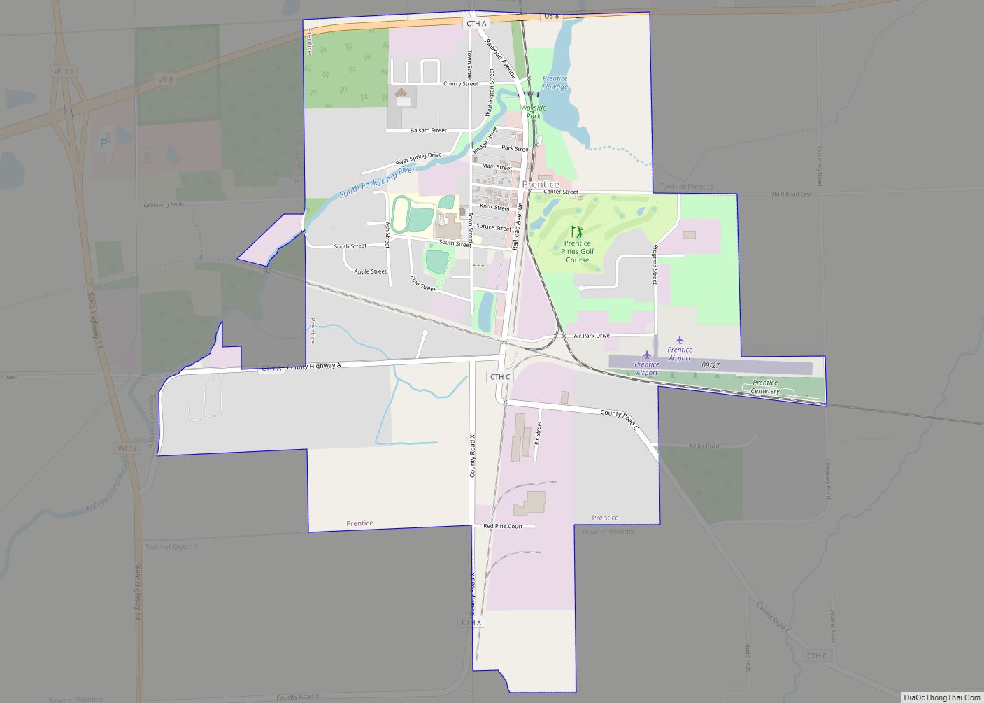
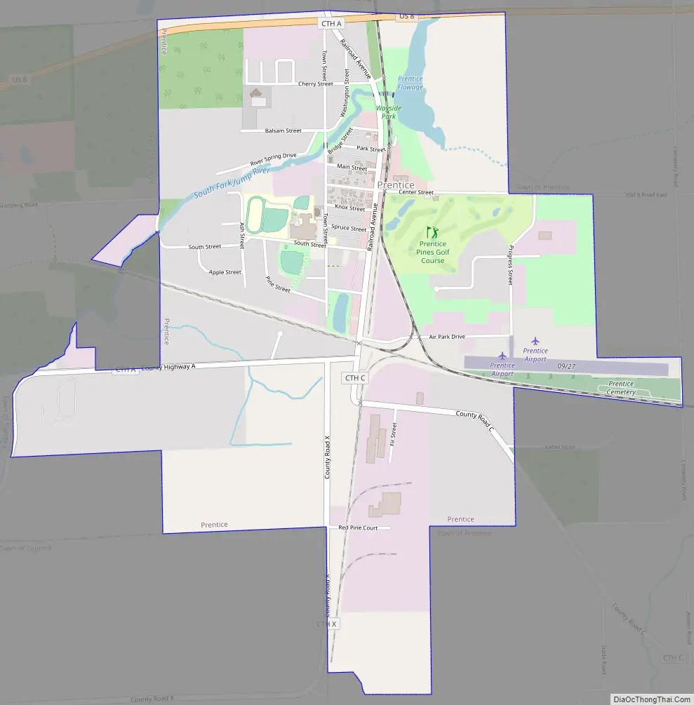
Prentice Road Map
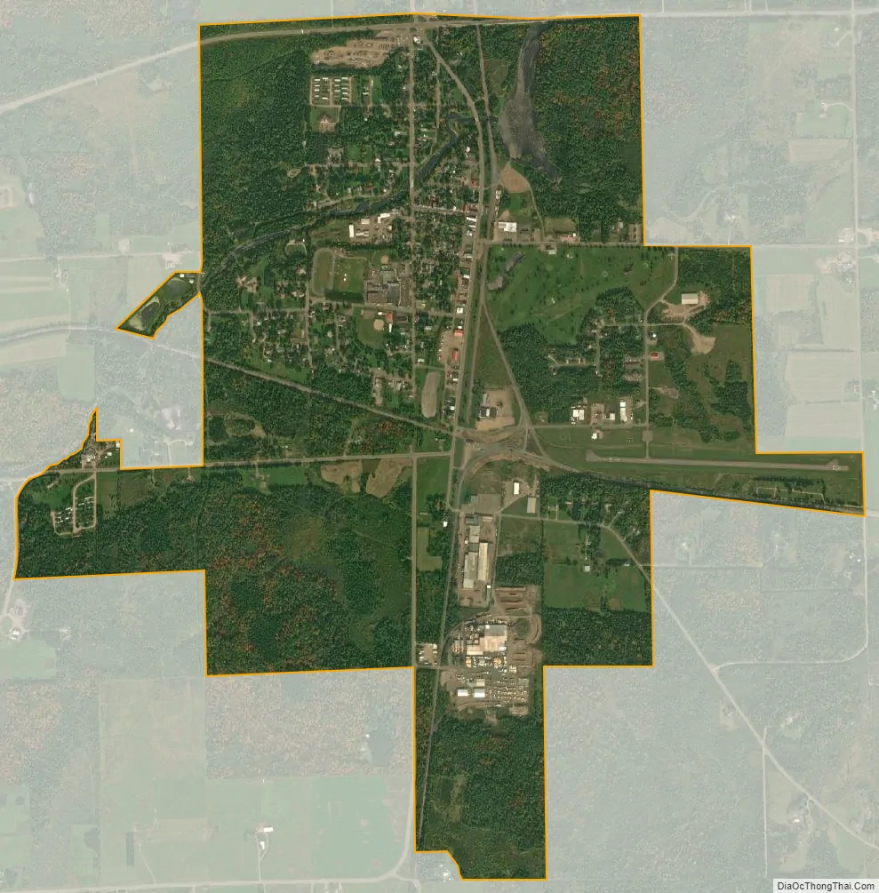
Prentice city Satellite Map
Geography
The town is irregularly shaped, consisting of a typically rectangular shape to the east of the Village of Prentice adjoined to an irregular rectangular slab west of the village, north of the Town of Ogema, east of the Town of Catawba, and south of the Town of Hackett.
According to the United States Census Bureau, the town has a total area of 69.5 square miles (180.1 km), of which, 69.3 square miles (179.6 km) of it is land and 0.2 square miles (0.5 km) of it (0.26%) is water.
The northern trailhead of Wisconsin’s Pine Line Trail, an unpaved, multiuse rail-trail extending just over 26 miles to Medford in the south, lies just outside Prentice.
Airport
Prentice is served by the Prentice Airport (5N2). Located one mile east of the village, the airport handles approximately 1,500 operations per year, with roughly 99% general aviation and 1% air taxi. The airport has a 3,250 foot asphalt runway (Runway 9-27).
See also
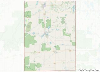
Map of Wisconsin State and its subdivision:- Adams
- Ashland
- Barron
- Bayfield
- Brown
- Buffalo
- Burnett
- Calumet
- Chippewa
- Clark
- Columbia
- Crawford
- Dane
- Dodge
- Door
- Douglas
- Dunn
- Eau Claire
- Florence
- Fond du Lac
- Forest
- Grant
- Green
- Green Lake
- Iowa
- Iron
- Jackson
- Jefferson
- Juneau
- Kenosha
- Kewaunee
- La Crosse
- Lafayette
- Lake Michigan
- Lake Superior
- Langlade
- Lincoln
- Manitowoc
- Marathon
- Marinette
- Marquette
- Menominee
- Milwaukee
- Monroe
- Oconto
- Oneida
- Outagamie
- Ozaukee
- Pepin
- Pierce
- Polk
- Portage
- Price
- Racine
- Richland
- Rock
- Rusk
- Saint Croix
- Sauk
- Sawyer
- Shawano
- Sheboygan
- Taylor
- Trempealeau
- Vernon
- Vilas
- Walworth
- Washburn
- Washington
- Waukesha
- Waupaca
- Waushara
- Winnebago
- Wood
- Alabama
- Alaska
- Arizona
- Arkansas
- California
- Colorado
- Connecticut
- Delaware
- District of Columbia
- Florida
- Georgia
- Hawaii
- Idaho
- Illinois
- Indiana
- Iowa
- Kansas
- Kentucky
- Louisiana
- Maine
- Maryland
- Massachusetts
- Michigan
- Minnesota
- Mississippi
- Missouri
- Montana
- Nebraska
- Nevada
- New Hampshire
- New Jersey
- New Mexico
- New York
- North Carolina
- North Dakota
- Ohio
- Oklahoma
- Oregon
- Pennsylvania
- Rhode Island
- South Carolina
- South Dakota
- Tennessee
- Texas
- Utah
- Vermont
- Virginia
- Washington
- West Virginia
- Wisconsin
- Wyoming