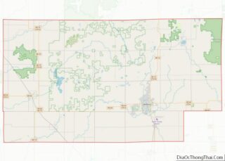
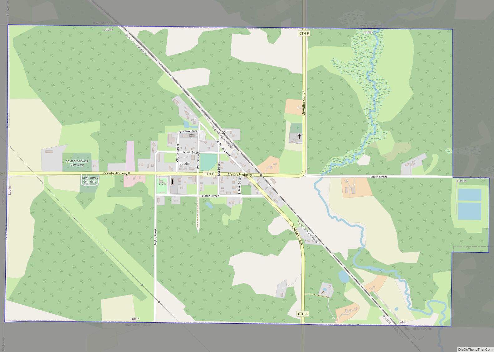
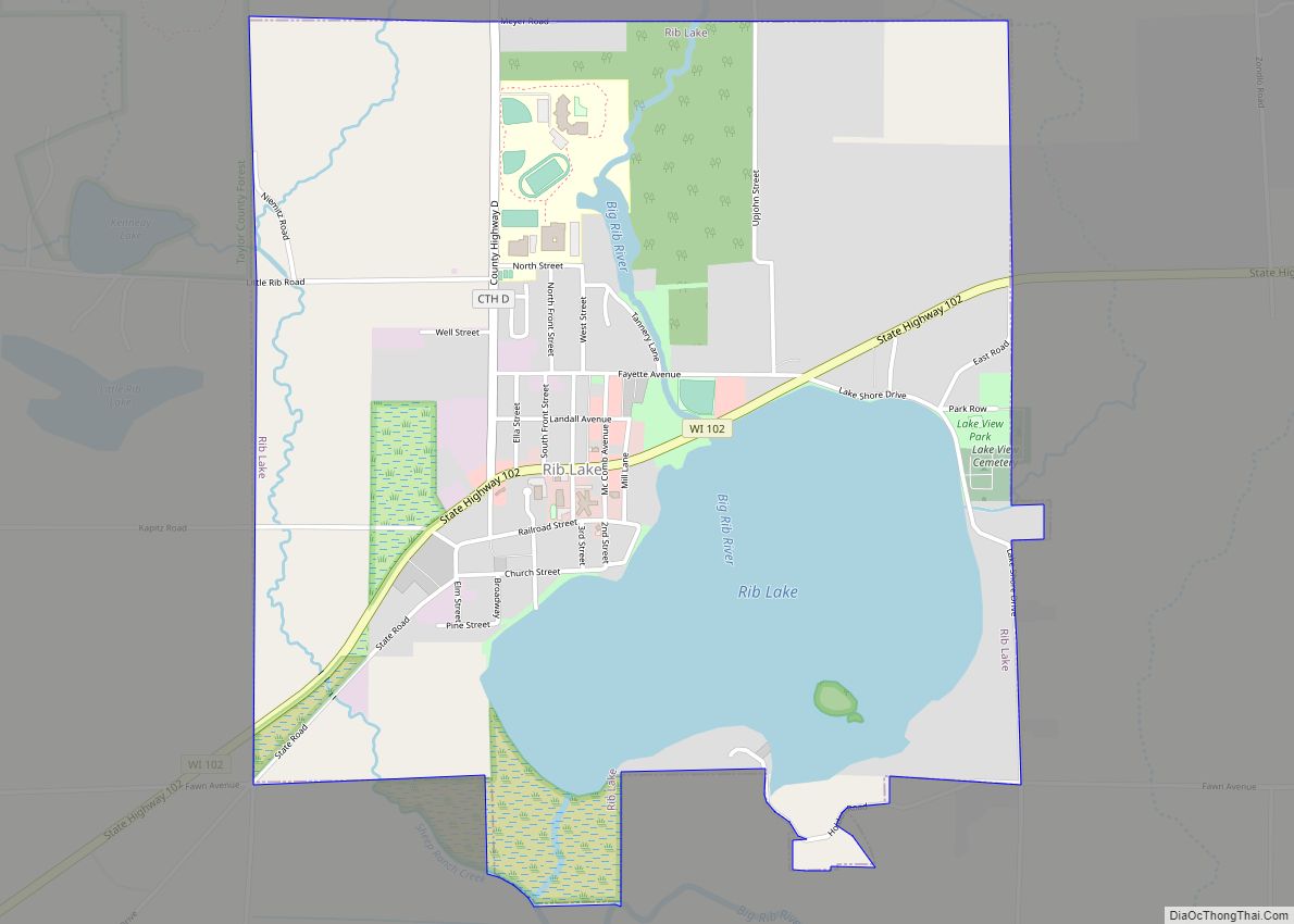
Rib Lake is a town in Taylor County, Wisconsin, United States. The population was 768 at the 2000 census. The village of Rib Lake is completely surrounded by the town.
| Name: | Rib Lake village |
|---|---|
| LSAD Code: | 47 |
| LSAD Description: | village (suffix) |
| State: | Wisconsin |
| County: | Taylor County |
| Elevation: | 1,581 ft (482 m) |
| Total Area: | 74.9 sq mi (193.9 km²) |
| Land Area: | 74.0 sq mi (191.7 km²) |
| Water Area: | 0.9 sq mi (2.2 km²) |
| Total Population: | 768 |
| Population Density: | 10.4/sq mi (2.4/km²) |
| Area code: | 715 & 534 |
| FIPS code: | 5567275 |
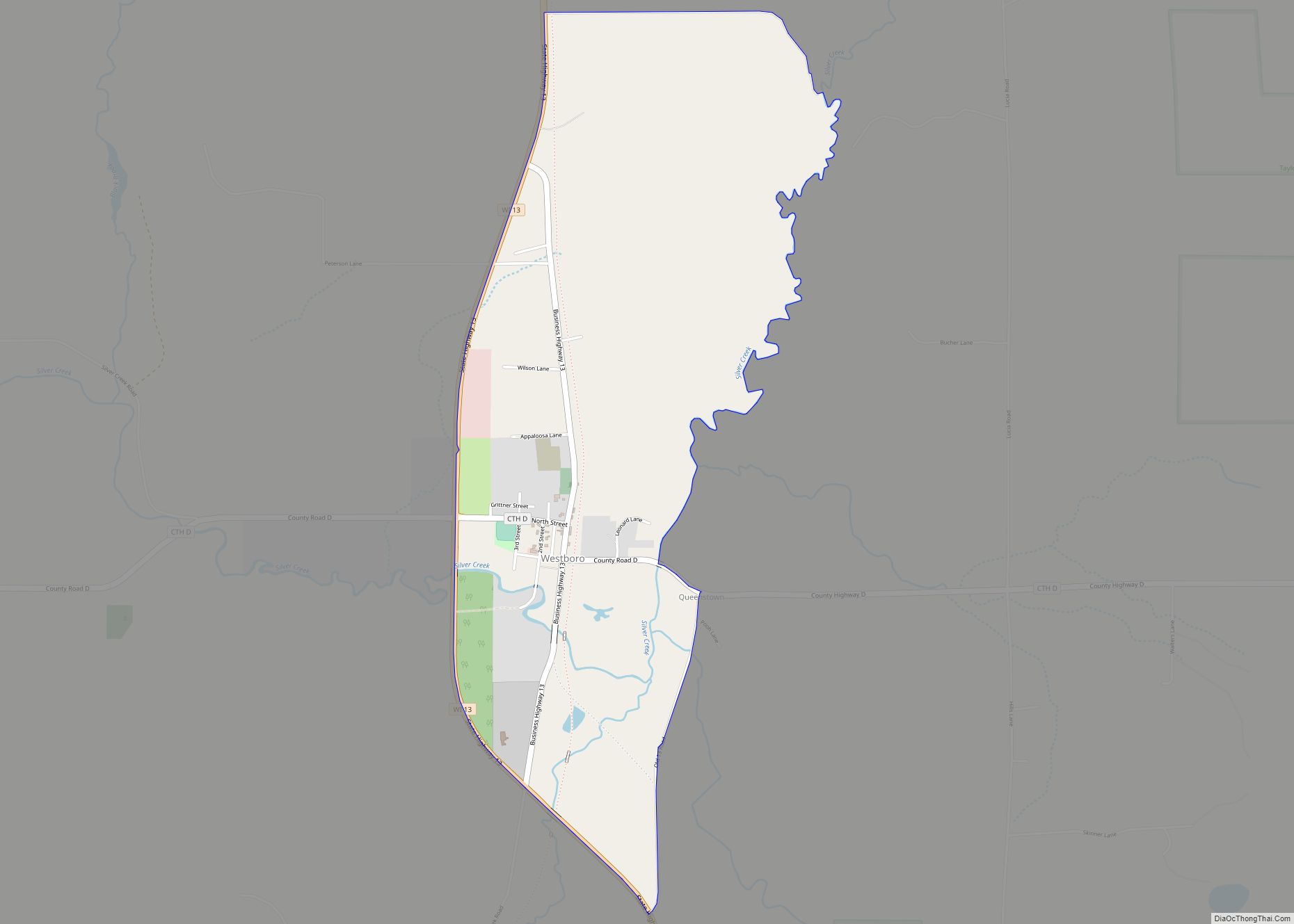
Online Interactive Map
Click on ![]() to view map in "full screen" mode.
to view map in "full screen" mode.
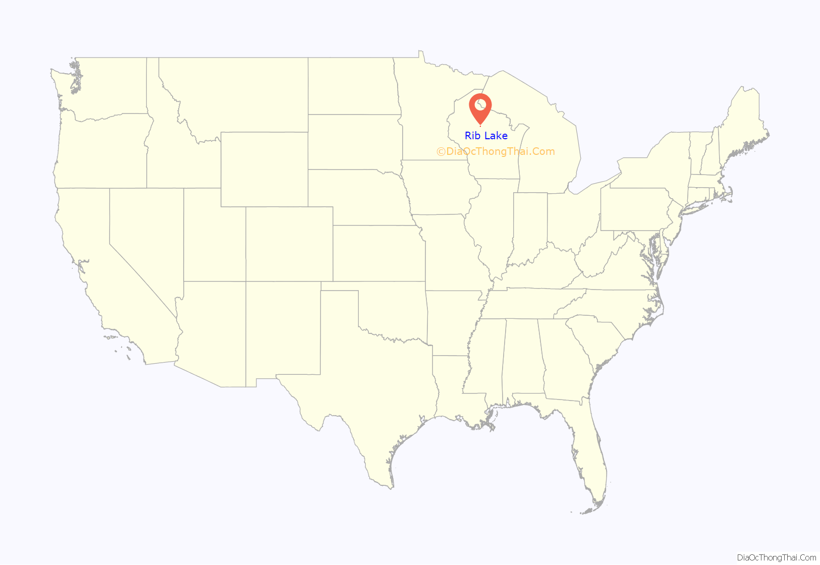
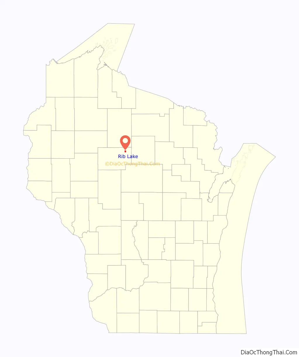
Rib Lake location map. Where is Rib Lake village?
History
Most of the edges of the six by six squares that would become Rib Lake were surveyed in October 1861 by a crew working for the U.S. government. In early 1862, the same crew marked all the section corners in the township, walking through the woods and swamps, measuring with chain and compass. When done, the deputy surveyor filed this general description for the six by six square that now contains the village of Rib Lake:
The area was logged from the 1880s on, with a large mill on the banks of Rib Lake. Bark from the hemlock mentioned above was another important early product, supplying the tannery in the village of Rib Lake. A good portion of the town is still forest, much of it Taylor County Forest.
Rustic Road #1, a scenic drive that winds over hills and around lakes and Wisconsin’s first official Rustic Road, was dedicated in 1975.
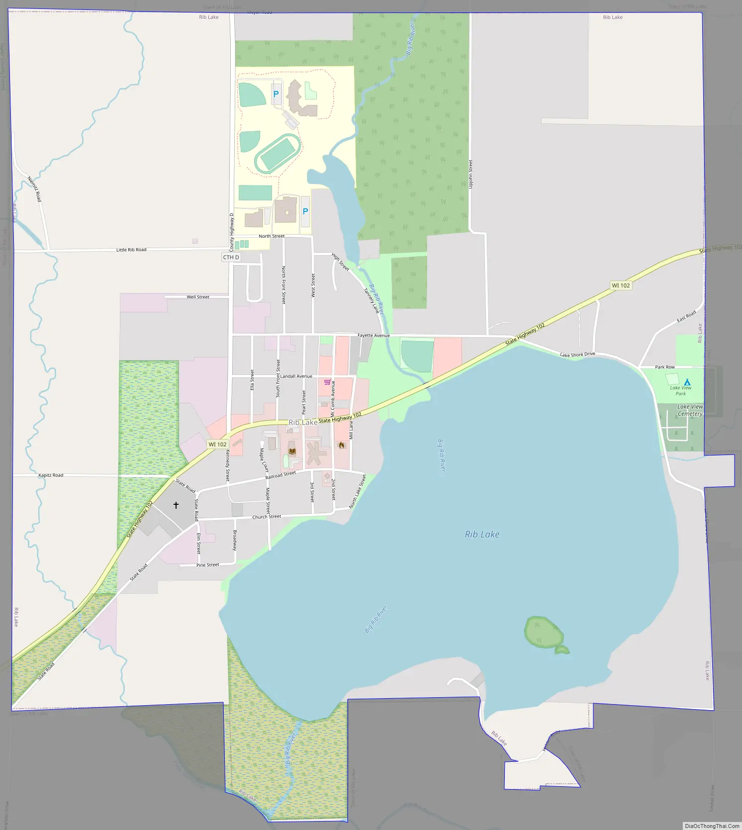
Rib Lake Road Map
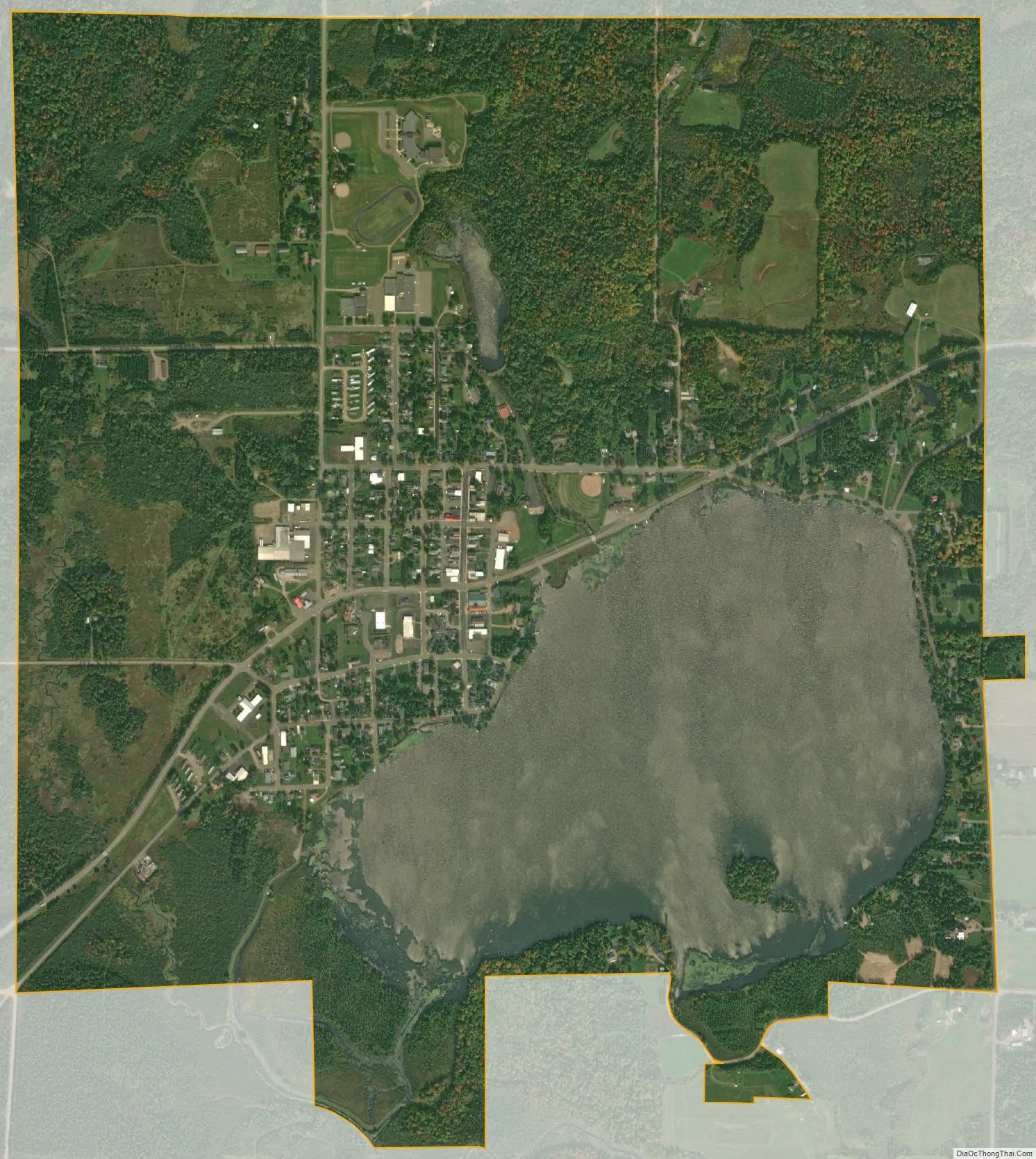
Rib Lake city Satellite Map
Geography
According to the United States Census Bureau, the town has a total area of 74.9 square miles (193.9 km), of which 74.0 square miles (191.7 km) is land and 0.9 square miles (2.2 km) (1.14%) is water.
Much of Rib Lake is hilly, with small glacial lakes. It lies within the Perkinstown terminal moraine, which is described under Taylor County.
See also
Map of Wisconsin State and its subdivision:- Adams
- Ashland
- Barron
- Bayfield
- Brown
- Buffalo
- Burnett
- Calumet
- Chippewa
- Clark
- Columbia
- Crawford
- Dane
- Dodge
- Door
- Douglas
- Dunn
- Eau Claire
- Florence
- Fond du Lac
- Forest
- Grant
- Green
- Green Lake
- Iowa
- Iron
- Jackson
- Jefferson
- Juneau
- Kenosha
- Kewaunee
- La Crosse
- Lafayette
- Lake Michigan
- Lake Superior
- Langlade
- Lincoln
- Manitowoc
- Marathon
- Marinette
- Marquette
- Menominee
- Milwaukee
- Monroe
- Oconto
- Oneida
- Outagamie
- Ozaukee
- Pepin
- Pierce
- Polk
- Portage
- Price
- Racine
- Richland
- Rock
- Rusk
- Saint Croix
- Sauk
- Sawyer
- Shawano
- Sheboygan
- Taylor
- Trempealeau
- Vernon
- Vilas
- Walworth
- Washburn
- Washington
- Waukesha
- Waupaca
- Waushara
- Winnebago
- Wood
- Alabama
- Alaska
- Arizona
- Arkansas
- California
- Colorado
- Connecticut
- Delaware
- District of Columbia
- Florida
- Georgia
- Hawaii
- Idaho
- Illinois
- Indiana
- Iowa
- Kansas
- Kentucky
- Louisiana
- Maine
- Maryland
- Massachusetts
- Michigan
- Minnesota
- Mississippi
- Missouri
- Montana
- Nebraska
- Nevada
- New Hampshire
- New Jersey
- New Mexico
- New York
- North Carolina
- North Dakota
- Ohio
- Oklahoma
- Oregon
- Pennsylvania
- Rhode Island
- South Carolina
- South Dakota
- Tennessee
- Texas
- Utah
- Vermont
- Virginia
- Washington
- West Virginia
- Wisconsin
- Wyoming