Shiocton is a village in Outagamie County, Wisconsin, United States. The population was 921 at the 2010 census. It is wholly surrounded by the Town of Bovina.
| Name: | Shiocton village |
|---|---|
| LSAD Code: | 47 |
| LSAD Description: | village (suffix) |
| State: | Wisconsin |
| County: | Outagamie County |
| Founded: | 1850 |
| Incorporated: | 1903 |
| Elevation: | 768 ft (234 m) |
| Total Area: | 1.67 sq mi (4.32 km²) |
| Land Area: | 1.56 sq mi (4.05 km²) |
| Water Area: | 0.10 sq mi (0.27 km²) |
| Total Population: | 921 |
| Population Density: | 584.13/sq mi (225.49/km²) |
| Area code: | 920 |
| FIPS code: | 5573625 |
| GNISfeature ID: | 1574055 |
| Website: | http://www.shiocton.org |
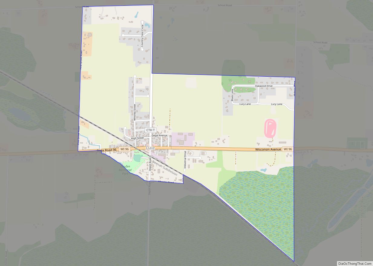
Online Interactive Map
Click on ![]() to view map in "full screen" mode.
to view map in "full screen" mode.
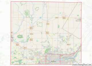
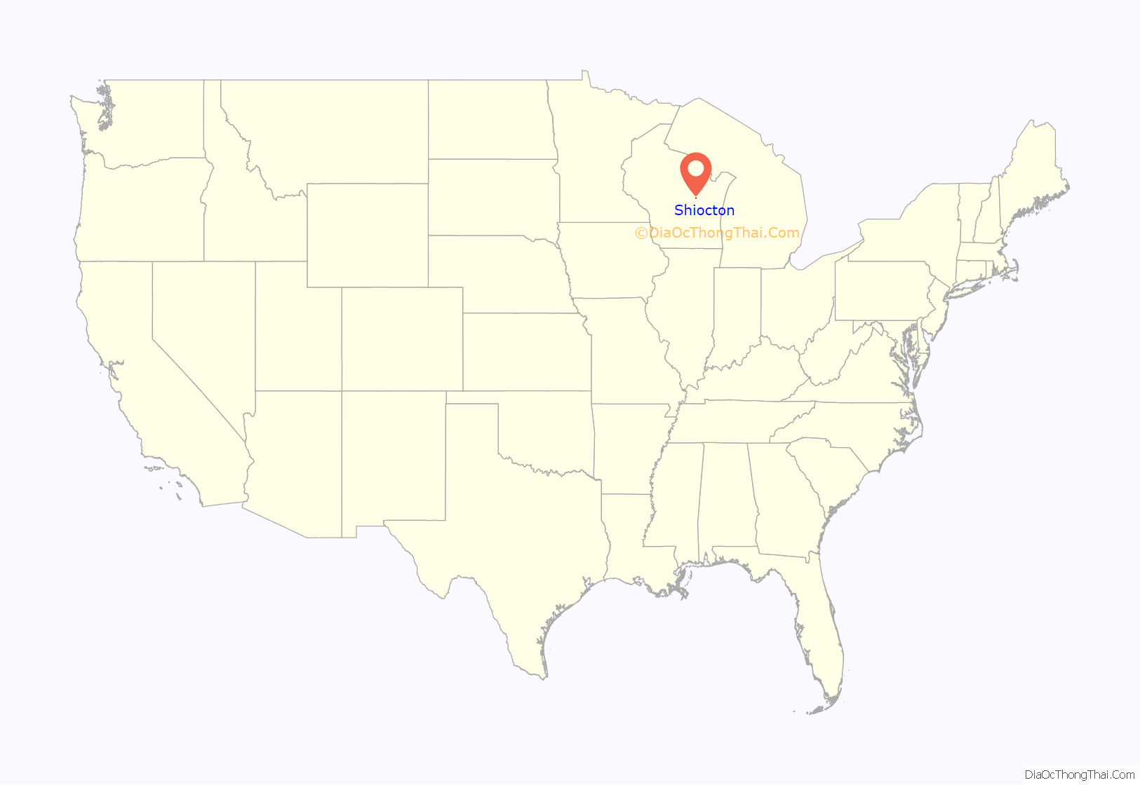
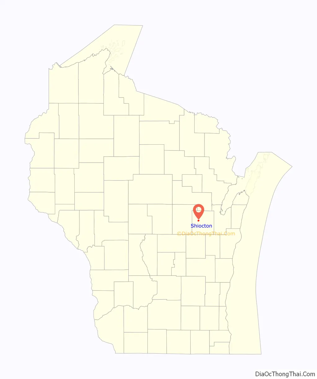
Shiocton location map. Where is Shiocton village?
History
In the Menominee language, this place is known as Māēnomehsāyak, “wild rice along the banks”. The name refers to the wild rice which is a traditional staple of the diets of many Native Americans living in the area, particularly the Menominee, whose name in English is ultimately from an Ojibwe word meaning “people of the wild rice”. The Menominee ceded this territory to the United States in the 1836 Treaty of the Cedars, after years of negotiations about how to accommodate the Oneida, Stockbridge-Munsee, and Brothertown peoples who were being removed from New York to Wisconsin.
In English, Shiocton was originally named Jordan’s Landing, or Jordanville, likely attributable to Woodford D. Jordan, one of the two first white settlers of the area. The community being referred to as Shiocton came later.
Shiocton Road Map
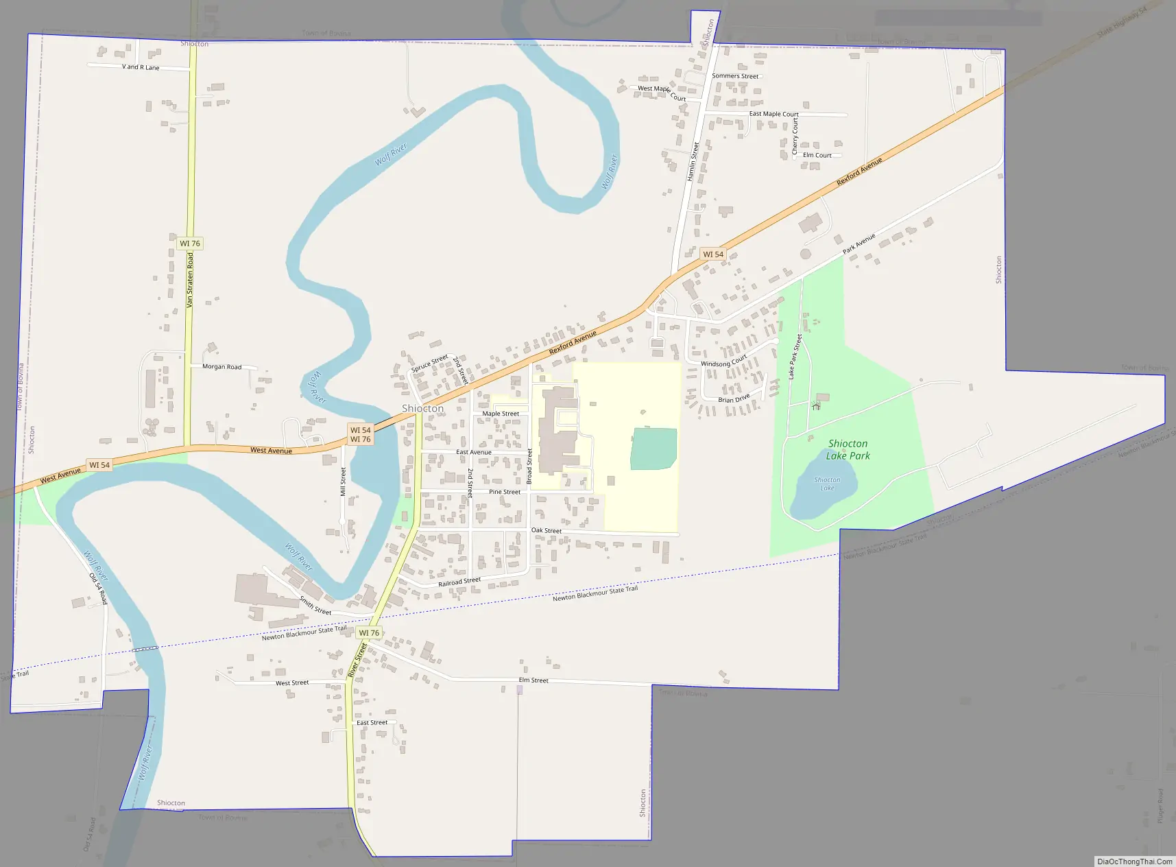
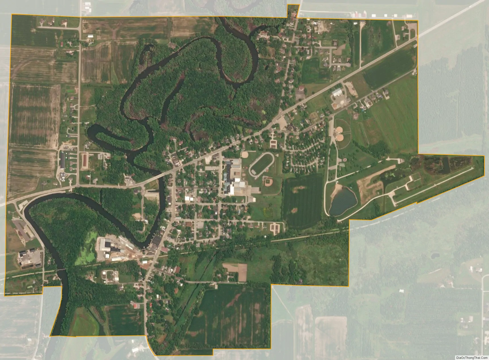
Shiocton city Satellite Map
Geography
Shiocton is located at 44°26′36″N 88°34′42″W / 44.44333°N 88.57833°W / 44.44333; -88.57833 (44.443363, -88.578269).
According to the United States Census Bureau, the village has a total area of 1.66 square miles (4.30 km), of which, 1.56 square miles (4.04 km) of it is land and 0.10 square miles (0.26 km) is water.
The Shioc River flows through the village and into the Wolf River.
See also
Map of Wisconsin State and its subdivision:- Adams
- Ashland
- Barron
- Bayfield
- Brown
- Buffalo
- Burnett
- Calumet
- Chippewa
- Clark
- Columbia
- Crawford
- Dane
- Dodge
- Door
- Douglas
- Dunn
- Eau Claire
- Florence
- Fond du Lac
- Forest
- Grant
- Green
- Green Lake
- Iowa
- Iron
- Jackson
- Jefferson
- Juneau
- Kenosha
- Kewaunee
- La Crosse
- Lafayette
- Lake Michigan
- Lake Superior
- Langlade
- Lincoln
- Manitowoc
- Marathon
- Marinette
- Marquette
- Menominee
- Milwaukee
- Monroe
- Oconto
- Oneida
- Outagamie
- Ozaukee
- Pepin
- Pierce
- Polk
- Portage
- Price
- Racine
- Richland
- Rock
- Rusk
- Saint Croix
- Sauk
- Sawyer
- Shawano
- Sheboygan
- Taylor
- Trempealeau
- Vernon
- Vilas
- Walworth
- Washburn
- Washington
- Waukesha
- Waupaca
- Waushara
- Winnebago
- Wood
- Alabama
- Alaska
- Arizona
- Arkansas
- California
- Colorado
- Connecticut
- Delaware
- District of Columbia
- Florida
- Georgia
- Hawaii
- Idaho
- Illinois
- Indiana
- Iowa
- Kansas
- Kentucky
- Louisiana
- Maine
- Maryland
- Massachusetts
- Michigan
- Minnesota
- Mississippi
- Missouri
- Montana
- Nebraska
- Nevada
- New Hampshire
- New Jersey
- New Mexico
- New York
- North Carolina
- North Dakota
- Ohio
- Oklahoma
- Oregon
- Pennsylvania
- Rhode Island
- South Carolina
- South Dakota
- Tennessee
- Texas
- Utah
- Vermont
- Virginia
- Washington
- West Virginia
- Wisconsin
- Wyoming