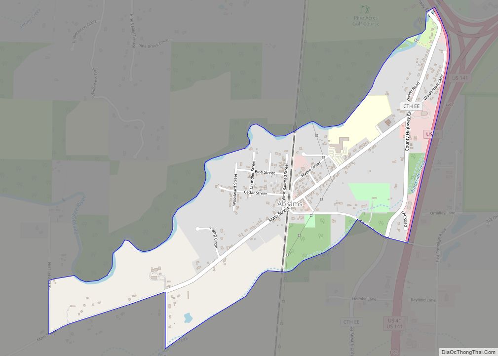
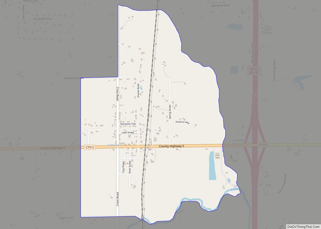
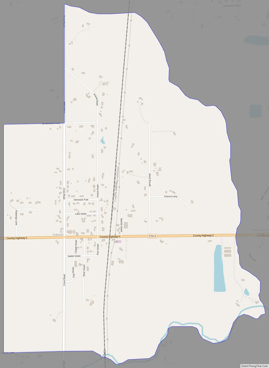
Sobieski, Wisconsin is an unincorporated census-designated place in Oconto County in northeastern Wisconsin, United States. It is located within the Town of Little Suamico. As of the 2010 census, its population was 259. It is part of the Green Bay Metropolitan Statistical Area. The Little Suamico Town Hall is located in Sobieski, just east of the Escanaba and Lake Superior Railroad.
Sobieski is located along County Trunk Highway S and Cross Road. Sandalwood Road and Krause Road also enter the community. The Little Suamico River flows just south of the St. Maximilian parish cemetery. County S intersects with U.S. Route 141 about a half-mile east of Sobieski.
| Name: | Sobieski CDP |
|---|---|
| LSAD Code: | 57 |
| LSAD Description: | CDP (suffix) |
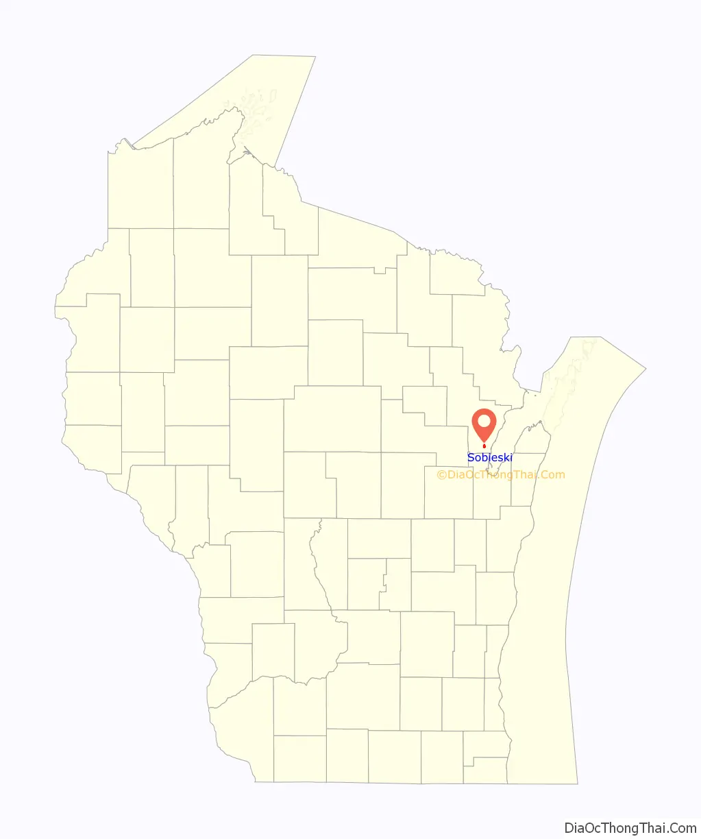
| State: | Wisconsin |
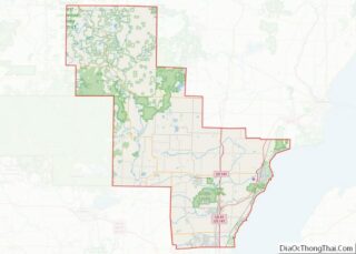
| County: | Oconto County |
| Total Area: | 1.259 sq mi (3.26 km²) |
| Land Area: | 1.259 sq mi (3.26 km²) |
| Water Area: | 0 sq mi (0 km²) |
| Total Population: | 259 |
| Population Density: | 210/sq mi (79/km²) |
| Area code: | 920 |
| FIPS code: | 5574500 |
Online Interactive Map
Click on ![]() to view map in "full screen" mode.
to view map in "full screen" mode.
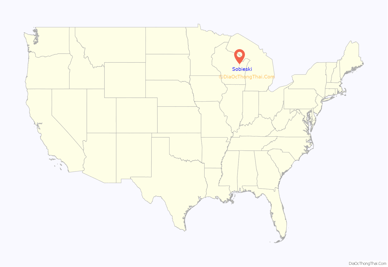
Sobieski location map. Where is Sobieski CDP?
Sobieski Road Map
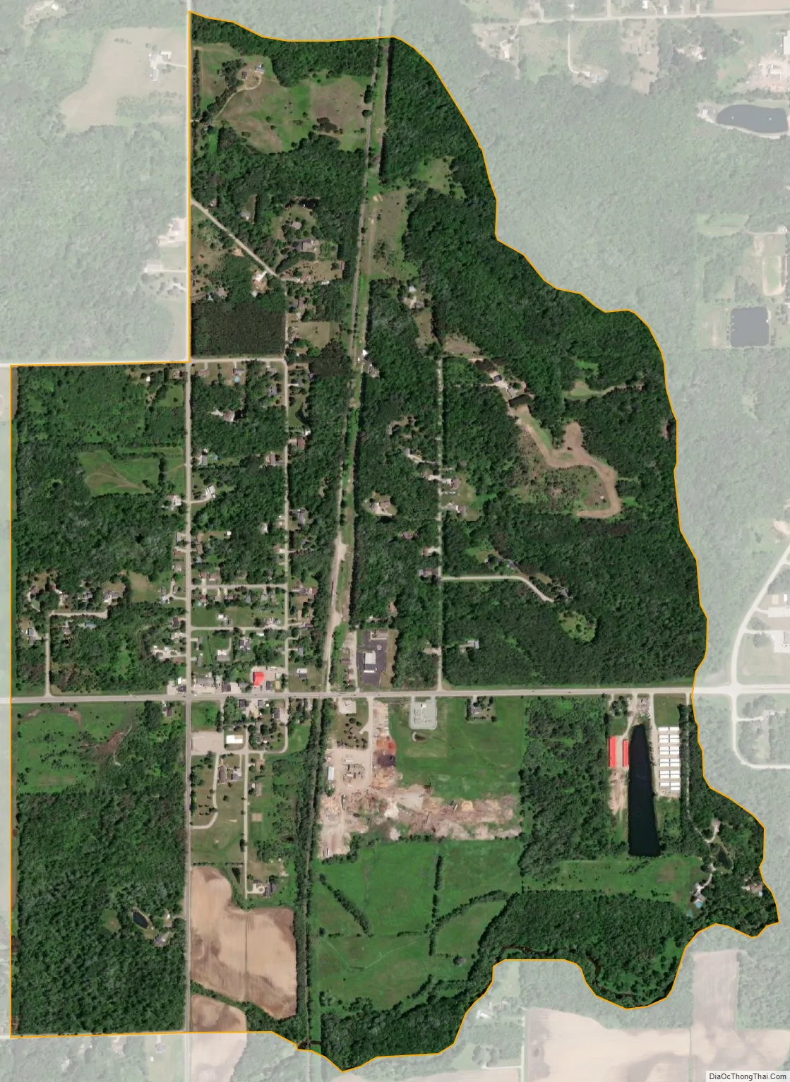
Sobieski city Satellite Map
See also
Map of Wisconsin State and its subdivision:- Adams
- Ashland
- Barron
- Bayfield
- Brown
- Buffalo
- Burnett
- Calumet
- Chippewa
- Clark
- Columbia
- Crawford
- Dane
- Dodge
- Door
- Douglas
- Dunn
- Eau Claire
- Florence
- Fond du Lac
- Forest
- Grant
- Green
- Green Lake
- Iowa
- Iron
- Jackson
- Jefferson
- Juneau
- Kenosha
- Kewaunee
- La Crosse
- Lafayette
- Lake Michigan
- Lake Superior
- Langlade
- Lincoln
- Manitowoc
- Marathon
- Marinette
- Marquette
- Menominee
- Milwaukee
- Monroe
- Oconto
- Oneida
- Outagamie
- Ozaukee
- Pepin
- Pierce
- Polk
- Portage
- Price
- Racine
- Richland
- Rock
- Rusk
- Saint Croix
- Sauk
- Sawyer
- Shawano
- Sheboygan
- Taylor
- Trempealeau
- Vernon
- Vilas
- Walworth
- Washburn
- Washington
- Waukesha
- Waupaca
- Waushara
- Winnebago
- Wood
- Alabama
- Alaska
- Arizona
- Arkansas
- California
- Colorado
- Connecticut
- Delaware
- District of Columbia
- Florida
- Georgia
- Hawaii
- Idaho
- Illinois
- Indiana
- Iowa
- Kansas
- Kentucky
- Louisiana
- Maine
- Maryland
- Massachusetts
- Michigan
- Minnesota
- Mississippi
- Missouri
- Montana
- Nebraska
- Nevada
- New Hampshire
- New Jersey
- New Mexico
- New York
- North Carolina
- North Dakota
- Ohio
- Oklahoma
- Oregon
- Pennsylvania
- Rhode Island
- South Carolina
- South Dakota
- Tennessee
- Texas
- Utah
- Vermont
- Virginia
- Washington
- West Virginia
- Wisconsin
- Wyoming