Stevens Point is the county seat of Portage County, Wisconsin, United States. The city was incorporated in 1858.
Its 2020 population of 25,666 makes it the largest city in the county. Stevens Point forms the core of the United States Census Bureau’s Stevens Point Micropolitan Statistical Area, which had a 2020 population of 70,377
Stevens Point is home to the University of Wisconsin–Stevens Point and a campus of Mid-State Technical College.
| Name: | Stevens Point city |
|---|---|
| LSAD Code: | 25 |
| LSAD Description: | city (suffix) |
| State: | Wisconsin |
| County: | Portage County |
| Elevation: | 1,089 ft (332 m) |
| Land Area: | 17.17 sq mi (44.47 km²) |
| Water Area: | 1.24 sq mi (3.21 km²) |
| Population Density: | 1,495.1/sq mi (577.3/km²) |
| Area code: | 715 & 534 |
| FIPS code: | 5577200 |
| GNISfeature ID: | 1574878 |
| Website: | stevenspoint.com |
Online Interactive Map
Click on ![]() to view map in "full screen" mode.
to view map in "full screen" mode.
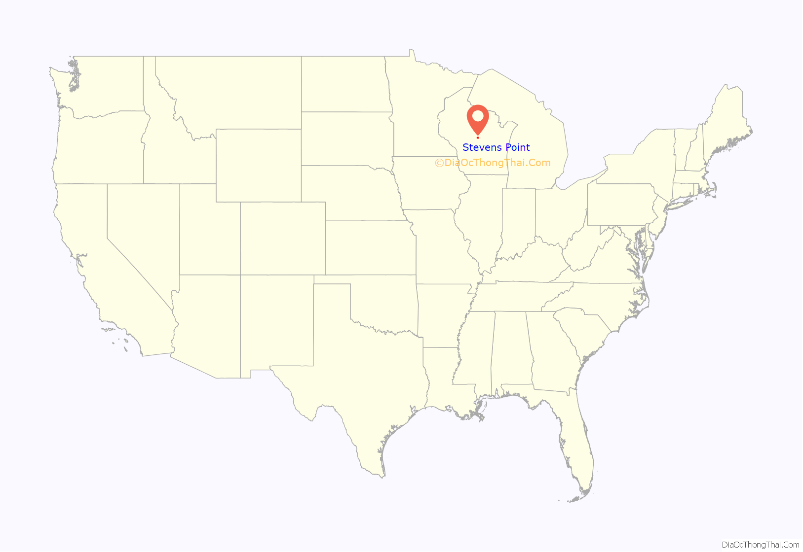
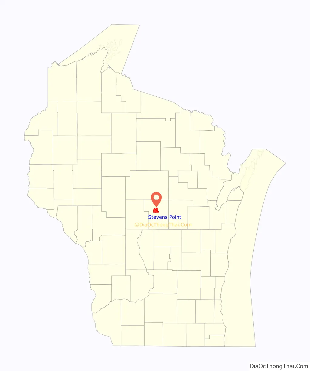
Stevens Point location map. Where is Stevens Point city?
History
Historically part of the Menominee homelands, a three-mile strip along the Wisconsin River was ceded to the United States in an 1836 treaty. In 1854 the Menominee made its last treaty with the U.S., gathering on a reservation on the Wolf River. In the Menominee language it is called Pasīpahkīhnen which means “It juts out as land” or “point of land”.
Stevens Point was named after George Stevens, who operated a grocery and supply business on the Wisconsin River during the extensive logging of interior Wisconsin. The river was used by logging companies to float logs to market. Loggers on the river found this a convenient stopping point, as the river bends slightly and the operation was from far upstream. The town developed from Stevens’s post and was named for him.
In 1845, the postal service came to Stevens Point and with this improvement in communications, the population tripled within 20 years.
In 1847, the first plat was laid out of what became the City of Stevens Point, including the Public Square. The town square was originally an area next to the Wisconsin River where professionals, craftsmen, businessmen, and loggers gathered before their river journeys, bringing revenue to the area. As years went by, the area around the town square grew as logging increased.
Most buildings were first built with readily available wood. Many cases of early fires were reported from 1850–1890. Around 1880, buildings began to be built of brick and sandstone.
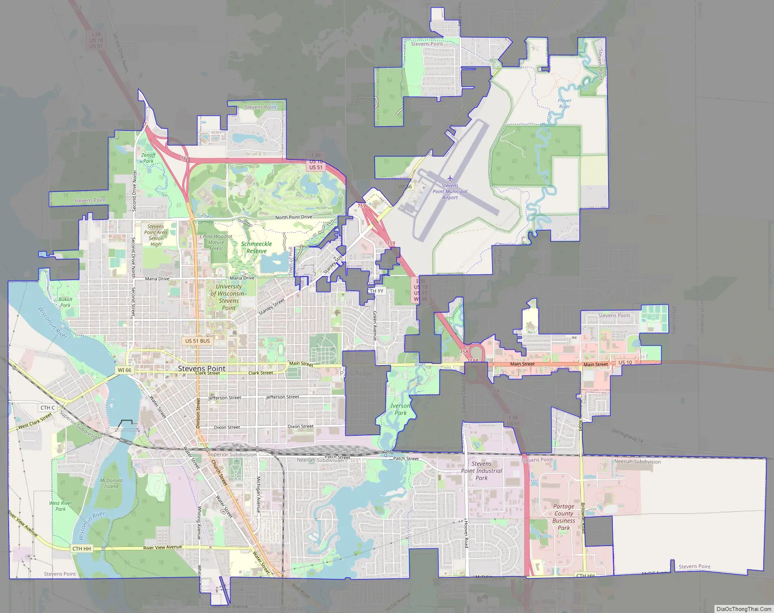
Stevens Point Road Map
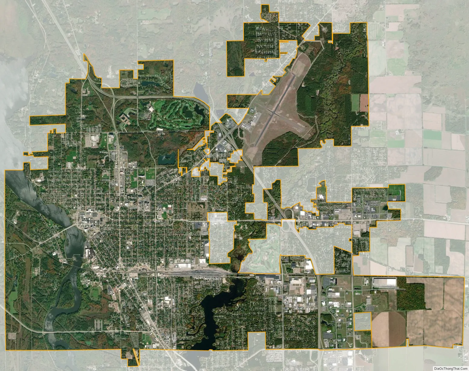
Stevens Point city Satellite Map
Geography
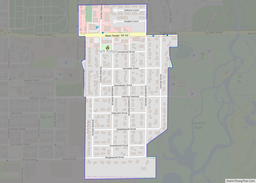
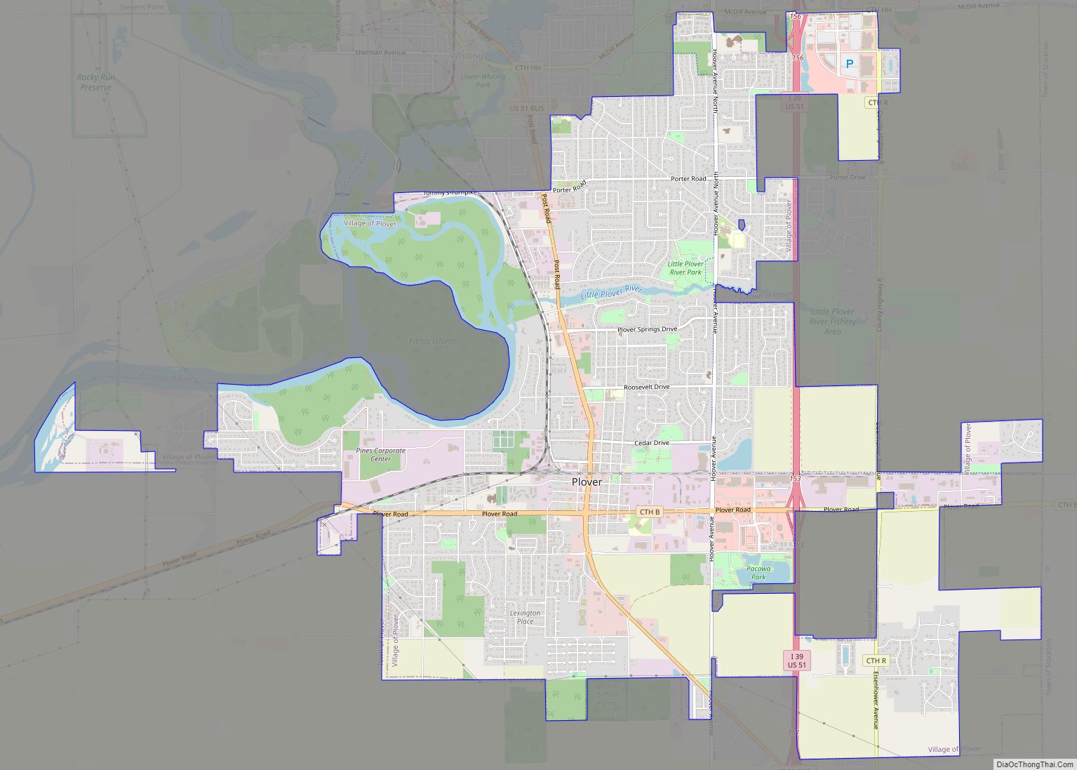
According to the United States Census Bureau, the city encompasses 18.41 square miles (47.7 km), including 17.17 square miles (44.5 km) of land 1.24 square miles (3.2 km) of water. The communities of Plover, Whiting and Park Ridge are adjacent to the city. The city’s main hydrology includes the Wisconsin River to the west and the Plover River, which joins the Wisconsin from the northeast at a point to the south, and which supplies much of the urban area’s water.
Climate
See also
Map of Wisconsin State and its subdivision:- Adams
- Ashland
- Barron
- Bayfield
- Brown
- Buffalo
- Burnett
- Calumet
- Chippewa
- Clark
- Columbia
- Crawford
- Dane
- Dodge
- Door
- Douglas
- Dunn
- Eau Claire
- Florence
- Fond du Lac
- Forest
- Grant
- Green
- Green Lake
- Iowa
- Iron
- Jackson
- Jefferson
- Juneau
- Kenosha
- Kewaunee
- La Crosse
- Lafayette
- Lake Michigan
- Lake Superior
- Langlade
- Lincoln
- Manitowoc
- Marathon
- Marinette
- Marquette
- Menominee
- Milwaukee
- Monroe
- Oconto
- Oneida
- Outagamie
- Ozaukee
- Pepin
- Pierce
- Polk
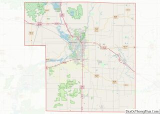
- Portage
- Price
- Racine
- Richland
- Rock
- Rusk
- Saint Croix
- Sauk
- Sawyer
- Shawano
- Sheboygan
- Taylor
- Trempealeau
- Vernon
- Vilas
- Walworth
- Washburn
- Washington
- Waukesha
- Waupaca
- Waushara
- Winnebago
- Wood
- Alabama
- Alaska
- Arizona
- Arkansas
- California
- Colorado
- Connecticut
- Delaware
- District of Columbia
- Florida
- Georgia
- Hawaii
- Idaho
- Illinois
- Indiana
- Iowa
- Kansas
- Kentucky
- Louisiana
- Maine
- Maryland
- Massachusetts
- Michigan
- Minnesota
- Mississippi
- Missouri
- Montana
- Nebraska
- Nevada
- New Hampshire
- New Jersey
- New Mexico
- New York
- North Carolina
- North Dakota
- Ohio
- Oklahoma
- Oregon
- Pennsylvania
- Rhode Island
- South Carolina
- South Dakota
- Tennessee
- Texas
- Utah
- Vermont
- Virginia
- Washington
- West Virginia
- Wisconsin
- Wyoming