Sun Prairie is a city in Dane County in the U.S. state of Wisconsin. A suburb of Madison, it is part of the Madison Metropolitan Statistical Area. The city’s population was 35,967 at the 2020 U.S. Census. It is the second-most populous city in Dane County after Madison.
| Name: | Sun Prairie city |
|---|---|
| LSAD Code: | 25 |
| LSAD Description: | city (suffix) |
| State: | Wisconsin |
| County: | Dane County |
| Elevation: | 984 ft (300 m) |
| Total Area: | 12.93 sq mi (33.49 km²) |
| Land Area: | 12.91 sq mi (33.44 km²) |
| Water Area: | 0.02 sq mi (0.06 km²) |
| Total Population: | 35,967 |
| Population Density: | 2,685.03/sq mi (1,036.67/km²) |
| ZIP code: | 53590 |
| Area code: | 608 |
| FIPS code: | 5578600 |
| GNISfeature ID: | 1584255 |
| Website: | cityofsunprairie.com |
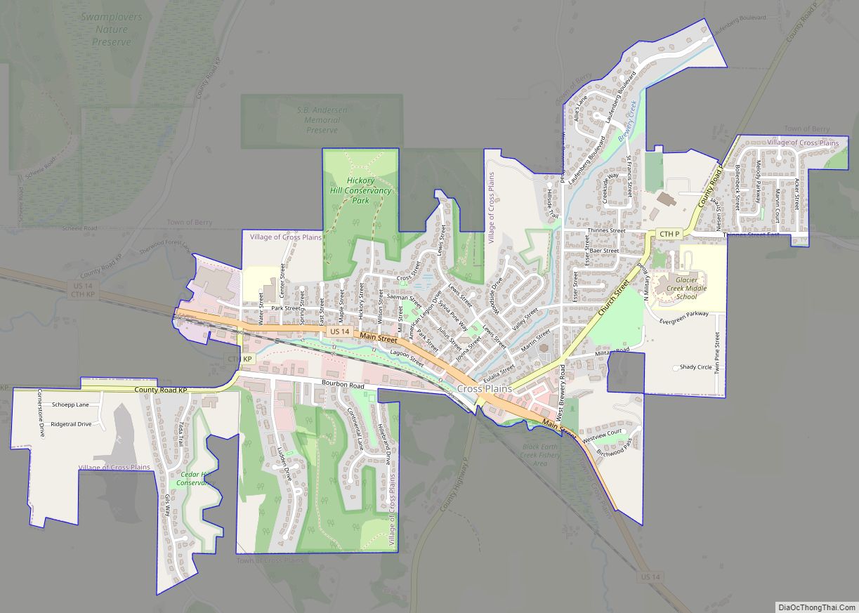
Online Interactive Map
Click on ![]() to view map in "full screen" mode.
to view map in "full screen" mode.
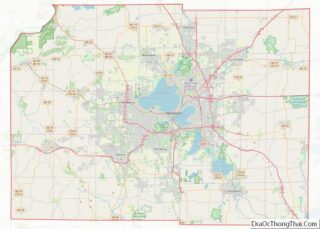
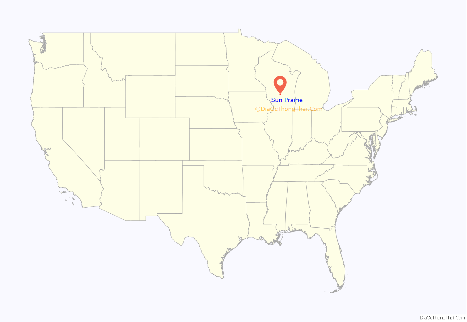
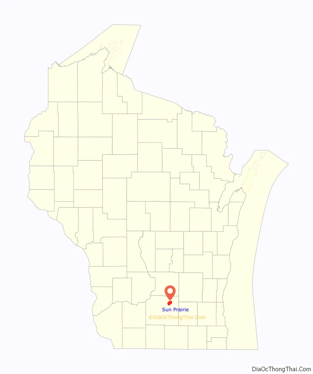
Sun Prairie location map. Where is Sun Prairie city?
History
President Martin Van Buren commissioned a party of 45 men, including Augustus A. Bird, to build a capitol for the Territory of Wisconsin in Madison. The group left Milwaukee on May 26, 1837, and traveled for days in the rain. On June 9, the group emerged at the edge of the prairie and with the sun shining for the first time in days, carved the words “Sun Prairie” into a tree. Charles Bird returned to the area two years later and became the first settler.
The Town of Sun Prairie was created on February 2, 1846. The village of Sun Prairie, which grew from that town, was incorporated in an act of the Wisconsin legislature on March 6, 1868.
On March 17, 1958, the Village Board ordered a referendum election on whether Sun Prairie should incorporate as a city of the fourth class after receiving a petition signed by over 100 electors. In the referendum election on May 6, 1958, 295 voted for incorporating as a city and 284 voted against. On May 15, 1958, the Wisconsin Secretary of State filed the certificate of incorporation of the city of Sun Prairie.
On July 10, 2018, a gas explosion leveled a downtown city block, destroying a bar and a pizza restaurant, as well as damaging the historic old city hall building and multiple other nearby buildings. Bar owner and Fire Captain Cory Barr was injured in the explosion and died as a result soon after. Many citizens and businesses around Sun Prairie offered their support to the Barr family and the affected businesses through fundraising campaigns. This tragic event was the origin of the tagline “Sun Prairie Strong”, a slogan which signifies the city’s strength as it comes together as a community.
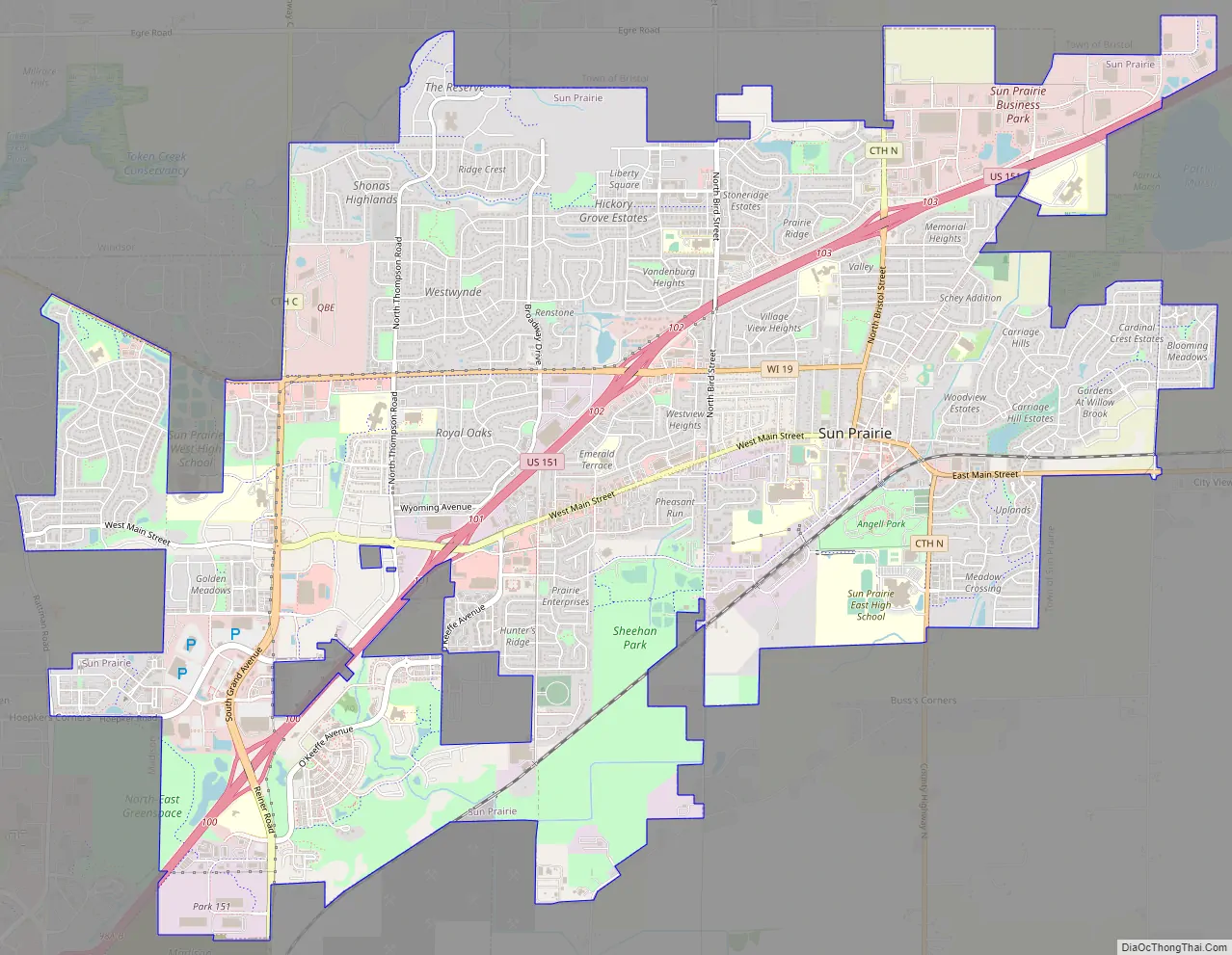
Sun Prairie Road Map
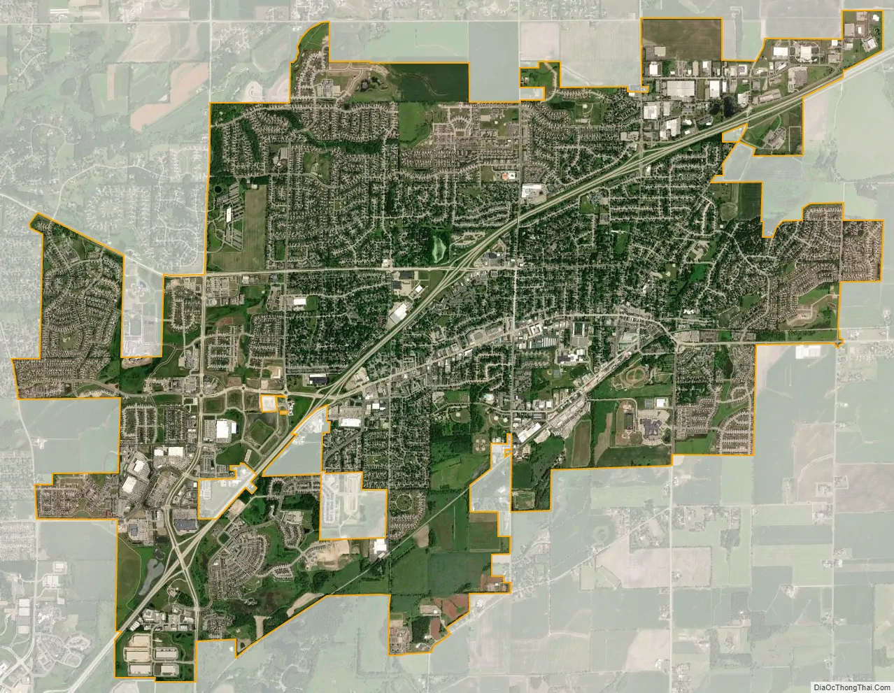
Sun Prairie city Satellite Map
Geography
According to the United States Census Bureau, the city has a total area of 12.25 square miles (31.73 km), of which, 12.23 square miles (31.68 km) is land and 0.02 square miles (0.05 km) is water. The city of Sun Prairie includes land that once was part of the towns of Bristol, Burke, Sun Prairie, and Windsor. On January 5, 2007, the city of Sun Prairie, city of Madison, village of DeForest, and town of Burke entered into a cooperative plan under which all remaining land in the town of Burke has been designated for attachment into the cities and village./>
Geology
The Yahara River Valley encompasses part of the city of Sun Prairie. This area contains deep glacial deposits created by the Wisconsin Glaciation. The eastern part of Dane County, known as the drumlin and marsh physiographic area, includes most of Sun Prairie. The deposits found in this area include general glacial deposits and marsh deposits, and consist of many small drumlins interspersed with shallow glacial deposits having poorly defined drainage.
The general soils associations in the Sun Prairie area include the Dodge-St. Charles-McHenry, Plano-Ringwood-Griswold, and Batavia-Houghton-Dresden Associations. The Dodge-St. Charles-McHenry soils are found in the eastern, southern, and central portions of Sun Prairie. This association has a varied landscape, which is mostly sloping, with some areas on benches and in depressions. The Dodge, St. Charles and McHenry soils are well drained to moderately well drained. The Sable soils in this association are nearly level and poorly drained. Most of the soils in this association have moderate permeability and a high available water capacity. Most also have slight to moderate limitations for urban uses and farming.
Cityscape
The landscape of the city consists mostly of gently rolling hills and plains. The elevation of the city averages about 984 feet (300 m) above mean sea level.
Sun Prairie has developed a number of traditional neighborhood developments (TND). Often referred to as “new urbanism”, these neighborhoods focus on the pedestrian and the appearance of city streets. While these developments have sought to address the problems and concerns associated with conventional suburban development and urban sprawl, many occupy former farmland and undeveloped rural lands. The city’s planners addressed the criticisms that they were “attempting to recreate “pretend” neighborhoods” by noting that the aim of the TND was to borrow those design ideas and features effective in older neighborhoods and adapting them to current needs.
See also
Map of Wisconsin State and its subdivision:- Adams
- Ashland
- Barron
- Bayfield
- Brown
- Buffalo
- Burnett
- Calumet
- Chippewa
- Clark
- Columbia
- Crawford
- Dane
- Dodge
- Door
- Douglas
- Dunn
- Eau Claire
- Florence
- Fond du Lac
- Forest
- Grant
- Green
- Green Lake
- Iowa
- Iron
- Jackson
- Jefferson
- Juneau
- Kenosha
- Kewaunee
- La Crosse
- Lafayette
- Lake Michigan
- Lake Superior
- Langlade
- Lincoln
- Manitowoc
- Marathon
- Marinette
- Marquette
- Menominee
- Milwaukee
- Monroe
- Oconto
- Oneida
- Outagamie
- Ozaukee
- Pepin
- Pierce
- Polk
- Portage
- Price
- Racine
- Richland
- Rock
- Rusk
- Saint Croix
- Sauk
- Sawyer
- Shawano
- Sheboygan
- Taylor
- Trempealeau
- Vernon
- Vilas
- Walworth
- Washburn
- Washington
- Waukesha
- Waupaca
- Waushara
- Winnebago
- Wood
- Alabama
- Alaska
- Arizona
- Arkansas
- California
- Colorado
- Connecticut
- Delaware
- District of Columbia
- Florida
- Georgia
- Hawaii
- Idaho
- Illinois
- Indiana
- Iowa
- Kansas
- Kentucky
- Louisiana
- Maine
- Maryland
- Massachusetts
- Michigan
- Minnesota
- Mississippi
- Missouri
- Montana
- Nebraska
- Nevada
- New Hampshire
- New Jersey
- New Mexico
- New York
- North Carolina
- North Dakota
- Ohio
- Oklahoma
- Oregon
- Pennsylvania
- Rhode Island
- South Carolina
- South Dakota
- Tennessee
- Texas
- Utah
- Vermont
- Virginia
- Washington
- West Virginia
- Wisconsin
- Wyoming