Suring is a village in Oconto County, Wisconsin, United States, along the 45th parallel. The population was 544 at the 2010 census. It is part of the Green Bay Metropolitan Statistical Area.
| Name: | Suring village |
|---|---|
| LSAD Code: | 47 |
| LSAD Description: | village (suffix) |
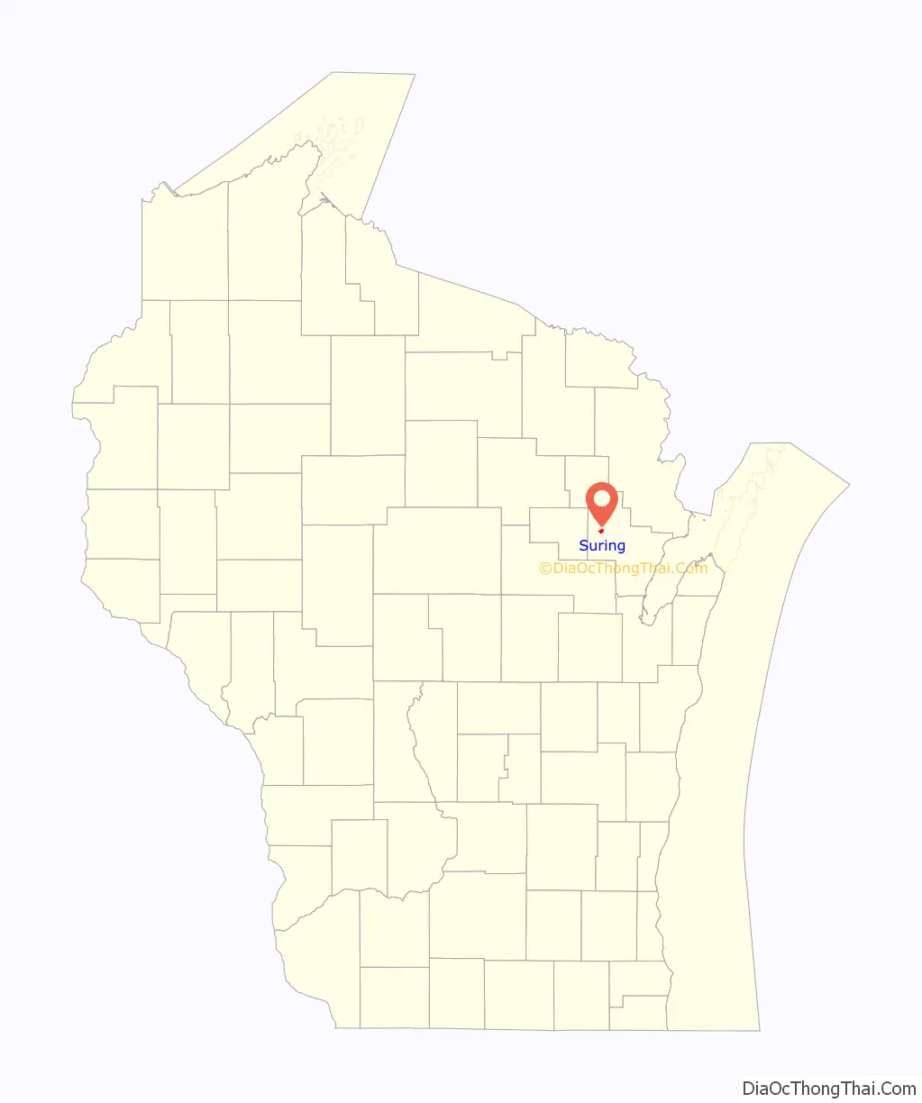
| State: | Wisconsin |
| County: | Oconto County |
| Elevation: | 801 ft (244 m) |
| Total Area: | 1.02 sq mi (2.66 km²) |
| Land Area: | 1.02 sq mi (2.66 km²) |
| Water Area: | 0.00 sq mi (0.00 km²) |
| Total Population: | 544 |
| Population Density: | 509.27/sq mi (196.59/km²) |
| Area code: | 920 |
| FIPS code: | 5578725 |
| GNISfeature ID: | 1580561 |
| Website: | www.ci.suring.wi.us |
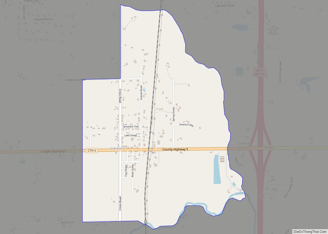
Online Interactive Map
Click on ![]() to view map in "full screen" mode.
to view map in "full screen" mode.
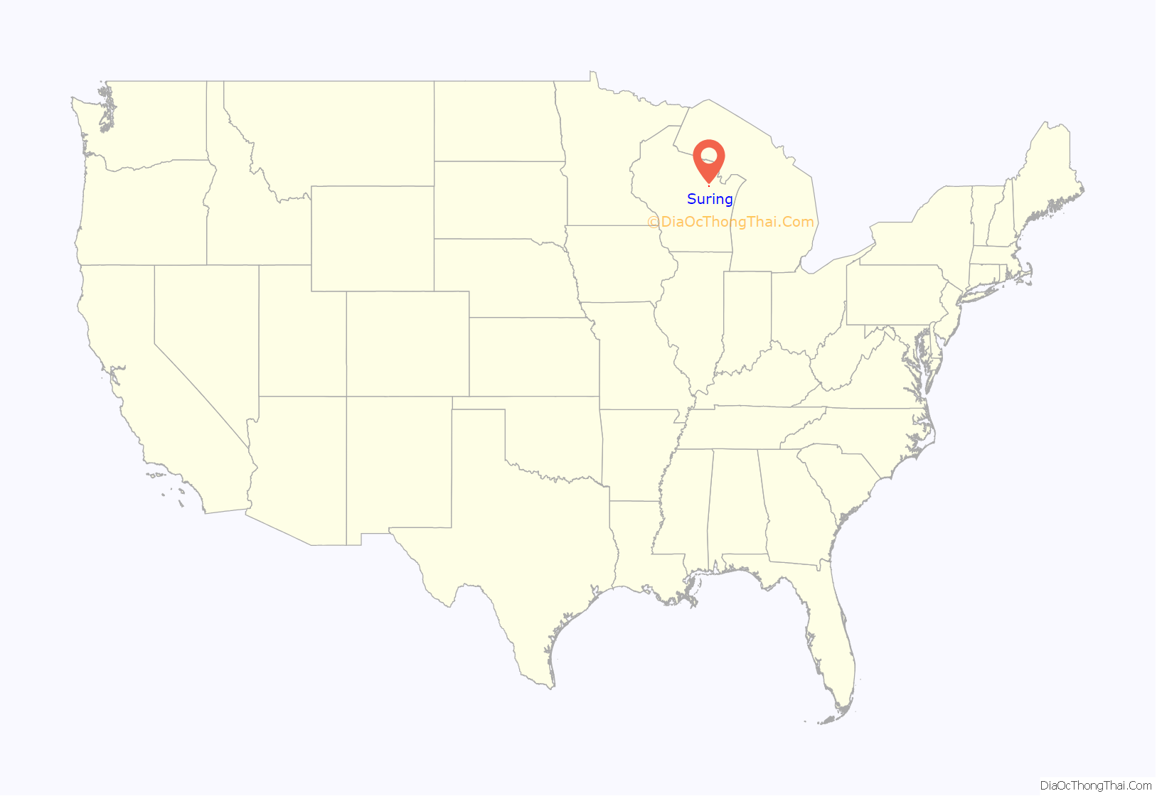
Suring location map. Where is Suring village?
History
This area lies within the traditional homeland of the Menominee, who lived here for millennia before European arrival. After years of negotiations with the Ho-Chunk and the United States government about how to accommodate the incoming populations of Oneida, Stockbridge-Munsee, and Brothertown peoples following their removal from New York, the Menominee signed the 1836 Treaty of the Cedars and ceded this territory to the United States. Following this land cession, white settlement could begin. A post office called Suring has been in operation since 1897. The village was named in English for Julius “Joe” Suring ((1851-07-30)July 30, 1851‒(1920-08-15)August 15, 1920), a local landowner. In the Menominee language, it is known as Naeqniw-Sīpiah ‘three rivers’.
Suring was mentioned in at least one national publication due to an incident concerning to parents where the Suring Public Schools superintendent and other administrators were alleged to have conducted multiple strip searches of both boys and girls in an effort to find hidden vaping devices. After the Oconto County district attorney declined to press charges, several parents hired a civil rights attorney to explore possible litigation against the school board.
Suring Road Map
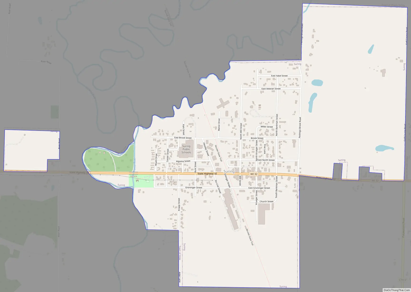
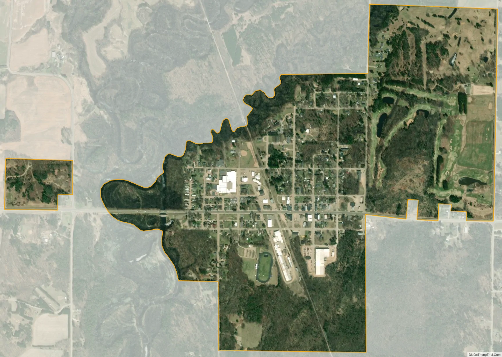
Suring city Satellite Map
Geography
Suring is located at 45°0′0″N 88°22′28″W / 45.00000°N 88.37444°W / 45.00000; -88.37444 (45.000016, -88.374481). Suring, Wisconsin, is located 50.5 miles northwest of Green Bay, Wisconsin.
According to the United States Census Bureau, the village has a total area of 1.01 square miles (2.62 km), all of it land. The Oconto River and Peshtigo Brook define its boundaries on the Southwest.
The village stresses its location on the 45th parallel north with a marker, placing it halfway between the equator, and the north pole.
Wisconsin Highway 32, conjoined with County highway M, passes through the village.
See also
Map of Wisconsin State and its subdivision:- Adams
- Ashland
- Barron
- Bayfield
- Brown
- Buffalo
- Burnett
- Calumet
- Chippewa
- Clark
- Columbia
- Crawford
- Dane
- Dodge
- Door
- Douglas
- Dunn
- Eau Claire
- Florence
- Fond du Lac
- Forest
- Grant
- Green
- Green Lake
- Iowa
- Iron
- Jackson
- Jefferson
- Juneau
- Kenosha
- Kewaunee
- La Crosse
- Lafayette
- Lake Michigan
- Lake Superior
- Langlade
- Lincoln
- Manitowoc
- Marathon
- Marinette
- Marquette
- Menominee
- Milwaukee
- Monroe
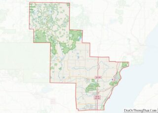
- Oconto
- Oneida
- Outagamie
- Ozaukee
- Pepin
- Pierce
- Polk
- Portage
- Price
- Racine
- Richland
- Rock
- Rusk
- Saint Croix
- Sauk
- Sawyer
- Shawano
- Sheboygan
- Taylor
- Trempealeau
- Vernon
- Vilas
- Walworth
- Washburn
- Washington
- Waukesha
- Waupaca
- Waushara
- Winnebago
- Wood
- Alabama
- Alaska
- Arizona
- Arkansas
- California
- Colorado
- Connecticut
- Delaware
- District of Columbia
- Florida
- Georgia
- Hawaii
- Idaho
- Illinois
- Indiana
- Iowa
- Kansas
- Kentucky
- Louisiana
- Maine
- Maryland
- Massachusetts
- Michigan
- Minnesota
- Mississippi
- Missouri
- Montana
- Nebraska
- Nevada
- New Hampshire
- New Jersey
- New Mexico
- New York
- North Carolina
- North Dakota
- Ohio
- Oklahoma
- Oregon
- Pennsylvania
- Rhode Island
- South Carolina
- South Dakota
- Tennessee
- Texas
- Utah
- Vermont
- Virginia
- Washington
- West Virginia
- Wisconsin
- Wyoming