Webster is a village in Burnett County in the U.S. state of Wisconsin. The population was 653 at the 2010 census. It is along Wisconsin Highway 35.
| Name: | Webster village |
|---|---|
| LSAD Code: | 47 |
| LSAD Description: | village (suffix) |
| State: | Wisconsin |
| County: | Burnett County |
| Total Area: | 1.75 sq mi (4.54 km²) |
| Land Area: | 1.75 sq mi (4.54 km²) |
| Water Area: | 0.00 sq mi (0.00 km²) |
| Total Population: | 653 |
| Population Density: | 353.11/sq mi (136.33/km²) |
| ZIP code: | 54893 |
| Area code: | 715 & 534 |
| FIPS code: | 5585025 |
| GNISfeature ID: | 1584391 |
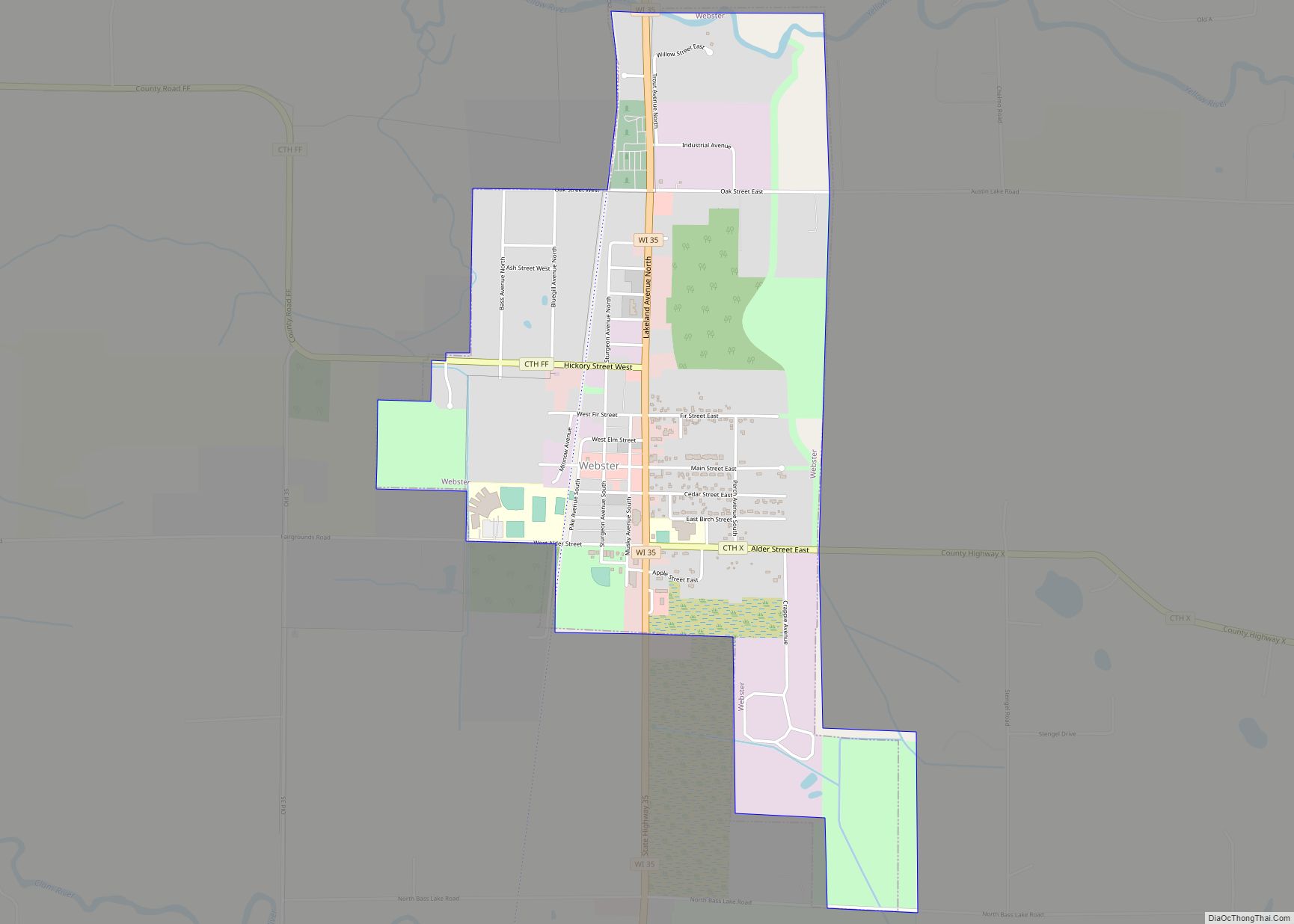
Online Interactive Map
Click on ![]() to view map in "full screen" mode.
to view map in "full screen" mode.
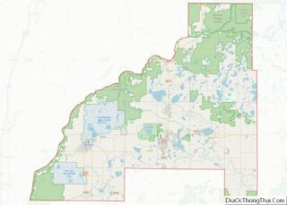
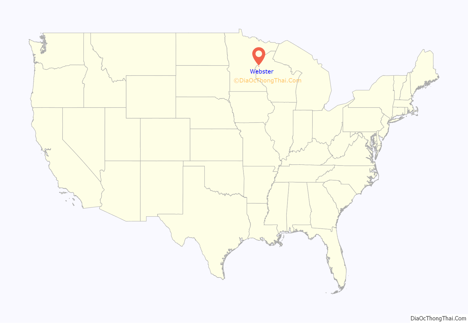
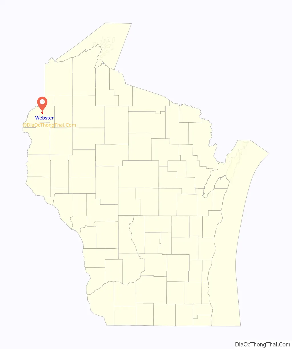
Webster location map. Where is Webster village?
History
The village was called Clam River until 1896, when a new post office was established and resident J.D. Rice petitioned U.S. Rep. John J. Jenkins to change the name to Webster, after lexicographer Noah Webster.
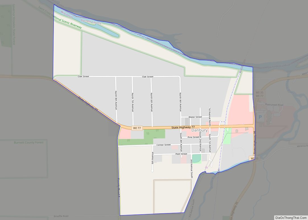
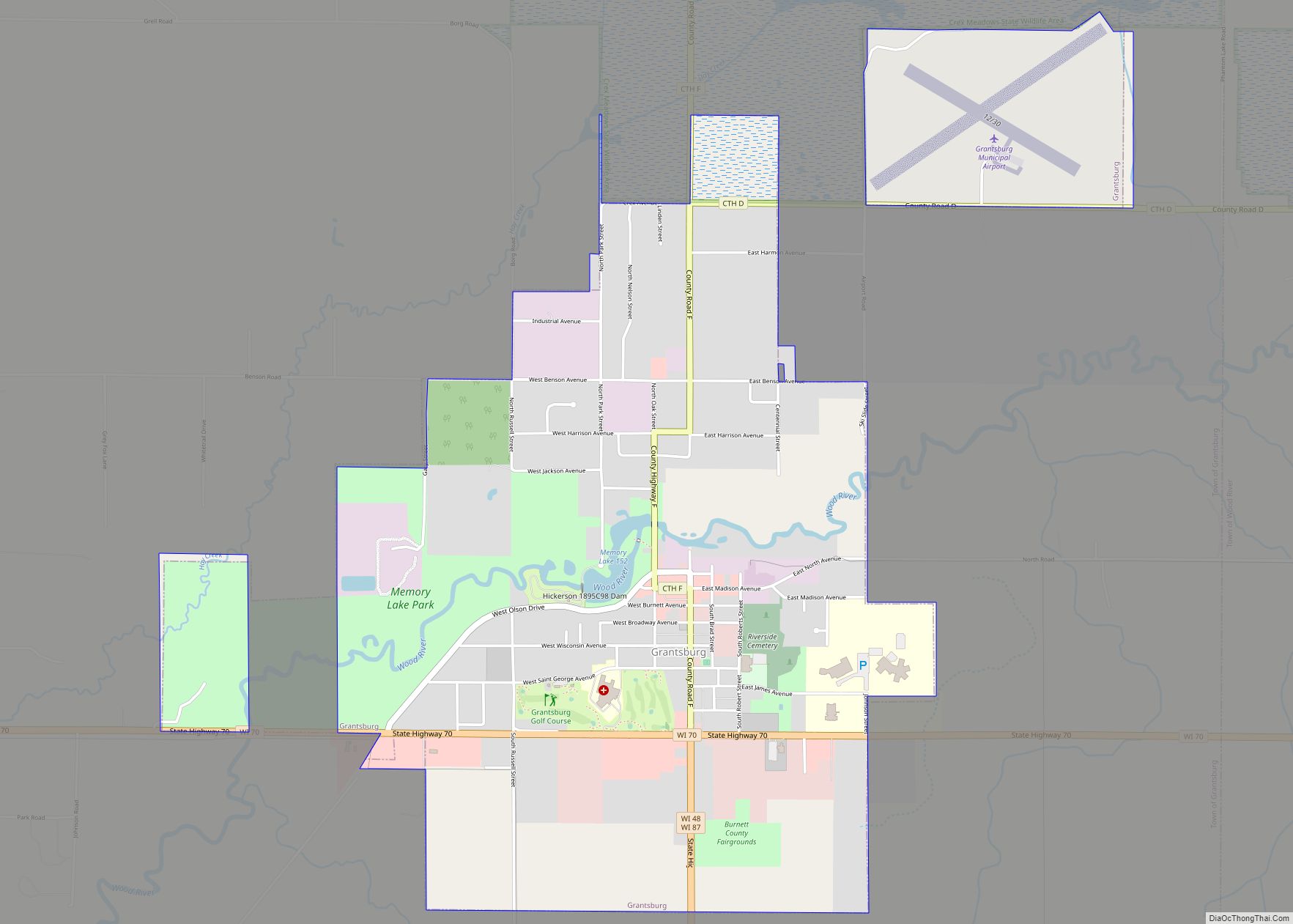
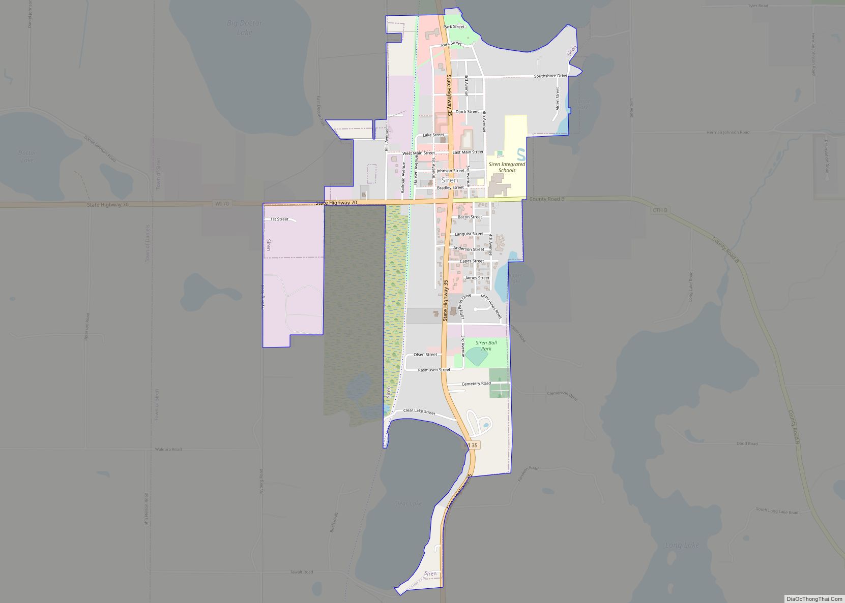
Webster Road Map
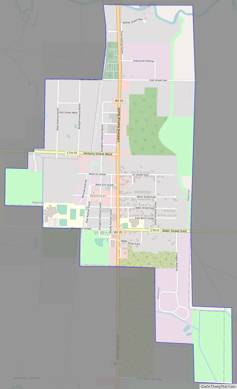
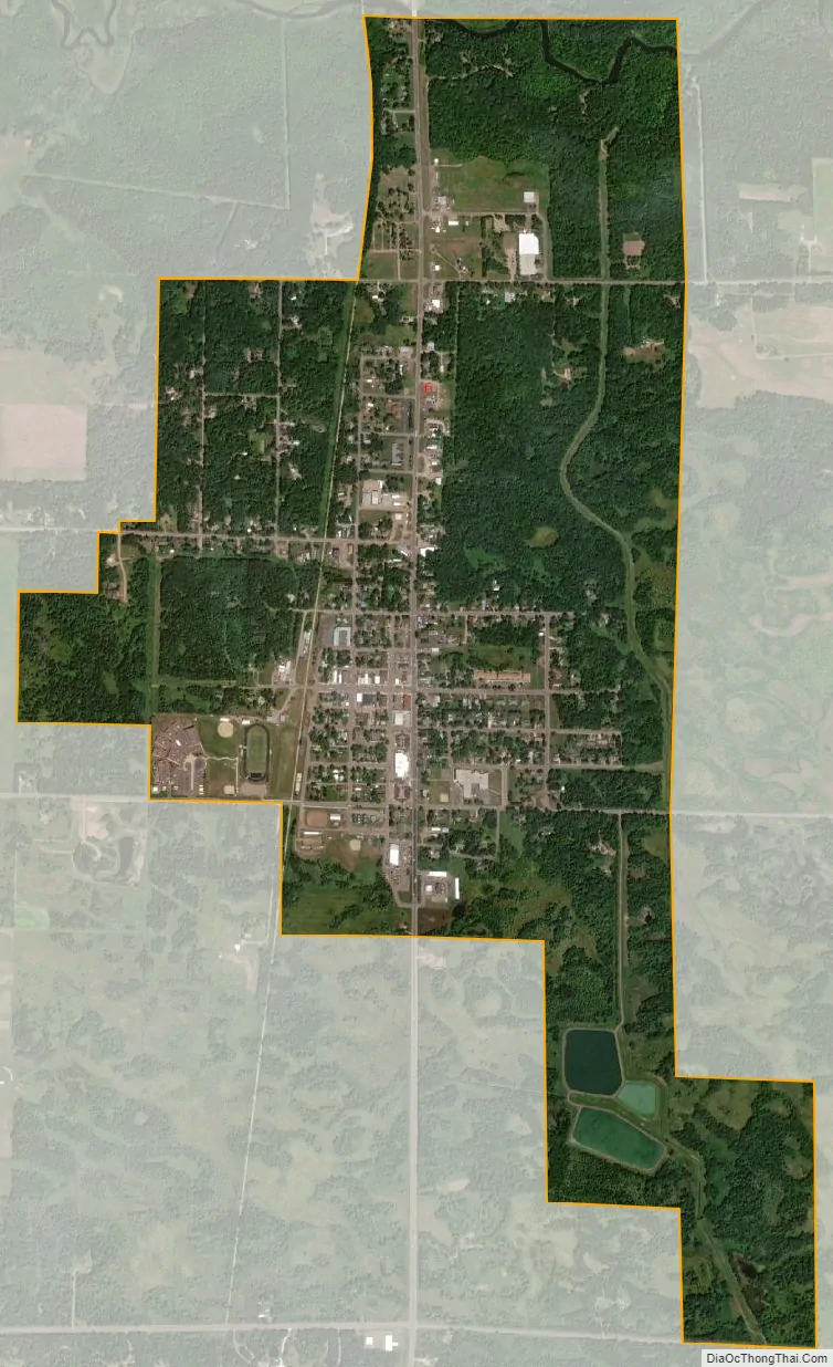
Webster city Satellite Map
Geography
Webster’s location is at 45°52′45″N 92°21′55″W / 45.87917°N 92.36528°W / 45.87917; -92.36528 (45.879066, -92.365163).
According to the United States Census Bureau, the village has a total area of 1.76 square miles (4.56 km), all of it land.
The village of Webster is geographically within the town of Meenon, but is a separate entity.
Webster is located 65 miles south of Superior, 94 miles northeast of Minneapolis, and 110 miles northwest of Eau Claire.
See also
Map of Wisconsin State and its subdivision:- Adams
- Ashland
- Barron
- Bayfield
- Brown
- Buffalo
- Burnett
- Calumet
- Chippewa
- Clark
- Columbia
- Crawford
- Dane
- Dodge
- Door
- Douglas
- Dunn
- Eau Claire
- Florence
- Fond du Lac
- Forest
- Grant
- Green
- Green Lake
- Iowa
- Iron
- Jackson
- Jefferson
- Juneau
- Kenosha
- Kewaunee
- La Crosse
- Lafayette
- Lake Michigan
- Lake Superior
- Langlade
- Lincoln
- Manitowoc
- Marathon
- Marinette
- Marquette
- Menominee
- Milwaukee
- Monroe
- Oconto
- Oneida
- Outagamie
- Ozaukee
- Pepin
- Pierce
- Polk
- Portage
- Price
- Racine
- Richland
- Rock
- Rusk
- Saint Croix
- Sauk
- Sawyer
- Shawano
- Sheboygan
- Taylor
- Trempealeau
- Vernon
- Vilas
- Walworth
- Washburn
- Washington
- Waukesha
- Waupaca
- Waushara
- Winnebago
- Wood
- Alabama
- Alaska
- Arizona
- Arkansas
- California
- Colorado
- Connecticut
- Delaware
- District of Columbia
- Florida
- Georgia
- Hawaii
- Idaho
- Illinois
- Indiana
- Iowa
- Kansas
- Kentucky
- Louisiana
- Maine
- Maryland
- Massachusetts
- Michigan
- Minnesota
- Mississippi
- Missouri
- Montana
- Nebraska
- Nevada
- New Hampshire
- New Jersey
- New Mexico
- New York
- North Carolina
- North Dakota
- Ohio
- Oklahoma
- Oregon
- Pennsylvania
- Rhode Island
- South Carolina
- South Dakota
- Tennessee
- Texas
- Utah
- Vermont
- Virginia
- Washington
- West Virginia
- Wisconsin
- Wyoming