White Lake is a village in Langlade County, Wisconsin, United States. The population was 363 at the 2010 census.
The White Lake Volunteer Fire Department is located within the village.
| Name: | White Lake village |
|---|---|
| LSAD Code: | 47 |
| LSAD Description: | village (suffix) |
| State: | Wisconsin |
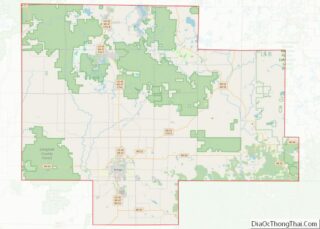
| County: | Langlade County |
| Elevation: | 1,286 ft (391.9728 m) |
| Total Area: | 2.39 sq mi (6.19 km²) |
| Land Area: | 2.10 sq mi (5.44 km²) |
| Water Area: | 0.29 sq mi (0.75 km²) 11.74% |
| Total Population: | 363 |
| Population Density: | 167.54/sq mi (64.70/km²) |
| Area code: | 715 & 534 |
| FIPS code: | 5586750 |
| GNISfeature ID: | 1580775 |
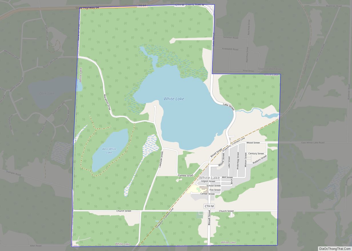
Online Interactive Map
Click on ![]() to view map in "full screen" mode.
to view map in "full screen" mode.
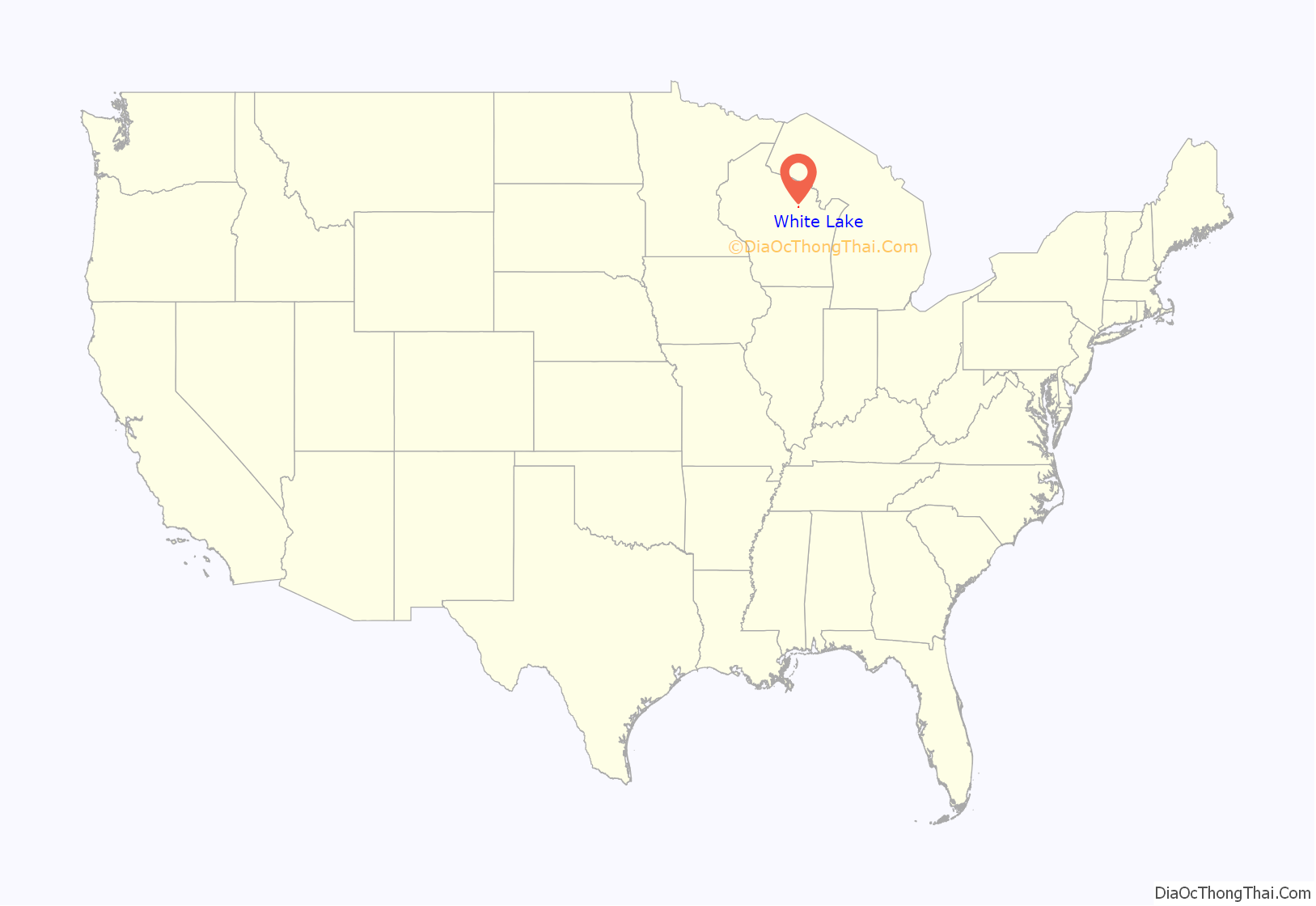
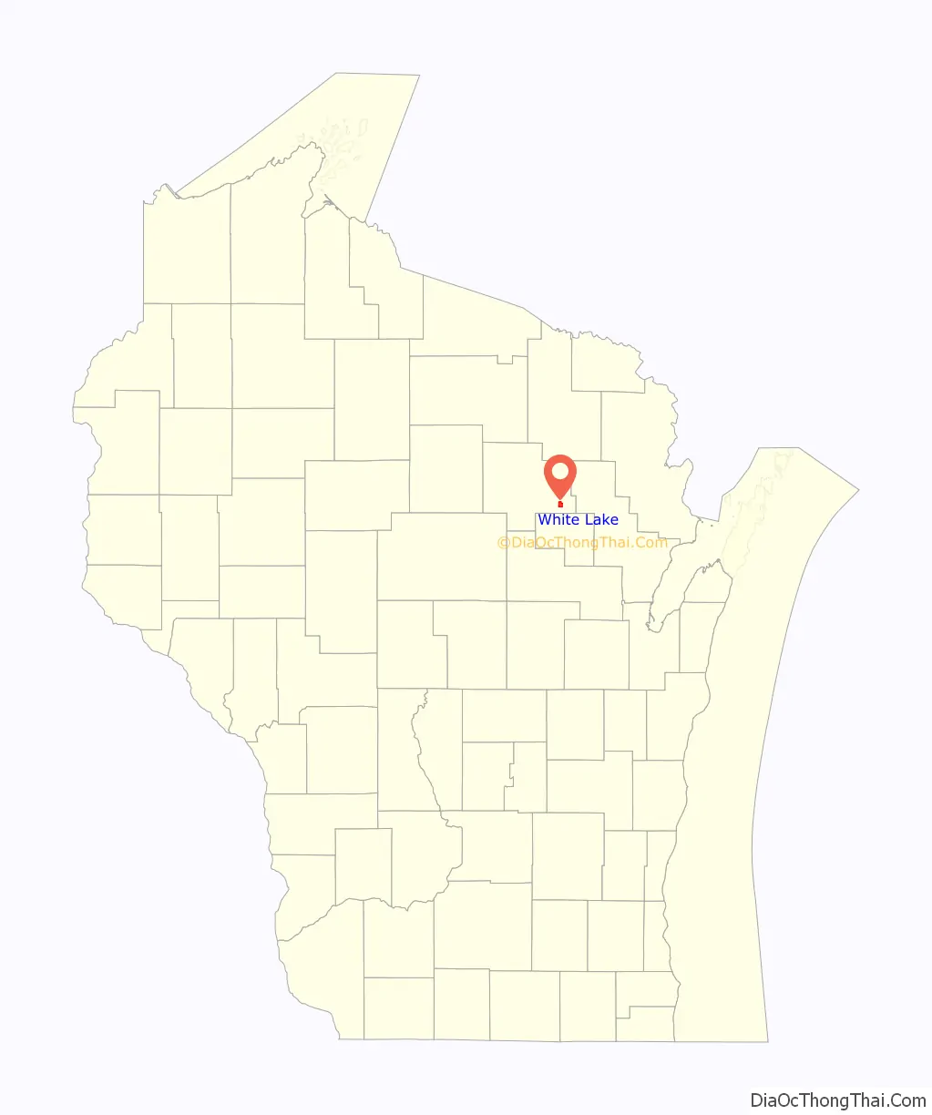
White Lake location map. Where is White Lake village?
History
The name “White” was given to the lake by the Native Americans who hunted and fished in the area many years ago. It was so named because of the white sand and marl in the lake bottom. In 1876, pioneer Isaac Farrow attempted to drain White Lake and make a hay meadow out of the level bottom. He failed in this venture because he didn’t realize the depth of the lake and the fact that it was fed by springs.
The White Lake area lies south and west of a former terminus of the Wisconsin and Northern Railroad, Van Ostrand. Service began running between Shawano and Van Ostrand in late 1907. Settlement in the area began to show preference to the White Lake area over Van Ostrand, a process that was accelerated by the construction of a new lumber mill completed at the end of 1916. The Wisconsin Northern moved its depot from Van Ostrand to White Lake at approximately that time. Van Ostrand was ultimately abandoned, while White Lake was incorporated as a village in 1926.
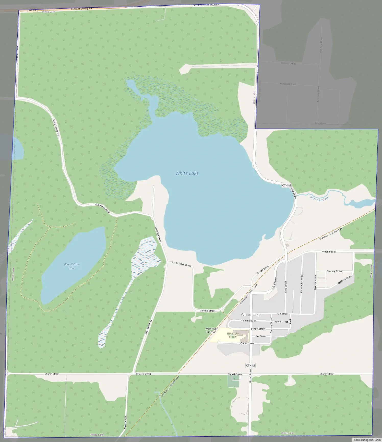
White Lake Road Map
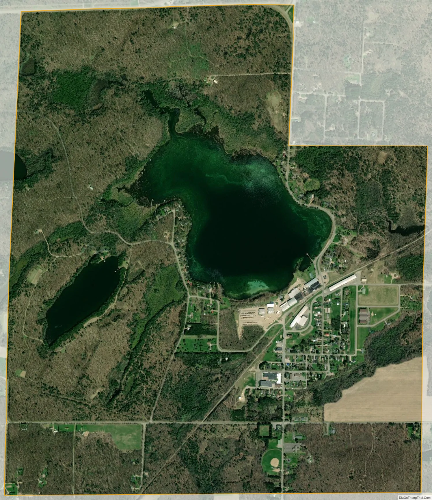
White Lake city Satellite Map
Geography
White Lake is located at 45°9′24″N 88°45′56″W / 45.15667°N 88.76556°W / 45.15667; -88.76556 (45.156596, -88.765597), in the eastern part of Langlade County about four miles west of the Wolf River and Wisconsin Highway 55. It is surrounded by the Town of Wolf River.
According to the United States Census Bureau, the village has a total area of 2.47 square miles (6.40 km), of which, 2.18 square miles (5.65 km) of it is land and 0.29 square miles (0.75 km) is water.
See also
Map of Wisconsin State and its subdivision:- Adams
- Ashland
- Barron
- Bayfield
- Brown
- Buffalo
- Burnett
- Calumet
- Chippewa
- Clark
- Columbia
- Crawford
- Dane
- Dodge
- Door
- Douglas
- Dunn
- Eau Claire
- Florence
- Fond du Lac
- Forest
- Grant
- Green
- Green Lake
- Iowa
- Iron
- Jackson
- Jefferson
- Juneau
- Kenosha
- Kewaunee
- La Crosse
- Lafayette
- Lake Michigan
- Lake Superior
- Langlade
- Lincoln
- Manitowoc
- Marathon
- Marinette
- Marquette
- Menominee
- Milwaukee
- Monroe
- Oconto
- Oneida
- Outagamie
- Ozaukee
- Pepin
- Pierce
- Polk
- Portage
- Price
- Racine
- Richland
- Rock
- Rusk
- Saint Croix
- Sauk
- Sawyer
- Shawano
- Sheboygan
- Taylor
- Trempealeau
- Vernon
- Vilas
- Walworth
- Washburn
- Washington
- Waukesha
- Waupaca
- Waushara
- Winnebago
- Wood
- Alabama
- Alaska
- Arizona
- Arkansas
- California
- Colorado
- Connecticut
- Delaware
- District of Columbia
- Florida
- Georgia
- Hawaii
- Idaho
- Illinois
- Indiana
- Iowa
- Kansas
- Kentucky
- Louisiana
- Maine
- Maryland
- Massachusetts
- Michigan
- Minnesota
- Mississippi
- Missouri
- Montana
- Nebraska
- Nevada
- New Hampshire
- New Jersey
- New Mexico
- New York
- North Carolina
- North Dakota
- Ohio
- Oklahoma
- Oregon
- Pennsylvania
- Rhode Island
- South Carolina
- South Dakota
- Tennessee
- Texas
- Utah
- Vermont
- Virginia
- Washington
- West Virginia
- Wisconsin
- Wyoming