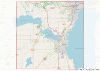
Winneconne is a town in Winnebago County, Wisconsin, United States. The population was 2,350 at the 2010 census. The Village of Winneconne is located within the town, on both sides of the Wolf River. The unincorporated community of Butte des Morts, named for a French and Native American trading war, is also located in the town. The town’s water resources of rivers and lakes makes it a center of hunting and fishing, including winter ice fishing.
| Name: | Winneconne village |
|---|---|
| LSAD Code: | 47 |
| LSAD Description: | village (suffix) |
| State: | Wisconsin |
| County: | Winnebago County |
| Total Area: | 33.7 sq mi (87.2 km²) |
| Land Area: | 21.5 sq mi (55.8 km²) |
| Water Area: | 12.1 sq mi (31.4 km²) |
| Total Population: | 2,350 |
| Population Density: | 109/sq mi (42.1/km²) |
| ZIP code: | 54986 |
| Area code: | 920 |
| FIPS code: | 5587900 |
| Website: | www.tn.winneconne.wi.gov |
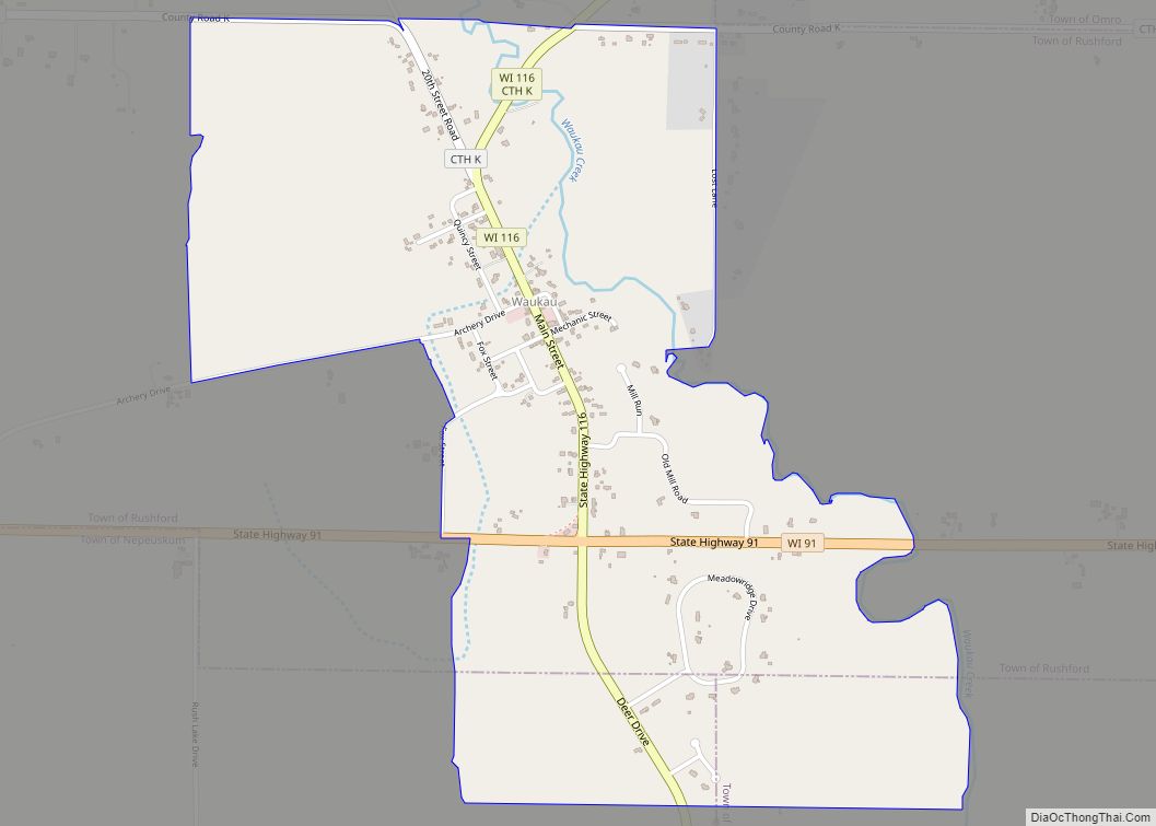
Online Interactive Map
Click on ![]() to view map in "full screen" mode.
to view map in "full screen" mode.
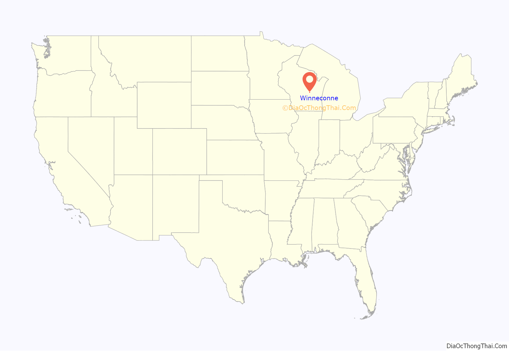
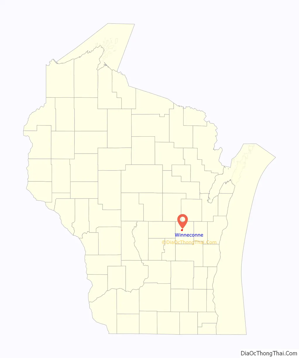
Winneconne location map. Where is Winneconne village?
History
The name is a word derived from the Menominee language meaning “place of skulls”. It refers to a battle site of the French colonial era, in which the Sauk and Fox fought against the French, Menominee and Chippewa for control over the regional fur trade and other resources. It also refers to a nearby prehistoric indigenous burial mound, the namesake for Lake Butte des Morts.
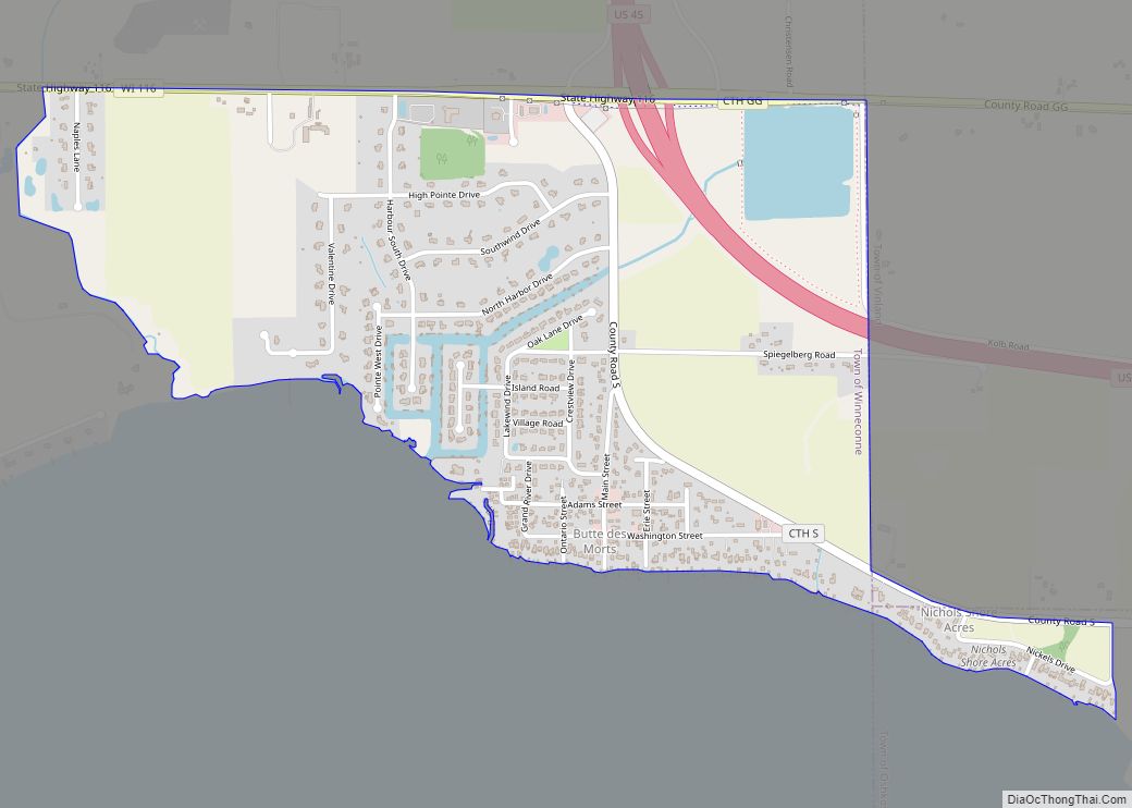
Winneconne Road Map
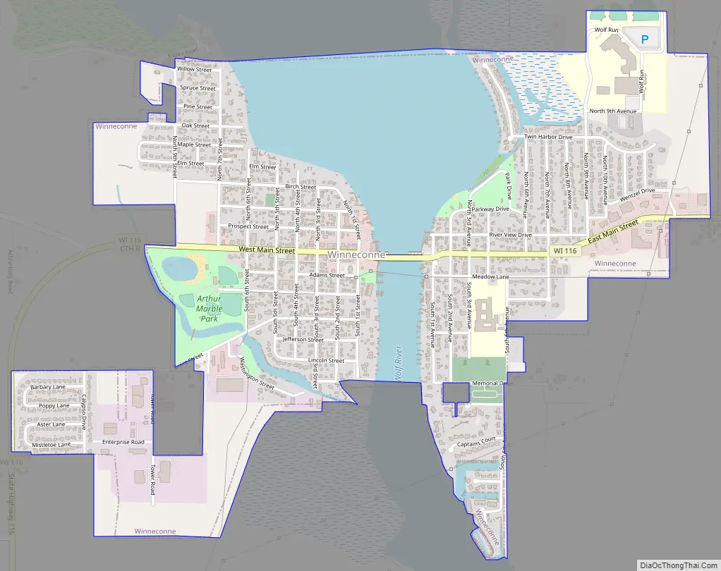
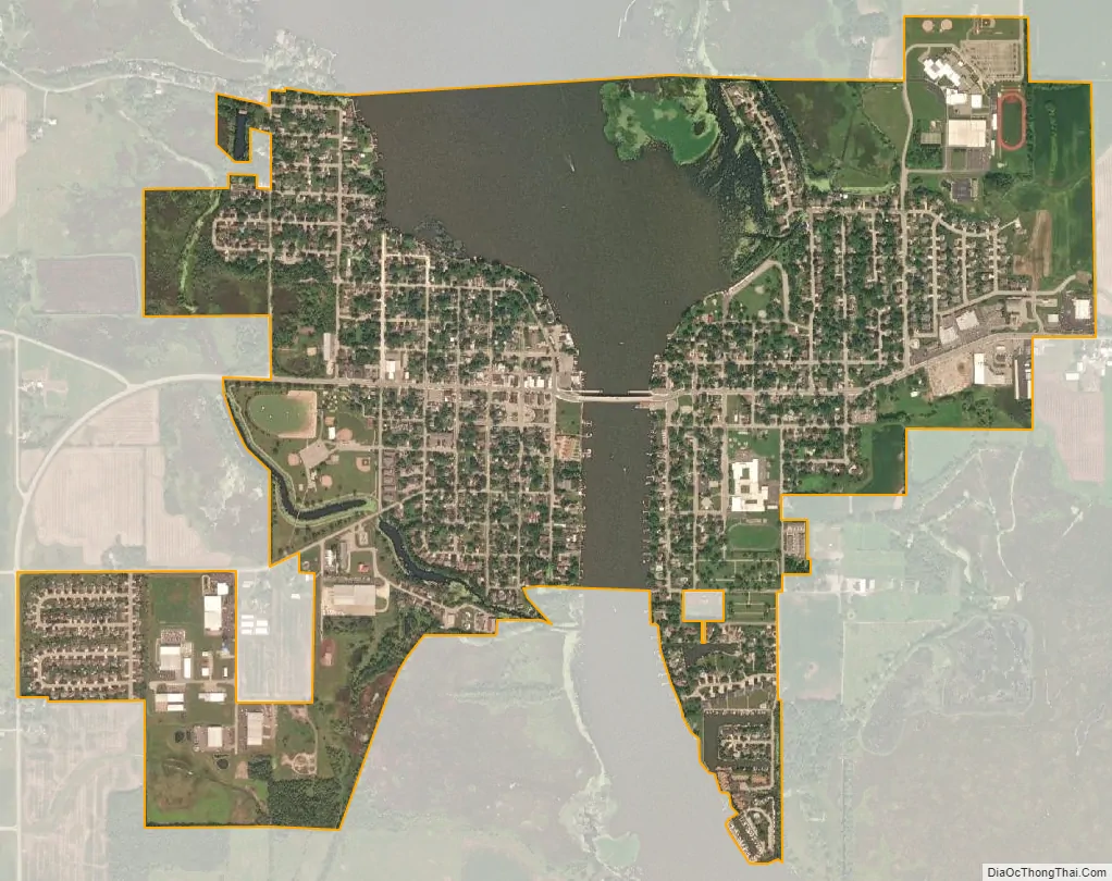
Winneconne city Satellite Map
Geography
According to the United States Census Bureau, the town has a total area of 33.7 square miles (87.2 km), of which 21.5 square miles (55.8 km) is land and 12.1 square miles (31.4 km), or 36.02%, is water. This is the area of the Wolf Chain, a series of connected lakes along the river.
See also
Map of Wisconsin State and its subdivision:- Adams
- Ashland
- Barron
- Bayfield
- Brown
- Buffalo
- Burnett
- Calumet
- Chippewa
- Clark
- Columbia
- Crawford
- Dane
- Dodge
- Door
- Douglas
- Dunn
- Eau Claire
- Florence
- Fond du Lac
- Forest
- Grant
- Green
- Green Lake
- Iowa
- Iron
- Jackson
- Jefferson
- Juneau
- Kenosha
- Kewaunee
- La Crosse
- Lafayette
- Lake Michigan
- Lake Superior
- Langlade
- Lincoln
- Manitowoc
- Marathon
- Marinette
- Marquette
- Menominee
- Milwaukee
- Monroe
- Oconto
- Oneida
- Outagamie
- Ozaukee
- Pepin
- Pierce
- Polk
- Portage
- Price
- Racine
- Richland
- Rock
- Rusk
- Saint Croix
- Sauk
- Sawyer
- Shawano
- Sheboygan
- Taylor
- Trempealeau
- Vernon
- Vilas
- Walworth
- Washburn
- Washington
- Waukesha
- Waupaca
- Waushara
- Winnebago
- Wood
- Alabama
- Alaska
- Arizona
- Arkansas
- California
- Colorado
- Connecticut
- Delaware
- District of Columbia
- Florida
- Georgia
- Hawaii
- Idaho
- Illinois
- Indiana
- Iowa
- Kansas
- Kentucky
- Louisiana
- Maine
- Maryland
- Massachusetts
- Michigan
- Minnesota
- Mississippi
- Missouri
- Montana
- Nebraska
- Nevada
- New Hampshire
- New Jersey
- New Mexico
- New York
- North Carolina
- North Dakota
- Ohio
- Oklahoma
- Oregon
- Pennsylvania
- Rhode Island
- South Carolina
- South Dakota
- Tennessee
- Texas
- Utah
- Vermont
- Virginia
- Washington
- West Virginia
- Wisconsin
- Wyoming