Accoville is an unincorporated community and census-designated place (CDP) in Logan County, West Virginia, United States. The community lies along Buffalo Creek. As of the 2010 United States Census, its population was 574.
| Name: | Accoville CDP |
|---|---|
| LSAD Code: | 57 |
| LSAD Description: | CDP (suffix) |
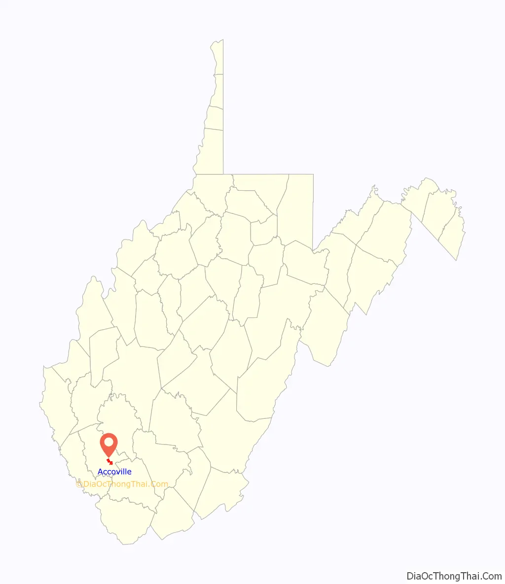
| State: | West Virginia |
| County: | Logan County |
| Elevation: | 830 ft (250 m) |
| Total Area: | 3.23 sq mi (8.37 km²) |
| Land Area: | 3.22 sq mi (8.35 km²) |
| Water Area: | 0.008 sq mi (0.02 km²) |
| Total Population: | 574 |
| Population Density: | 178/sq mi (68.7/km²) |
| ZIP code: | 25606 |
| FIPS code: | 5400196 |
| GNISfeature ID: | 1534798 |
Online Interactive Map
Click on ![]() to view map in "full screen" mode.
to view map in "full screen" mode.
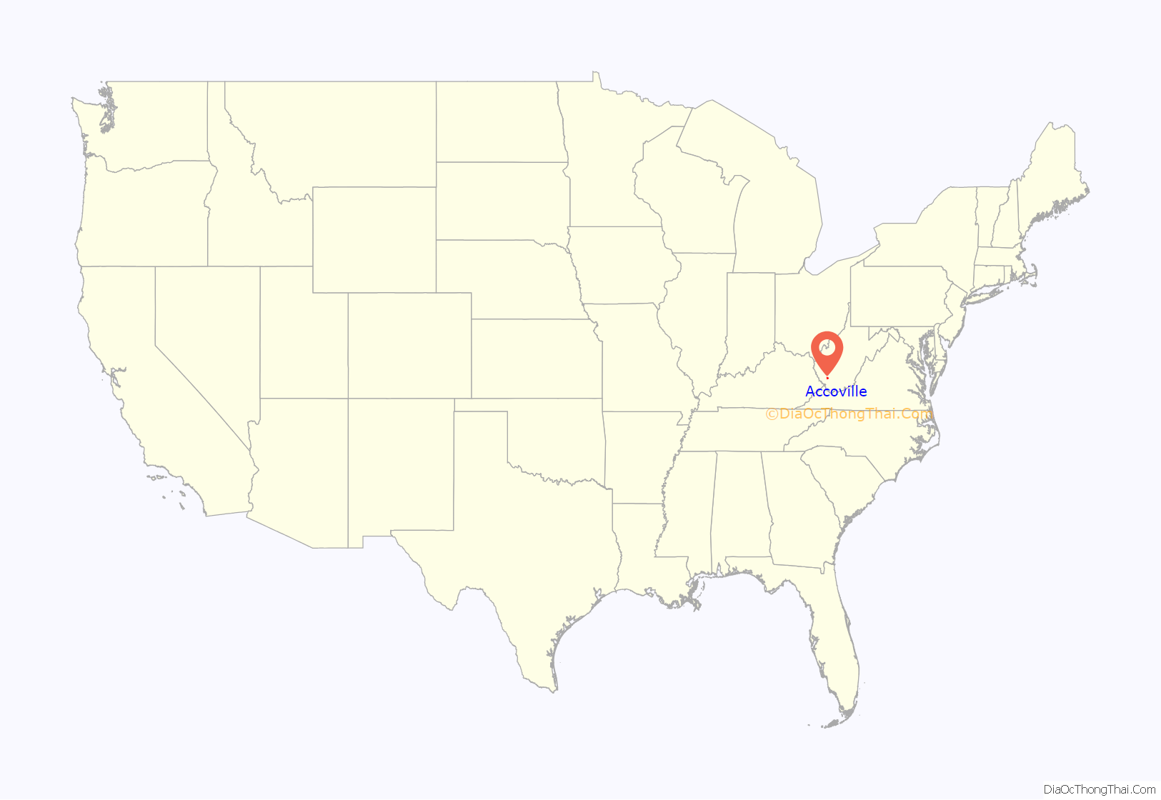
Accoville location map. Where is Accoville CDP?
History
Accoville derived its name from the local Amherst Coal Company (ACCO).
Accoville was in the path of the Buffalo Creek flood in 1972. The devastating man made disaster was caused by a Coal Mine dam failure located by a hillside.
Accoville’s Don Israel Bragg, 33, was killed in the 2006 Aracoma Alma Mine disaster in Melville, along with Ellery Hatfield, 47, of Simon.
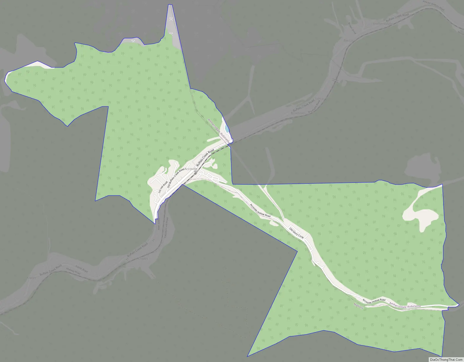
Accoville Road Map
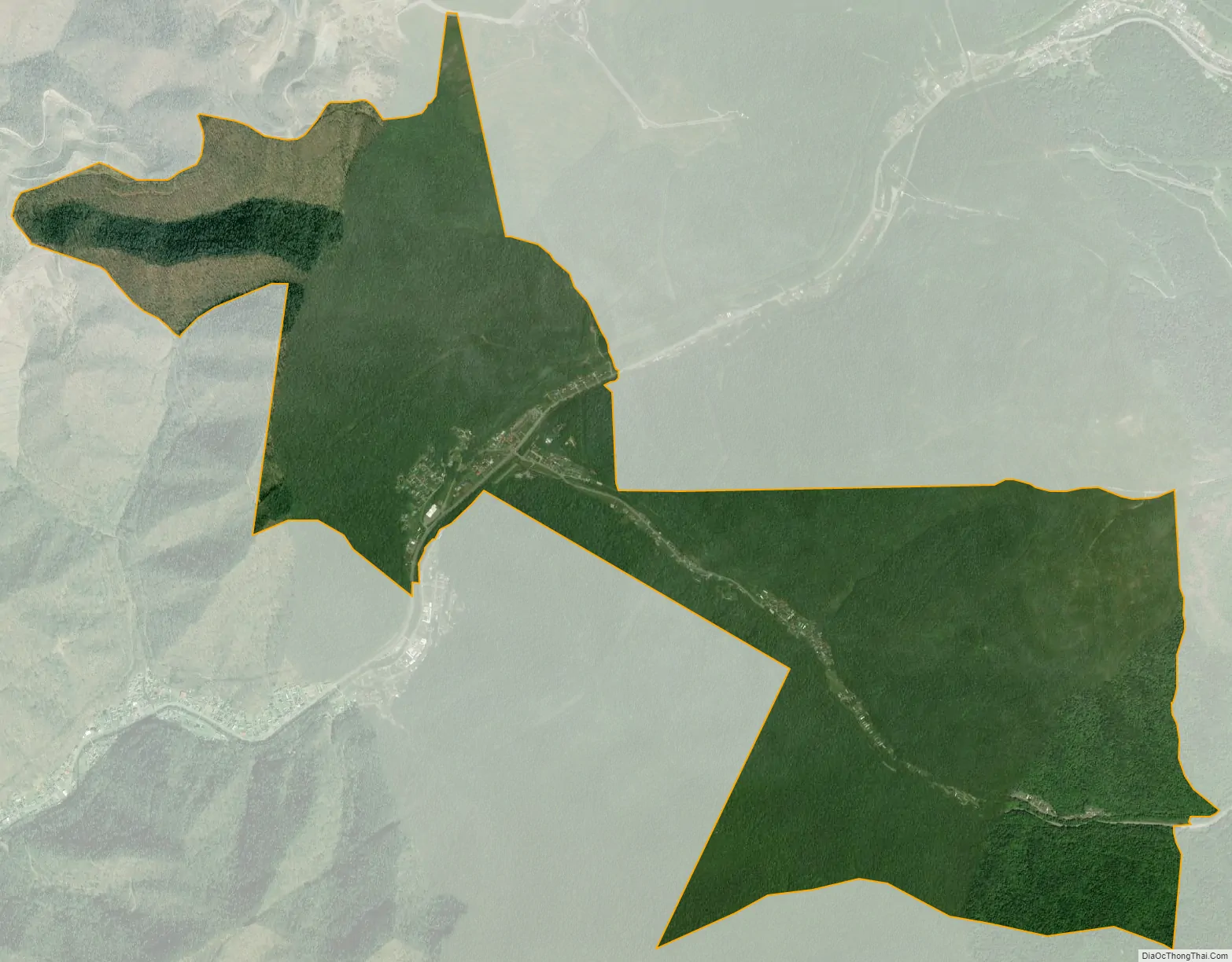
Accoville city Satellite Map
Geography
Accoville is in southeastern Logan County, in the valley of Buffalo Creek, and extending to the east up its Right Fork. It is bordered by Amherstdale to the northeast (up Buffalo Creek) and by Kistler to the southwest (down the creek). Logan, the county seat, is 16 miles (26 km) to the northwest, down Buffalo Creek and then the Guyandotte River.
According to the U.S. Census Bureau, the Accoville CDP has a total area of 3.2 square miles (8.4 km), of which 0.0 square miles (0.02 km), or 0.21%, are water.
See also
Map of West Virginia State and its subdivision:- Barbour
- Berkeley
- Boone
- Braxton
- Brooke
- Cabell
- Calhoun
- Clay
- Doddridge
- Fayette
- Gilmer
- Grant
- Greenbrier
- Hampshire
- Hancock
- Hardy
- Harrison
- Jackson
- Jefferson
- Kanawha
- Lewis
- Lincoln
- Logan
- Marion
- Marshall
- Mason
- McDowell
- Mercer
- Mineral
- Mingo
- Monongalia
- Monroe
- Morgan
- Nicholas
- Ohio
- Pendleton
- Pleasants
- Pocahontas
- Preston
- Putnam
- Raleigh
- Randolph
- Ritchie
- Roane
- Summers
- Taylor
- Tucker
- Tyler
- Upshur
- Wayne
- Webster
- Wetzel
- Wirt
- Wood
- Wyoming
- Alabama
- Alaska
- Arizona
- Arkansas
- California
- Colorado
- Connecticut
- Delaware
- District of Columbia
- Florida
- Georgia
- Hawaii
- Idaho
- Illinois
- Indiana
- Iowa
- Kansas
- Kentucky
- Louisiana
- Maine
- Maryland
- Massachusetts
- Michigan
- Minnesota
- Mississippi
- Missouri
- Montana
- Nebraska
- Nevada
- New Hampshire
- New Jersey
- New Mexico
- New York
- North Carolina
- North Dakota
- Ohio
- Oklahoma
- Oregon
- Pennsylvania
- Rhode Island
- South Carolina
- South Dakota
- Tennessee
- Texas
- Utah
- Vermont
- Virginia
- Washington
- West Virginia
- Wisconsin
- Wyoming


