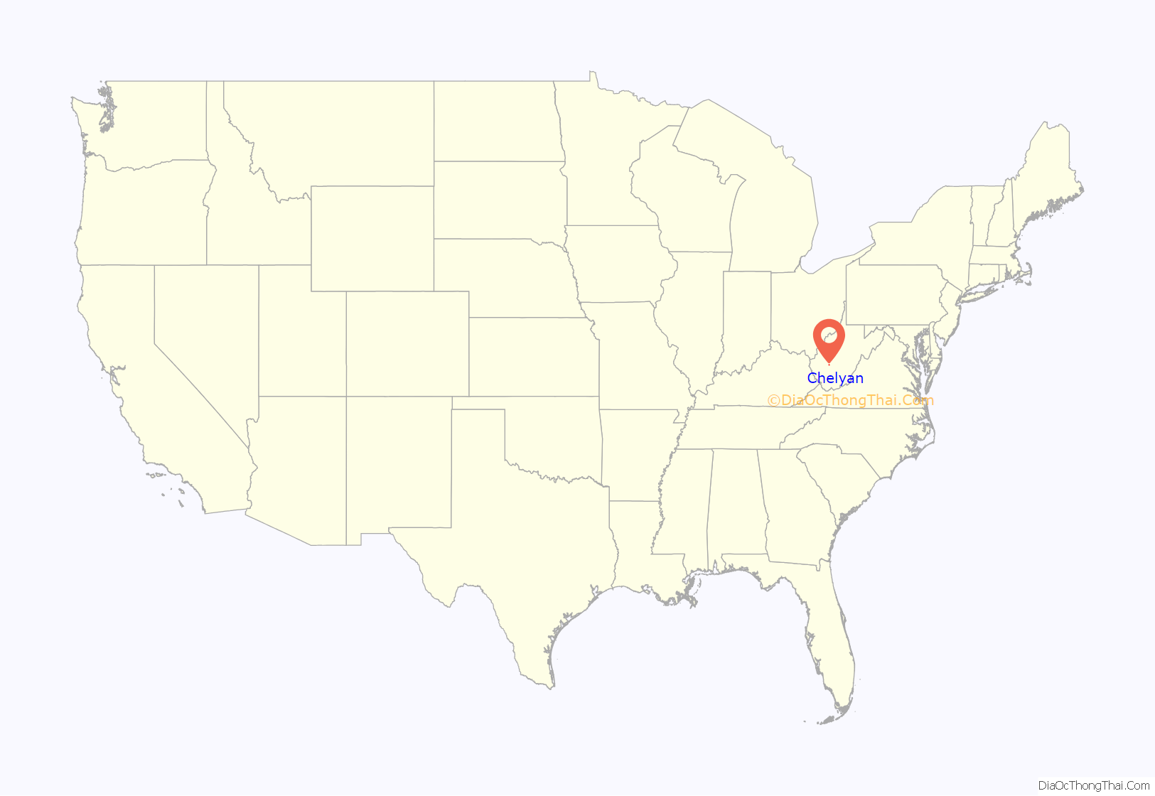
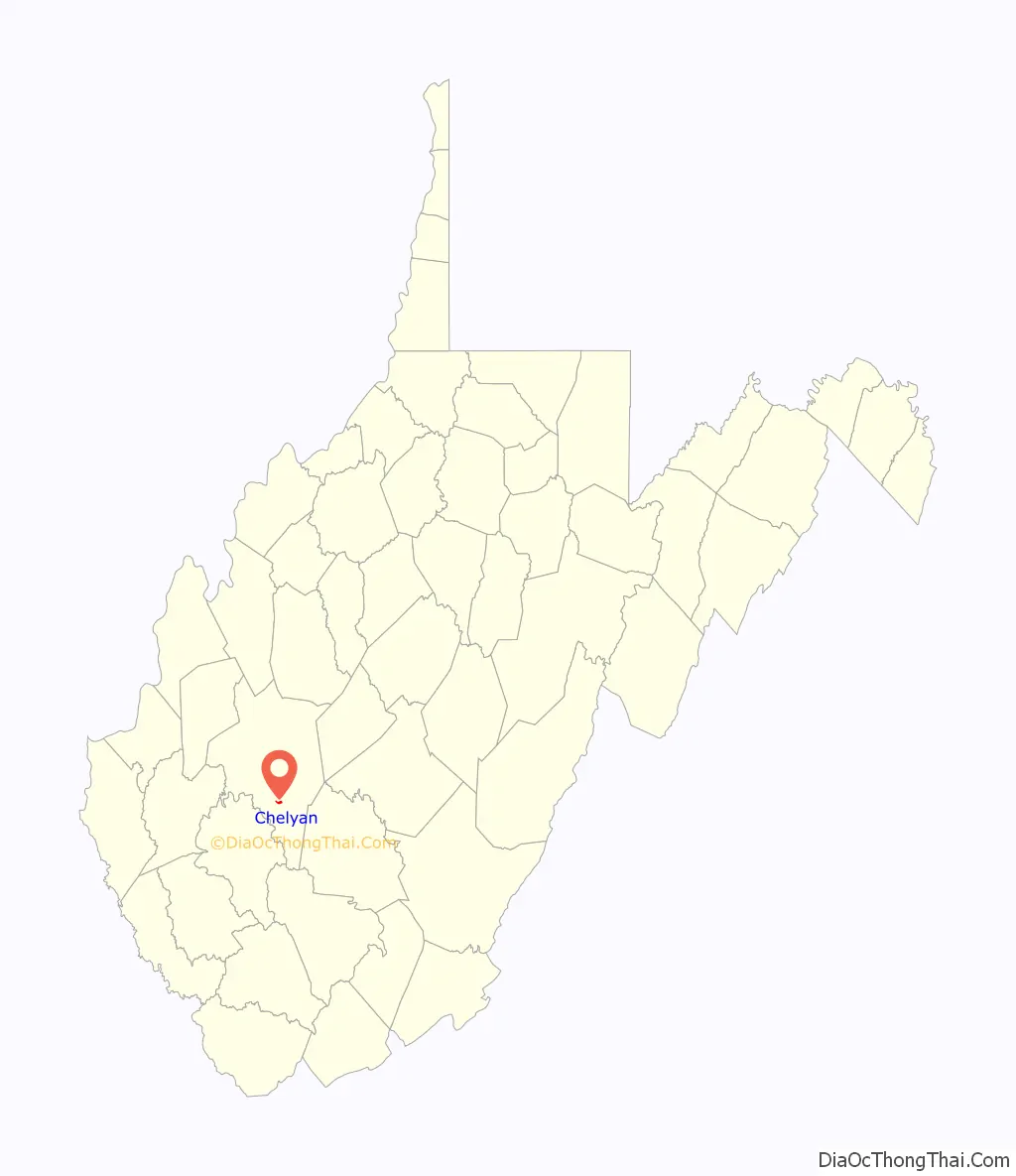
Chelyan (/ˈʃiːljən/ SHEEL-yən) is a census-designated place (CDP) in Kanawha County, West Virginia, United States. Chelyan is located on the south bank of the Kanawha River, southeast of Chesapeake. It is served by Exit 85 of the West Virginia Turnpike. As of the 2010 census, its population was 776.
The community has the name of Chelyan Calvert, the child of an early postmaster.
| Name: | Chelyan CDP |
|---|---|
| LSAD Code: | 57 |
| LSAD Description: | CDP (suffix) |
| State: | West Virginia |
| County: | Kanawha County |
| Elevation: | 617 ft (188 m) |
| Total Area: | 0.430 sq mi (1.11 km²) |
| Land Area: | 0.403 sq mi (1.04 km²) |
| Water Area: | 0.027 sq mi (0.07 km²) |
| Total Population: | 778 |
| Population Density: | 1,800/sq mi (700/km²) |
| Area code: | 304 & 681 |
| FIPS code: | 5414812 |
| GNISfeature ID: | 1537231 |
Online Interactive Map
Click on ![]() to view map in "full screen" mode.
to view map in "full screen" mode.
Chelyan location map. Where is Chelyan CDP?
Chelyan Road Map
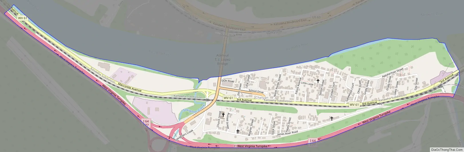
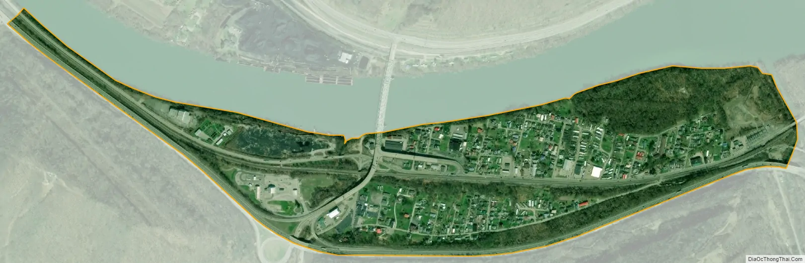
Chelyan city Satellite Map
See also
Map of West Virginia State and its subdivision:- Barbour
- Berkeley
- Boone
- Braxton
- Brooke
- Cabell
- Calhoun
- Clay
- Doddridge
- Fayette
- Gilmer
- Grant
- Greenbrier
- Hampshire
- Hancock
- Hardy
- Harrison
- Jackson
- Jefferson
- Kanawha
- Lewis
- Lincoln
- Logan
- Marion
- Marshall
- Mason
- McDowell
- Mercer
- Mineral
- Mingo
- Monongalia
- Monroe
- Morgan
- Nicholas
- Ohio
- Pendleton
- Pleasants
- Pocahontas
- Preston
- Putnam
- Raleigh
- Randolph
- Ritchie
- Roane
- Summers
- Taylor
- Tucker
- Tyler
- Upshur
- Wayne
- Webster
- Wetzel
- Wirt
- Wood
- Wyoming
- Alabama
- Alaska
- Arizona
- Arkansas
- California
- Colorado
- Connecticut
- Delaware
- District of Columbia
- Florida
- Georgia
- Hawaii
- Idaho
- Illinois
- Indiana
- Iowa
- Kansas
- Kentucky
- Louisiana
- Maine
- Maryland
- Massachusetts
- Michigan
- Minnesota
- Mississippi
- Missouri
- Montana
- Nebraska
- Nevada
- New Hampshire
- New Jersey
- New Mexico
- New York
- North Carolina
- North Dakota
- Ohio
- Oklahoma
- Oregon
- Pennsylvania
- Rhode Island
- South Carolina
- South Dakota
- Tennessee
- Texas
- Utah
- Vermont
- Virginia
- Washington
- West Virginia
- Wisconsin
- Wyoming