Clendenin is a town in Kanawha County, West Virginia, United States, situated along the Elk River. The population was 850 at the 2020 census.
| Name: | Clendenin town |
|---|---|
| LSAD Code: | 43 |
| LSAD Description: | town (suffix) |
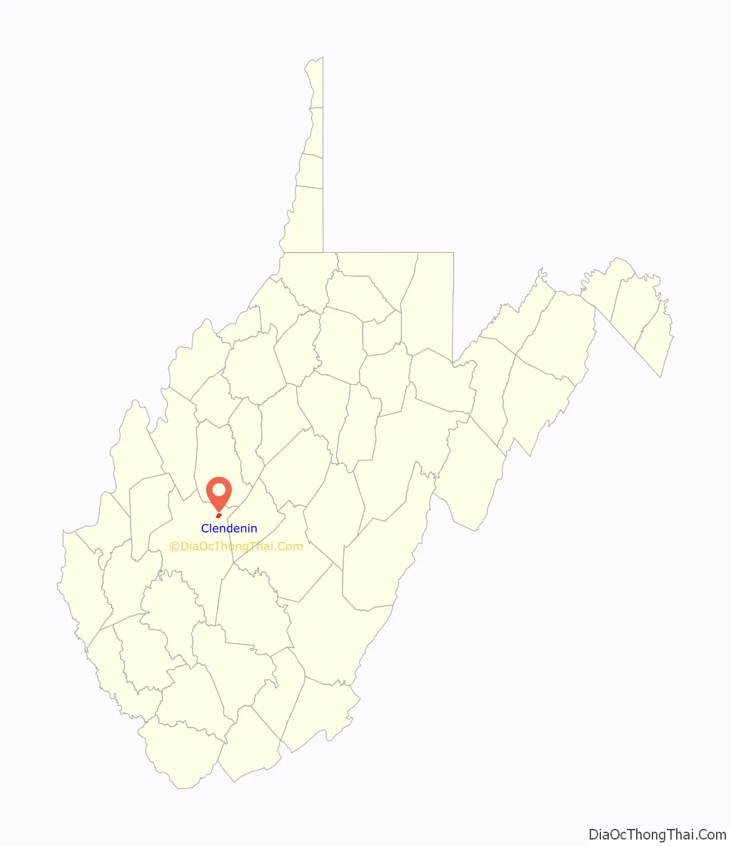
| State: | West Virginia |
| County: | Kanawha County |
| Elevation: | 623 ft (190 m) |
| Total Area: | 1.52 sq mi (3.94 km²) |
| Land Area: | 1.44 sq mi (3.73 km²) |
| Water Area: | 0.08 sq mi (0.21 km²) |
| Total Population: | 850 |
| Population Density: | 762.83/sq mi (294.56/km²) |
| ZIP code: | 25045 |
| Area code: | 304 |
| FIPS code: | 5416012 |
| GNISfeature ID: | 1537398 |
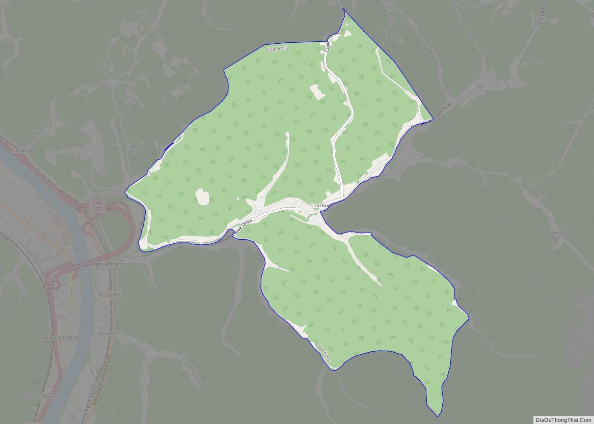
Online Interactive Map
Click on ![]() to view map in "full screen" mode.
to view map in "full screen" mode.
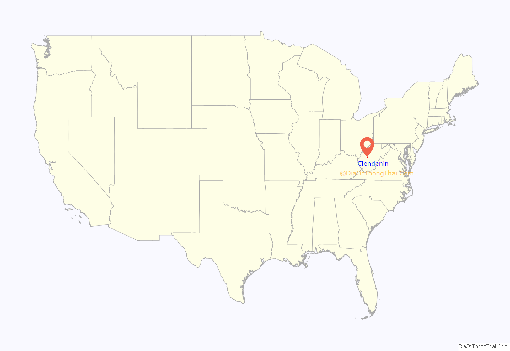
Clendenin location map. Where is Clendenin town?
History
In the 1800s, Clendenin was a small settlement at the confluence of Big Sandy Creek and the Elk River that eventually became a small village named Chilton. At this time, timber and coal mining were the principal industries in the area. In 1846, one of the first cannel coal veins was discovered at Falling Rock (only a few miles from Chilton/Clendenin) and became a rich source for manufacturing artificial gas. Clendenin was platted in 1877.
In 1893, the Coal and Coke railroad was built running through Clendenin, paralleling the Elk River and allowing the logging industry to set up residence. Along with the drilling of the first gas well in the area in 1900, this allowed the development of one of the largest oil and gas fields in West Virginia. The town was incorporated in 1904 and named after the Clendenin family, an early pioneer family in the Kanawha River Valley. The first petrochemical plant in the world was built in Clendenin in 1920. This plant was the original Union Carbide Corporation facility. Other chief economic staples included timber, coal, gas, oil, and salt. The decades from 1900 to 1930 saw most of the towns growth, and construction of most of the major buildings in town, including the elementary, middle, and high schools, several large churches, three banks, and several blocks of commercial buildings. When Union Carbide moved their production plant from Falling Rock to Charleston, the economy slowed but Clendenin remained a commercial hub for northern Kanawha County, southern Roane County, and western Clay County until Interstate 79 bypassed the town in the 1980s.
Clendenin suffered damage during the 2016 West Virginia flood. Recovery was largely complete by January 2020, although some homes remained in need of demolition or rebuilding.
The current mayor of Clendenin is Kay Summers. Town elections (including the office of mayor and city council) occur every two years. Recent efforts have been made by 25045-A New Clendenin (a non-profit corporation based in Clendenin) and the Business and Industrial Development Corporation (headquartered in Charleston) to enhance economic and cultural development in the town.
Clendenin Road Map
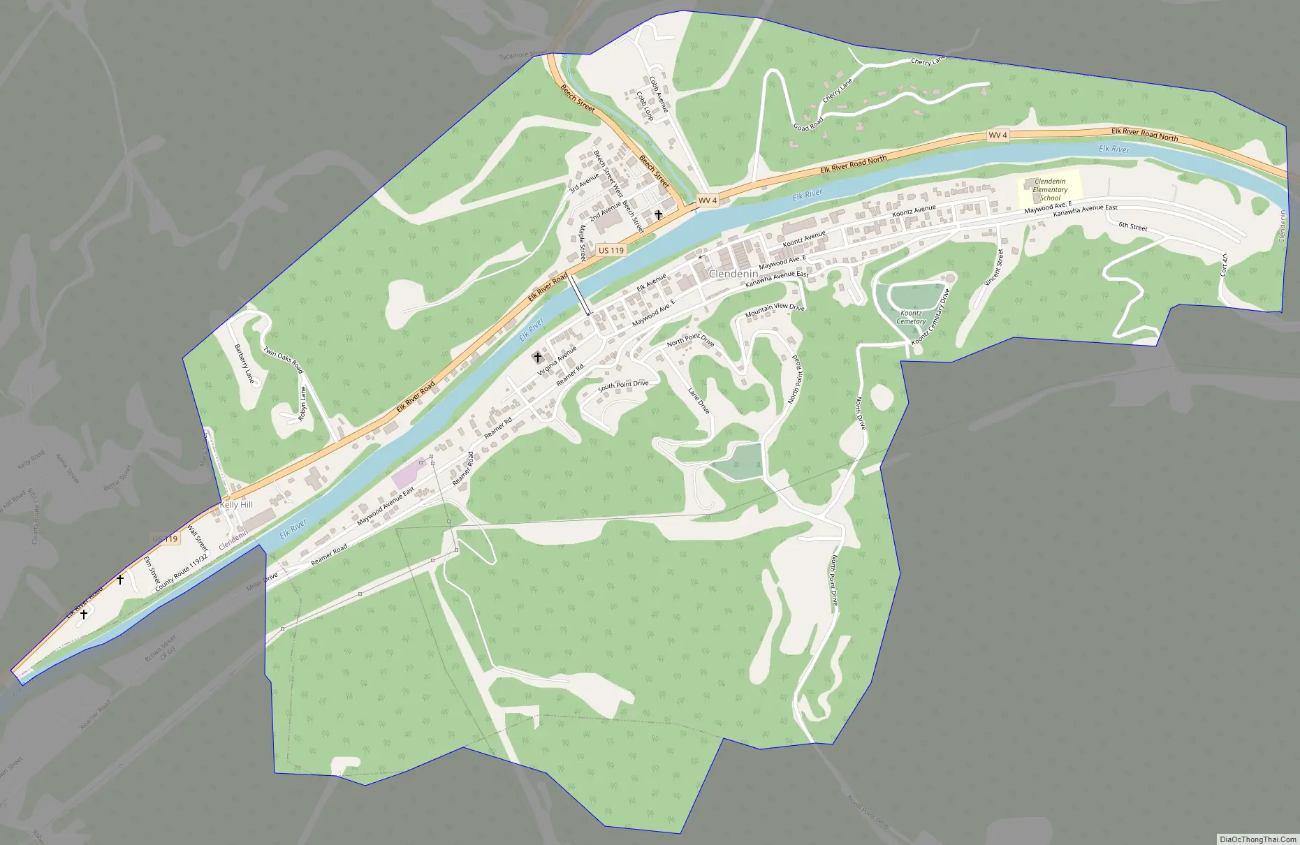
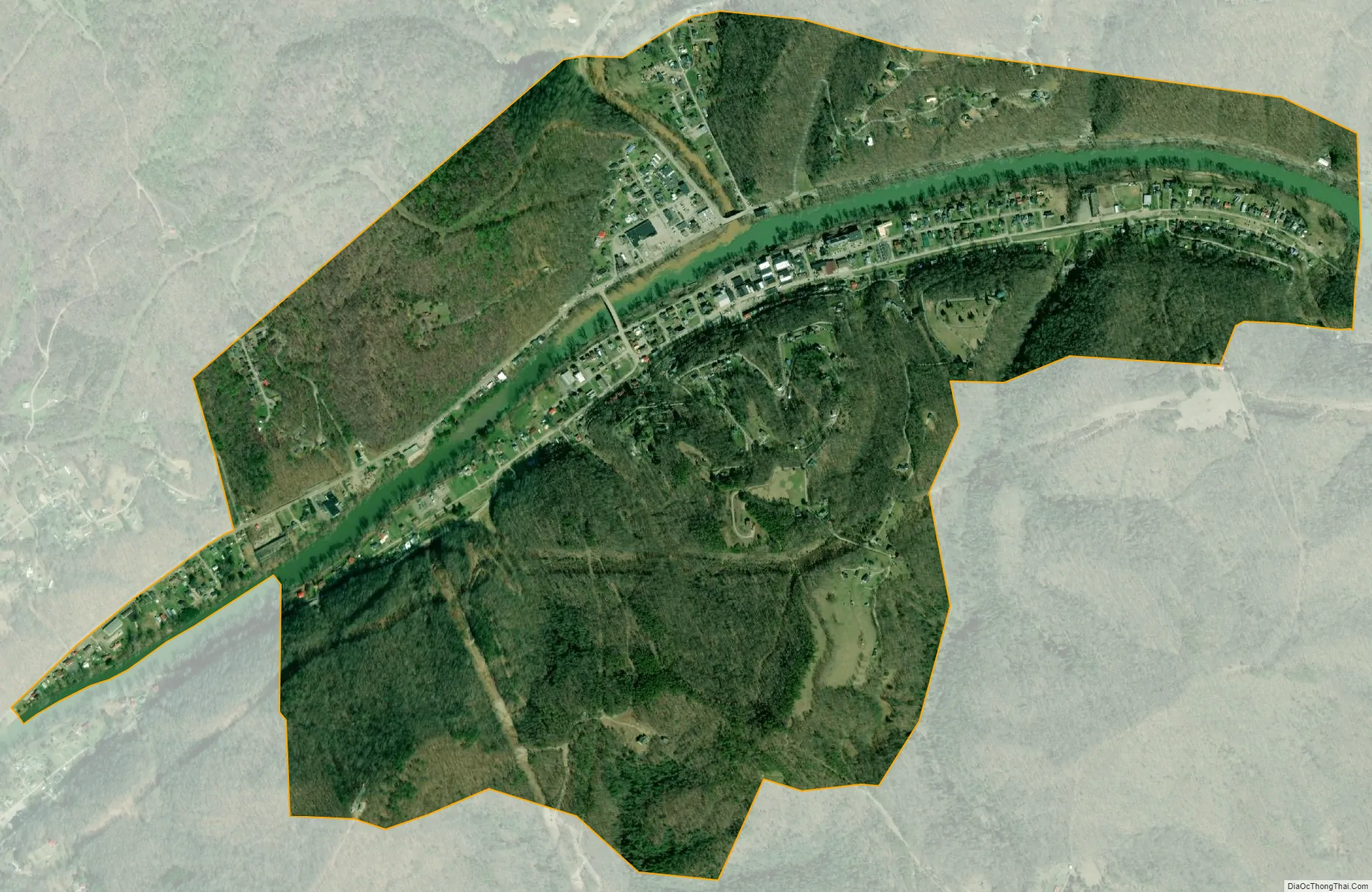
Clendenin city Satellite Map
Geography
According to the United States Census Bureau, the town has a total area of 1.51 square miles (3.91 km), of which 1.44 square miles (3.73 km) is land and 0.07 square miles (0.18 km) is water.
Climate
The climate in this area is characterized by hot, humid summers and generally mild to cool winters. According to the Köppen Climate Classification system, Clendenin has a humid subtropical climate, abbreviated “Cfa” on climate maps. In Clendenin, 236 days out of the year have fog, and 153 days have precipitation.
See also
Map of West Virginia State and its subdivision:- Barbour
- Berkeley
- Boone
- Braxton
- Brooke
- Cabell
- Calhoun
- Clay
- Doddridge
- Fayette
- Gilmer
- Grant
- Greenbrier
- Hampshire
- Hancock
- Hardy
- Harrison
- Jackson
- Jefferson
- Kanawha
- Lewis
- Lincoln
- Logan
- Marion
- Marshall
- Mason
- McDowell
- Mercer
- Mineral
- Mingo
- Monongalia
- Monroe
- Morgan
- Nicholas
- Ohio
- Pendleton
- Pleasants
- Pocahontas
- Preston
- Putnam
- Raleigh
- Randolph
- Ritchie
- Roane
- Summers
- Taylor
- Tucker
- Tyler
- Upshur
- Wayne
- Webster
- Wetzel
- Wirt
- Wood
- Wyoming
- Alabama
- Alaska
- Arizona
- Arkansas
- California
- Colorado
- Connecticut
- Delaware
- District of Columbia
- Florida
- Georgia
- Hawaii
- Idaho
- Illinois
- Indiana
- Iowa
- Kansas
- Kentucky
- Louisiana
- Maine
- Maryland
- Massachusetts
- Michigan
- Minnesota
- Mississippi
- Missouri
- Montana
- Nebraska
- Nevada
- New Hampshire
- New Jersey
- New Mexico
- New York
- North Carolina
- North Dakota
- Ohio
- Oklahoma
- Oregon
- Pennsylvania
- Rhode Island
- South Carolina
- South Dakota
- Tennessee
- Texas
- Utah
- Vermont
- Virginia
- Washington
- West Virginia
- Wisconsin
- Wyoming