Dunbar is a city in Kanawha County, West Virginia, United States, situated along the Kanawha River. The population was 7,479 at the 2020 census.
| Name: | Dunbar city |
|---|---|
| LSAD Code: | 25 |
| LSAD Description: | city (suffix) |
| State: | West Virginia |
| County: | Kanawha County |
| Elevation: | 594 ft (181 m) |
| Total Area: | 2.81 sq mi (7.27 km²) |
| Land Area: | 2.80 sq mi (7.26 km²) |
| Water Area: | 0.00 sq mi (0.01 km²) |
| Total Population: | 7,479 |
| Population Density: | 2,531.41/sq mi (977.26/km²) |
| ZIP code: | 25064 |
| Area code: | 304 |
| FIPS code: | 5422564 |
| GNISfeature ID: | 1538426 |
| Website: | www.cityofdunbarwv.gov |
Online Interactive Map
Click on ![]() to view map in "full screen" mode.
to view map in "full screen" mode.
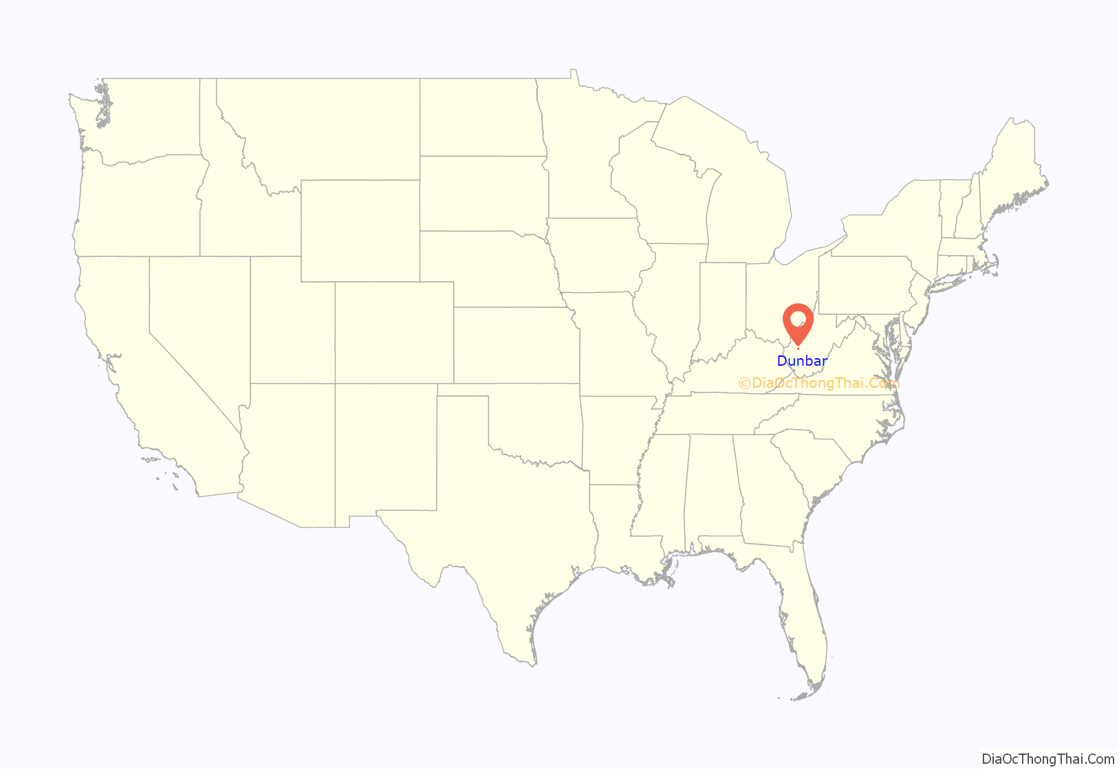
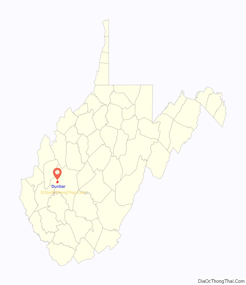
Dunbar location map. Where is Dunbar city?
History
Dunbar was incorporated on April 19, 1921, by an Act of the West Virginia Legislature. Dunbar is on land that was originally occupied by Native Americans with 11 mounds identified in the residential areas. The land was granted to George Washington for his military service and was named for Mary Dunbar after she inherited the land from Washington, although other sources say it was named for Dunbar Baines, a prominent area banker.
Dunbar was a farming community until industries began to evolve in the city with the opening of glass and bottling plants in 1912. The Gravely Plow was invented in Dunbar in 1916.
Located at Dunbar is the Dutch Hollow Wine Cellars, listed on the National Register of Historic Places in 1970. The park is listed on the Register due to the walk-in wine cellars located within the Park. In the past the area was known for its vineyards and the cellars were used to store wine made from the grapes grown in the vineyards. The cellars were thought to be built around 1860 due to the popularity of wine-making. The wine was then hauled to Charleston and Cincinnati. After the Civil War, wine making was no longer profitable and the vineyards were abandoned. The popularity of wine in neighboring Virginia and Ohio also had an impact on grape growing in West Virginia. The wine cellars are preserved and protected for future generations due to the foresight of Dunbar to develop the area into a City park.
Dunbar Road Map
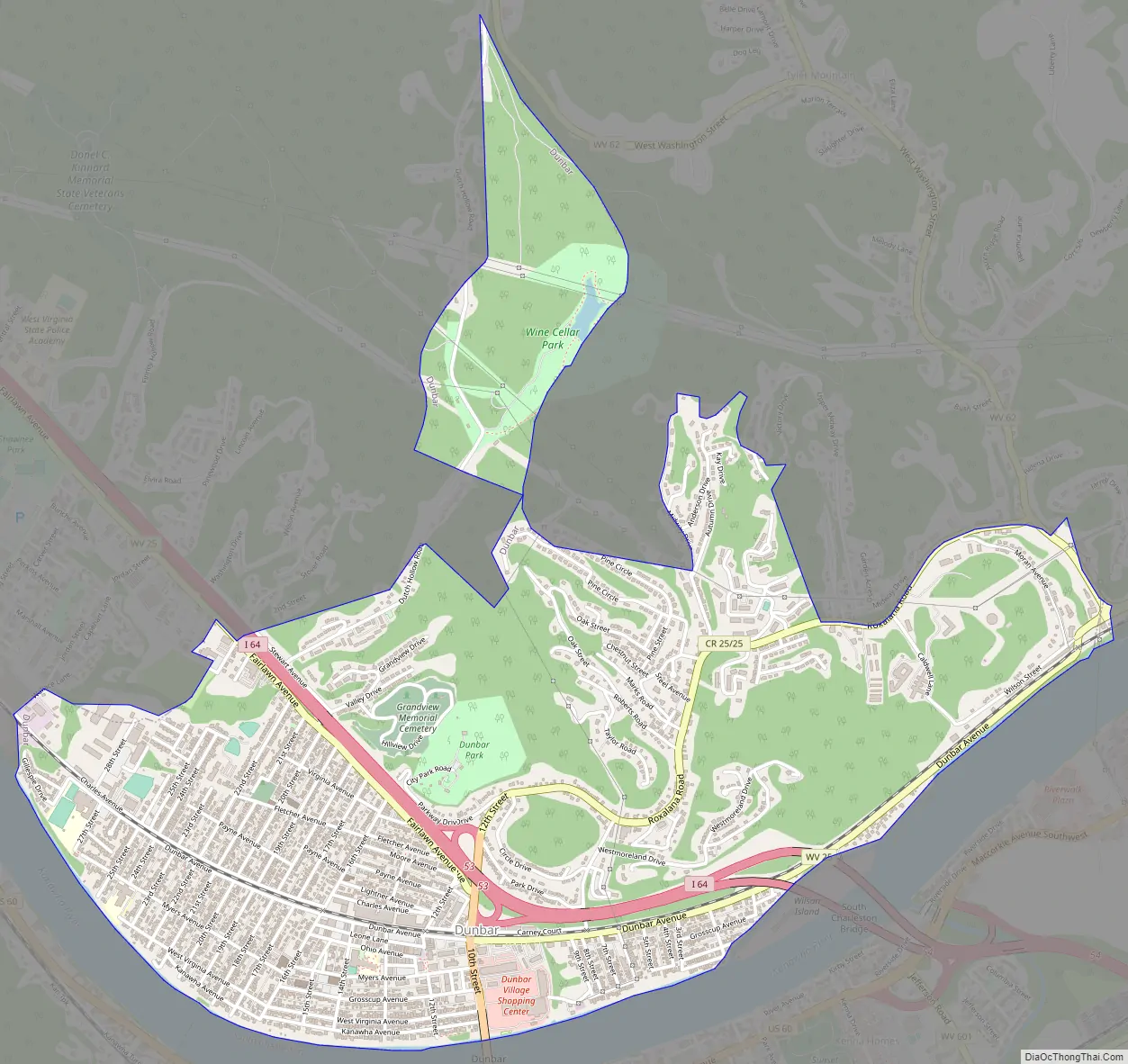
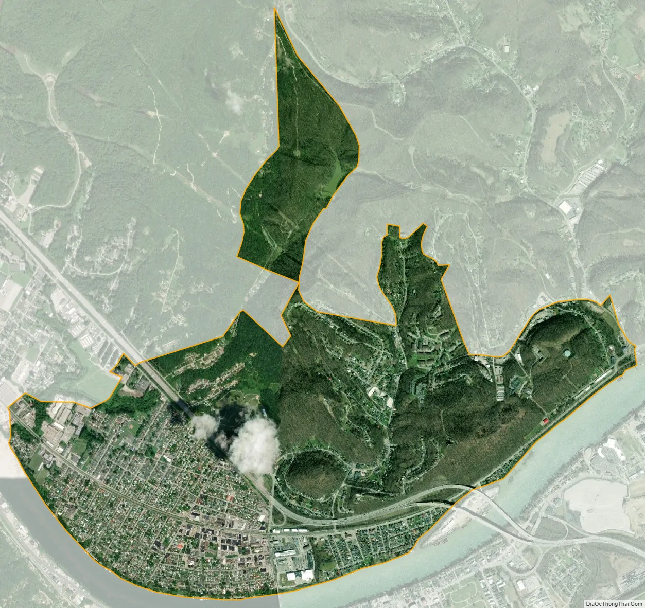
Dunbar city Satellite Map
Geography
Dunbar is located at 38°21′52″N 81°44′22″W / 38.36444°N 81.73944°W / 38.36444; -81.73944 (38.364319, -81.739539). Dunbar is served by Interstate 64 and WV 25.
According to the United States Census Bureau, the city has a total area of 2.81 square miles (7.28 km), of which 2.80 square miles (7.25 km) is land and 0.01 square miles (0.03 km) is water.
See also
Map of West Virginia State and its subdivision:- Barbour
- Berkeley
- Boone
- Braxton
- Brooke
- Cabell
- Calhoun
- Clay
- Doddridge
- Fayette
- Gilmer
- Grant
- Greenbrier
- Hampshire
- Hancock
- Hardy
- Harrison
- Jackson
- Jefferson
- Kanawha
- Lewis
- Lincoln
- Logan
- Marion
- Marshall
- Mason
- McDowell
- Mercer
- Mineral
- Mingo
- Monongalia
- Monroe
- Morgan
- Nicholas
- Ohio
- Pendleton
- Pleasants
- Pocahontas
- Preston
- Putnam
- Raleigh
- Randolph
- Ritchie
- Roane
- Summers
- Taylor
- Tucker
- Tyler
- Upshur
- Wayne
- Webster
- Wetzel
- Wirt
- Wood
- Wyoming
- Alabama
- Alaska
- Arizona
- Arkansas
- California
- Colorado
- Connecticut
- Delaware
- District of Columbia
- Florida
- Georgia
- Hawaii
- Idaho
- Illinois
- Indiana
- Iowa
- Kansas
- Kentucky
- Louisiana
- Maine
- Maryland
- Massachusetts
- Michigan
- Minnesota
- Mississippi
- Missouri
- Montana
- Nebraska
- Nevada
- New Hampshire
- New Jersey
- New Mexico
- New York
- North Carolina
- North Dakota
- Ohio
- Oklahoma
- Oregon
- Pennsylvania
- Rhode Island
- South Carolina
- South Dakota
- Tennessee
- Texas
- Utah
- Vermont
- Virginia
- Washington
- West Virginia
- Wisconsin
- Wyoming