Jefferson is a census-designated place (CDP) in Kanawha County, West Virginia, United States, along the Kanawha River. The population was 676 at the 2010 census. Jefferson was incorporated on March 22, 1997, but was disincorporated less than a decade later on February 21, 2007.
In January 2001, Jefferson was profiled on The Daily Show with Jon Stewart by faux reporter Stephen Colbert.
| Name: | Jefferson CDP |
|---|---|
| LSAD Code: | 57 |
| LSAD Description: | CDP (suffix) |
| State: | West Virginia |
| County: | Kanawha County |
| Elevation: | 591 ft (180 m) |
| Total Area: | 0.5 sq mi (1.4 km²) |
| Land Area: | 0.3 sq mi (0.9 km²) |
| Water Area: | 0.2 sq mi (0.5 km²) |
| Total Population: | 676 |
| Population Density: | 1,768.6/sq mi (682.9/km²) |
| ZIP code: | 25177 |
| Area code: | 304 |
| FIPS code: | 5441010 |
| GNISfeature ID: | 1802732 |
Online Interactive Map
Click on ![]() to view map in "full screen" mode.
to view map in "full screen" mode.
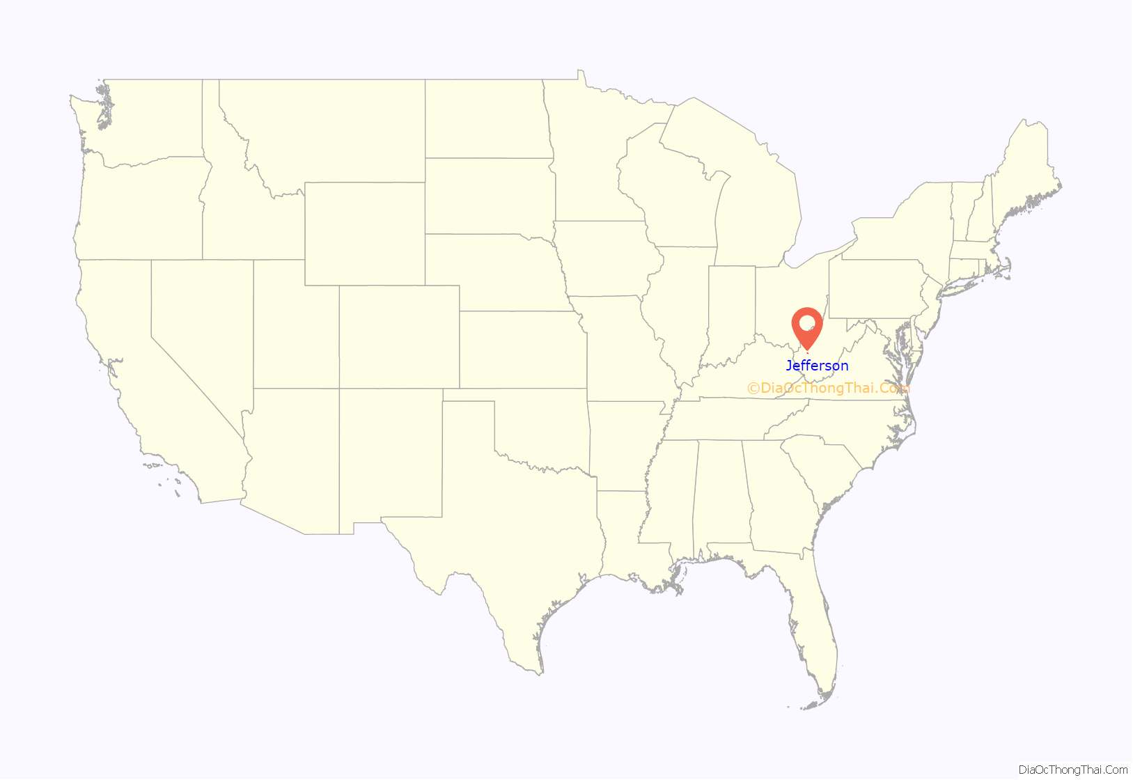
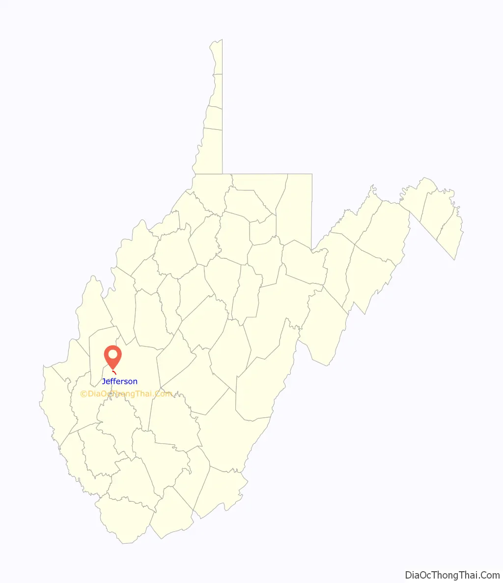
Jefferson location map. Where is Jefferson CDP?
Jefferson Road Map
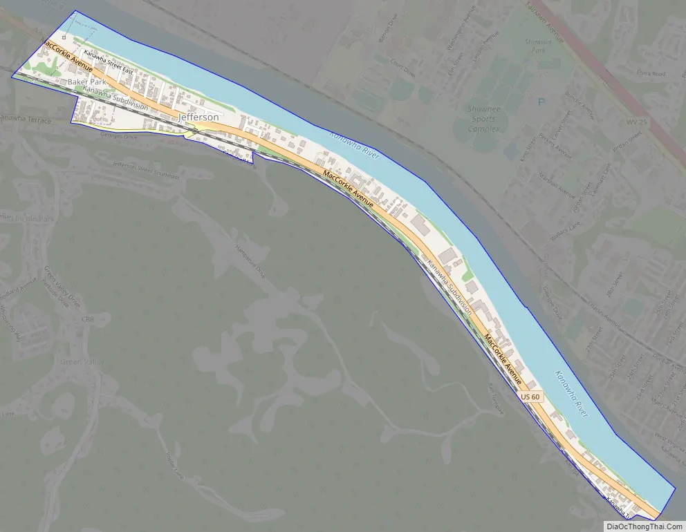
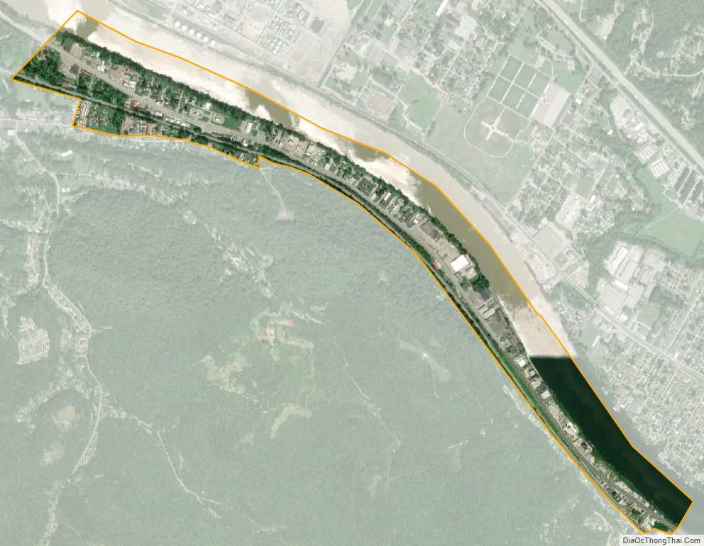
Jefferson city Satellite Map
Geography
Jefferson is located at 38°22′27″N 81°46′43″W / 38.37417°N 81.77861°W / 38.37417; -81.77861 (38.374102, -81.778726).
According to the United States Census Bureau, the CDP has a total area of 0.5 square miles (1.4 km); 0.3 square miles (0.9 km) of this is land, and 0.2 square miles (0.5 km) is water.
See also
Map of West Virginia State and its subdivision:- Barbour
- Berkeley
- Boone
- Braxton
- Brooke
- Cabell
- Calhoun
- Clay
- Doddridge
- Fayette
- Gilmer
- Grant
- Greenbrier
- Hampshire
- Hancock
- Hardy
- Harrison
- Jackson
- Jefferson
- Kanawha
- Lewis
- Lincoln
- Logan
- Marion
- Marshall
- Mason
- McDowell
- Mercer
- Mineral
- Mingo
- Monongalia
- Monroe
- Morgan
- Nicholas
- Ohio
- Pendleton
- Pleasants
- Pocahontas
- Preston
- Putnam
- Raleigh
- Randolph
- Ritchie
- Roane
- Summers
- Taylor
- Tucker
- Tyler
- Upshur
- Wayne
- Webster
- Wetzel
- Wirt
- Wood
- Wyoming
- Alabama
- Alaska
- Arizona
- Arkansas
- California
- Colorado
- Connecticut
- Delaware
- District of Columbia
- Florida
- Georgia
- Hawaii
- Idaho
- Illinois
- Indiana
- Iowa
- Kansas
- Kentucky
- Louisiana
- Maine
- Maryland
- Massachusetts
- Michigan
- Minnesota
- Mississippi
- Missouri
- Montana
- Nebraska
- Nevada
- New Hampshire
- New Jersey
- New Mexico
- New York
- North Carolina
- North Dakota
- Ohio
- Oklahoma
- Oregon
- Pennsylvania
- Rhode Island
- South Carolina
- South Dakota
- Tennessee
- Texas
- Utah
- Vermont
- Virginia
- Washington
- West Virginia
- Wisconsin
- Wyoming