New Cumberland is a city in and the county seat of Hancock County, West Virginia, United States, along the Ohio River. The population was 1,020 as of the 2020 census. It is part of the Weirton–Steubenville metropolitan area.
| Name: | New Cumberland city |
|---|---|
| LSAD Code: | 25 |
| LSAD Description: | city (suffix) |
| State: | West Virginia |
| County: | Hancock County |
| Elevation: | 722 ft (220 m) |
| Total Area: | 1.86 sq mi (4.82 km²) |
| Land Area: | 1.22 sq mi (3.16 km²) |
| Water Area: | 0.64 sq mi (1.66 km²) |
| Total Population: | 1,020 |
| Population Density: | 824.59/sq mi (318.47/km²) |
| ZIP code: | 26047 |
| Area code: | 304 |
| FIPS code: | 5458372 |
| GNISfeature ID: | 1555205 |
| Website: | www.cityofnewcumberland.net |
Online Interactive Map
Click on ![]() to view map in "full screen" mode.
to view map in "full screen" mode.
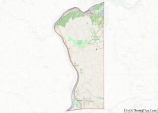
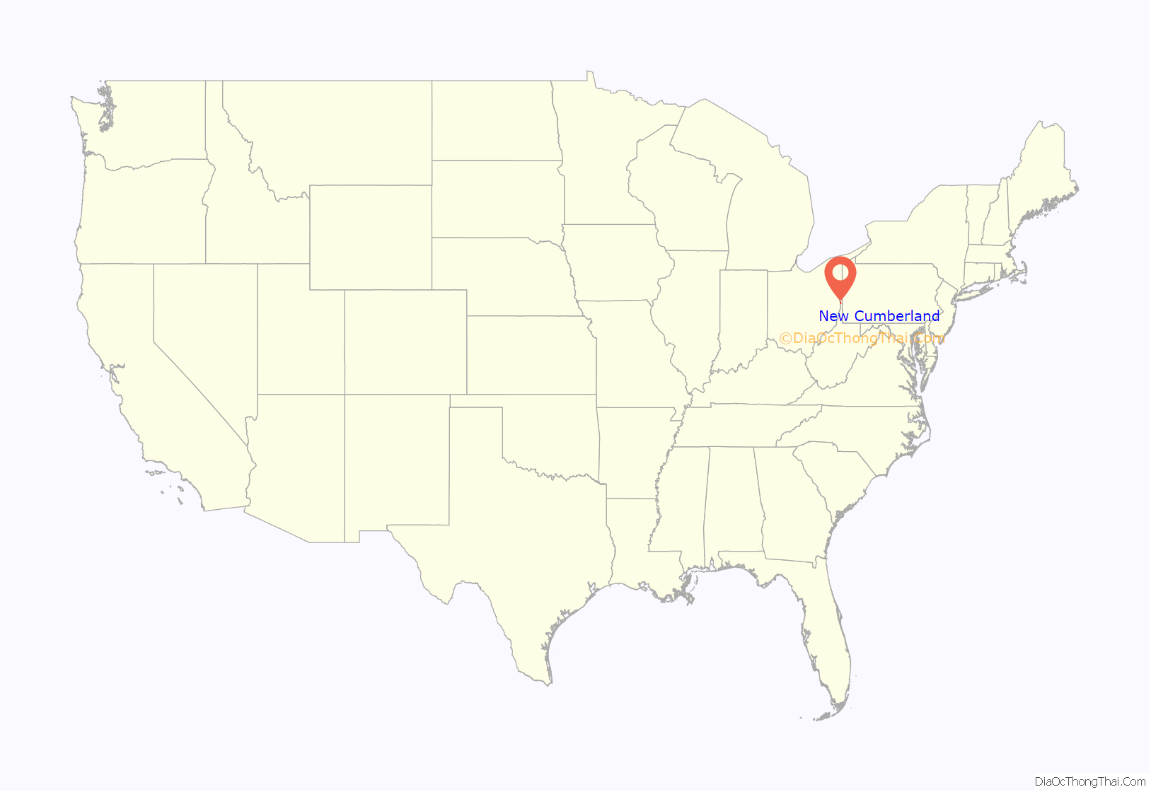
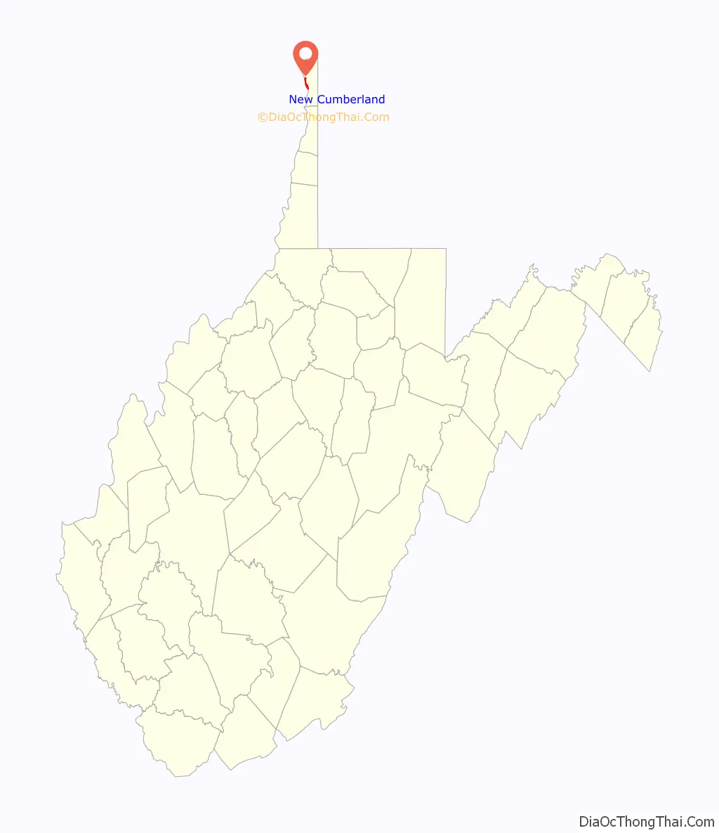
New Cumberland location map. Where is New Cumberland city?
History
Pioneer George Chapman settled in the area of present-day New Cumberland in 1783 or 1784 and founded Fort Chapman. In 1839, John Cuppy laid out a town at the site and named it Vernon, although it was also referred to as Cuppytown. Cuppy changed the name to New Cumberland per the requests of the earliest land buyers, naming it after Cumberland, Maryland. The town was incorporated by the West Virginia Legislature in 1872.
When Hancock County was formed in 1848, New Cumberland competed with New Manchester (at the time Fairview, and later, Pughtown) for the county seat. New Cumberland was chosen by thirteen votes in a referendum, but the already-seated courthouse in New Manchester refused to comply. In 1850, New Cumberland won a second referendum by forty-six votes and the seat was moved, but just two years later yet another referendum resulted in a New Manchester victory. In 1884, a final election resolved the matter, and New Cumberland became the permanent county seat.
Local industry in the past involved the manufacture of fire and paving brick, sewer pipe, glassware, foundry and machine-shop products, and tiling. There were also coal mines and mills for the pulverization of fire clay for use in ironworks. The First National Bank-Graham Building and Marshall House are listed on the National Register of Historic Places.
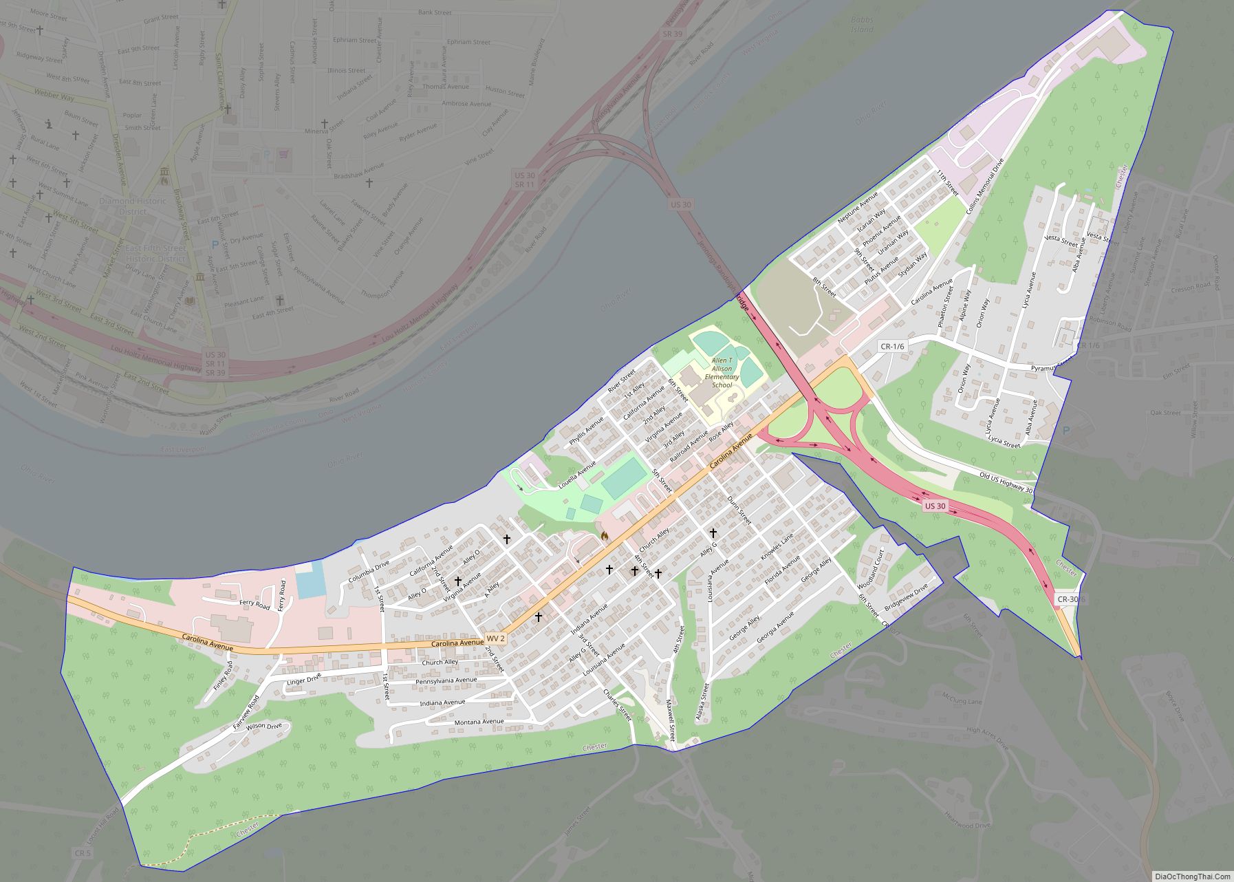
New Cumberland Road Map
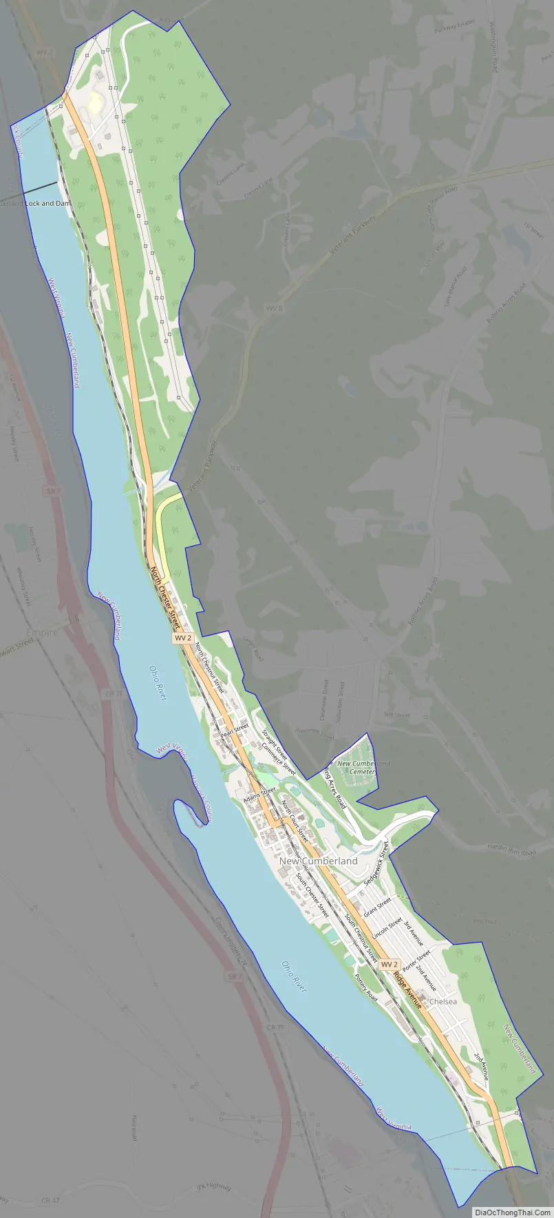
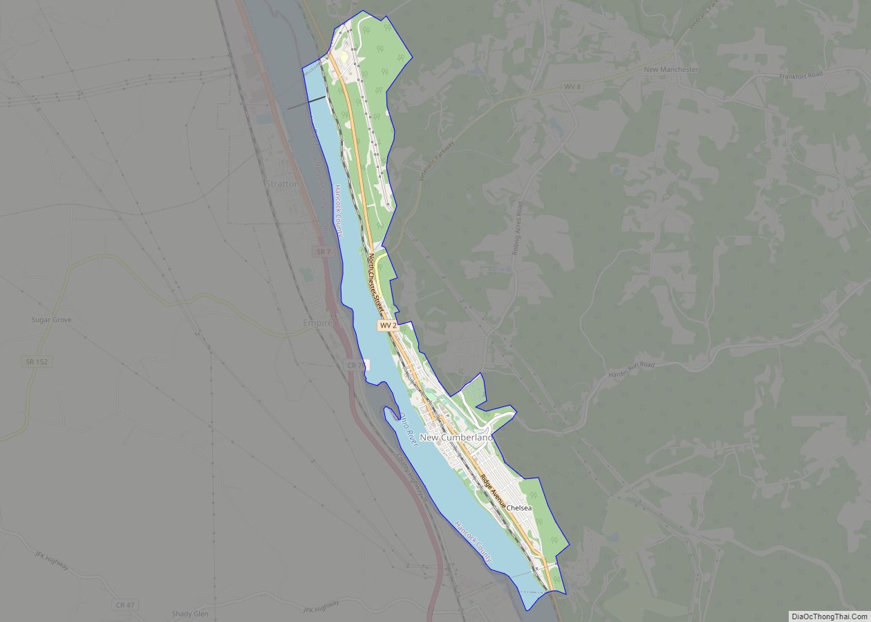
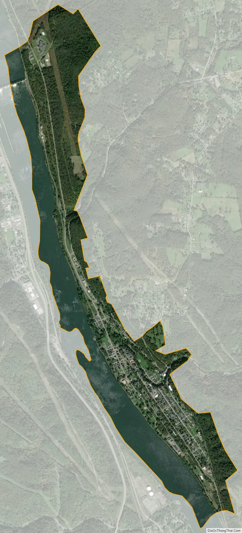
New Cumberland city Satellite Map
Geography
New Cumberland is located at 40°29′57″N 80°36′29″W / 40.49917°N 80.60806°W / 40.49917; -80.60806 (40.499146, -80.607960).
According to the United States Census Bureau, the city has a total area of 1.86 square miles (4.82 km), of which 1.22 square miles (3.16 km) is land and 0.64 square miles (1.66 km) is water. Due to the relative proximity of the Ohio River, New Cumberland has been the victim of several floods. Notable floods include 1959, where approximately 60 families were evacuated.
Climate
This climatic region is typified by large seasonal temperature differences, with warm to hot (and often humid) summers and cold (sometimes severely cold) winters. According to the Köppen Climate Classification system, New Cumberland has a humid continental climate, abbreviated “Dfb” on climate maps.
See also
Map of West Virginia State and its subdivision:- Barbour
- Berkeley
- Boone
- Braxton
- Brooke
- Cabell
- Calhoun
- Clay
- Doddridge
- Fayette
- Gilmer
- Grant
- Greenbrier
- Hampshire
- Hancock
- Hardy
- Harrison
- Jackson
- Jefferson
- Kanawha
- Lewis
- Lincoln
- Logan
- Marion
- Marshall
- Mason
- McDowell
- Mercer
- Mineral
- Mingo
- Monongalia
- Monroe
- Morgan
- Nicholas
- Ohio
- Pendleton
- Pleasants
- Pocahontas
- Preston
- Putnam
- Raleigh
- Randolph
- Ritchie
- Roane
- Summers
- Taylor
- Tucker
- Tyler
- Upshur
- Wayne
- Webster
- Wetzel
- Wirt
- Wood
- Wyoming
- Alabama
- Alaska
- Arizona
- Arkansas
- California
- Colorado
- Connecticut
- Delaware
- District of Columbia
- Florida
- Georgia
- Hawaii
- Idaho
- Illinois
- Indiana
- Iowa
- Kansas
- Kentucky
- Louisiana
- Maine
- Maryland
- Massachusetts
- Michigan
- Minnesota
- Mississippi
- Missouri
- Montana
- Nebraska
- Nevada
- New Hampshire
- New Jersey
- New Mexico
- New York
- North Carolina
- North Dakota
- Ohio
- Oklahoma
- Oregon
- Pennsylvania
- Rhode Island
- South Carolina
- South Dakota
- Tennessee
- Texas
- Utah
- Vermont
- Virginia
- Washington
- West Virginia
- Wisconsin
- Wyoming