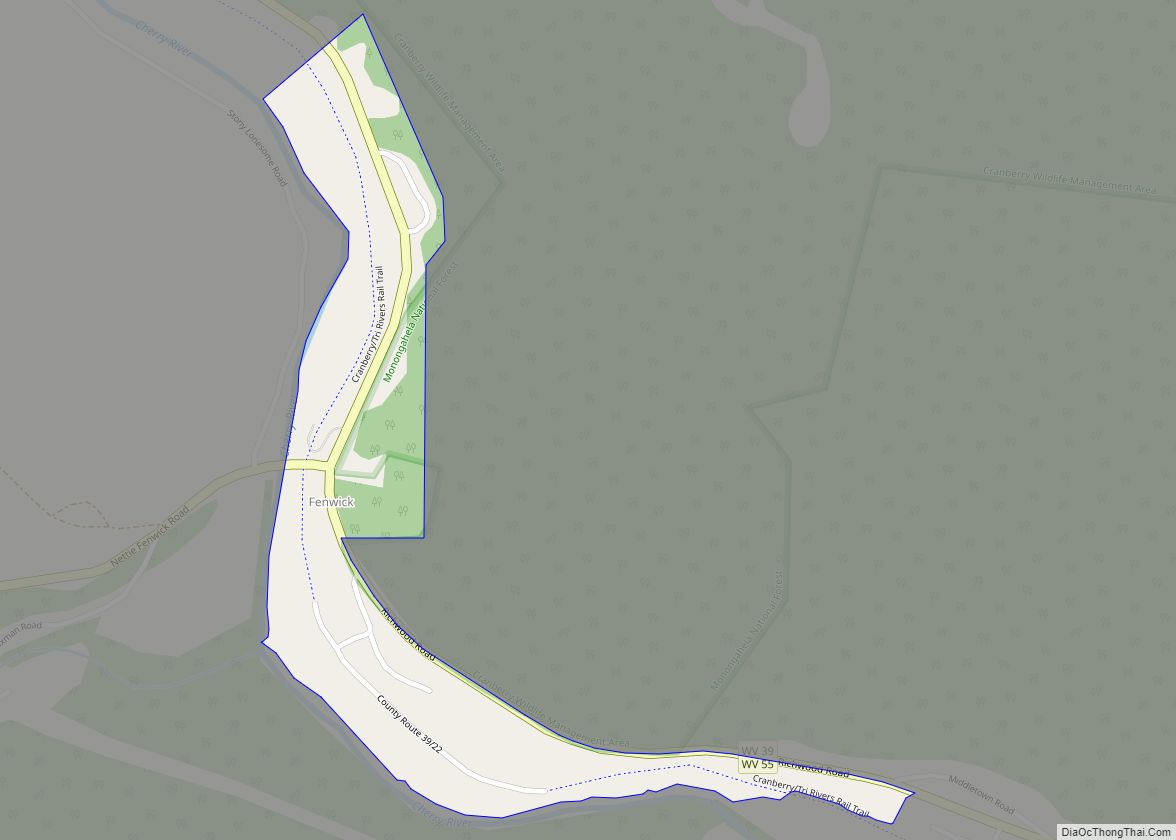
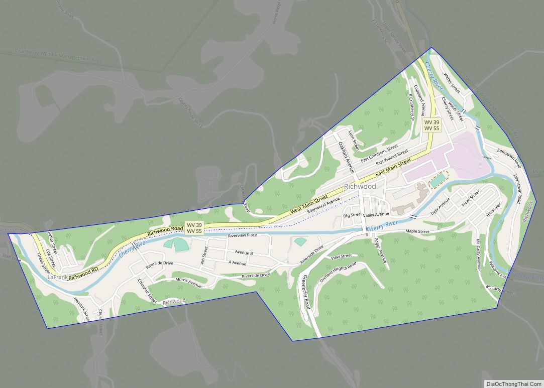
Richwood is a city in Nicholas County, West Virginia, United States. In 2020, the census showed Richwood with a population of 1,661. During the 19th and early 20th century Richwood was a booming coal and lumber town. Richwood has a very rich history, including the formation of the Cherry River Navy civic organization to draw attention to issues important to the community. Richwood has also become known statewide as the “Ramp Capital of the World”. Each year, in April, the city hosts a large festival that draws visitors from around the country.
| Name: | Richwood city |
|---|---|
| LSAD Code: | 25 |
| LSAD Description: | city (suffix) |
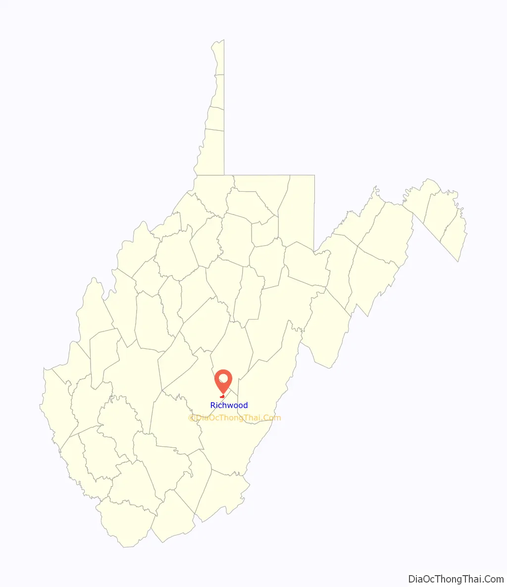
| State: | West Virginia |
| County: | Nicholas County |
| Elevation: | 2,205 ft (672 m) |
| Total Area: | 1.67 sq mi (4.32 km²) |
| Land Area: | 1.61 sq mi (4.17 km²) |
| Water Area: | 0.06 sq mi (0.15 km²) 3.59% |
| Total Population: | 1,661 |
| Population Density: | 1,152.17/sq mi (444.95/km²) |
| ZIP code: | 26261 |
| Area code: | 304, 681 |
| FIPS code: | 5468116 |
| GNISfeature ID: | 1555475 |
| Website: | cityofrichwoodwv.com |
Online Interactive Map
Click on ![]() to view map in "full screen" mode.
to view map in "full screen" mode.
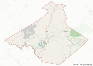
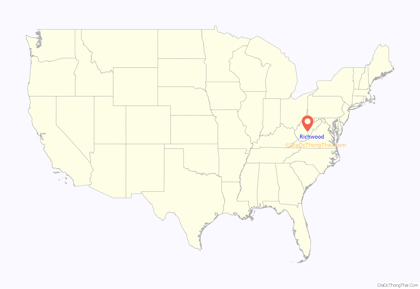
Richwood location map. Where is Richwood city?
History
The area surrounding the forks of the Cherry River has been populated since the late 1700s. During the 19th century, the area was a sparsely settled semi-wilderness of homesteads and subsistence farms. This changed in 1898 when a railroad was extended into the area, then known as Cherry Tree Bottoms. In 1901, the town was incorporated with its present name referencing the abundant hardwood forests in the area. Soon, the area possessed a large sawmill and the world’s largest clothespin factory.
The town was once home to several large businesses and industries. In addition to the sawmill and the clothespin factory, there were other factories that produced wood-based products such as axe-handles and paper. Coal also came into the industry picture during Richwood’s boom-era during pre-Depression years. Banking was a white-collar industry that succeeded in the city with the large companies investing into the city’s financial corporations. Once the large factories closed or relocated, many of the people followed. The final hit was when the coal industry took a downward turn and most of the local coal mines ceased operation.
Richwood now seeks to be reborn as both an artisan community and a technology center. The Downtown Richwood Historic District was listed on the National Register of Historic Places in 2001.
Richwood is the headquarters of the Cherry River Navy community organization. It was founded by John Teets, A.B. Campbell, and Lee Reese to promote the construction of a since-built missing link in West Virginia Route 39 between Richwood and Marlinton.
On June 23, 2016, a historically severe flood impacted portions of West Virginia. Richwood was among the towns most heavily affected. Flood damage resulted in significant damage to area infrastructure and condemnation of the Richwood High School and Richwood Middle School buildings.
In 2021 former Richwood mayor Bob Henry Baber was sentenced to 1–10 years in jail and to pay restitution for defrauding the city after the major flood in 2016. He had pressured a city clerk to write him out a check for volunteer work done after the flood. In 2021 Ashley Freeman, the wife of a police chief of Richwood who had just resigned from his position a week before, was also charged with embezzling over $4,000 from the town’s Little League.
Richwood Road Map
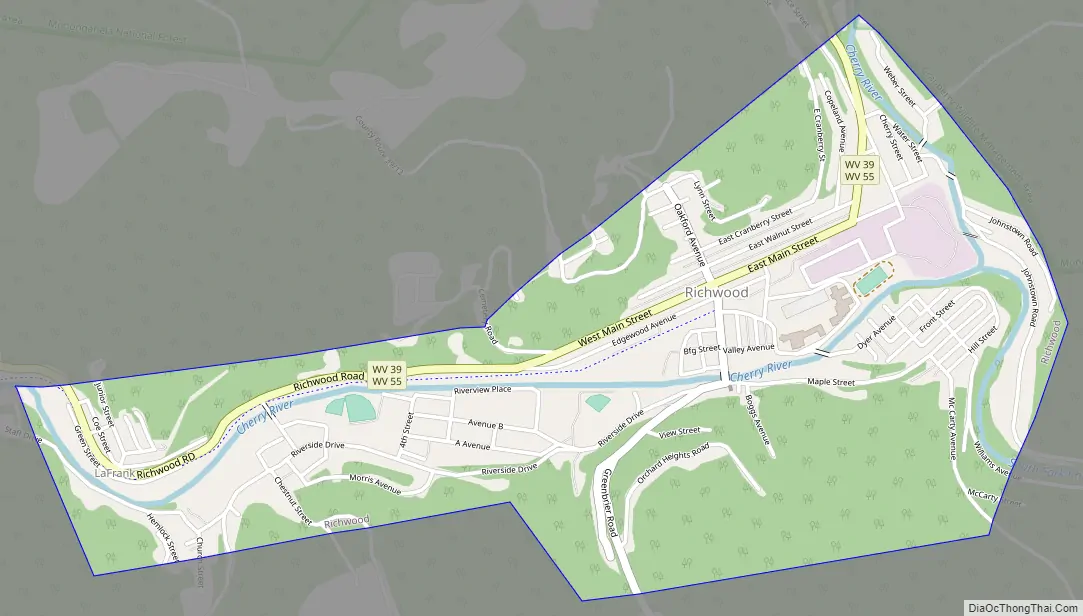
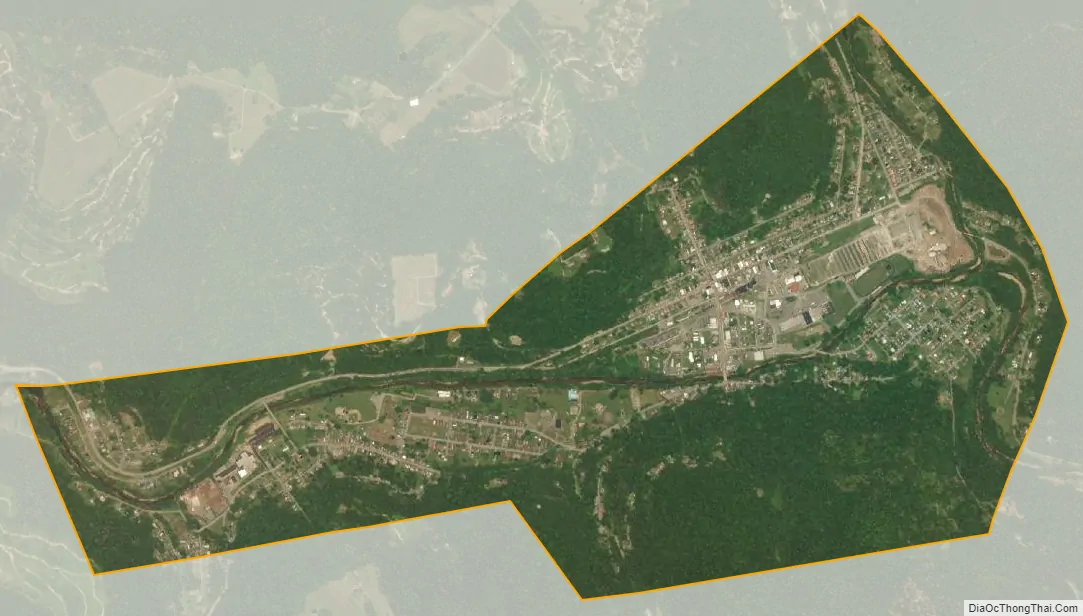
Richwood city Satellite Map
Geography
Richwood is located at 38°13′25″N 80°32′12″W / 38.22361°N 80.53667°W / 38.22361; -80.53667 (38.223637, -80.536676). The Cherry River is formed at Richwood by the confluence of its north and south forks. Some of the city is relatively flat bottom land located along the river valley while neighborhoods are located on steep adjoining hillsides.
According to the United States Census Bureau, the city has a total area of 1.67 square miles (4.33 km), of which 1.61 square miles (4.17 km) is land and 0.06 square miles (0.16 km) is water.
Climate
The climate in this area has mild differences between highs and lows, and there is adequate rainfall year-round. According to the Köppen Climate Classification system, Richwood has a marine west coast climate, abbreviated “Cfb” on climate maps.
See also
Map of West Virginia State and its subdivision:- Barbour
- Berkeley
- Boone
- Braxton
- Brooke
- Cabell
- Calhoun
- Clay
- Doddridge
- Fayette
- Gilmer
- Grant
- Greenbrier
- Hampshire
- Hancock
- Hardy
- Harrison
- Jackson
- Jefferson
- Kanawha
- Lewis
- Lincoln
- Logan
- Marion
- Marshall
- Mason
- McDowell
- Mercer
- Mineral
- Mingo
- Monongalia
- Monroe
- Morgan
- Nicholas
- Ohio
- Pendleton
- Pleasants
- Pocahontas
- Preston
- Putnam
- Raleigh
- Randolph
- Ritchie
- Roane
- Summers
- Taylor
- Tucker
- Tyler
- Upshur
- Wayne
- Webster
- Wetzel
- Wirt
- Wood
- Wyoming
- Alabama
- Alaska
- Arizona
- Arkansas
- California
- Colorado
- Connecticut
- Delaware
- District of Columbia
- Florida
- Georgia
- Hawaii
- Idaho
- Illinois
- Indiana
- Iowa
- Kansas
- Kentucky
- Louisiana
- Maine
- Maryland
- Massachusetts
- Michigan
- Minnesota
- Mississippi
- Missouri
- Montana
- Nebraska
- Nevada
- New Hampshire
- New Jersey
- New Mexico
- New York
- North Carolina
- North Dakota
- Ohio
- Oklahoma
- Oregon
- Pennsylvania
- Rhode Island
- South Carolina
- South Dakota
- Tennessee
- Texas
- Utah
- Vermont
- Virginia
- Washington
- West Virginia
- Wisconsin
- Wyoming