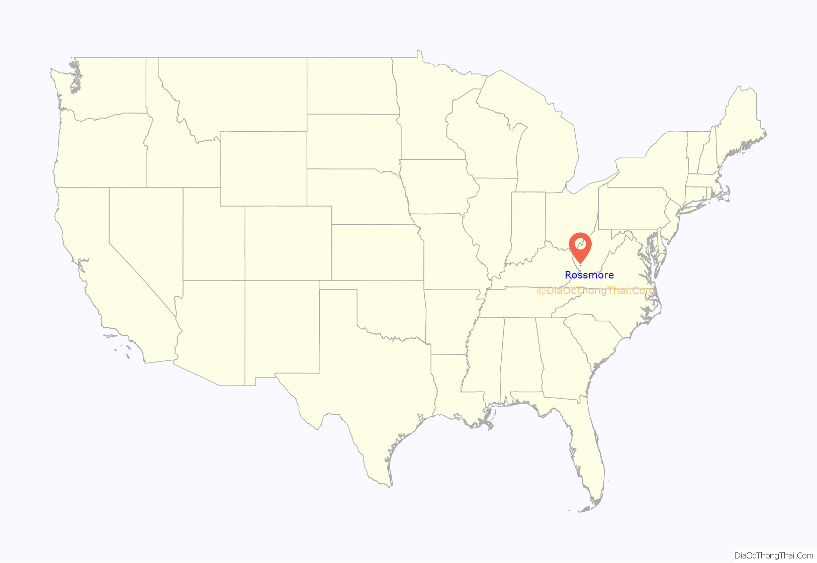
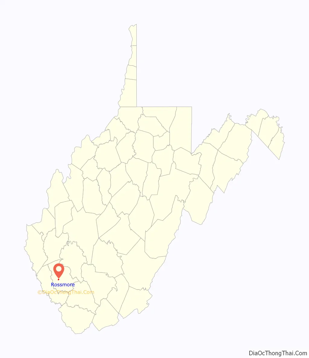
Rossmore is an unincorporated community and census-designated place (CDP) in Logan County, West Virginia, United States, along West Virginia Route 44 and Island Creek. Its population was 301 as of the 2010 census.
| Name: | Rossmore CDP |
|---|---|
| LSAD Code: | 57 |
| LSAD Description: | CDP (suffix) |
| State: | West Virginia |
| County: | Logan County |
| Elevation: | 728 ft (222 m) |
| Total Area: | 0.629 sq mi (1.63 km²) |
| Land Area: | 0.623 sq mi (1.61 km²) |
| Water Area: | 0.006 sq mi (0.02 km²) |
| Total Population: | 301 |
| Population Density: | 483.1/sq mi (186.5/km²) |
| ZIP code: | 25601 |
| Area code: | 304 & 681 |
| FIPS code: | 5470468 |
| GNISfeature ID: | 1546096 |
Online Interactive Map
Click on ![]() to view map in "full screen" mode.
to view map in "full screen" mode.
Rossmore location map. Where is Rossmore CDP?
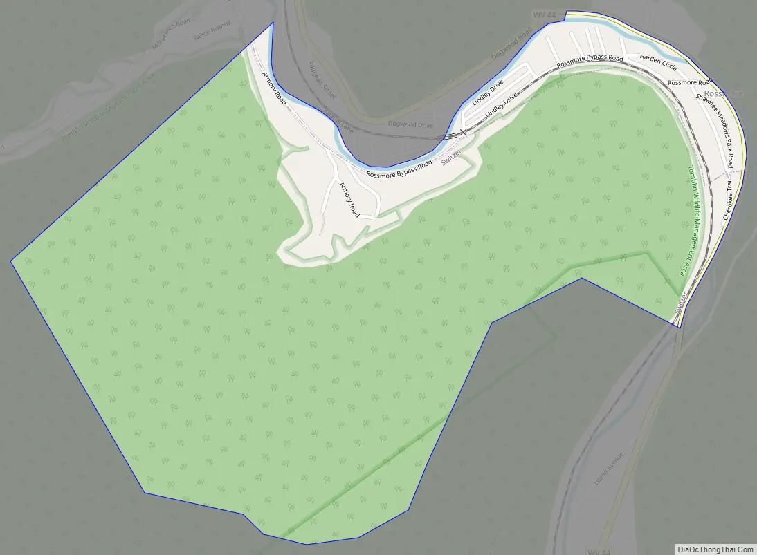
Rossmore Road Map
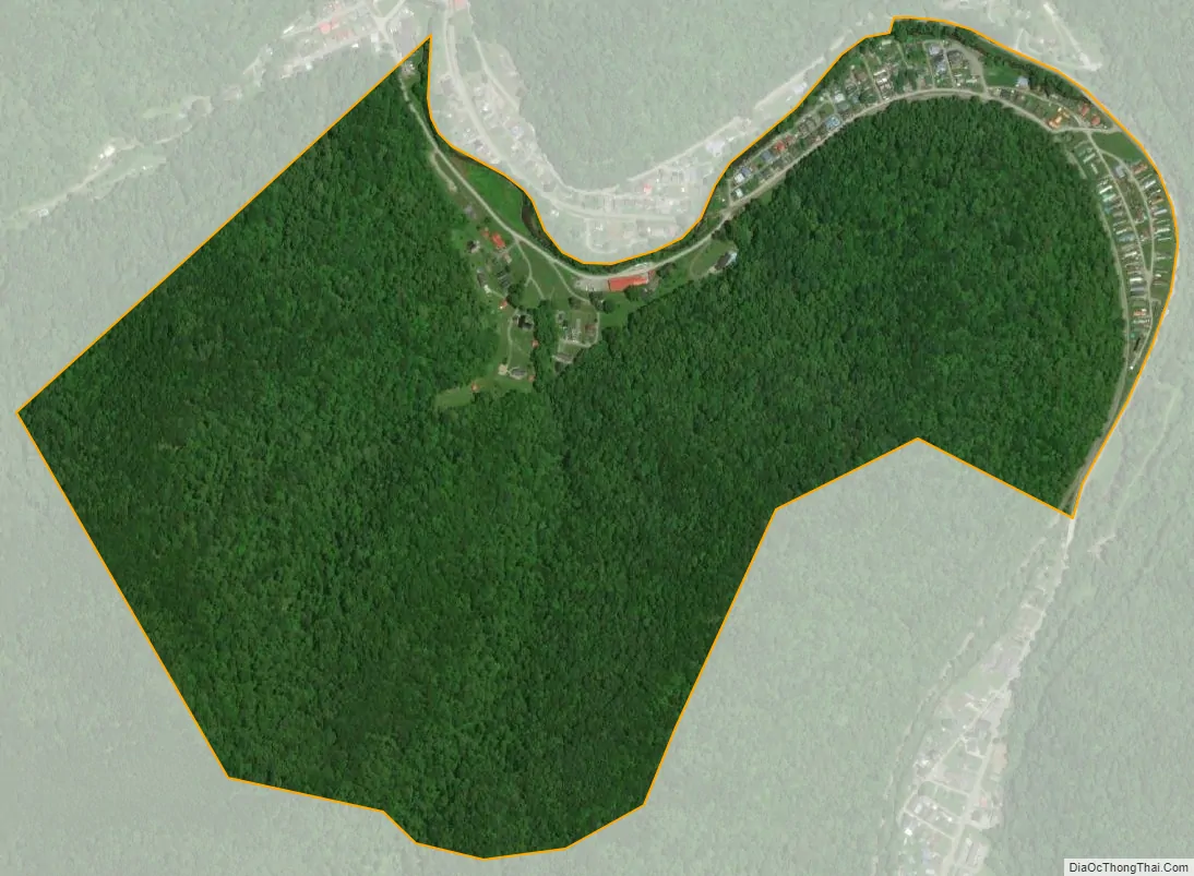
Rossmore city Satellite Map
Geography
Rossmore is in central Logan County and is bordered to the north by Monaville and to the south by Switzer. WV-44, following Island Creek, leads north (downstream) 5 miles (8 km) to Logan, the county seat, and south 13 miles (21 km) to U.S. Route 52 at the headwaters of the creek.
According to the U.S. Census Bureau, the Rossmore CDP has a total area of 0.6 square miles (1.6 km), of which 0.01 square miles (0.02 km), or 0.96%, are water.
See also
Map of West Virginia State and its subdivision:- Barbour
- Berkeley
- Boone
- Braxton
- Brooke
- Cabell
- Calhoun
- Clay
- Doddridge
- Fayette
- Gilmer
- Grant
- Greenbrier
- Hampshire
- Hancock
- Hardy
- Harrison
- Jackson
- Jefferson
- Kanawha
- Lewis
- Lincoln
- Logan
- Marion
- Marshall
- Mason
- McDowell
- Mercer
- Mineral
- Mingo
- Monongalia
- Monroe
- Morgan
- Nicholas
- Ohio
- Pendleton
- Pleasants
- Pocahontas
- Preston
- Putnam
- Raleigh
- Randolph
- Ritchie
- Roane
- Summers
- Taylor
- Tucker
- Tyler
- Upshur
- Wayne
- Webster
- Wetzel
- Wirt
- Wood
- Wyoming
- Alabama
- Alaska
- Arizona
- Arkansas
- California
- Colorado
- Connecticut
- Delaware
- District of Columbia
- Florida
- Georgia
- Hawaii
- Idaho
- Illinois
- Indiana
- Iowa
- Kansas
- Kentucky
- Louisiana
- Maine
- Maryland
- Massachusetts
- Michigan
- Minnesota
- Mississippi
- Missouri
- Montana
- Nebraska
- Nevada
- New Hampshire
- New Jersey
- New Mexico
- New York
- North Carolina
- North Dakota
- Ohio
- Oklahoma
- Oregon
- Pennsylvania
- Rhode Island
- South Carolina
- South Dakota
- Tennessee
- Texas
- Utah
- Vermont
- Virginia
- Washington
- West Virginia
- Wisconsin
- Wyoming


