Rupert is a town in Greenbrier County, West Virginia, United States. The population was 881 at the 2020 census.
| Name: | Rupert town |
|---|---|
| LSAD Code: | 43 |
| LSAD Description: | town (suffix) |
| State: | West Virginia |
| County: | Greenbrier County |
| Elevation: | 2,425 ft (739 m) |
| Total Area: | 0.78 sq mi (2.03 km²) |
| Land Area: | 0.77 sq mi (1.99 km²) |
| Water Area: | 0.01 sq mi (0.04 km²) |
| Total Population: | 881 |
| Population Density: | 1,165.58/sq mi (449.78/km²) |
| ZIP code: | 25984 |
| Area code: | 304 |
| FIPS code: | 5470828 |
| GNISfeature ID: | 2391398 |
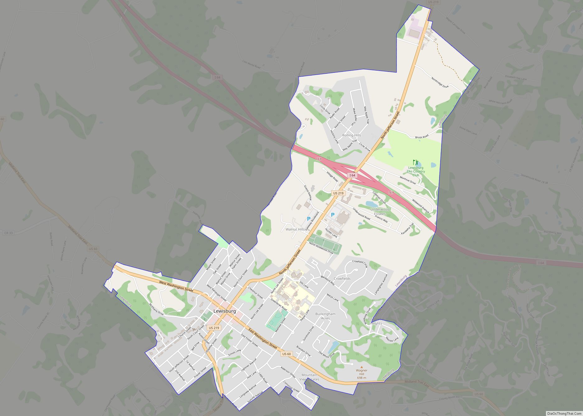
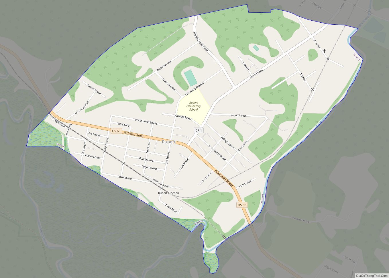
Online Interactive Map
Click on ![]() to view map in "full screen" mode.
to view map in "full screen" mode.
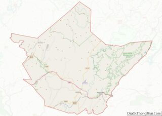
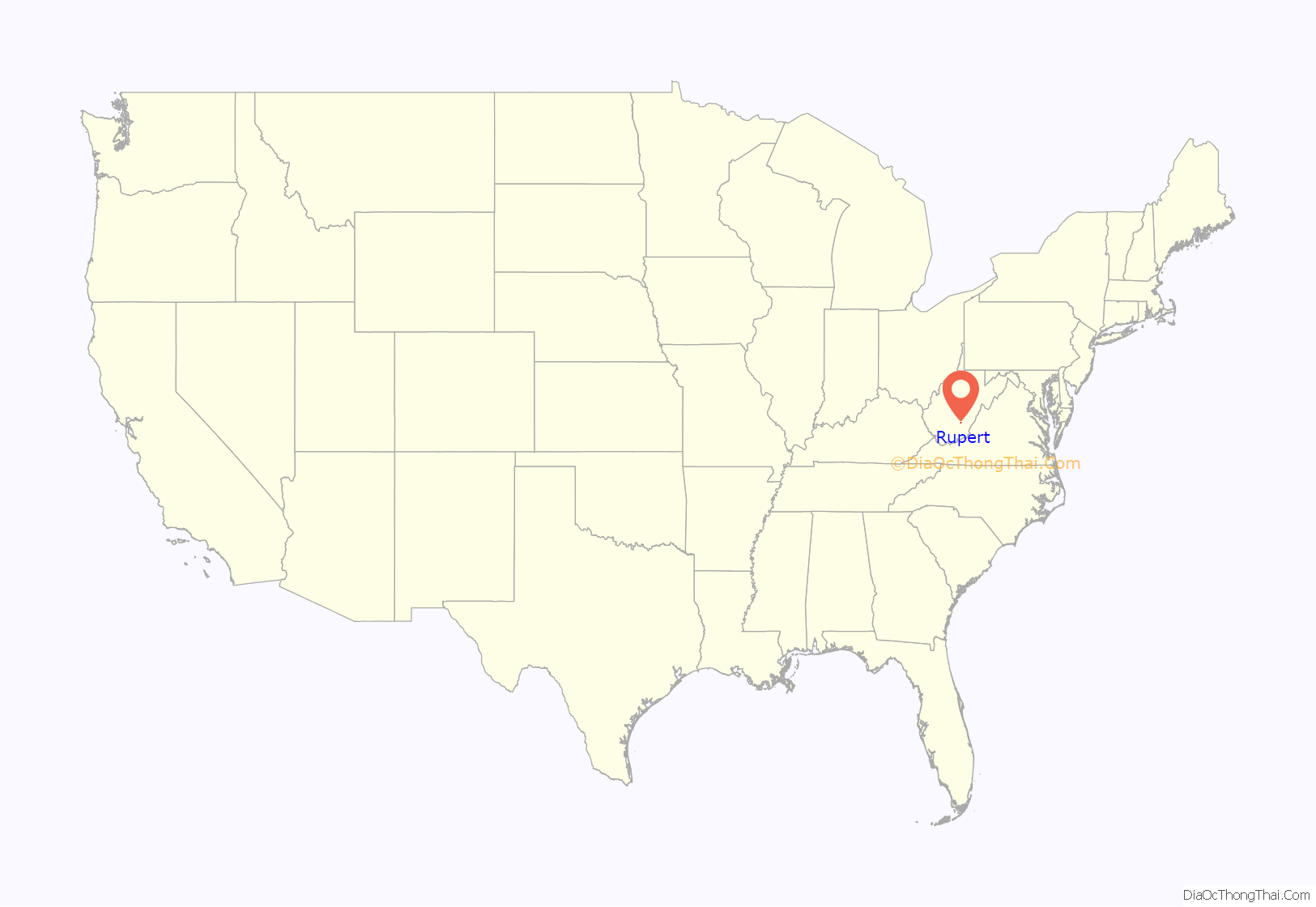
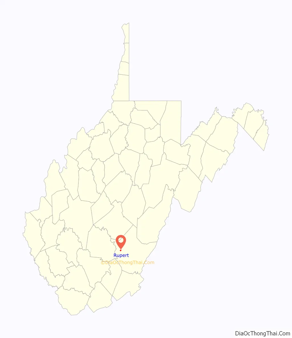
Rupert location map. Where is Rupert town?
History
Cyrus A. Rupert first came to Greenbrier County, circa 1829, when he was seventeen years old. Cyrus, the seventh of eleven children, was born at Point Pleasant on October 7, 1812. His parents were Henry Rupert and Naomi Henkle Rupert. Apparently, Cyrus chose to go to Greenbrier County to be with his brothers, Gideon and Paul, who were running a general store at Clintonville. Cyrus’ father, Henry, died in 1835 and most of the family, including Gideon, then migrated westward to Pekin, Illinois. Paul moved to Louisville, Kentucky, but Cyrus chose to stay in Greenbrier County. Why Cyrus and his brothers came to Greenbrier County is not known. However, there were Henkles in the area and were possibly related to their mother.
Cyrus became friends with Andrew McClung and it is probably through him that Cyrus began to acquire property near the mouth of Big Clear Creek. This property became the basis for a settlement that would later become Rupert, West Virginia.
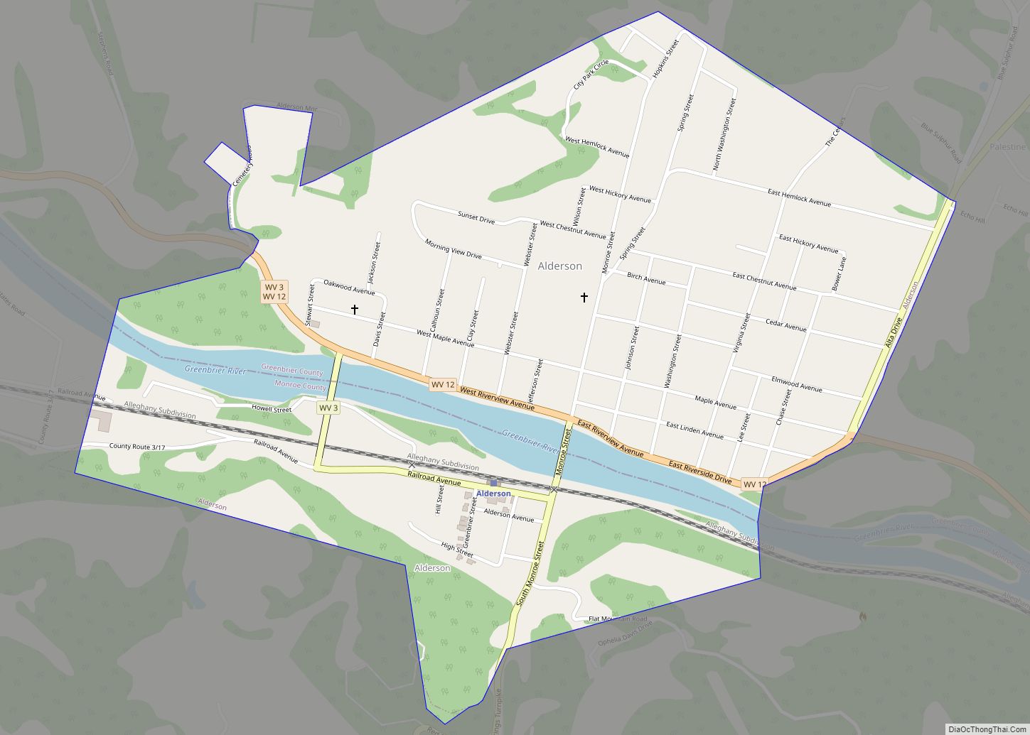
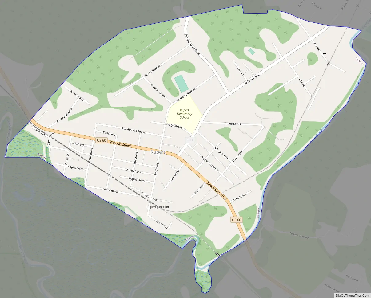
Rupert Road Map
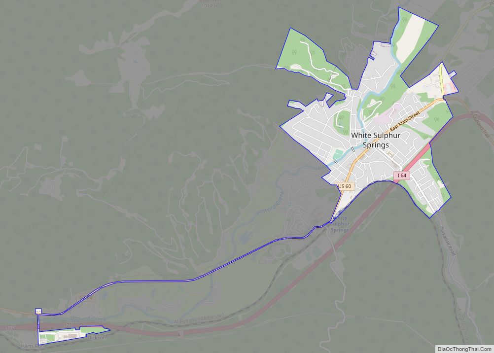
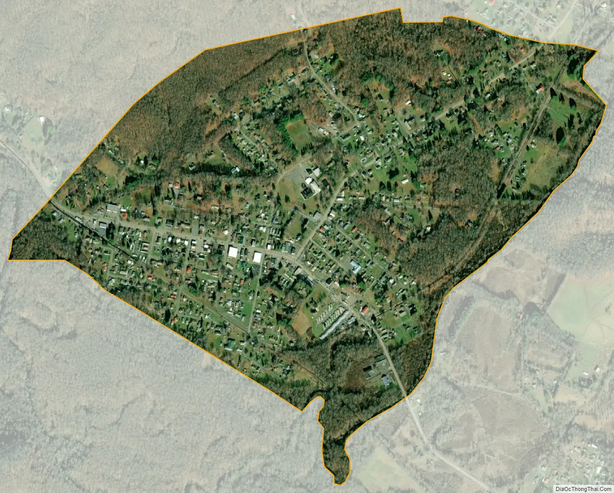
Rupert city Satellite Map
Geography
According to the United States Census Bureau, the town has a total area of 0.79 square miles (2.05 km), of which 0.77 square miles (1.99 km) is land and 0.02 square miles (0.05 km) is water.
See also
Map of West Virginia State and its subdivision:- Barbour
- Berkeley
- Boone
- Braxton
- Brooke
- Cabell
- Calhoun
- Clay
- Doddridge
- Fayette
- Gilmer
- Grant
- Greenbrier
- Hampshire
- Hancock
- Hardy
- Harrison
- Jackson
- Jefferson
- Kanawha
- Lewis
- Lincoln
- Logan
- Marion
- Marshall
- Mason
- McDowell
- Mercer
- Mineral
- Mingo
- Monongalia
- Monroe
- Morgan
- Nicholas
- Ohio
- Pendleton
- Pleasants
- Pocahontas
- Preston
- Putnam
- Raleigh
- Randolph
- Ritchie
- Roane
- Summers
- Taylor
- Tucker
- Tyler
- Upshur
- Wayne
- Webster
- Wetzel
- Wirt
- Wood
- Wyoming
- Alabama
- Alaska
- Arizona
- Arkansas
- California
- Colorado
- Connecticut
- Delaware
- District of Columbia
- Florida
- Georgia
- Hawaii
- Idaho
- Illinois
- Indiana
- Iowa
- Kansas
- Kentucky
- Louisiana
- Maine
- Maryland
- Massachusetts
- Michigan
- Minnesota
- Mississippi
- Missouri
- Montana
- Nebraska
- Nevada
- New Hampshire
- New Jersey
- New Mexico
- New York
- North Carolina
- North Dakota
- Ohio
- Oklahoma
- Oregon
- Pennsylvania
- Rhode Island
- South Carolina
- South Dakota
- Tennessee
- Texas
- Utah
- Vermont
- Virginia
- Washington
- West Virginia
- Wisconsin
- Wyoming