Shrewsbury is a census-designated place (CDP) and unincorporated community in Kanawha County, West Virginia, United States. Shrewsbury is located on the north bank of the Kanawha River along U.S. Route 60. As of the 2010 census, its population was 652.
Like the nearby community of Dickinson, Shrewsbury was given its name due to the early history of the Dickinson and Shrewsbury families within the area.
Shrewsbury is home to a Liberty gas station and convenience store, the Mason-Dixon Bar, and three churches; The Shrewsbury Church of God, Shrewsbury Community Church and the Shrewsbury Baptist Church.
| Name: | Shrewsbury CDP |
|---|---|
| LSAD Code: | 57 |
| LSAD Description: | CDP (suffix) |
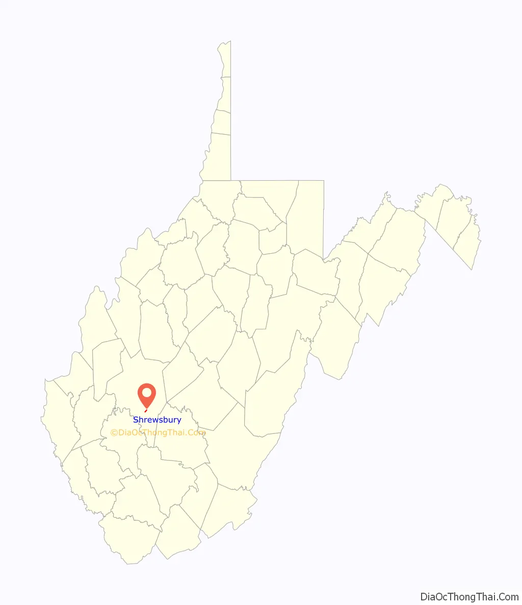
| State: | West Virginia |
| County: | Kanawha County |
| Elevation: | 623 ft (190 m) |
| Total Area: | 0.435 sq mi (1.13 km²) |
| Land Area: | 0.350 sq mi (0.91 km²) |
| Water Area: | 0.085 sq mi (0.22 km²) |
| Total Population: | 652 |
| Population Density: | 1,500/sq mi (580/km²) |
| Area code: | 304 & 681 |
| FIPS code: | 5473876 |
| GNISfeature ID: | 1546745 |
Online Interactive Map
Click on ![]() to view map in "full screen" mode.
to view map in "full screen" mode.
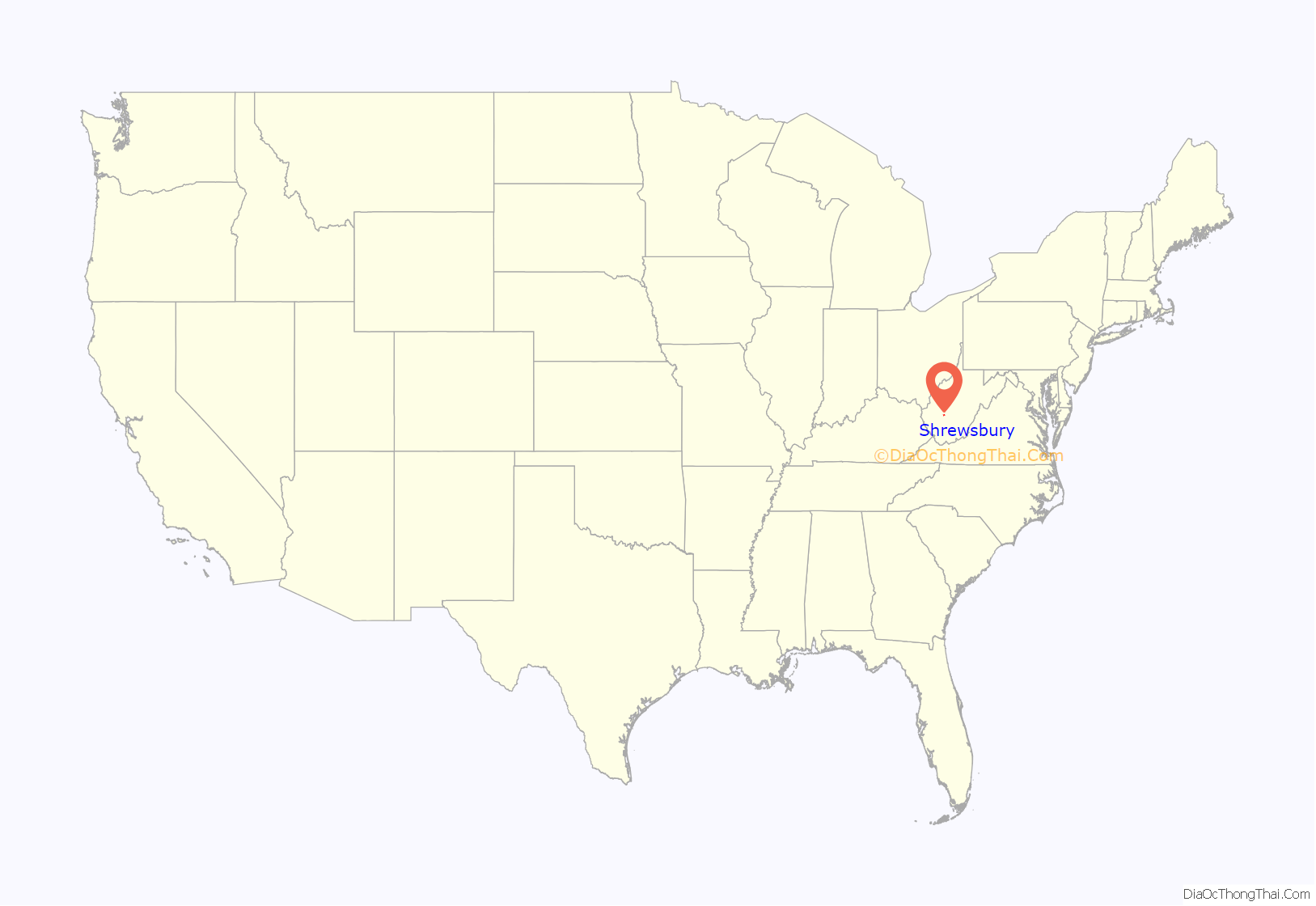
Shrewsbury location map. Where is Shrewsbury CDP?
Shrewsbury Road Map
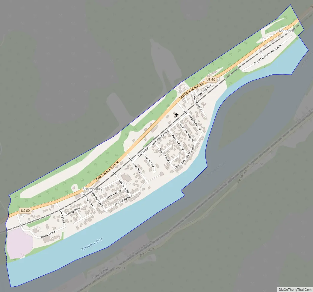
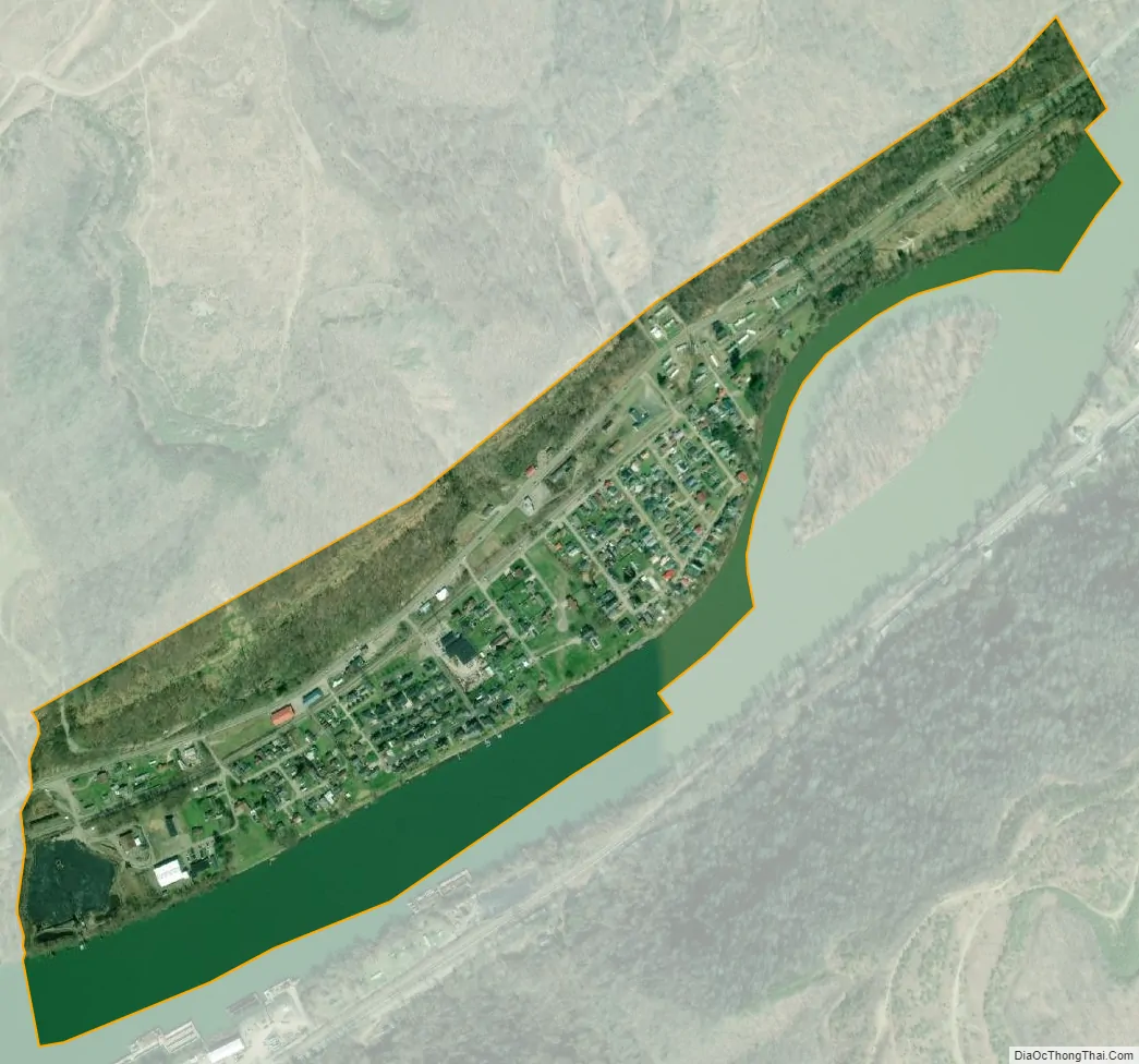
Shrewsbury city Satellite Map
See also
Map of West Virginia State and its subdivision:- Barbour
- Berkeley
- Boone
- Braxton
- Brooke
- Cabell
- Calhoun
- Clay
- Doddridge
- Fayette
- Gilmer
- Grant
- Greenbrier
- Hampshire
- Hancock
- Hardy
- Harrison
- Jackson
- Jefferson
- Kanawha
- Lewis
- Lincoln
- Logan
- Marion
- Marshall
- Mason
- McDowell
- Mercer
- Mineral
- Mingo
- Monongalia
- Monroe
- Morgan
- Nicholas
- Ohio
- Pendleton
- Pleasants
- Pocahontas
- Preston
- Putnam
- Raleigh
- Randolph
- Ritchie
- Roane
- Summers
- Taylor
- Tucker
- Tyler
- Upshur
- Wayne
- Webster
- Wetzel
- Wirt
- Wood
- Wyoming
- Alabama
- Alaska
- Arizona
- Arkansas
- California
- Colorado
- Connecticut
- Delaware
- District of Columbia
- Florida
- Georgia
- Hawaii
- Idaho
- Illinois
- Indiana
- Iowa
- Kansas
- Kentucky
- Louisiana
- Maine
- Maryland
- Massachusetts
- Michigan
- Minnesota
- Mississippi
- Missouri
- Montana
- Nebraska
- Nevada
- New Hampshire
- New Jersey
- New Mexico
- New York
- North Carolina
- North Dakota
- Ohio
- Oklahoma
- Oregon
- Pennsylvania
- Rhode Island
- South Carolina
- South Dakota
- Tennessee
- Texas
- Utah
- Vermont
- Virginia
- Washington
- West Virginia
- Wisconsin
- Wyoming