South Charleston is a city in Kanawha County, West Virginia, United States. It is located to the west of the state capital of Charleston. The population was 13,639 at the 2020 census. It was established in 1906, but not incorporated until 1917. The Criel Mound built circa 0 B.C. by the Adena culture is adjacent to the city’s downtown business district.
It is home to the Charleston Ordnance Center, a former naval munitions factory established for use in World War I.
The city is serviced by Interstate 64, U.S. Route 60, U.S. Route 119, West Virginia Route 601 and West Virginia Route 214, and is adjacent to the Kanawha River. The city is serviced by the Kanawha Valley Regional Transportation Authority bus system. A general aviation airfield, Mallory Airport, is located off Chestnut Street, approximately two miles south of U.S. Route 60, with the nearest commercial aviation service being at Yeager Airport in Charleston. South Charleston serves as the headquarters to the West Virginia Division of Natural Resources and the West Virginia State Police.
| Name: | South Charleston city |
|---|---|
| LSAD Code: | 25 |
| LSAD Description: | city (suffix) |
| State: | West Virginia |
| County: | Kanawha County |
| Founded: | 1906 |
| Incorporated: | 1919 |
| Elevation: | 604 ft (183 m) |
| Land Area: | 8.64 sq mi (22.38 km²) |
| Water Area: | 0.89 sq mi (2.31 km²) |
| Population Density: | 1,394.01/sq mi (538.22/km²) |
| ZIP code: | 25303, 25309 |
| Area code: | 304 |
| FIPS code: | 5475292 |
| GNISfeature ID: | 1555663 |
Online Interactive Map
Click on ![]() to view map in "full screen" mode.
to view map in "full screen" mode.
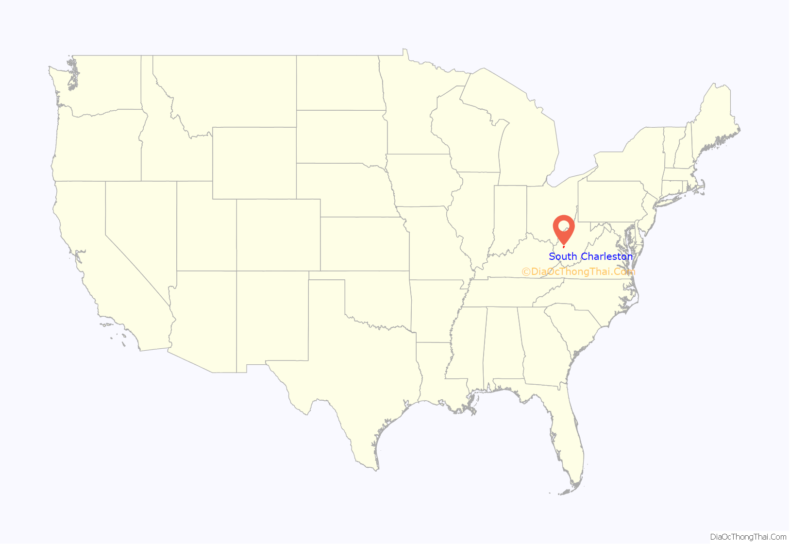
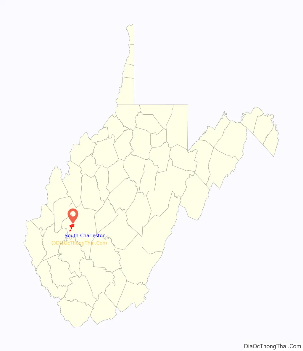
South Charleston location map. Where is South Charleston city?
History
South Charleston was established in 1906, but not incorporated until 1917.
It is home to the Charleston Ordnance Center, a former naval munitions factory established for use in World War I. It employed over 11,000 workers and produced 130,000 gun barrels for U.S. warships.
South Charleston Road Map
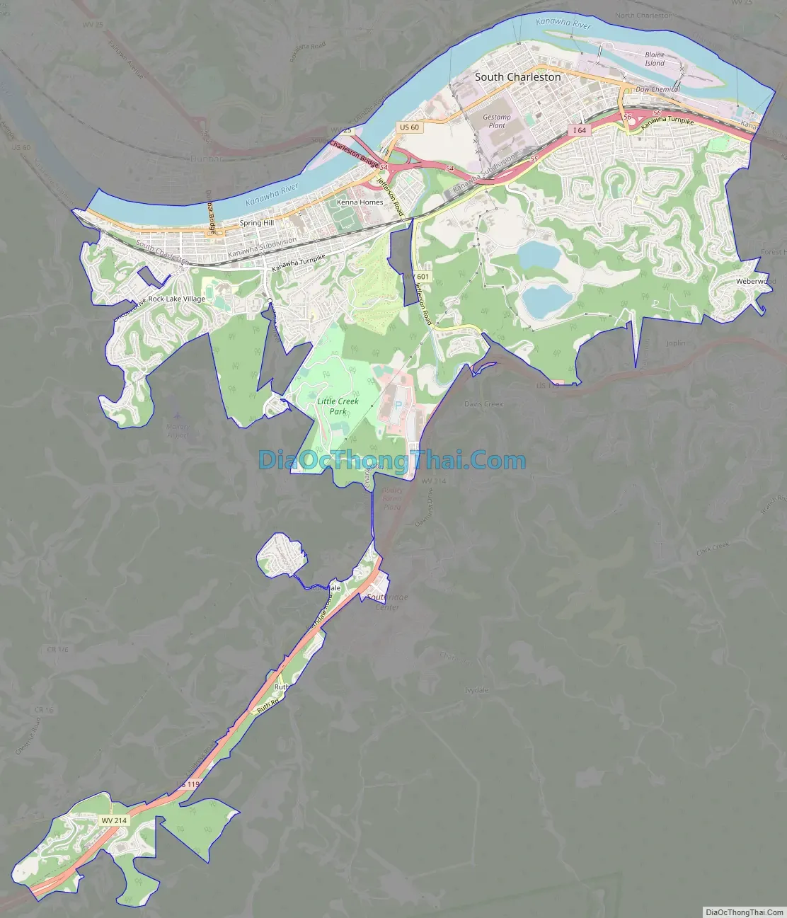
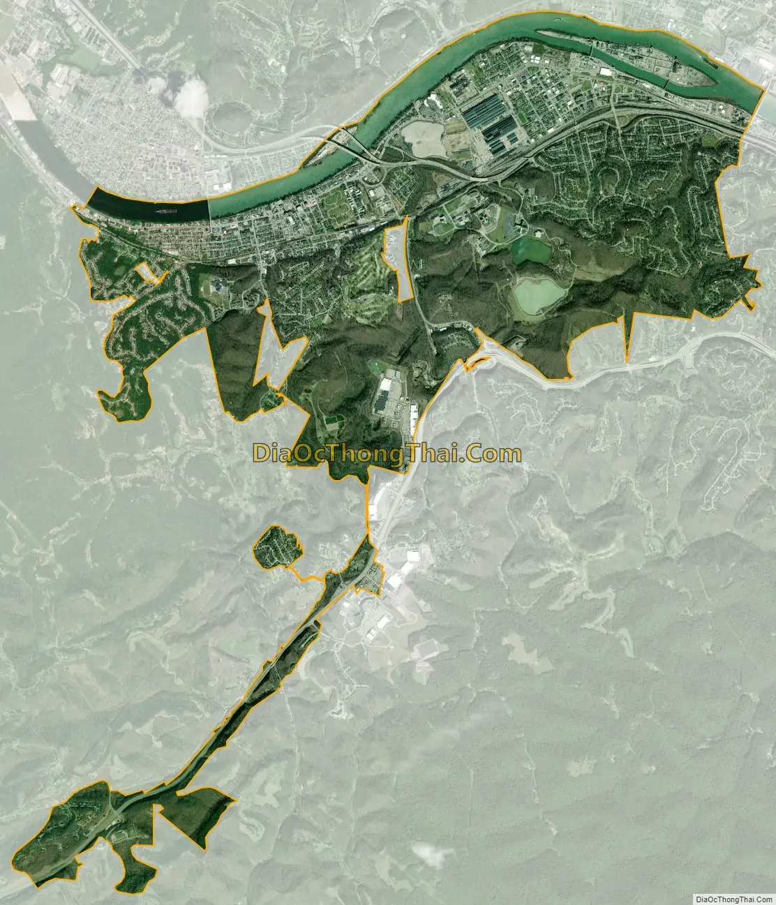
South Charleston city Satellite Map
Geography
South Charleston is located at 38°21′9″N 81°42′43″W / 38.35250°N 81.71194°W / 38.35250; -81.71194 (38.352455, −81.712001).
According to the United States Census Bureau, the city has a total area of 8.51 square miles (22.04 km), of which 7.61 square miles (19.71 km) is land and 0.90 square miles (2.33 km) is water.
Climate
The climate in this area is characterized by hot, humid summers and generally mild to cool winters. According to the Köppen Climate Classification system, South Charleston has a humid subtropical climate, abbreviated “Cfa” on climate maps.
See also
Map of West Virginia State and its subdivision:- Barbour
- Berkeley
- Boone
- Braxton
- Brooke
- Cabell
- Calhoun
- Clay
- Doddridge
- Fayette
- Gilmer
- Grant
- Greenbrier
- Hampshire
- Hancock
- Hardy
- Harrison
- Jackson
- Jefferson
- Kanawha
- Lewis
- Lincoln
- Logan
- Marion
- Marshall
- Mason
- McDowell
- Mercer
- Mineral
- Mingo
- Monongalia
- Monroe
- Morgan
- Nicholas
- Ohio
- Pendleton
- Pleasants
- Pocahontas
- Preston
- Putnam
- Raleigh
- Randolph
- Ritchie
- Roane
- Summers
- Taylor
- Tucker
- Tyler
- Upshur
- Wayne
- Webster
- Wetzel
- Wirt
- Wood
- Wyoming
- Alabama
- Alaska
- Arizona
- Arkansas
- California
- Colorado
- Connecticut
- Delaware
- District of Columbia
- Florida
- Georgia
- Hawaii
- Idaho
- Illinois
- Indiana
- Iowa
- Kansas
- Kentucky
- Louisiana
- Maine
- Maryland
- Massachusetts
- Michigan
- Minnesota
- Mississippi
- Missouri
- Montana
- Nebraska
- Nevada
- New Hampshire
- New Jersey
- New Mexico
- New York
- North Carolina
- North Dakota
- Ohio
- Oklahoma
- Oregon
- Pennsylvania
- Rhode Island
- South Carolina
- South Dakota
- Tennessee
- Texas
- Utah
- Vermont
- Virginia
- Washington
- West Virginia
- Wisconsin
- Wyoming