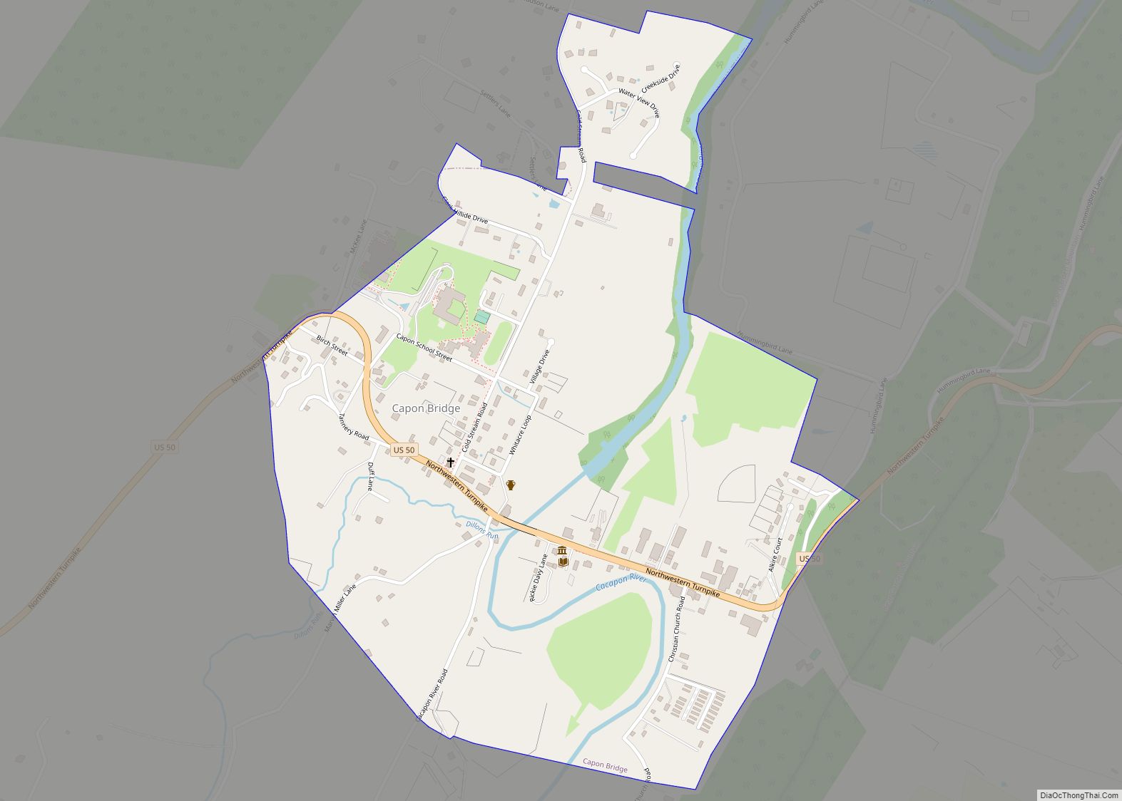
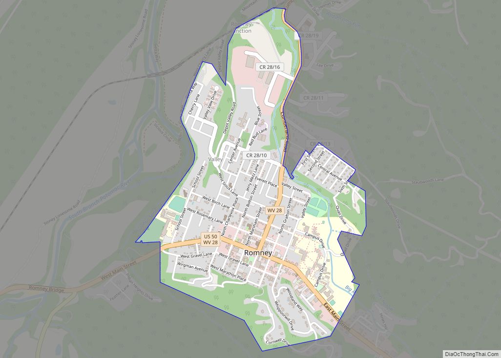
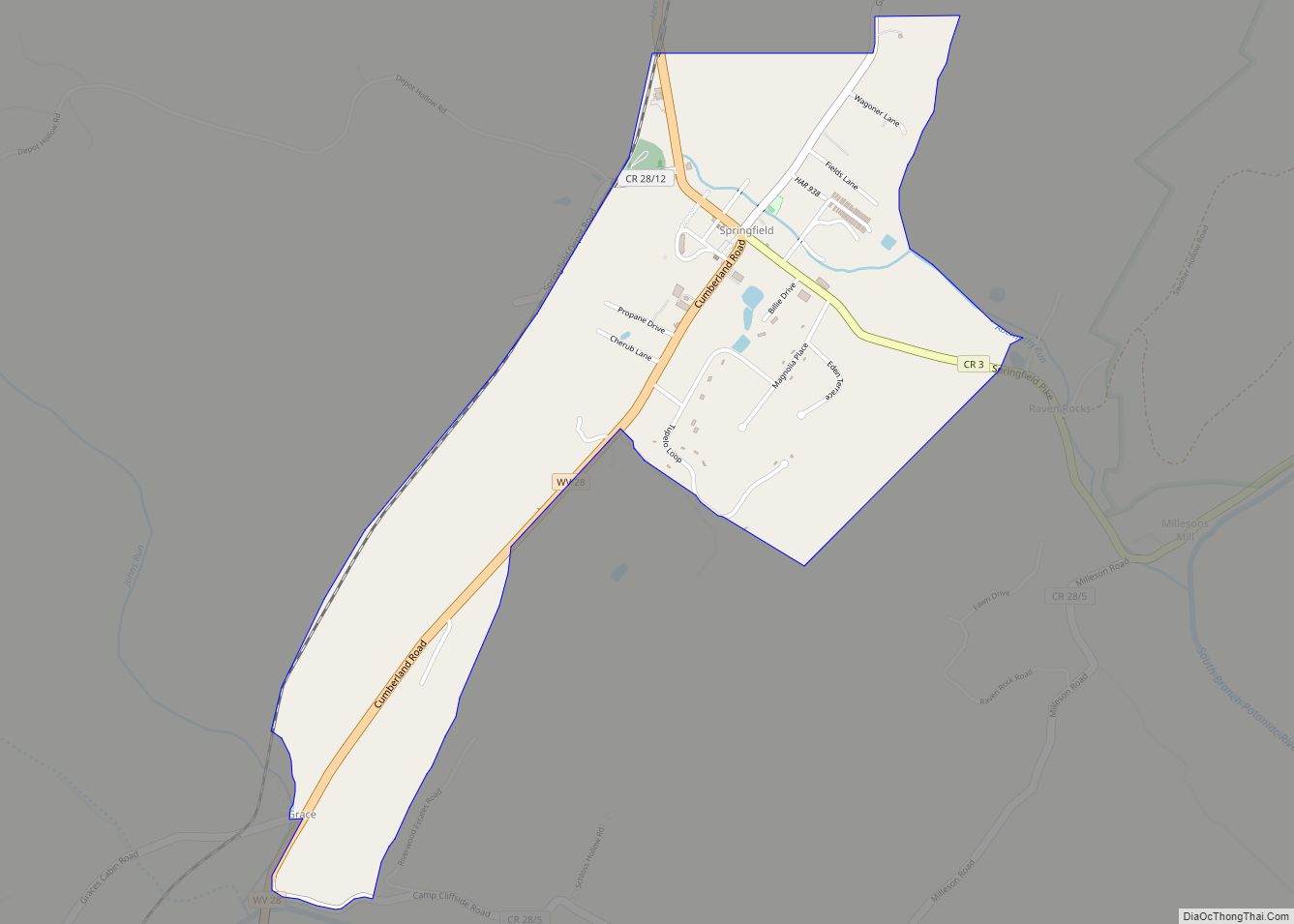
Springfield is a census-designated place (CDP) in northwestern Hampshire County in the U.S. state of West Virginia. As of the 2010 census, Springfield had a population of 477. Springfield is located north of Romney along West Virginia Route 28 at its junction with Green Spring Road (West Virginia Secondary Route 1) and Springfield Pike (West Virginia Secondary Route 3). It is currently considering incorporation.
| Name: | Springfield CDP |
|---|---|
| LSAD Code: | 57 |
| LSAD Description: | CDP (suffix) |
| State: | West Virginia |
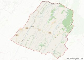
| County: | Hampshire County |
| Elevation: | 735 ft (224 m) |
| Total Area: | 1.341 sq mi (3.47 km²) |
| Land Area: | 1.340 sq mi (3.47 km²) |
| Water Area: | 0.001 sq mi (0.003 km²) |
| Total Population: | 477 |
| Population Density: | 360/sq mi (140/km²) |
| ZIP code: | 26763 |
| Area code: | 304 |
| FIPS code: | 5476084 |
| GNISfeature ID: | 1547219 |
Online Interactive Map
Click on ![]() to view map in "full screen" mode.
to view map in "full screen" mode.
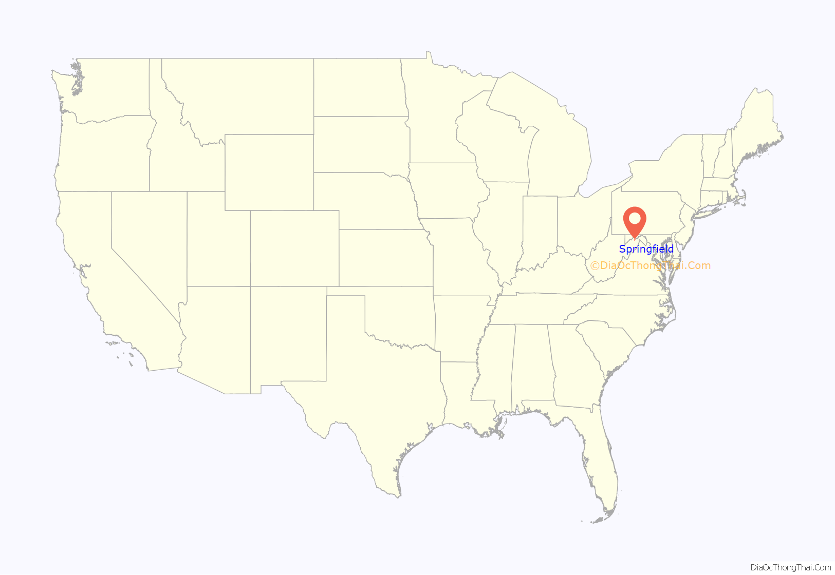
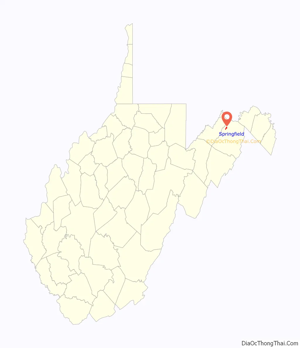
Springfield location map. Where is Springfield CDP?
History
Established on December 16, 1790, at the “Cross Roads” of Hampshire County on the property of William and Samuel Abernethy by an act of the Virginia General Assembly, Springfield was named in commemoration of the Battle of Springfield (1780).
George Washington first visited the Springfield area in 1748 as a member of a party that surveyed the land holdings of Thomas Fairfax, 6th Lord Fairfax of Cameron in the South Branch Potomac River Valley.
In June 1861, the town organized a company of men known as the “Potomac Guards” in support of the Confederacy. The company was under the command of Captain Philip T. Grace.
On August 23, 1861, Springfield played host to an American Civil War skirmish between the Unionists and the Confederates.
Historic Sites
Today, Springfield is the site of a number of historic private residences dating from the 18th and 19th Centuries.
- 63 Springfield Pike (1860), Springfield Pike (CR 3)
- Ridgedale (George W. Washington Farm), Washington Bottom Road (CR 28/3)
- Frenchwood, Route 28 South and Market Street
- The house is currently being restored. Captain John W. Shouse supposedly built the circa 1855 brick house.
- Springfield United Methodist Church, Vine Street
Springfield Road Map
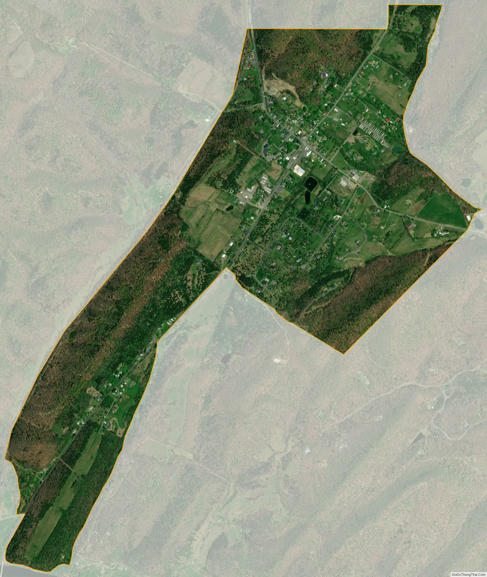
Springfield city Satellite Map
See also
Map of West Virginia State and its subdivision:- Barbour
- Berkeley
- Boone
- Braxton
- Brooke
- Cabell
- Calhoun
- Clay
- Doddridge
- Fayette
- Gilmer
- Grant
- Greenbrier
- Hampshire
- Hancock
- Hardy
- Harrison
- Jackson
- Jefferson
- Kanawha
- Lewis
- Lincoln
- Logan
- Marion
- Marshall
- Mason
- McDowell
- Mercer
- Mineral
- Mingo
- Monongalia
- Monroe
- Morgan
- Nicholas
- Ohio
- Pendleton
- Pleasants
- Pocahontas
- Preston
- Putnam
- Raleigh
- Randolph
- Ritchie
- Roane
- Summers
- Taylor
- Tucker
- Tyler
- Upshur
- Wayne
- Webster
- Wetzel
- Wirt
- Wood
- Wyoming
- Alabama
- Alaska
- Arizona
- Arkansas
- California
- Colorado
- Connecticut
- Delaware
- District of Columbia
- Florida
- Georgia
- Hawaii
- Idaho
- Illinois
- Indiana
- Iowa
- Kansas
- Kentucky
- Louisiana
- Maine
- Maryland
- Massachusetts
- Michigan
- Minnesota
- Mississippi
- Missouri
- Montana
- Nebraska
- Nevada
- New Hampshire
- New Jersey
- New Mexico
- New York
- North Carolina
- North Dakota
- Ohio
- Oklahoma
- Oregon
- Pennsylvania
- Rhode Island
- South Carolina
- South Dakota
- Tennessee
- Texas
- Utah
- Vermont
- Virginia
- Washington
- West Virginia
- Wisconsin
- Wyoming