St. Albans is a city in western Kanawha County, West Virginia, United States, at the confluence of the Kanawha and Coal rivers. The population was 10,861 at the 2020 census. It is part of the Charleston metropolitan area.
| Name: | St. Albans city |
|---|---|
| LSAD Code: | 25 |
| LSAD Description: | city (suffix) |
| State: | West Virginia |
| County: | Kanawha County |
| Elevation: | 610 ft (186 m) |
| Total Area: | 3.69 sq mi (9.56 km²) |
| Land Area: | 3.62 sq mi (9.36 km²) |
| Water Area: | 0.08 sq mi (0.20 km²) |
| Total Population: | 10,861 |
| Population Density: | 2,743.57/sq mi (1,059.34/km²) |
| ZIP code: | 25177 |
| Area code: | 304 |
| FIPS code: | 5471212 |
| GNISfeature ID: | 1555553 |
| Website: | www.stalbanswv.com |
Online Interactive Map
Click on ![]() to view map in "full screen" mode.
to view map in "full screen" mode.
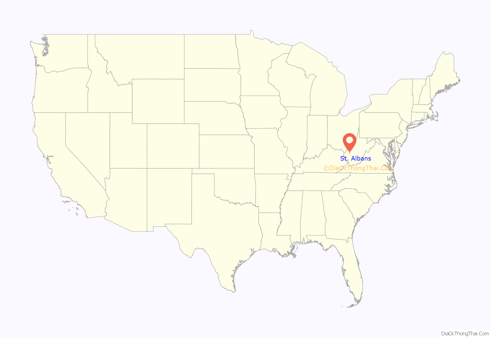
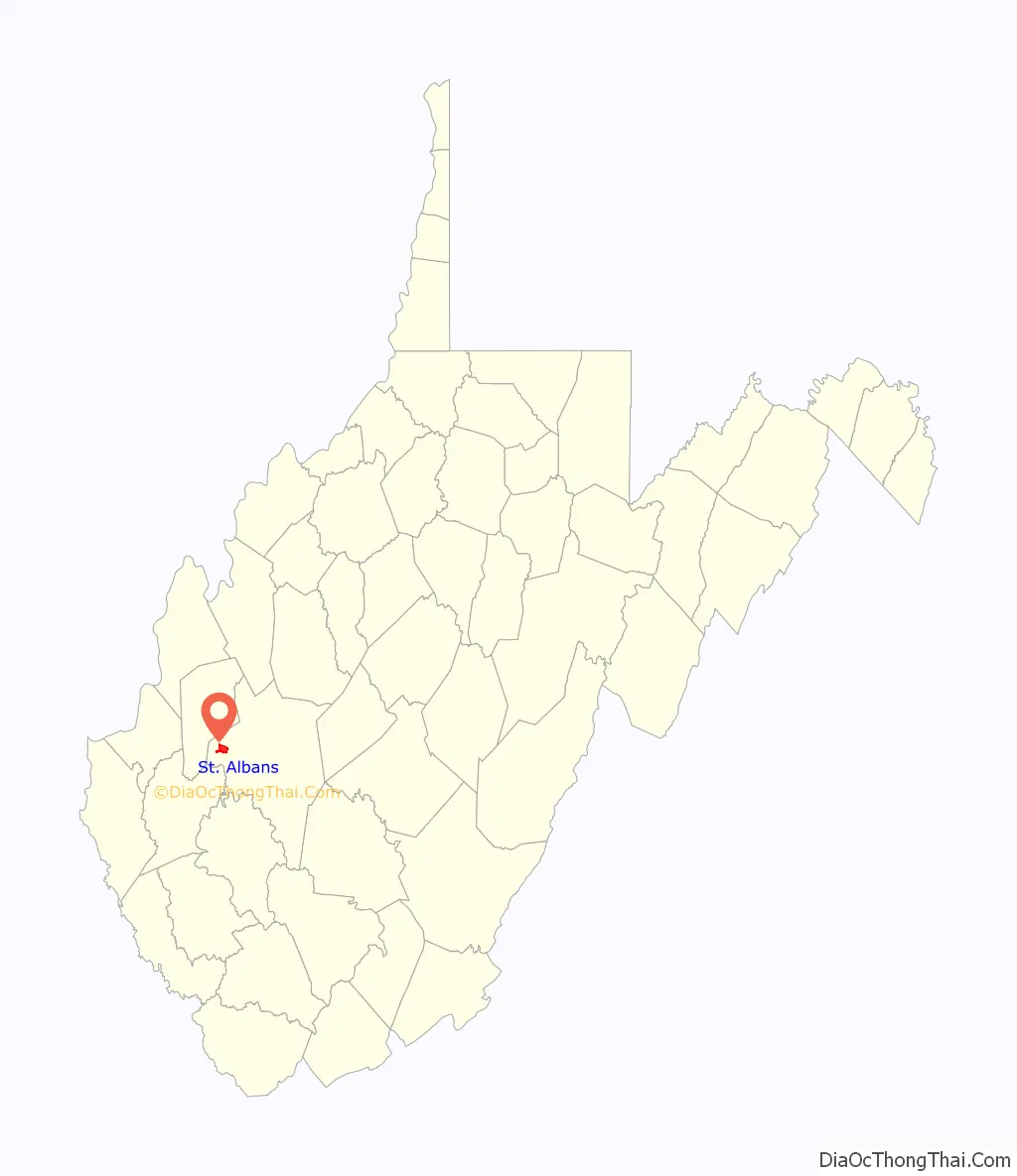
St. Albans location map. Where is St. Albans city?
History
St. Albans was laid out in 1816. Originally, it was known as Philippi, after Philip Thompson, an early settler, the name afterwards being changed to Colesmouth due to the area and river being discovered by Samuel Cole. The city was then incorporated as Kanawha City in 1868. The town was renamed in 1872 by H.C. Parsons of the C & O Railroad in honor of his birthplace in St. Albans, Vermont, which is itself named after St. Albans in Hertfordshire, England. The latter town is named for St. Alban, believed to have been the first British Christian martyr.
St. Albans Road Map
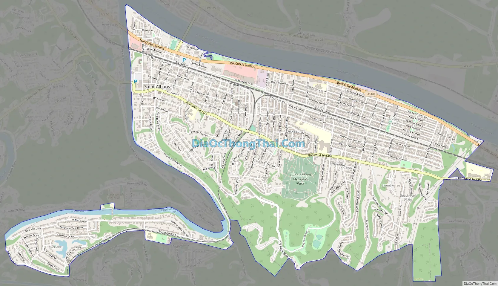
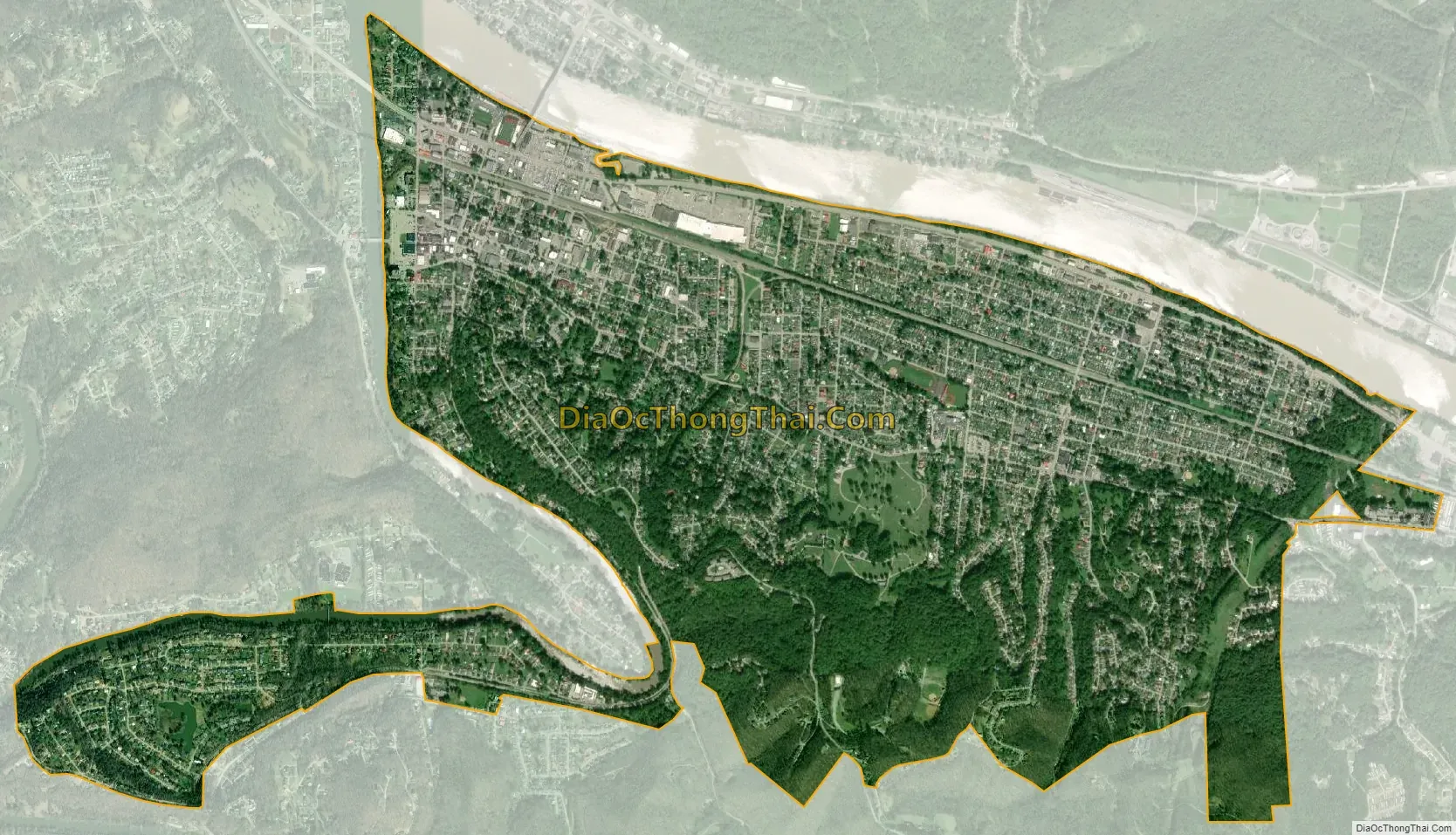
St. Albans city Satellite Map
Geography
According to the United States Census Bureau, the city has a total area of 3.70 square miles (9.58 km), of which 3.62 square miles (9.38 km) is land and 0.08 square miles (0.21 km) is water.
See also
Map of West Virginia State and its subdivision:- Barbour
- Berkeley
- Boone
- Braxton
- Brooke
- Cabell
- Calhoun
- Clay
- Doddridge
- Fayette
- Gilmer
- Grant
- Greenbrier
- Hampshire
- Hancock
- Hardy
- Harrison
- Jackson
- Jefferson
- Kanawha
- Lewis
- Lincoln
- Logan
- Marion
- Marshall
- Mason
- McDowell
- Mercer
- Mineral
- Mingo
- Monongalia
- Monroe
- Morgan
- Nicholas
- Ohio
- Pendleton
- Pleasants
- Pocahontas
- Preston
- Putnam
- Raleigh
- Randolph
- Ritchie
- Roane
- Summers
- Taylor
- Tucker
- Tyler
- Upshur
- Wayne
- Webster
- Wetzel
- Wirt
- Wood
- Wyoming
- Alabama
- Alaska
- Arizona
- Arkansas
- California
- Colorado
- Connecticut
- Delaware
- District of Columbia
- Florida
- Georgia
- Hawaii
- Idaho
- Illinois
- Indiana
- Iowa
- Kansas
- Kentucky
- Louisiana
- Maine
- Maryland
- Massachusetts
- Michigan
- Minnesota
- Mississippi
- Missouri
- Montana
- Nebraska
- Nevada
- New Hampshire
- New Jersey
- New Mexico
- New York
- North Carolina
- North Dakota
- Ohio
- Oklahoma
- Oregon
- Pennsylvania
- Rhode Island
- South Carolina
- South Dakota
- Tennessee
- Texas
- Utah
- Vermont
- Virginia
- Washington
- West Virginia
- Wisconsin
- Wyoming