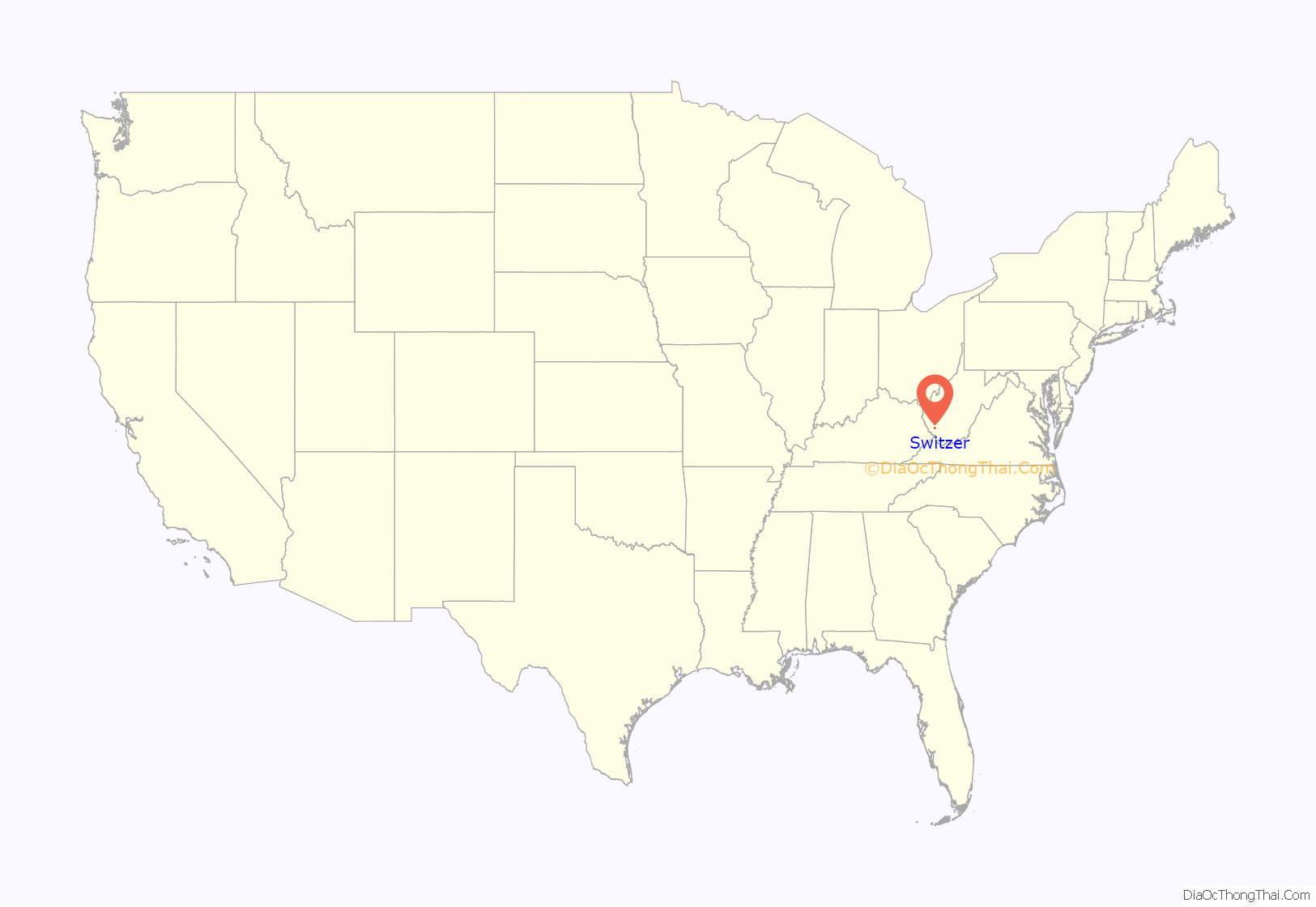
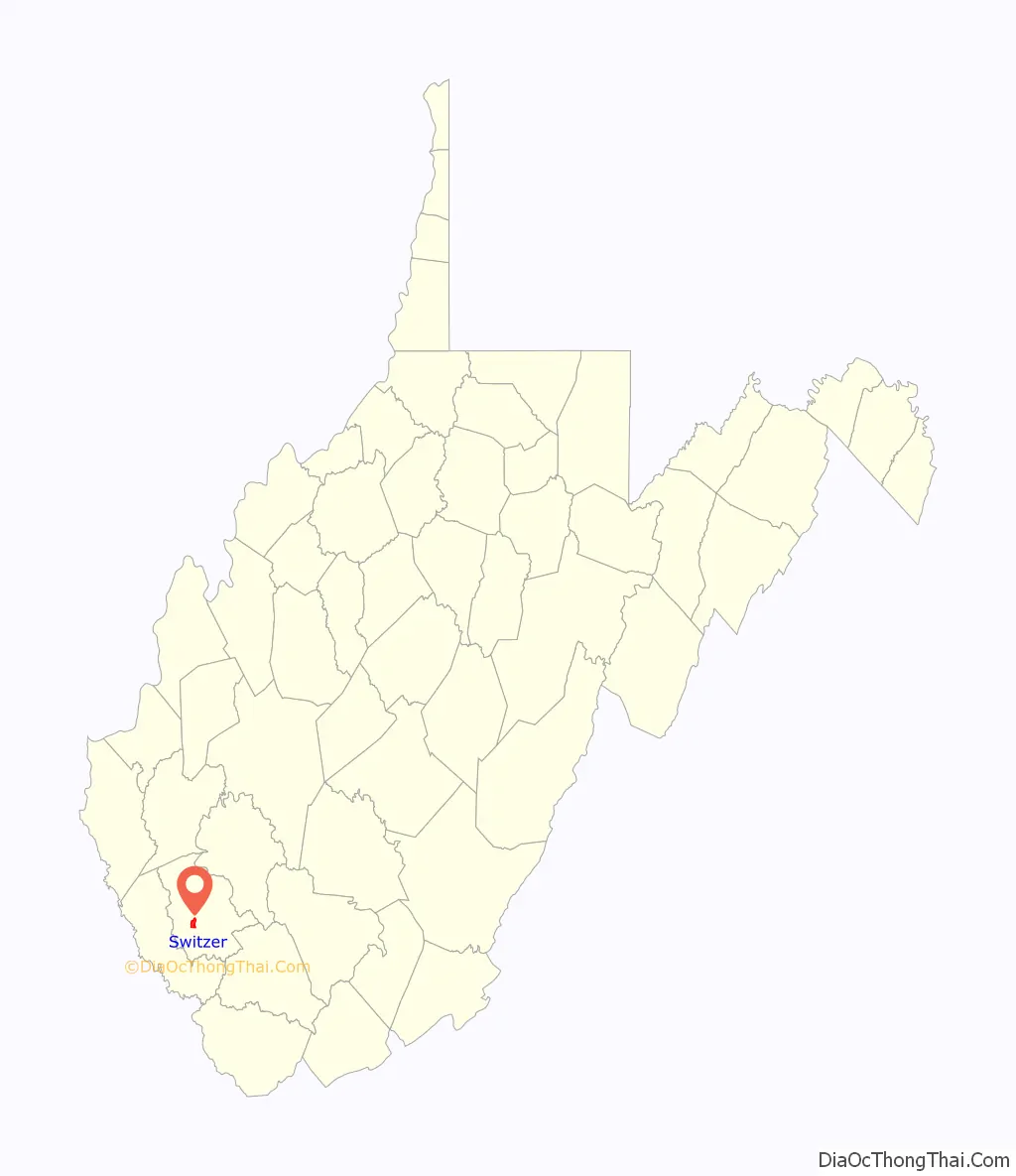
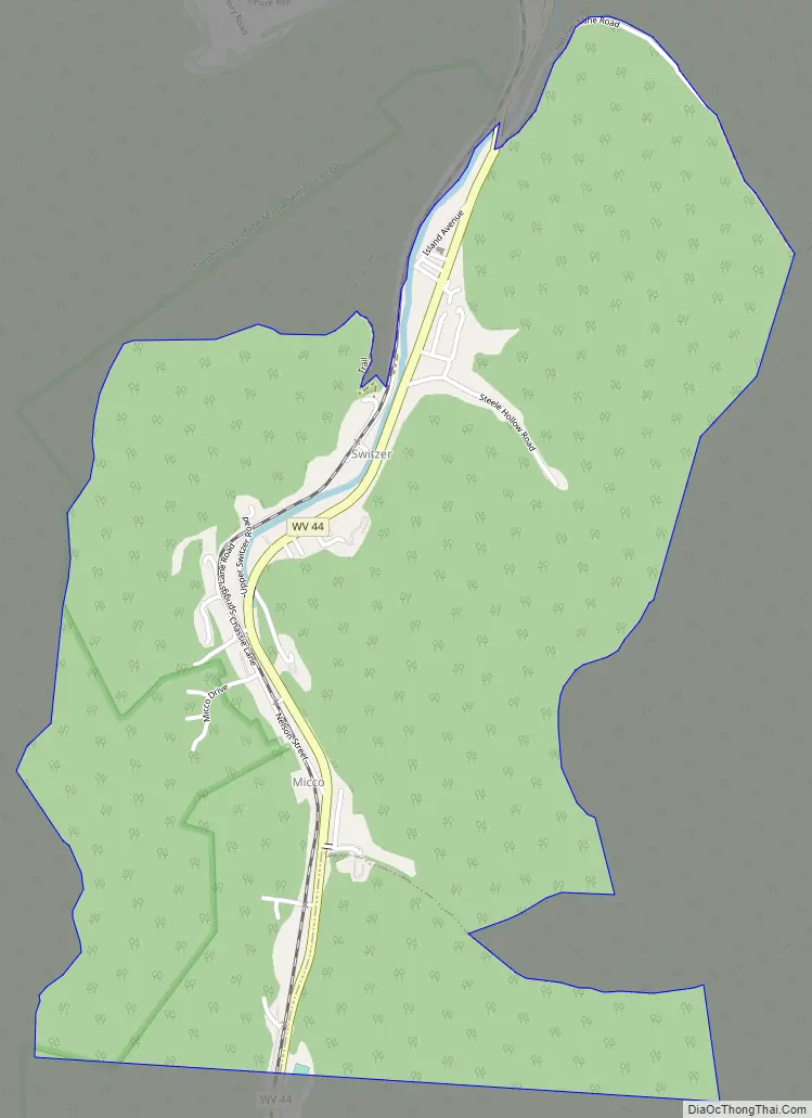
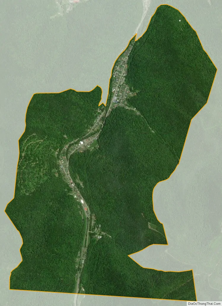
Switzer is an unincorporated community and census-designated place (CDP) in Logan County, West Virginia, United States. The CDP includes the neighboring unincorporated community of Micco. The total CDP population was 595 at the 2010 census.
The community was, most likely, named after the local Switzer family.
| Name: | Switzer CDP |
|---|---|
| LSAD Code: | 57 |
| LSAD Description: | CDP (suffix) |
| State: | West Virginia |
| County: | Logan County |
| Elevation: | 745 ft (227 m) |
| Total Area: | 2.36 sq mi (6.12 km²) |
| Land Area: | 2.34 sq mi (6.06 km²) |
| Water Area: | 0.02 sq mi (0.06 km²) |
| Total Population: | 595 |
| Population Density: | 254/sq mi (98.2/km²) |
| ZIP code: | 25647 |
| Area code: | 304 |
| FIPS code: | 5478796 |
| GNISfeature ID: | 1555771 |
Online Interactive Map
Click on ![]() to view map in "full screen" mode.
to view map in "full screen" mode.
Switzer location map. Where is Switzer CDP?
Switzer Road Map
Switzer city Satellite Map
Geography
Switzer is located in southwestern Logan County along Island Creek and West Virginia Route 44. The CDP is bordered to the north by Rossmore and to the south by Chauncey. Via WV-44, it is 6 miles (10 km) north to Logan, the county seat.
According to the United States Census Bureau, the Switzer CDP has a total area of 2.4 square miles (6.1 km), of which 0.02 square miles (0.06 km), or 1.02%, are water. Via Island Creek, Switzer is part of the Guyandotte River watershed, flowing north to the Ohio River near Huntington.
See also
Map of West Virginia State and its subdivision:- Barbour
- Berkeley
- Boone
- Braxton
- Brooke
- Cabell
- Calhoun
- Clay
- Doddridge
- Fayette
- Gilmer
- Grant
- Greenbrier
- Hampshire
- Hancock
- Hardy
- Harrison
- Jackson
- Jefferson
- Kanawha
- Lewis
- Lincoln
- Logan
- Marion
- Marshall
- Mason
- McDowell
- Mercer
- Mineral
- Mingo
- Monongalia
- Monroe
- Morgan
- Nicholas
- Ohio
- Pendleton
- Pleasants
- Pocahontas
- Preston
- Putnam
- Raleigh
- Randolph
- Ritchie
- Roane
- Summers
- Taylor
- Tucker
- Tyler
- Upshur
- Wayne
- Webster
- Wetzel
- Wirt
- Wood
- Wyoming
- Alabama
- Alaska
- Arizona
- Arkansas
- California
- Colorado
- Connecticut
- Delaware
- District of Columbia
- Florida
- Georgia
- Hawaii
- Idaho
- Illinois
- Indiana
- Iowa
- Kansas
- Kentucky
- Louisiana
- Maine
- Maryland
- Massachusetts
- Michigan
- Minnesota
- Mississippi
- Missouri
- Montana
- Nebraska
- Nevada
- New Hampshire
- New Jersey
- New Mexico
- New York
- North Carolina
- North Dakota
- Ohio
- Oklahoma
- Oregon
- Pennsylvania
- Rhode Island
- South Carolina
- South Dakota
- Tennessee
- Texas
- Utah
- Vermont
- Virginia
- Washington
- West Virginia
- Wisconsin
- Wyoming


