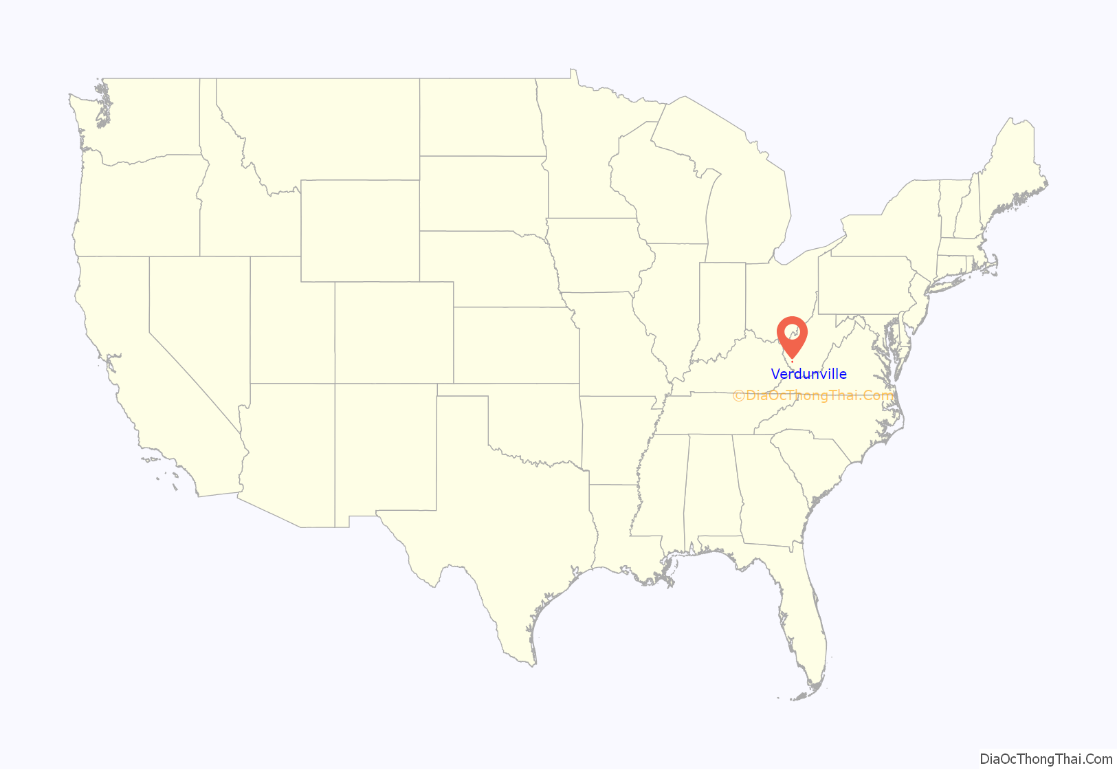
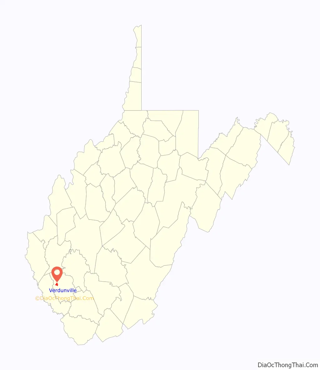
Verdunville is an unincorporated community and census-designated place (CDP) in Logan County, West Virginia, United States. It is 3.5 miles (5.6 km) west of Logan, the county seat. Verdunville has a post office with ZIP code 25649. The Verdunville CDP includes the neighboring community of Shegon. As of the 2010 census, the total CDP population was 687.
The community’s name commemorates the Battle of Verdun.
| Name: | Verdunville CDP |
|---|---|
| LSAD Code: | 57 |
| LSAD Description: | CDP (suffix) |
| State: | West Virginia |
| County: | Logan County |
| Elevation: | 879 ft (268 m) |
| Total Area: | 2.673 sq mi (6.92 km²) |
| Land Area: | 2.671 sq mi (6.92 km²) |
| Water Area: | 0.002 sq mi (0.005 km²) |
| Total Population: | 687 |
| Population Density: | 257.2/sq mi (99.3/km²) |
| ZIP code: | 25649 |
| Area code: | 304 & 681 |
| FIPS code: | 5483332 |
| GNISfeature ID: | 1548644 |
Online Interactive Map
Click on ![]() to view map in "full screen" mode.
to view map in "full screen" mode.
Verdunville location map. Where is Verdunville CDP?
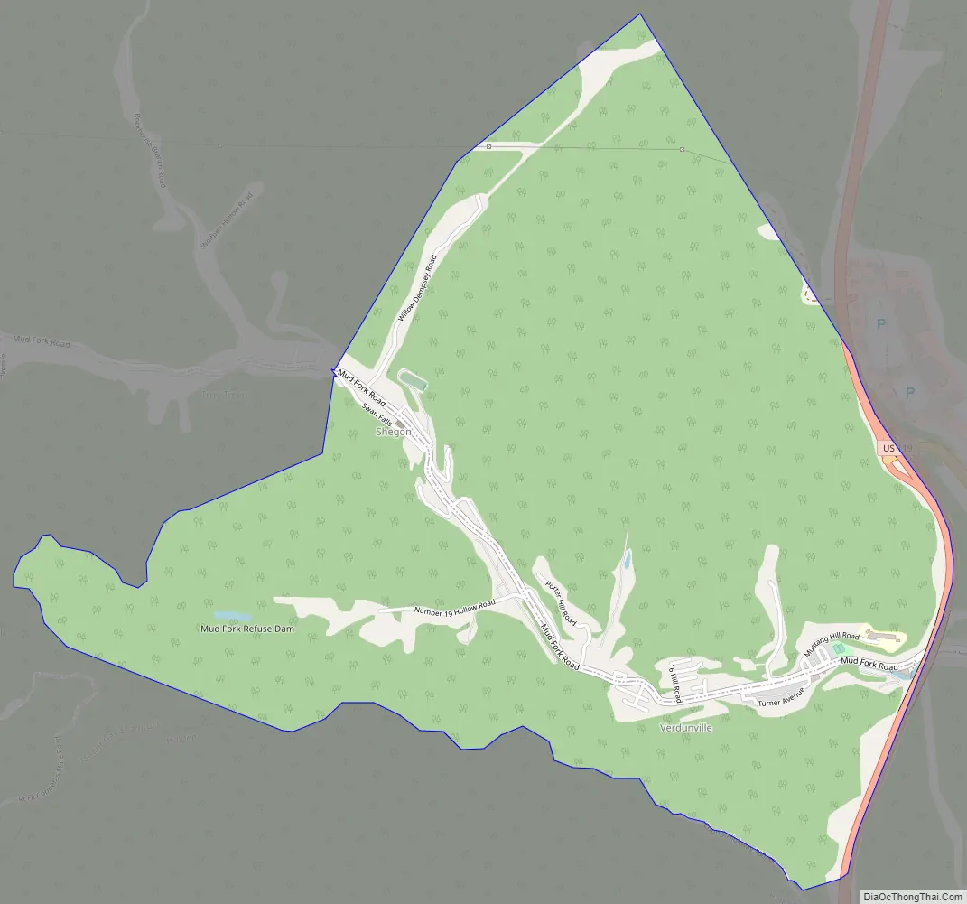
Verdunville Road Map
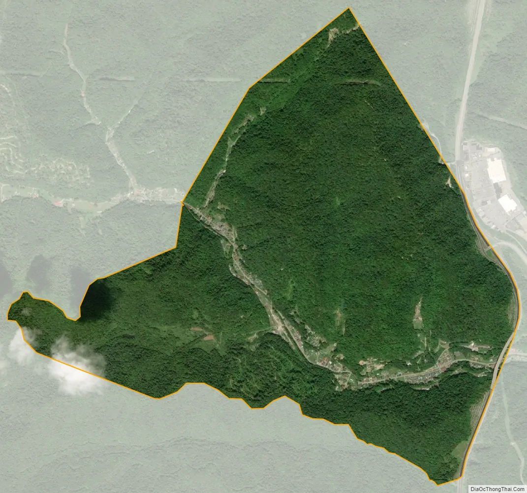
Verdunville city Satellite Map
Geography
Verdunville is in west-central Logan County, in the valley of the Mud Fork, an east-flowing tributary of Island Creek and part of the Guyandotte River watershed. Mud Fork Road runs up the valley from Mount Gay in the east (near Logan), through Verdunville and Shegon to the northwest, and leads eventually to Dingess in Mingo County. U.S. Route 119, a four-lane expressway, forms the eastern edge of the Verdunville CDP, with the closest access from an interchange with West Virginia Route 73 north of the Mud Fork valley.
According to the U.S. Census Bureau, the Verdunville CDP has a total area of 2.7 square miles (6.9 km), of which 1.1 acres (4,549 m), or 0.07%, are water.
See also
Map of West Virginia State and its subdivision:- Barbour
- Berkeley
- Boone
- Braxton
- Brooke
- Cabell
- Calhoun
- Clay
- Doddridge
- Fayette
- Gilmer
- Grant
- Greenbrier
- Hampshire
- Hancock
- Hardy
- Harrison
- Jackson
- Jefferson
- Kanawha
- Lewis
- Lincoln
- Logan
- Marion
- Marshall
- Mason
- McDowell
- Mercer
- Mineral
- Mingo
- Monongalia
- Monroe
- Morgan
- Nicholas
- Ohio
- Pendleton
- Pleasants
- Pocahontas
- Preston
- Putnam
- Raleigh
- Randolph
- Ritchie
- Roane
- Summers
- Taylor
- Tucker
- Tyler
- Upshur
- Wayne
- Webster
- Wetzel
- Wirt
- Wood
- Wyoming
- Alabama
- Alaska
- Arizona
- Arkansas
- California
- Colorado
- Connecticut
- Delaware
- District of Columbia
- Florida
- Georgia
- Hawaii
- Idaho
- Illinois
- Indiana
- Iowa
- Kansas
- Kentucky
- Louisiana
- Maine
- Maryland
- Massachusetts
- Michigan
- Minnesota
- Mississippi
- Missouri
- Montana
- Nebraska
- Nevada
- New Hampshire
- New Jersey
- New Mexico
- New York
- North Carolina
- North Dakota
- Ohio
- Oklahoma
- Oregon
- Pennsylvania
- Rhode Island
- South Carolina
- South Dakota
- Tennessee
- Texas
- Utah
- Vermont
- Virginia
- Washington
- West Virginia
- Wisconsin
- Wyoming


