Montana (/mɒnˈtænə/ (listen)) is a state in the Mountain West division of the Western United States. It is bordered by Idaho to the west, North Dakota and South Dakota to the east, Wyoming to the south, and the Canadian provinces of Alberta, British Columbia, and Saskatchewan to the north. It is the fourth-largest state by area, the eighth-least populous state, and the third-least densely populated state. Its state capital is Helena, while the largest city is Billings. The western half of Montana contains numerous mountain ranges, while the eastern half is characterized by western prairie terrain and badlands, with smaller mountain ranges found throughout the state. The state has a reputation for a libertarian bent in popular opinion and policy.
Montana has no official nickname but several unofficial ones, most notably “Big Sky Country”, “The Treasure State”, “Land of the Shining Mountains”, and “The Last Best Place”. Its economy is primarily based on agriculture, including ranching and cereal grain farming. Other significant economic resources include oil, gas, coal, mining, and lumber. The health care, service, and government sectors are also significant to the state’s economy. Montana’s fastest-growing sector is tourism, with 12.6 million tourists (as of 2019) visiting the state each year.
| Before statehood: | Montana Territory |
|---|---|
| Admitted to the Union: | November 8, 1889 (41st) |
| Capital: | Helena |
| Largest city: | Billings |
| Largest metro and urban areas: | Billings |
| Elevation: | 3,400 ft (1,040 m) |
| Total Area: | 147,040 sq mi (380,800 km) |
| Area Rank: | 4th |
| Total Population: | 1,085,407 |
| Population Rank: | 43rd |
| Population Density: | 7.09/sq mi (2.73/km) |
| Population Density Rank: | 48th |
| Median Household Income: | $56,539 |
| Income Rank: | 40th |
| Demonym(s): | Montanan |
| USPS abbreviation: | MT |
| ISO 3166 code: | US-MT |
| Website: | www.mt.gov |
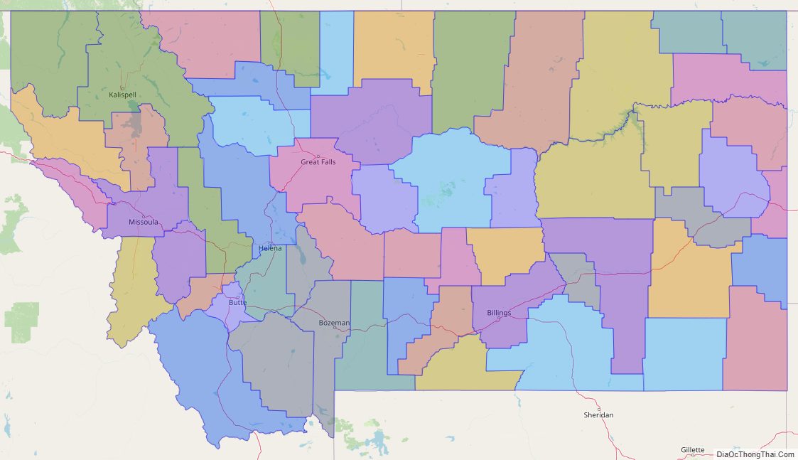
Online Interactive Map
Click on ![]() to view map in "full screen" mode.
to view map in "full screen" mode.
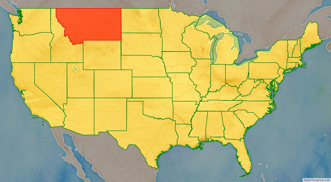
Montana location map. Where is Montana state?
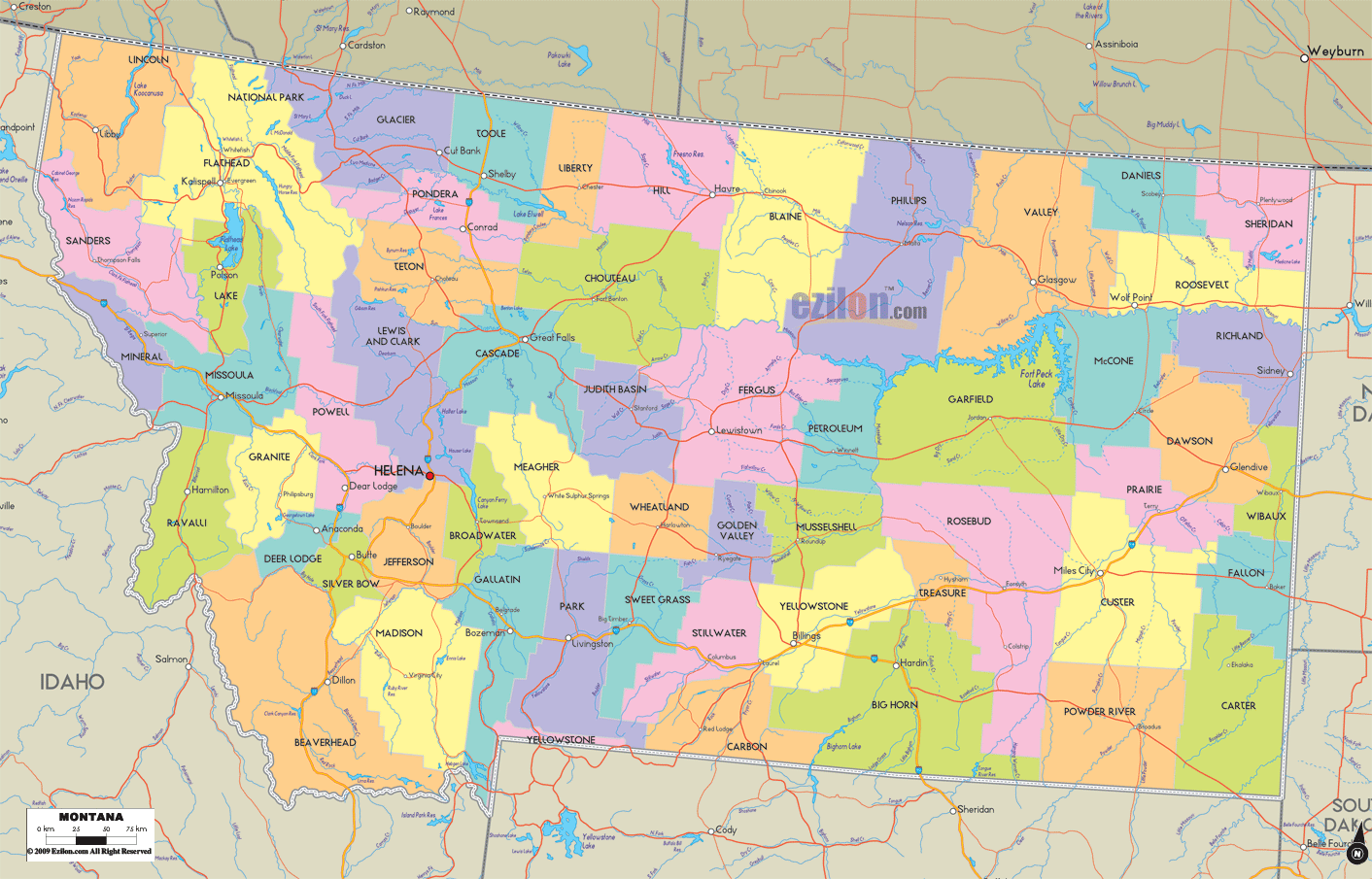
Montana Road Map
Montana Map – Roads & Cities
Montana Street Map
Montana State Map – Places and Landmarks
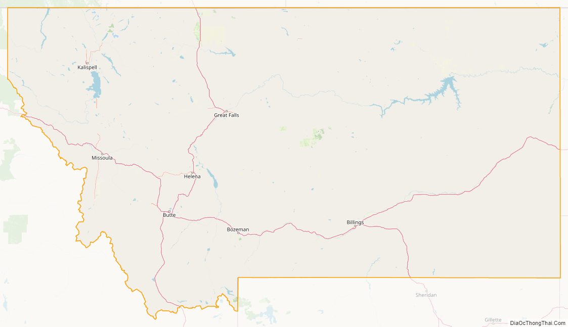
Montana Political Map
Montana Lakes and Rivers Map
Geography
Montana is one of the eight Mountain States, located in the north of the region known as the Western United States. It borders North Dakota and South Dakota to the east. Wyoming is to the south, Idaho is to the west and southwest, and the Canadian provinces of British Columbia, Alberta, and Saskatchewan are to the north, making it the only state to border three Canadian provinces.
With an area of 147,040 square miles (380,800 km), Montana is slightly larger than Japan. It is the fourth-largest state in the United States after Alaska, Texas, and California, and the largest landlocked state.
Topography
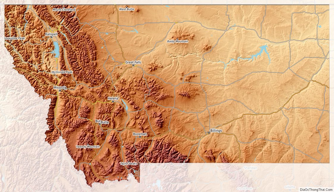
The state’s topography is roughly defined by the Continental Divide, which splits much of the state into distinct eastern and western regions. Most of Montana’s hundred or more named mountain ranges are in the state’s western half, most of which is geologically and geographically part of the northern Rocky Mountains. The Absaroka and Beartooth ranges in the state’s south-central part are technically part of the Central Rocky Mountains. The Rocky Mountain Front is a significant feature in the state’s north-central portion, and isolated island ranges that interrupt the prairie landscape common in the central and eastern parts of the state. About 60 percent of the state is prairie, part of the northern Great Plains.
The Bitterroot Mountains—one of the longest continuous ranges in the Rocky Mountain chain from Alaska to Mexico—along with smaller ranges, including the Coeur d’Alene Mountains and the Cabinet Mountains, divide the state from Idaho. The southern third of the Bitterroot range blends into the Continental Divide. Other major mountain ranges west of the divide include the Cabinet Mountains, the Anaconda Range, the Missions, the Garnet Range, the Sapphire Mountains, and the Flint Creek Range.
The divide’s northern section, where the mountains rapidly give way to prairie, is part of the Rocky Mountain Front. The front is most pronounced in the Lewis Range, located primarily in Glacier National Park. Due to the configuration of mountain ranges in Glacier National Park, the Northern Divide (which begins in Alaska’s Seward Peninsula) crosses this region and turns east in Montana at Triple Divide Peak. It causes the Waterton River, Belly, and Saint Mary rivers to flow north into Alberta, Canada. There they join the Saskatchewan River, which ultimately empties into Hudson Bay.
East of the divide, several roughly parallel ranges cover the state’s southern part, including the Gravelly Range, Madison Range, Gallatin Range, Absaroka Mountains, and Beartooth Mountains. The Beartooth Plateau is the largest continuous land mass over 10,000 feet (3,000 m) high in the continental United States. It contains the state’s highest point, Granite Peak, 12,799 feet (3,901 m) high. North of these ranges are the Big Belt Mountains, Bridger Mountains, Tobacco Roots, and several island ranges, including the Crazy Mountains and Little Belt Mountains.
Between many mountain ranges are several rich river valleys. The Big Hole, Bitterroot, Gallatin, Flathead, and Paradise Valleys have extensive agricultural resources and multiple opportunities for tourism and recreation.
East and north of this transition zone are the expansive and sparsely populated Northern Plains, with tableland prairies, smaller island mountain ranges, and badlands. The isolated island ranges east of the Divide include the Bear Paw Mountains, Bull Mountains, Castle Mountains, Crazy Mountains, Highwood Mountains, Judith Mountains, Little Belt Mountains, Little Rocky Mountains, the Pryor Mountains, Little Snowy Mountains, Big Snowy Mountains, Sweet Grass Hills, and—in the state’s southeastern corner near Ekalaka—the Long Pines. Many of these isolated eastern ranges were created about 120 to 66 million years ago when magma welling up from the interior cracked and bowed the earth’s surface here.
The area east of the divide in the state’s north-central portion is known for the Missouri Breaks and other significant rock formations. Three buttes south of Great Falls are major landmarks: Cascade, Crown, Square, Shaw, and Buttes. Known as laccoliths, they formed when igneous rock protruded through cracks in the sedimentary rock. The underlying surface consists of sandstone and shale. Surface soils in the area are highly diverse, and greatly affected by the local geology, whether glaciated plain, intermountain basin, mountain foothills, or tableland. Foothill regions are often covered in weathered stone or broken slate, or consist of uncovered bare rock (usually igneous, quartzite, sandstone, or shale). The soil of intermountain basins usually consists of clay, gravel, sand, silt, and volcanic ash, much of it laid down by lakes which covered the region during the Oligocene 33 to 23 million years ago. Tablelands are often topped with argillite gravel and weathered quartzite, occasionally underlain by shale. The glaciated plains are generally covered in clay, gravel, sand, and silt left by the proglacial Lake Great Falls or by moraines or gravel-covered former lake basins left by the Wisconsin glaciation 85,000 to 11,000 years ago. Farther east, areas such as Makoshika State Park near Glendive and Medicine Rocks State Park near Ekalaka contain some of the most scenic badlands regions in the state.
The Hell Creek Formation in Northeast Montana is a major source of dinosaur fossils. Paleontologist Jack Horner of the Museum of the Rockies in Bozeman brought this formation to the world’s attention with several major finds.
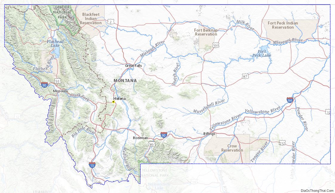
Montana has thousands of named rivers and creeks, 450 miles (720 km) of which are known for “blue-ribbon” trout fishing. Montana’s water resources provide for recreation, hydropower, crop and forage irrigation, mining, and water for human consumption.
Montana is one of few geographic areas in the world whose rivers form parts of three major watersheds (i.e. where two continental divides intersect). Its rivers feed the Pacific Ocean, the Gulf of Mexico, and Hudson Bay. The watersheds divide at Triple Divide Peak in Glacier National Park. If Hudson Bay is considered part of the Arctic Ocean, Triple Divide Peak is the only place on Earth with drainage to three different oceans.
All waters in Montana west of the divide flow into the Columbia River. The Clark Fork of the Columbia (not to be confused with the Clarks Fork of the Yellowstone River) rises near Butte and flows northwest to Missoula, where it is joined by the Blackfoot River and Bitterroot River. Farther downstream, it is joined by the Flathead River before entering Idaho near Lake Pend Oreille. The Pend Oreille River forms the outflow of Lake Pend Oreille. The Pend Oreille River joined the Columbia River, which flows to the Pacific Ocean—making the 579-mile (932 km) long Clark Fork/Pend Oreille (considered a single river system) the longest river in the Rocky Mountains. The Clark Fork discharges the greatest volume of water of any river exiting the state. The Kootenai River in northwest Montana is another major tributary of the Columbia.
East of the divide the Missouri River, which is formed by the confluence of the Jefferson, Madison, and Gallatin Rivers near Three Forks, flows due north through the west-central part of the state to Great Falls. From this point, it then flows generally east through fairly flat agricultural land and the Missouri Breaks to Fort Peck reservoir. The stretch of river between Fort Benton and the Fred Robinson Bridge at the western boundary of Fort Peck Reservoir was designated a National Wild and Scenic River in 1976. The Missouri enters North Dakota near Fort Union, having drained more than half the land area of Montana (82,000 square miles (210,000 km)). Nearly one-third of the Missouri River in Montana lies behind 10 dams: Toston, Canyon Ferry, Hauser, Holter, Black Eagle, Rainbow, Cochrane, Ryan, Morony, and Fort Peck. Other major Montana tributaries of the Missouri include the Smith, Milk, Marias, Judith, and Musselshell Rivers. Montana also claims the disputed title of possessing the world’s shortest river, the Roe River, just outside Great Falls. Through the Missouri, these rivers ultimately join the Mississippi River and flow into the Gulf of Mexico.
Hell Roaring Creek begins in southern Montana, and when combined with the Red Rock, Beaverhead, Jefferson, Missouri, and Mississippi River, is the longest river in North America and the fourth longest river in the world.
The Yellowstone River rises on the Continental Divide near Younts Peak in Wyoming’s Teton Wilderness. It flows north through Yellowstone National Park, enters Montana near Gardiner, and passes through the Paradise Valley to Livingston. It then flows northeasterly across the state through Billings, Miles City, Glendive, and Sidney. The Yellowstone joins the Missouri in North Dakota just east of Fort Union. It is the longest undammed, free-flowing river in the contiguous United States, and drains about a quarter of Montana (36,000 square miles (93,000 km)). Major tributaries of the Yellowstone include the Boulder, Stillwater, Clarks Fork, Bighorn, Tongue, and Powder Rivers.
The Northern Divide turns east in Montana at Triple Divide Peak, causing the Waterton, Belly, and Saint Mary Rivers to flow north into Alberta. There they join the Saskatchewan River, which ultimately empties into Hudson Bay.
Montana has some 3,000 named lakes and reservoirs, including Flathead Lake, the largest natural freshwater lake in the western United States. Other major lakes include Whitefish Lake in the Flathead Valley and Lake McDonald and St. Mary Lake in Glacier National Park. The largest reservoir in the state is Fort Peck Reservoir on the Missouri river, which is contained by the second largest earthen dam and largest hydraulically filled dam in the world. Other major reservoirs include Hungry Horse on the Flathead River; Lake Koocanusa on the Kootenai River; Lake Elwell on the Marias River; Clark Canyon on the Beaverhead River; Yellowtail on the Bighorn River, Canyon Ferry, Hauser, Holter, Rainbow; and Black Eagle on the Missouri River.
Flora and fauna
Vegetation of the state includes lodgepole pine, ponderosa pine, Douglas fir, larch, spruce, aspen, birch, red cedar, hemlock, ash, alder, rocky mountain maple and cottonwood trees. Forests cover about 25% of the state. Flowers native to Montana include asters, bitterroots, daisies, lupins, poppies, primroses, columbine, lilies, orchids, and dryads. Several species of sagebrush and cactus and many species of grasses are common. Many species of mushrooms and lichens are also found in the state.
Montana is home to diverse fauna including 14 amphibian, 90 fish, 117 mammal, 20 reptile, and 427 bird species. Additionally, more than 10,000 invertebrate species are present, including 180 mollusks and 30 crustaceans. Montana has the largest grizzly bear population in the lower 48 states. Montana hosts five federally endangered species–black-footed ferret, whooping crane, least tern, pallid sturgeon, and white sturgeon and seven threatened species including the grizzly bear, Canadian lynx, and bull trout. Since re-introduction the gray wolf population has stabilized at about 900 animals, and they have been delisted as endangered. The Montana Department of Fish, Wildlife and Parks manages fishing and hunting seasons for at least 17 species of game fish, including seven species of trout, walleye, and smallmouth bass and at least 29 species of game birds and animals including ring-neck pheasant, grey partridge, elk, pronghorn antelope, mule deer, whitetail deer, gray wolf, and bighorn sheep.
Protected lands
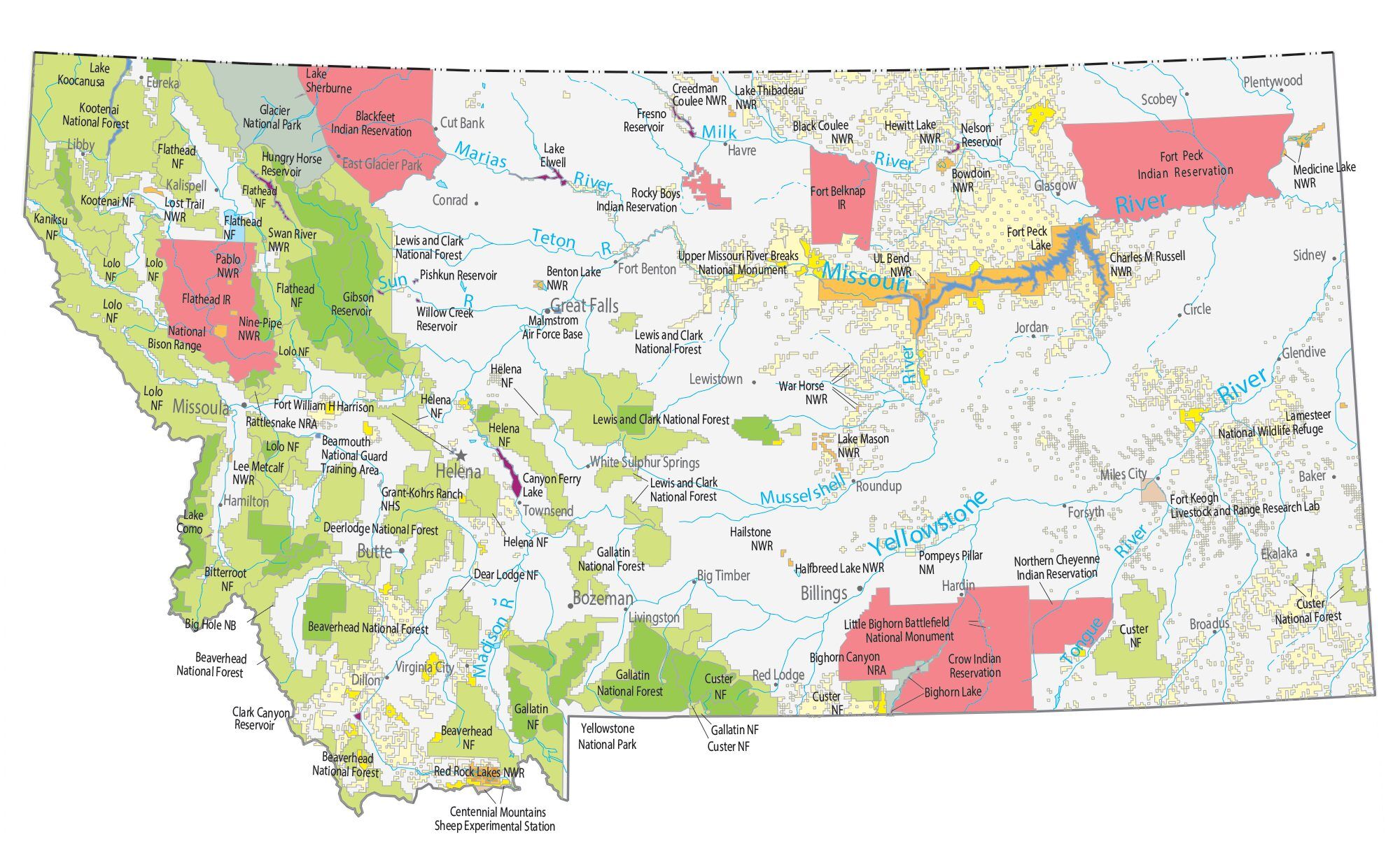
Montana contains Glacier National Park, “The Crown of the Continent”, and parts of Yellowstone National Park, including three of the park’s five entrances. Other federally recognized sites include the Little Bighorn National Monument, Bighorn Canyon National Recreation Area, and Big Hole National Battlefield. The Bison Range is managed by the Confederated Salish and Kootenai Tribes and the American Prairie is owned and operated by a nonprofit organization.
Federal and state agencies administer approximately 31,300,000 acres (127,000 km), or 35 percent of Montana’s land. The U.S. Department of Agriculture Forest Service administers 16,800,000 acres (68,000 km) of forest land in ten National Forests. There are approximately 3,300,000 acres (13,000 km) of wilderness in 12 separate wilderness areas that are part of the National Wilderness Preservation System established by the Wilderness Act of 1964. The U.S. Department of the Interior Bureau of Land Management controls 8,100,000 acres (33,000 km) of federal land. The U.S. Department of the Interior Fish and Wildlife Service administers 110,000 acres (450 km) of 1.1 million acres of National Wildlife Refuges and waterfowl production areas in Montana. The U.S. Department of the Interior Bureau of Reclamation administers approximately 300,000 acres (1,200 km) of land and water surface in the state. The Montana Department of Fish, Wildlife and Parks operate approximately 275,265 acres (1,113.96 km) of state parks and access points on the state’s rivers and lakes. The Montana Department of Natural Resources and Conservation manages 5,200,000 acres (21,000 km) of School Trust Land ceded by the federal government under the Land Ordinance of 1785 to the state in 1889 when Montana was granted statehood. These lands are managed by the state for the benefit of public schools and institutions in the state.
Areas managed by the National Park Service include:
- Big Hole National Battlefield near Wisdom
- Bighorn Canyon National Recreation Area near Fort Smith
- Glacier National Park
- Grant-Kohrs Ranch National Historic Site at Deer Lodge
- Lewis and Clark National Historic Trail
- Little Bighorn Battlefield National Monument near Crow Agency
Montana Physical Map
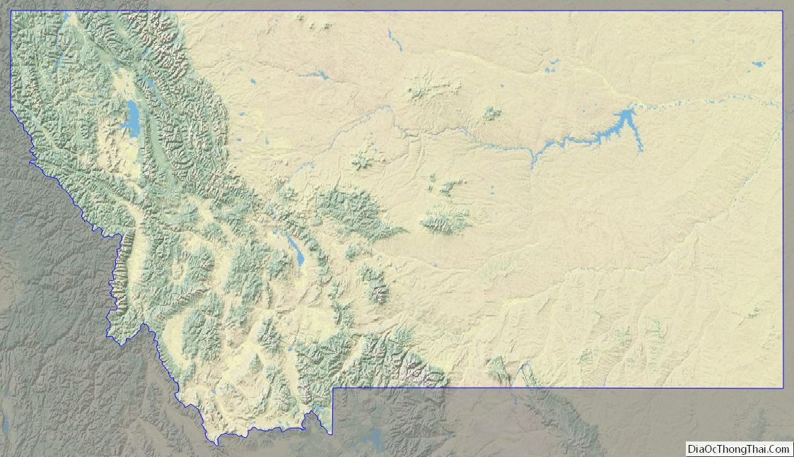

Montana Topographic Map
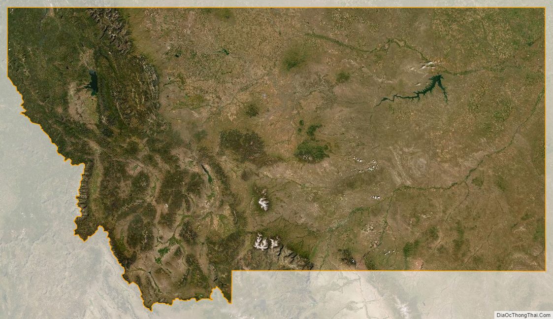
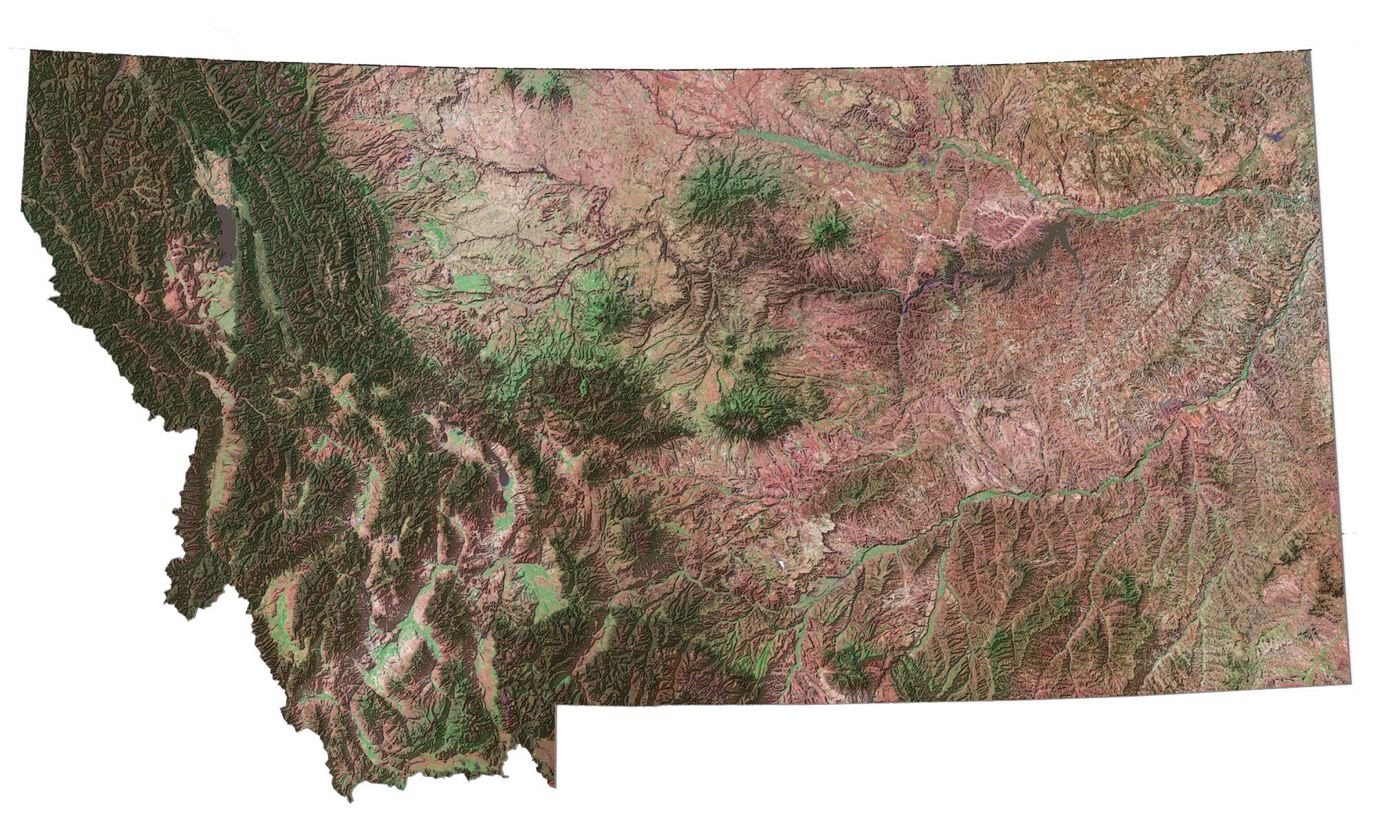
Montana Satellite Map
Others printable maps
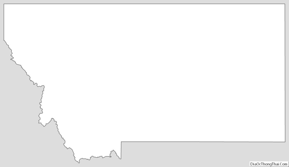
Montana Outline Map
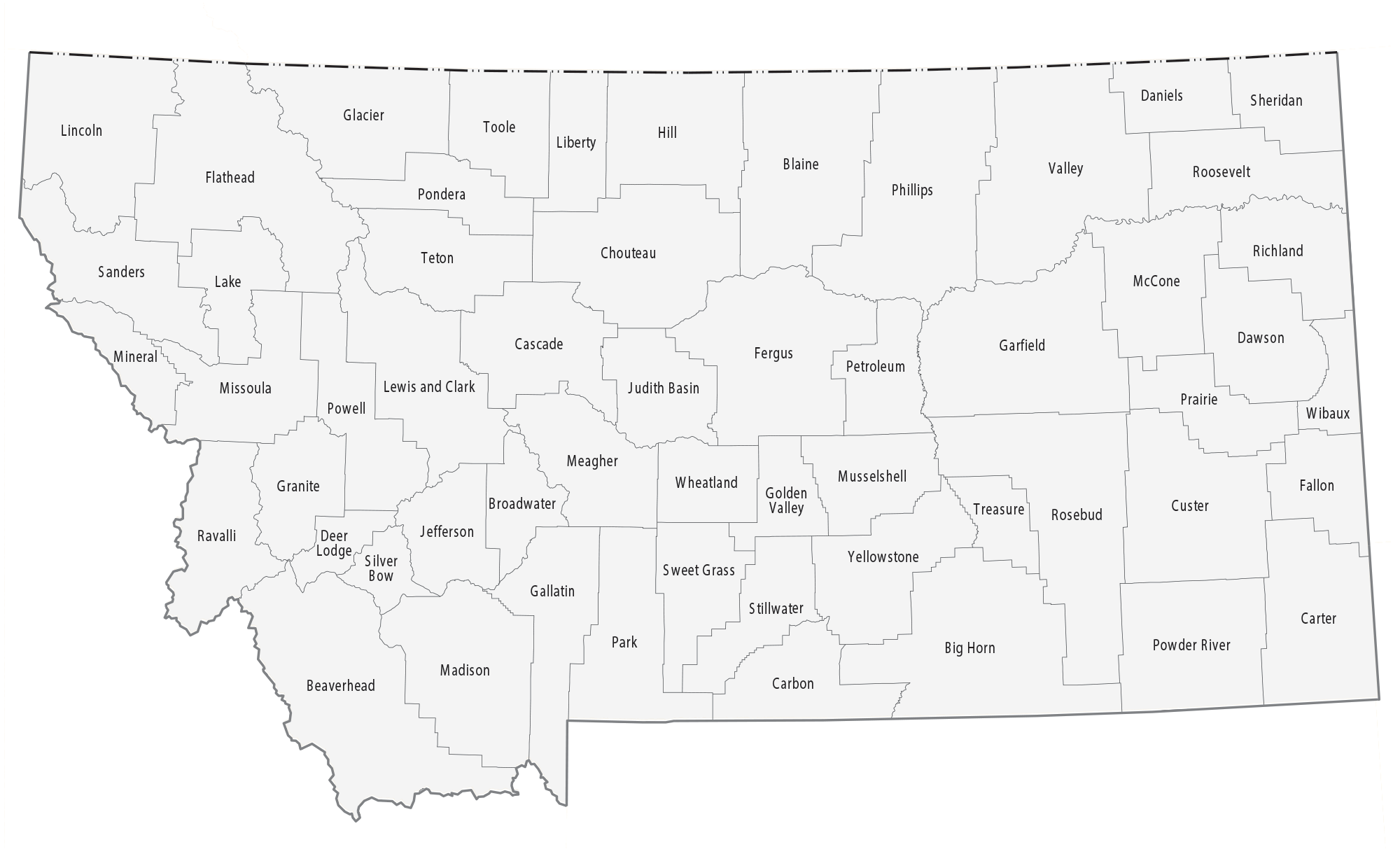
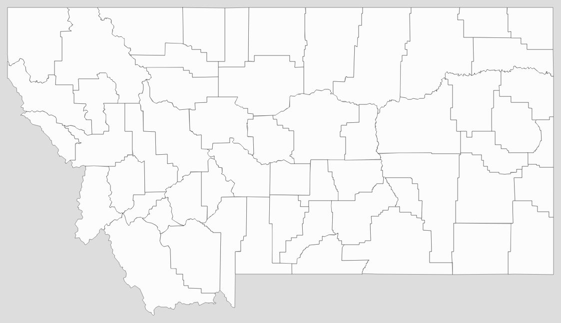
Blank Montana County Map
See also
Map of Montana State and its subdivision:- Beaverhead
- Big Horn
- Blaine
- Broadwater
- Carbon
- Carter
- Cascade
- Chouteau
- Custer
- Daniels
- Dawson
- Deer Lodge
- Fallon
- Fergus
- Flathead
- Gallatin
- Garfield
- Glacier
- Golden Valley
- Granite
- Hill
- Jefferson
- Judith Basin
- Lake
- Lewis and Clark
- Liberty
- Lincoln
- Madison
- McCone
- Meagher
- Mineral
- Missoula
- Musselshell
- Park
- Petroleum
- Phillips
- Pondera
- Powder River
- Powell
- Prairie
- Ravalli
- Richland
- Roosevelt
- Rosebud
- Sanders
- Sheridan
- Silver Bow
- Stillwater
- Sweet Grass
- Teton
- Toole
- Treasure
- Valley
- Wheatland
- Wibaux
- Yellowstone
- Alabama
- Alaska
- Arizona
- Arkansas
- California
- Colorado
- Connecticut
- Delaware
- District of Columbia
- Florida
- Georgia
- Hawaii
- Idaho
- Illinois
- Indiana
- Iowa
- Kansas
- Kentucky
- Louisiana
- Maine
- Maryland
- Massachusetts
- Michigan
- Minnesota
- Mississippi
- Missouri
- Montana
- Nebraska
- Nevada
- New Hampshire
- New Jersey
- New Mexico
- New York
- North Carolina
- North Dakota
- Ohio
- Oklahoma
- Oregon
- Pennsylvania
- Rhode Island
- South Carolina
- South Dakota
- Tennessee
- Texas
- Utah
- Vermont
- Virginia
- Washington
- West Virginia
- Wisconsin
- Wyoming


