Potter County is a county in the Commonwealth of Pennsylvania. As of the 2020 census, its population was 16,396, making it the fifth-least populous county in Pennsylvania. Its county seat is Coudersport. The county was created in 1804 and later organized in 1836. It is named after James Potter, who was a general from Pennsylvania in the Continental Army during the American Revolution. Due to its remoteness and natural environment, it has been nicknamed “God’s Country”.
Potter County is located in the Allegheny Plateau and Susquehanna Valley region.
| Name: | Potter County |
|---|---|
| FIPS code: | 42-105 |
| State: | Pennsylvania |
| Founded: | September 1, 1826 |
| Named for: | James Potter |
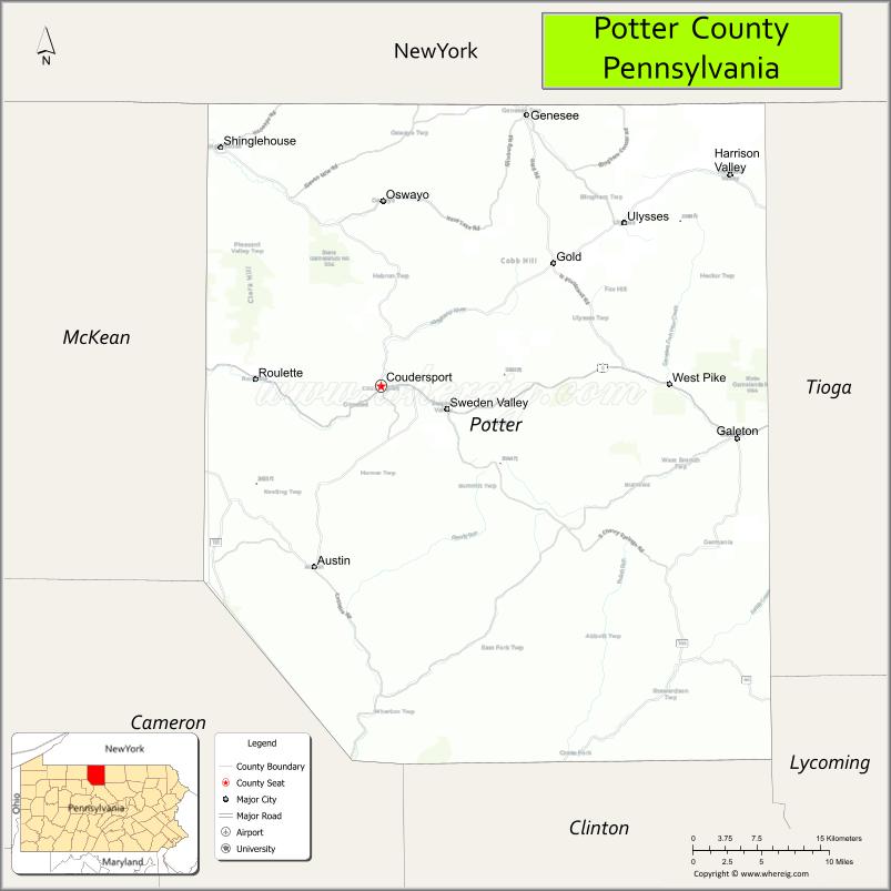
| Seat: | Coudersport |
| Total Area: | 1,082 sq mi (2,800 km²) |
| Land Area: | 1,081 sq mi (2,800 km²) |
| Total Population: | 16,396 |
| Population Density: | 15/sq mi (6/km²) |
| Time zone: | UTC−5 (Eastern) |
| Summer Time Zone (DST): | UTC−4 (EDT) |
| Website: | visitpottertioga.com |
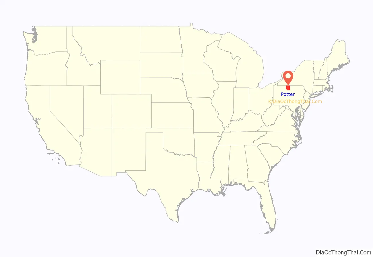
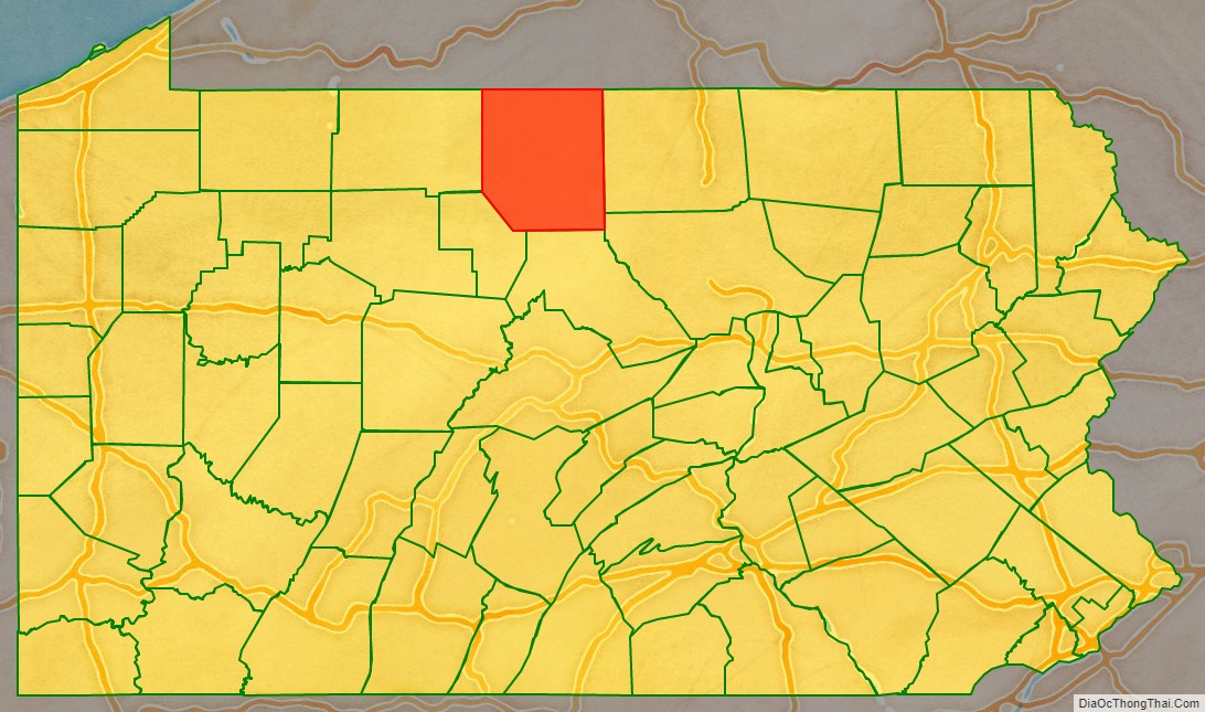
Potter County location map. Where is Potter County?
History
Major Isaac Lyman, an American Revolutionary war veteran was one of the first permanent settlers in Potter County. Major Lyman is recognized as the founder of Potter County. He was paid $10 for each settler he convinced to move to Potter County. He built his home in 1809 in nearby Lymansville, now known as Ladona, just east of Coudersport along Rt. 6. Major Lyman also built the first road to cross Potter County and Potter County’s first sawmill and gristmill.
Lyman had a colorful personal history. After the death in childbirth of his first wife, Sally Edgecombe, he remarried; later, he left his second wife and started a third family in Potter County. The second Mrs. Lyman was determined not to suffer on her own. She sought out the major, travelling from Bolton Landing, New York, to Potter County with the help of their son, Burrell, who was 18 at the time. Major Lyman lived with these two families in Potter County. Historical accounts of the living situation vary. Some say that Lyman kept both wives under one roof. Others state that two log homes for the families were on the same piece of property. Descendants of Major Lyman’s three families still live and work in Potter County.
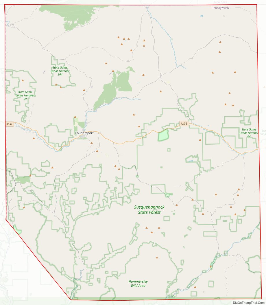
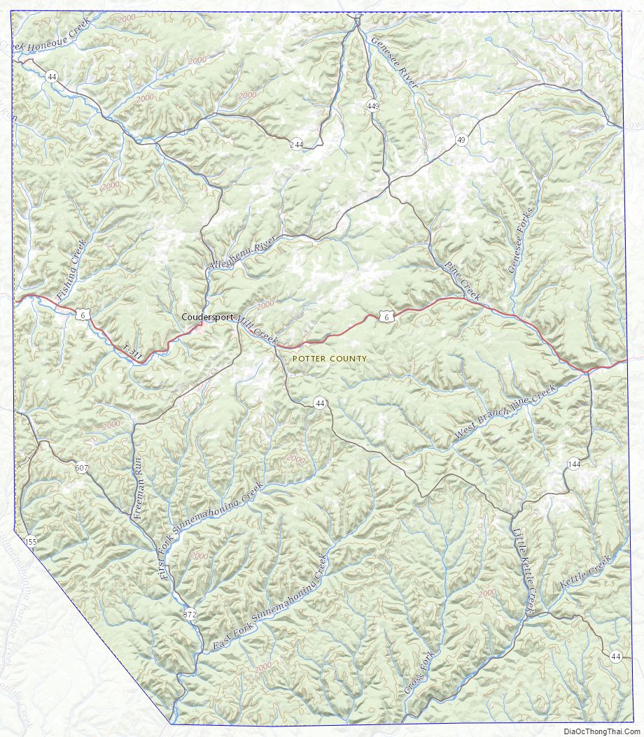
Potter County Road Map
Geography
According to the U.S. Census Bureau, the county has a total area of 1,082 square miles (2,800 km), of which 0.2 square miles (0.52 km) (0.02%) is covered by water.
Three major watersheds meet, forming a triple divide, in Potter County: Chesapeake Bay, St. Lawrence River, and Mississippi River. Moreover, the main stem by volume of the entire Mississippi river system, the Allegheny River, has its source in central Potter County, near Cobb Hill.
Potter has a warm-summer humid continental climate (Dfb) and average monthly temperatures in Coudersport range from 22.0 °F in January to 66.4 °F in July. [1]
Adjacent counties
- Allegany County, New York (north)
- Steuben County, New York (northeast)
- Tioga County (east)
- Lycoming County (southeast)
- Clinton County (south)
- Cameron County (southwest)
- McKean County (west)
Major highways
- US 6
- PA 44
- PA 49
- PA 144
- PA 155
- PA 244
- PA 449
- PA 607
- PA 872
Potter County Topographic Map
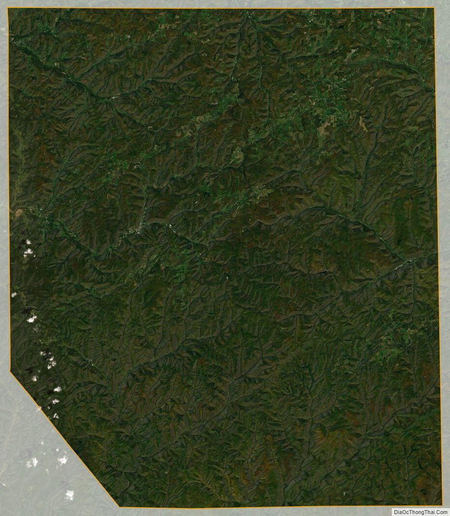
Potter County Satellite Map
Potter County Outline Map

See also
Map of Pennsylvania State and its subdivision:- Adams
- Allegheny
- Armstrong
- Beaver
- Bedford
- Berks
- Blair
- Bradford
- Bucks
- Butler
- Cambria
- Cameron
- Carbon
- Centre
- Chester
- Clarion
- Clearfield
- Clinton
- Columbia
- Crawford
- Cumberland
- Dauphin
- Delaware
- Elk
- Erie
- Fayette
- Forest
- Franklin
- Fulton
- Greene
- Huntingdon
- Indiana
- Jefferson
- Juniata
- Lackawanna
- Lancaster
- Lawrence
- Lebanon
- Lehigh
- Luzerne
- Lycoming
- Mc Kean
- Mercer
- Mifflin
- Monroe
- Montgomery
- Montour
- Northampton
- Northumberland
- Perry
- Philadelphia
- Pike
- Potter
- Schuylkill
- Snyder
- Somerset
- Sullivan
- Susquehanna
- Tioga
- Union
- Venango
- Warren
- Washington
- Wayne
- Westmoreland
- Wyoming
- York
- Alabama
- Alaska
- Arizona
- Arkansas
- California
- Colorado
- Connecticut
- Delaware
- District of Columbia
- Florida
- Georgia
- Hawaii
- Idaho
- Illinois
- Indiana
- Iowa
- Kansas
- Kentucky
- Louisiana
- Maine
- Maryland
- Massachusetts
- Michigan
- Minnesota
- Mississippi
- Missouri
- Montana
- Nebraska
- Nevada
- New Hampshire
- New Jersey
- New Mexico
- New York
- North Carolina
- North Dakota
- Ohio
- Oklahoma
- Oregon
- Pennsylvania
- Rhode Island
- South Carolina
- South Dakota
- Tennessee
- Texas
- Utah
- Vermont
- Virginia
- Washington
- West Virginia
- Wisconsin
- Wyoming