Altheimer is a city in Plum Bayou Township, Jefferson County, Arkansas. It is situated on the Union Pacific Railway, 11 miles (18 km) northeast of Pine Bluff. As of the 2010 census it had a population of 984, down from 1,192 at the 2000 census. As of 2018 the estimated population was 829.
| Name: | Altheimer city |
|---|---|
| LSAD Code: | 25 |
| LSAD Description: | city (suffix) |
| State: | Arkansas |
| County: | Jefferson County |
| Founded: | 1886 (1886) |
| Incorporated: | 1919 (1919) |
| Elevation: | 207 ft (63 m) |
| Land Area: | 2.05 sq mi (5.31 km²) |
| Water Area: | 0.07 sq mi (0.18 km²) |
| Population Density: | 339.51/sq mi (131.11/km²) |
| ZIP code: | 72004 |
| Area code: | 870 |
| FIPS code: | 0501150 |
| GNISfeature ID: | 45849 |
Online Interactive Map
Click on ![]() to view map in "full screen" mode.
to view map in "full screen" mode.
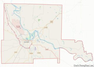
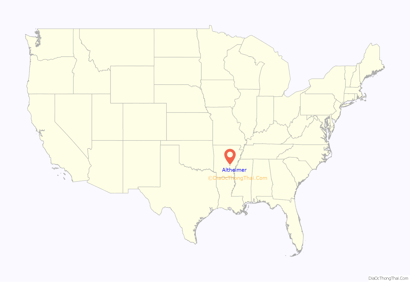
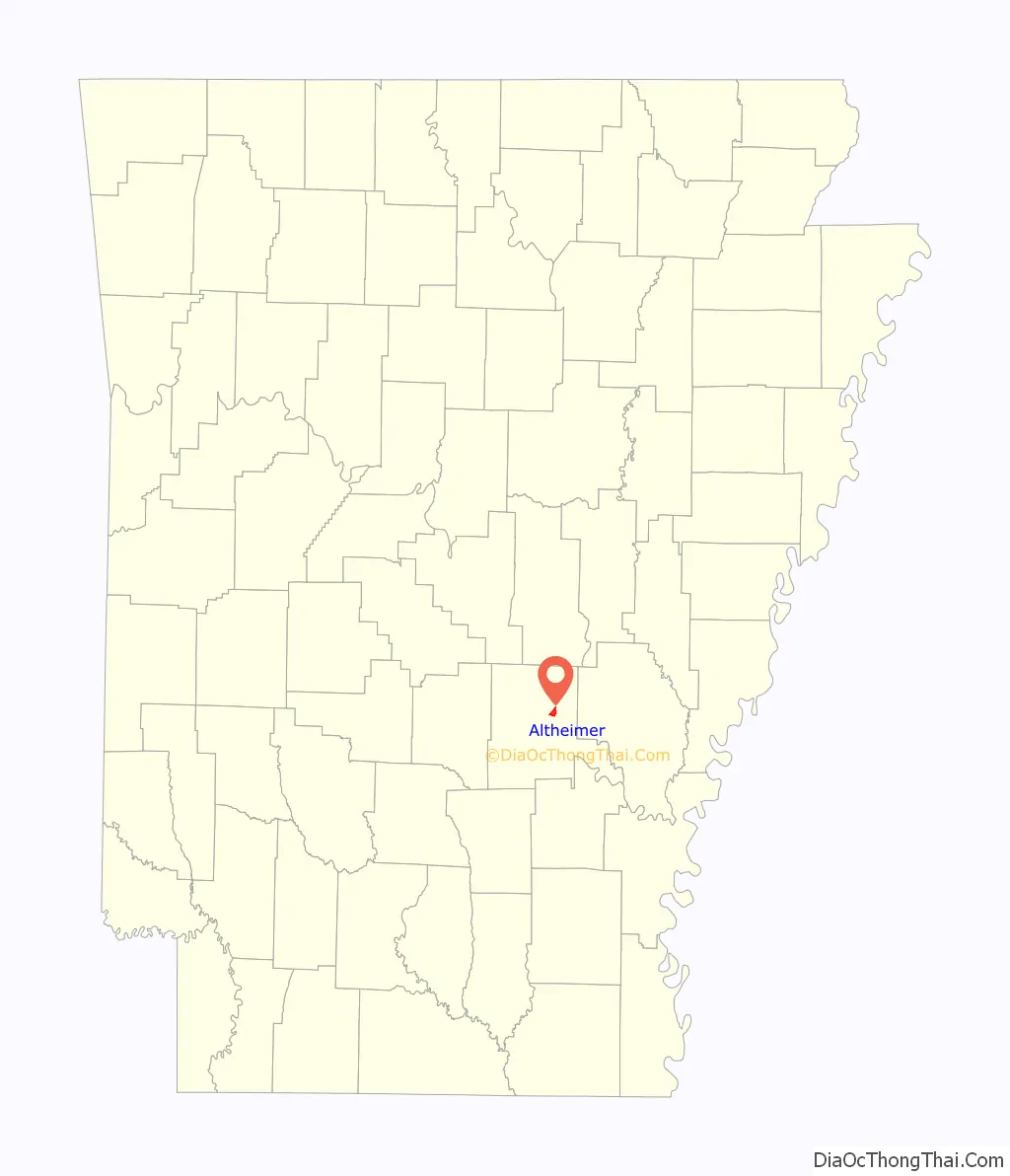
Altheimer location map. Where is Altheimer city?
History
The city was named for brothers Joseph and Louis Altheimer, two Pine Bluff merchants. Louis, who was born in Eberstadt in 1850, read stories by German adventurer Frederick Gerstacker telling of the rich natural resources in Arkansas, and left for America as a teenager, eventually settling in Pine Bluff. Louis brought his brother Joseph with him to the land that would eventually bear their name. Joseph’s son, Benjamin, became a successful attorney, establishing the prominent Chicago law firm of Altheimer, Mayer, Woods, and Smith (later known as Altheimer & Gray), and serving twice as president of Chicago’s Iroquois Club, the city’s oldest Democratic Party political club. Benjamin owned 15,000 acres (61 km) of land in Arkansas. His foundation, the Ben J. Altheimer Foundation, provided scholarships and funding for projects throughout the state and continues today as the Ben J. Altheimer Charitable Foundation, Inc.
Altheimer is home to many restored pioneer-era log cabins, Victorian era plantation houses and museums. One of the most prominent locations is The Elms, a former plantation house on the Collier Estate built in 1886, renovated by Ben Altheimer in the 1930s. Listed on the National Register of Historic Places, The Elms is open to the public for retreats, family reunions and tours. Also located on the property are the Elms Duck Lodges, which provides hunting and fishing in the private lake and pond. Roselawn, also known as the Collier-Barnett House, was built in 1875 and added to National Register of Historic Places in 1978. Lake Dick is an oxbow lake located four miles (6 km) south of Altheimer. This area formerly held farmsteads of eighty Caucasian families who were moved into the area in 1936 as part of the Farm Security Administration. Lake Dick was added to the register in 1975.
In 2007 and 2013, respectively, Altheimer’s secondary and elementary schools closed. As a result a number of residents moved to Pine Bluff to be closer to the zoned schools operated by the Dollarway School District, and multiple businesses had lost revenue.
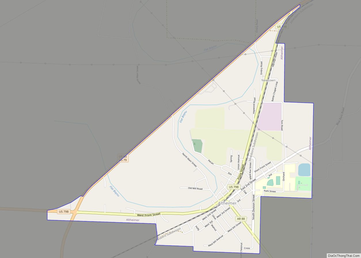
Altheimer Road Map
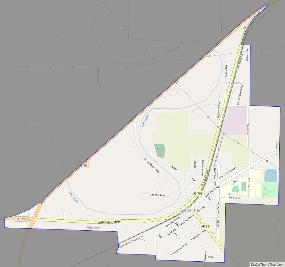
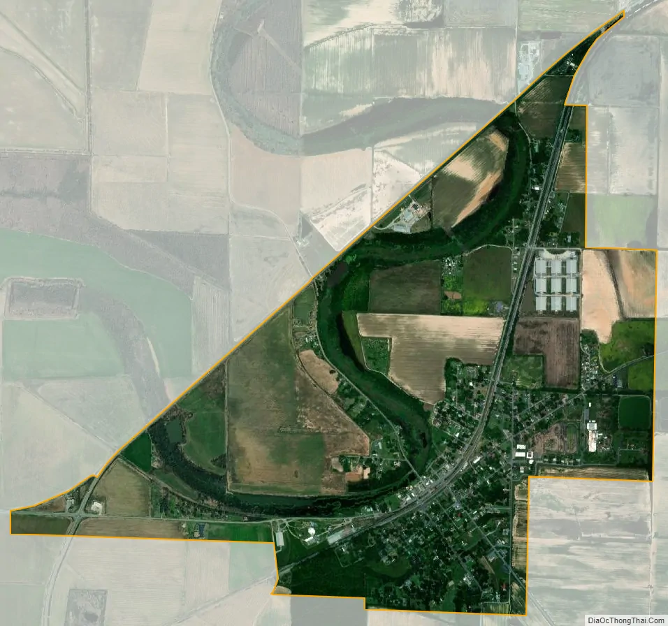
Altheimer city Satellite Map
Geography
Altheimer is part of the Timberlands Region, an area rich in natural resources that was discovered by pioneers from the eastern states in the early 19th century. Deer hunting, bass fishing, timber and oil are plentiful in this area.
Altheimer is in northeastern Jefferson County, 14 miles (23 km) northeast of Pine Bluff, the county seat. U.S. Route 63/79 runs along the northwestern edge of the city, leading southwest to Pine Bluff and northeast 11 miles (18 km) to Humphrey. Little Rock, the state capital, is 50 miles (80 km) to the northwest by road.
According to the U.S. Census Bureau, Altheimer has a total area of 2.2 square miles (5.6 km), of which 2.1 square miles (5.4 km) are land and 0.1 square miles (0.2 km), or 3.22%, are water. Flat Bayou winds through the center of the city, flowing north toward Wabbaseka Bayou, which in turn flows southeast via a succession of names to the Arkansas River.
See also
Map of Arkansas State and its subdivision:- Arkansas
- Ashley
- Baxter
- Benton
- Boone
- Bradley
- Calhoun
- Carroll
- Chicot
- Clark
- Clay
- Cleburne
- Cleveland
- Columbia
- Conway
- Craighead
- Crawford
- Crittenden
- Cross
- Dallas
- Desha
- Drew
- Faulkner
- Franklin
- Fulton
- Garland
- Grant
- Greene
- Hempstead
- Hot Spring
- Howard
- Independence
- Izard
- Jackson
- Jefferson
- Johnson
- Lafayette
- Lawrence
- Lee
- Lincoln
- Little River
- Logan
- Lonoke
- Madison
- Marion
- Miller
- Mississippi
- Monroe
- Montgomery
- Nevada
- Newton
- Ouachita
- Perry
- Phillips
- Pike
- Poinsett
- Polk
- Pope
- Prairie
- Pulaski
- Randolph
- Saint Francis
- Saline
- Scott
- Searcy
- Sebastian
- Sevier
- Sharp
- Stone
- Union
- Van Buren
- Washington
- White
- Woodruff
- Yell
- Alabama
- Alaska
- Arizona
- Arkansas
- California
- Colorado
- Connecticut
- Delaware
- District of Columbia
- Florida
- Georgia
- Hawaii
- Idaho
- Illinois
- Indiana
- Iowa
- Kansas
- Kentucky
- Louisiana
- Maine
- Maryland
- Massachusetts
- Michigan
- Minnesota
- Mississippi
- Missouri
- Montana
- Nebraska
- Nevada
- New Hampshire
- New Jersey
- New Mexico
- New York
- North Carolina
- North Dakota
- Ohio
- Oklahoma
- Oregon
- Pennsylvania
- Rhode Island
- South Carolina
- South Dakota
- Tennessee
- Texas
- Utah
- Vermont
- Virginia
- Washington
- West Virginia
- Wisconsin
- Wyoming