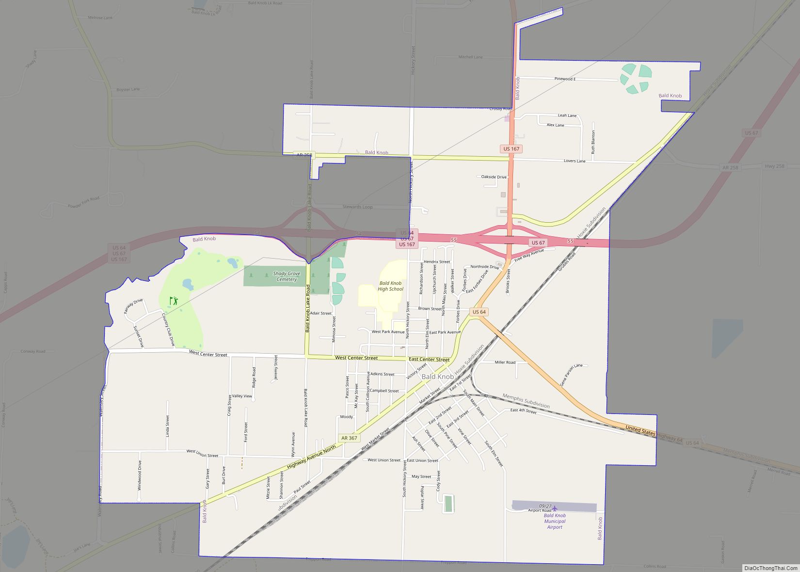
Bald Knob is a city in White County, Arkansas, United States. The population was 2,897 at the 2010 census. Located at the intersection of two of the state’s natural regions, Bald Knob is often promoted as “where the Ozarks meet the Delta”. Bald Knob is known for its yearly Home Fest held during Mother’s Day weekend. It was once known as the leading strawberry producer in the world in the 1950s. Bald Knob was established in 1881.
| Name: | Bald Knob city |
|---|---|
| LSAD Code: | 25 |
| LSAD Description: | city (suffix) |
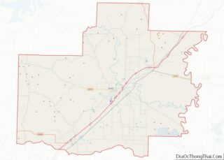
| State: | Arkansas |
| County: | White County |
| Elevation: | 223 ft (68 m) |
| Total Area: | 5.03 sq mi (13.01 km²) |
| Land Area: | 4.96 sq mi (12.83 km²) |
| Water Area: | 0.07 sq mi (0.18 km²) |
| Total Population: | 2,522 |
| Population Density: | 508.98/sq mi (196.52/km²) |
| ZIP code: | 72010 |
| Area code: | 501 |
| FIPS code: | 0503280 |
| GNISfeature ID: | 0076228 |
Online Interactive Map
Click on ![]() to view map in "full screen" mode.
to view map in "full screen" mode.
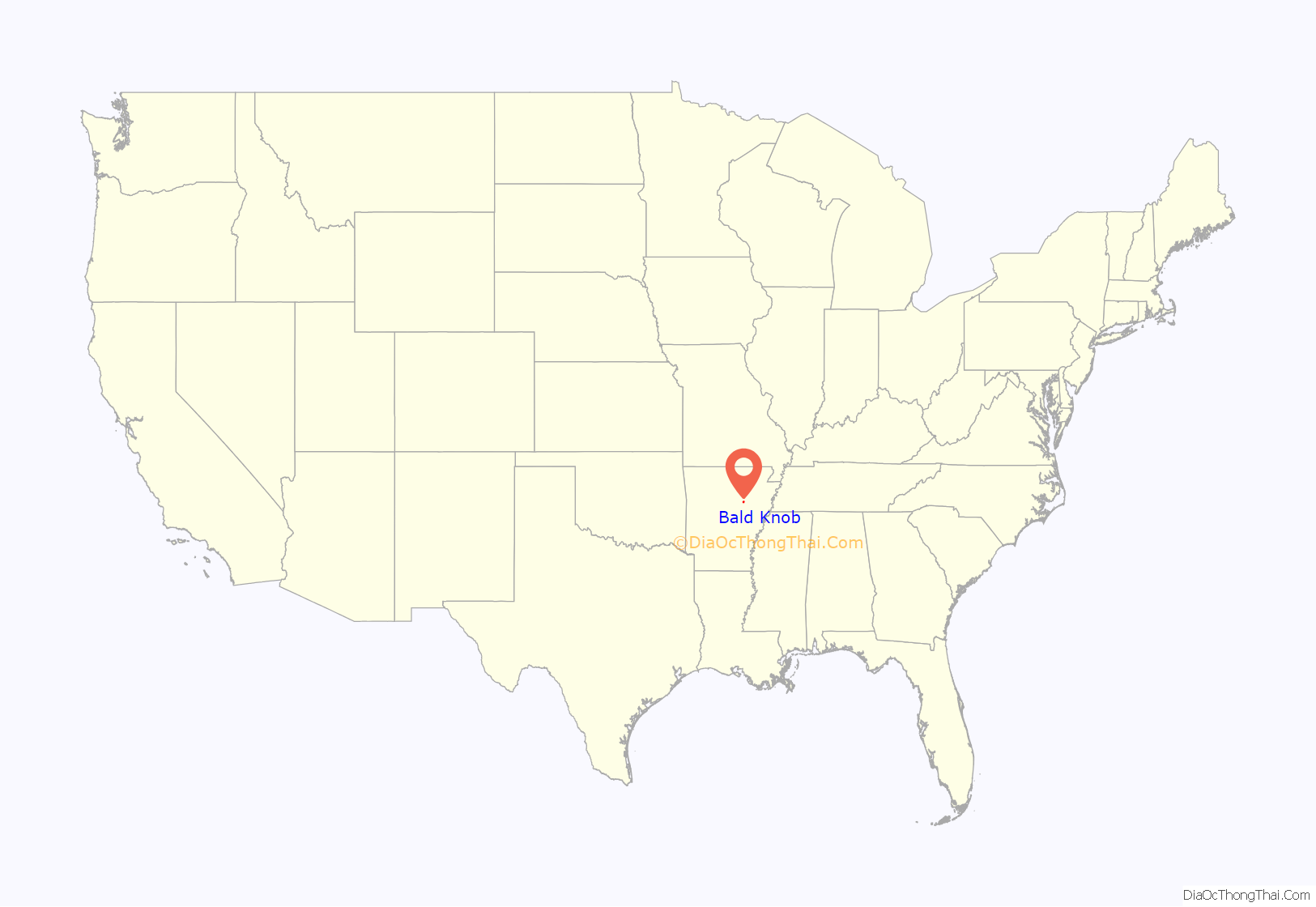
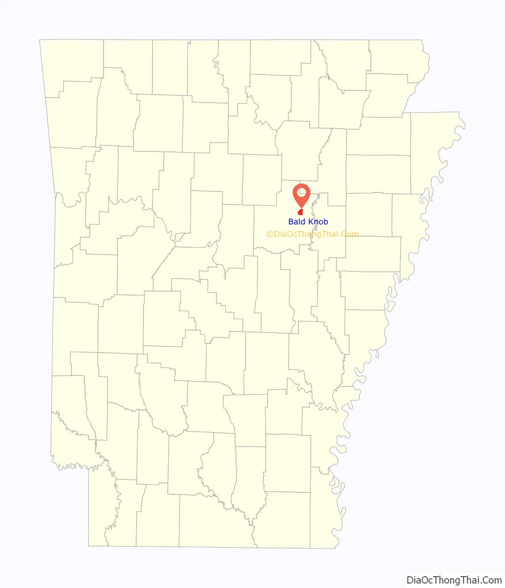
Bald Knob location map. Where is Bald Knob city?
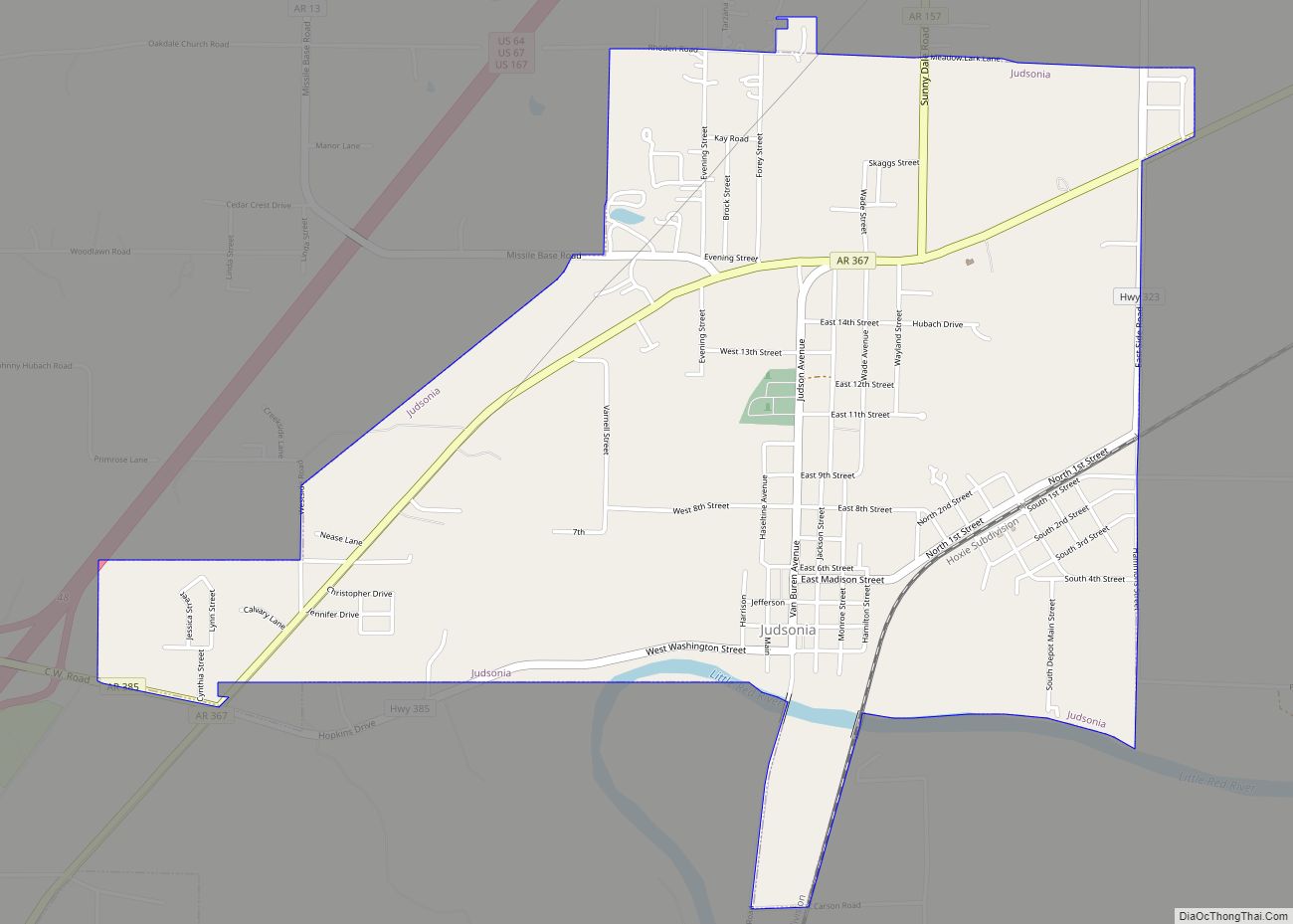
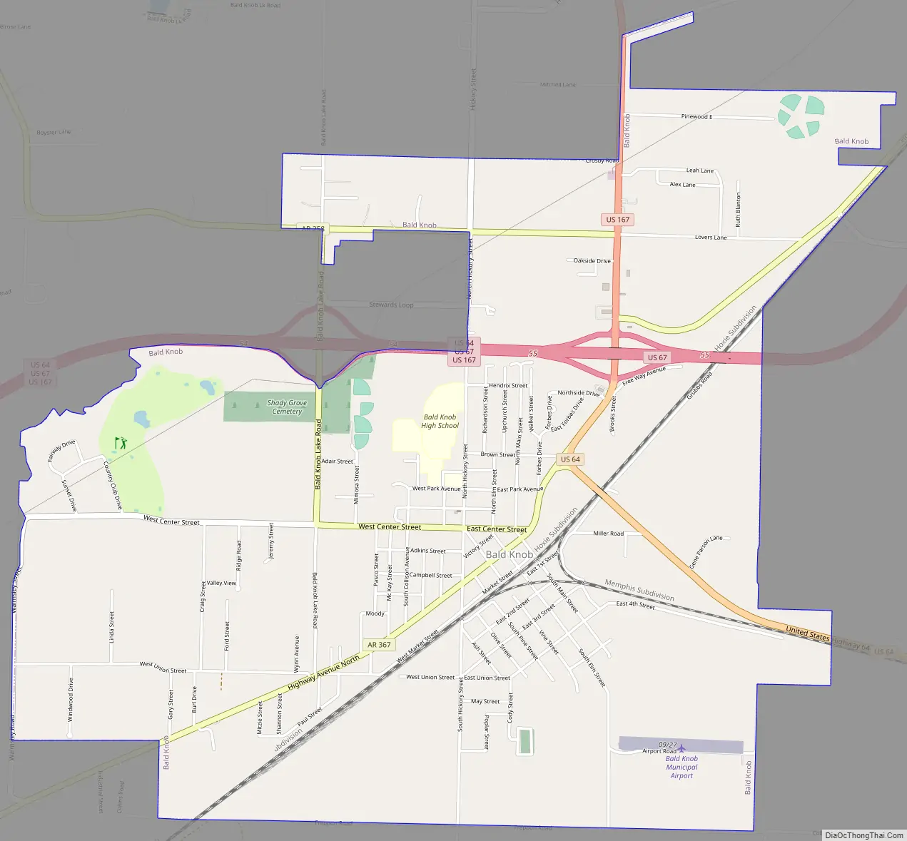
Bald Knob Road Map
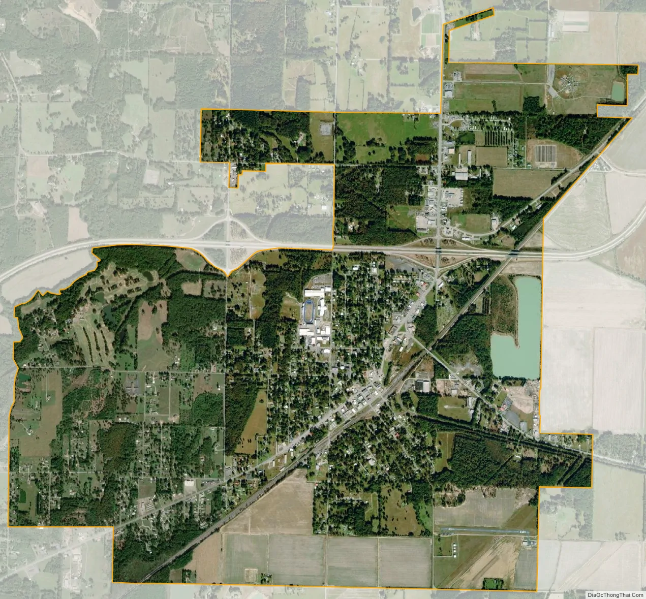
Bald Knob city Satellite Map
Geography
Bald Knob is located at 35°18′42″N 91°34′12″W / 35.31167°N 91.57000°W / 35.31167; -91.57000 (35.311535, -91.569951).
According to the United States Census Bureau, the city has a total area of 4.6 square miles (12 km), of which 4.5 square miles (12 km) is land and 0.1 square miles (0.26 km) is water.
See also
Map of Arkansas State and its subdivision:- Arkansas
- Ashley
- Baxter
- Benton
- Boone
- Bradley
- Calhoun
- Carroll
- Chicot
- Clark
- Clay
- Cleburne
- Cleveland
- Columbia
- Conway
- Craighead
- Crawford
- Crittenden
- Cross
- Dallas
- Desha
- Drew
- Faulkner
- Franklin
- Fulton
- Garland
- Grant
- Greene
- Hempstead
- Hot Spring
- Howard
- Independence
- Izard
- Jackson
- Jefferson
- Johnson
- Lafayette
- Lawrence
- Lee
- Lincoln
- Little River
- Logan
- Lonoke
- Madison
- Marion
- Miller
- Mississippi
- Monroe
- Montgomery
- Nevada
- Newton
- Ouachita
- Perry
- Phillips
- Pike
- Poinsett
- Polk
- Pope
- Prairie
- Pulaski
- Randolph
- Saint Francis
- Saline
- Scott
- Searcy
- Sebastian
- Sevier
- Sharp
- Stone
- Union
- Van Buren
- Washington
- White
- Woodruff
- Yell
- Alabama
- Alaska
- Arizona
- Arkansas
- California
- Colorado
- Connecticut
- Delaware
- District of Columbia
- Florida
- Georgia
- Hawaii
- Idaho
- Illinois
- Indiana
- Iowa
- Kansas
- Kentucky
- Louisiana
- Maine
- Maryland
- Massachusetts
- Michigan
- Minnesota
- Mississippi
- Missouri
- Montana
- Nebraska
- Nevada
- New Hampshire
- New Jersey
- New Mexico
- New York
- North Carolina
- North Dakota
- Ohio
- Oklahoma
- Oregon
- Pennsylvania
- Rhode Island
- South Carolina
- South Dakota
- Tennessee
- Texas
- Utah
- Vermont
- Virginia
- Washington
- West Virginia
- Wisconsin
- Wyoming