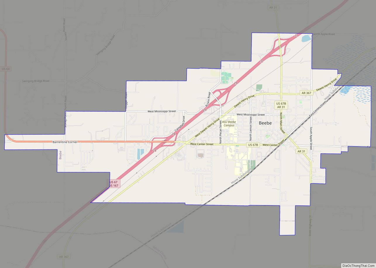
Beebe is a city in White County, Arkansas, United States. The population was 7,315 at the 2010 U.S. Census, making it the second most populous in the county. The city is home to Arkansas State University-Beebe. ASU-Beebe also has branch campuses in Heber Springs and Searcy and at Little Rock Air Force Base.
| Name: | Beebe city |
|---|---|
| LSAD Code: | 25 |
| LSAD Description: | city (suffix) |
| State: | Arkansas |
| County: | White County |
| Elevation: | 246 ft (75 m) |
| Total Area: | 10.25 sq mi (26.56 km²) |
| Land Area: | 10.14 sq mi (26.27 km²) |
| Water Area: | 0.11 sq mi (0.29 km²) |
| Total Population: | 8,437 |
| Population Density: | 831.72/sq mi (321.13/km²) |
| ZIP code: | 72012 |
| Area code: | 501 |
| FIPS code: | 0504600 |
| GNISfeature ID: | 0081843 |
| Website: | beebeark.org |
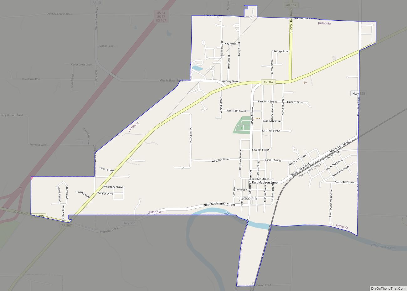
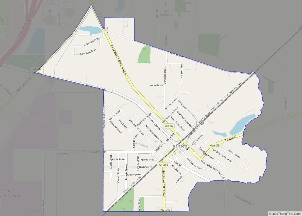
Online Interactive Map
Click on ![]() to view map in "full screen" mode.
to view map in "full screen" mode.
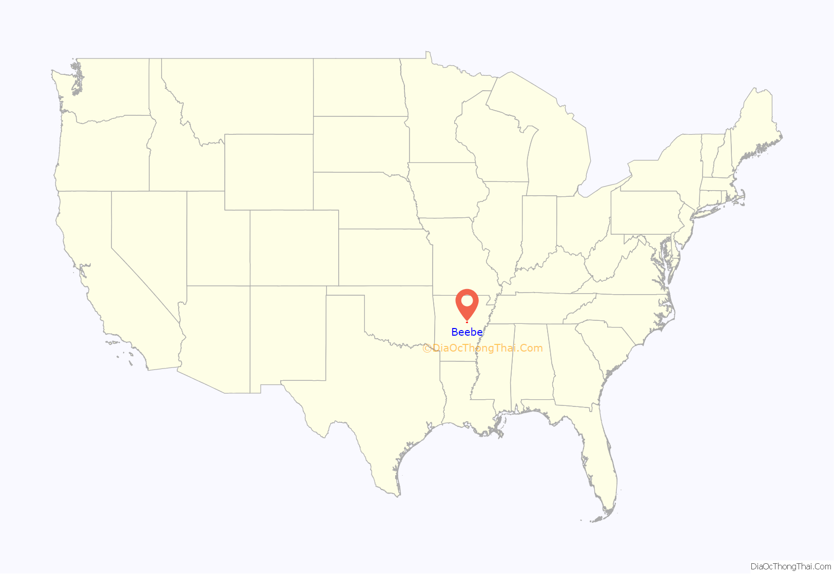
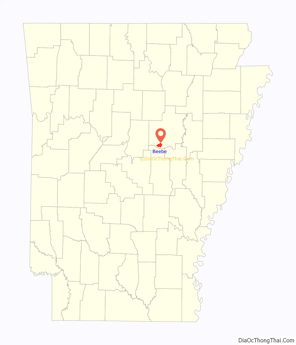
Beebe location map. Where is Beebe city?
History
The community was named after Roswell Beebe, a railroad executive responsible for bringing the rail line that runs through the city. Beebe was incorporated in 1875.
Beebe Road Map

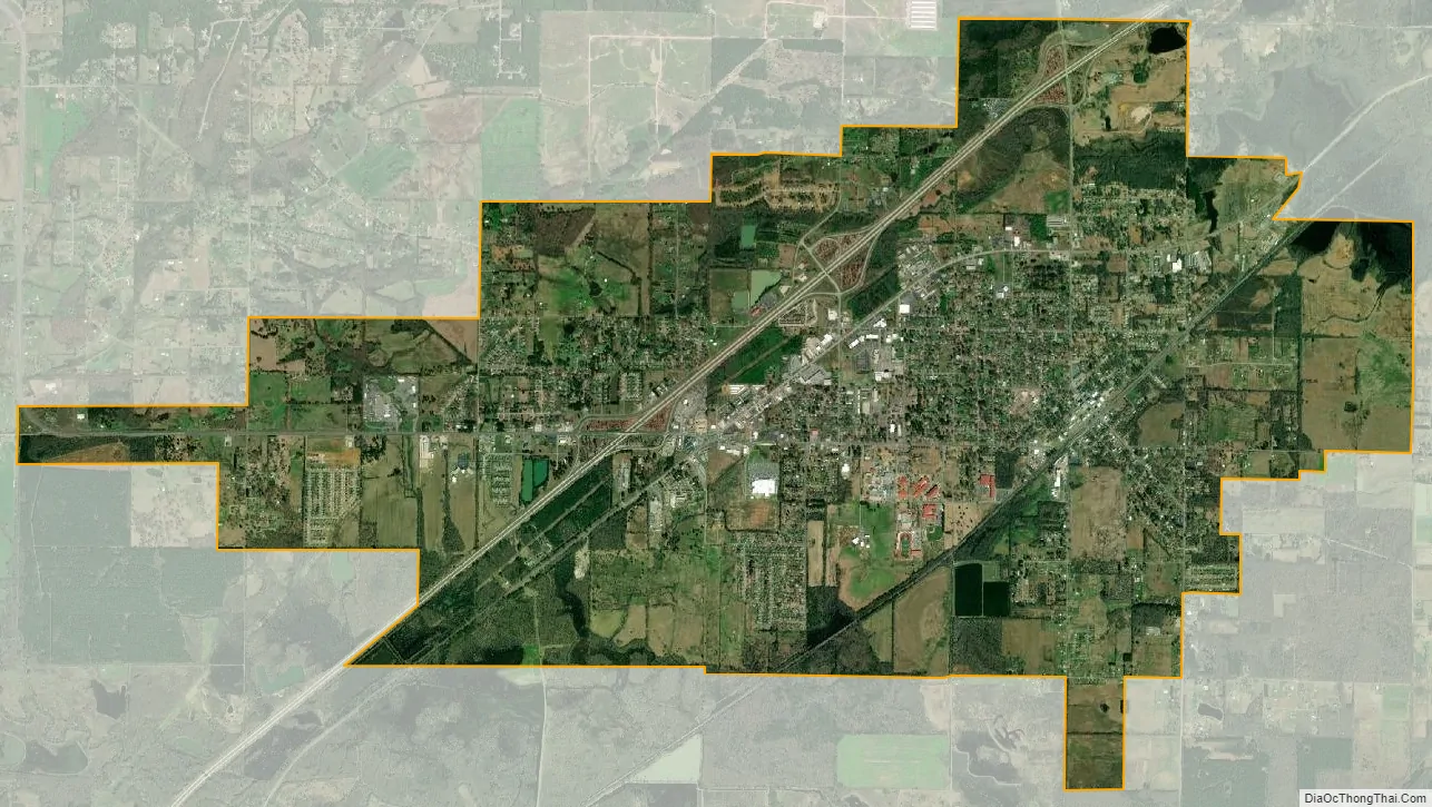
Beebe city Satellite Map
Geography
According to the United States Census Bureau, the city has a total area of 4.3 square miles (11 km), all land.
See also
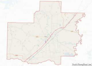
Map of Arkansas State and its subdivision:- Arkansas
- Ashley
- Baxter
- Benton
- Boone
- Bradley
- Calhoun
- Carroll
- Chicot
- Clark
- Clay
- Cleburne
- Cleveland
- Columbia
- Conway
- Craighead
- Crawford
- Crittenden
- Cross
- Dallas
- Desha
- Drew
- Faulkner
- Franklin
- Fulton
- Garland
- Grant
- Greene
- Hempstead
- Hot Spring
- Howard
- Independence
- Izard
- Jackson
- Jefferson
- Johnson
- Lafayette
- Lawrence
- Lee
- Lincoln
- Little River
- Logan
- Lonoke
- Madison
- Marion
- Miller
- Mississippi
- Monroe
- Montgomery
- Nevada
- Newton
- Ouachita
- Perry
- Phillips
- Pike
- Poinsett
- Polk
- Pope
- Prairie
- Pulaski
- Randolph
- Saint Francis
- Saline
- Scott
- Searcy
- Sebastian
- Sevier
- Sharp
- Stone
- Union
- Van Buren
- Washington
- White
- Woodruff
- Yell
- Alabama
- Alaska
- Arizona
- Arkansas
- California
- Colorado
- Connecticut
- Delaware
- District of Columbia
- Florida
- Georgia
- Hawaii
- Idaho
- Illinois
- Indiana
- Iowa
- Kansas
- Kentucky
- Louisiana
- Maine
- Maryland
- Massachusetts
- Michigan
- Minnesota
- Mississippi
- Missouri
- Montana
- Nebraska
- Nevada
- New Hampshire
- New Jersey
- New Mexico
- New York
- North Carolina
- North Dakota
- Ohio
- Oklahoma
- Oregon
- Pennsylvania
- Rhode Island
- South Carolina
- South Dakota
- Tennessee
- Texas
- Utah
- Vermont
- Virginia
- Washington
- West Virginia
- Wisconsin
- Wyoming