Bellefonte is a town in Boone County, Arkansas, United States. The population was 530 at the 2010 census. It is part of the Harrison Micropolitan Statistical Area. Bellefonte gained national attention in 2013 when the city’s mayor, James Wiggs, was recognized as the oldest active mayor in the United States at 90 years of age.
| Name: | Bellefonte town |
|---|---|
| LSAD Code: | 43 |
| LSAD Description: | town (suffix) |
| State: | Arkansas |
| County: | Boone County |
| Elevation: | 1,060 ft (323 m) |
| Total Area: | 0.62 sq mi (1.61 km²) |
| Land Area: | 0.62 sq mi (1.61 km²) |
| Water Area: | 0.00 sq mi (0.00 km²) |
| Total Population: | 411 |
| Population Density: | 660.77/sq mi (255.21/km²) |
| FIPS code: | 0504900 |
| GNISfeature ID: | 0076293 |
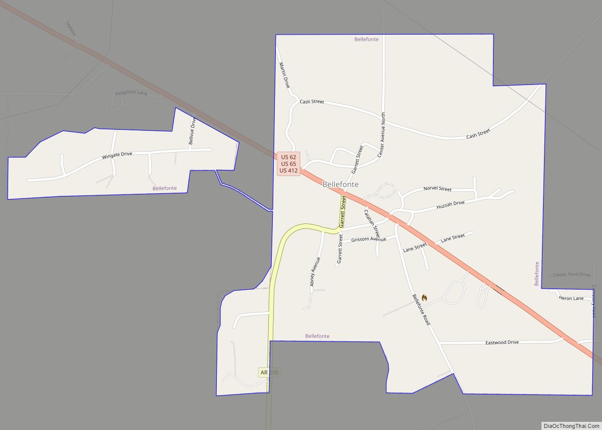
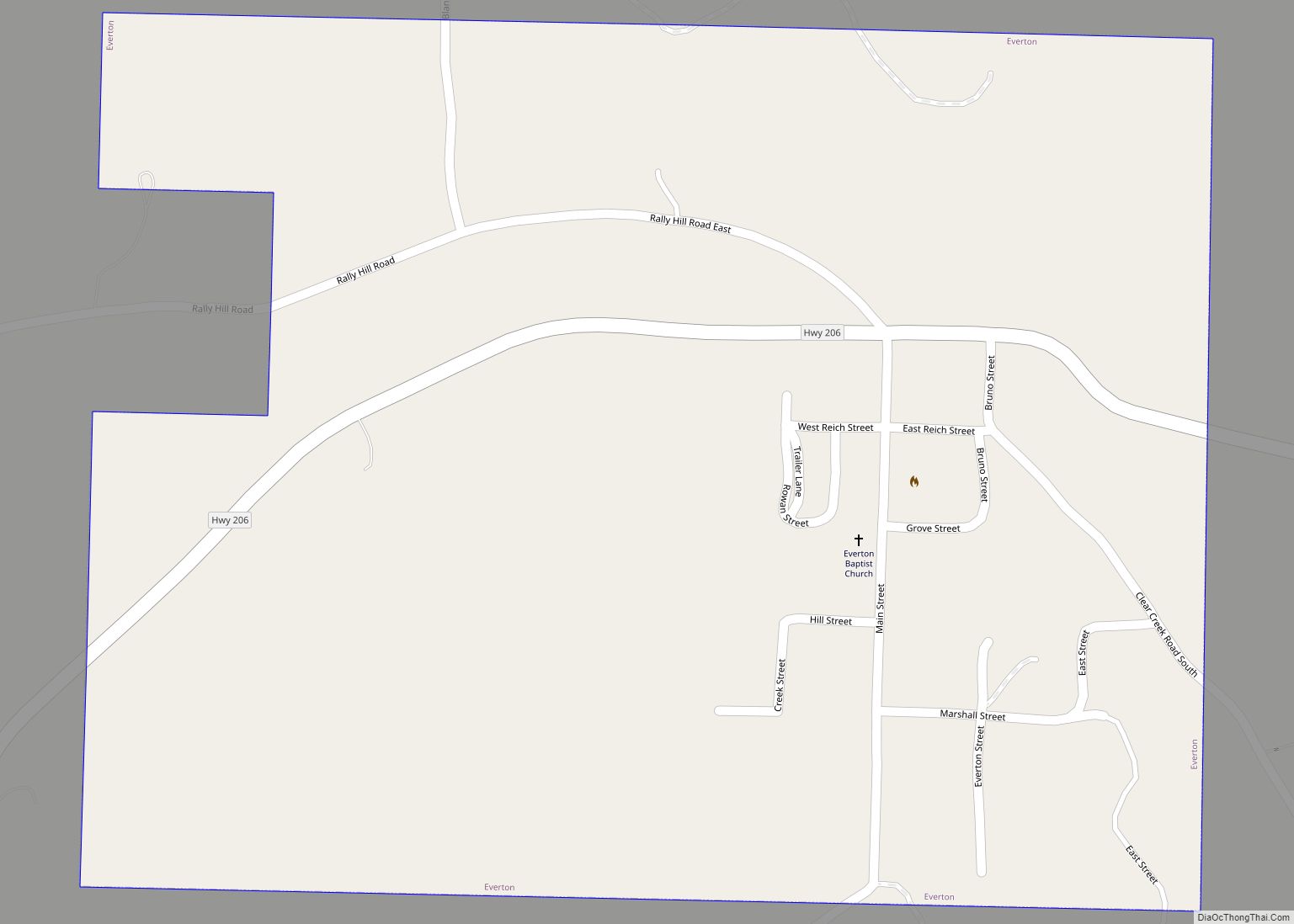
Online Interactive Map
Click on ![]() to view map in "full screen" mode.
to view map in "full screen" mode.
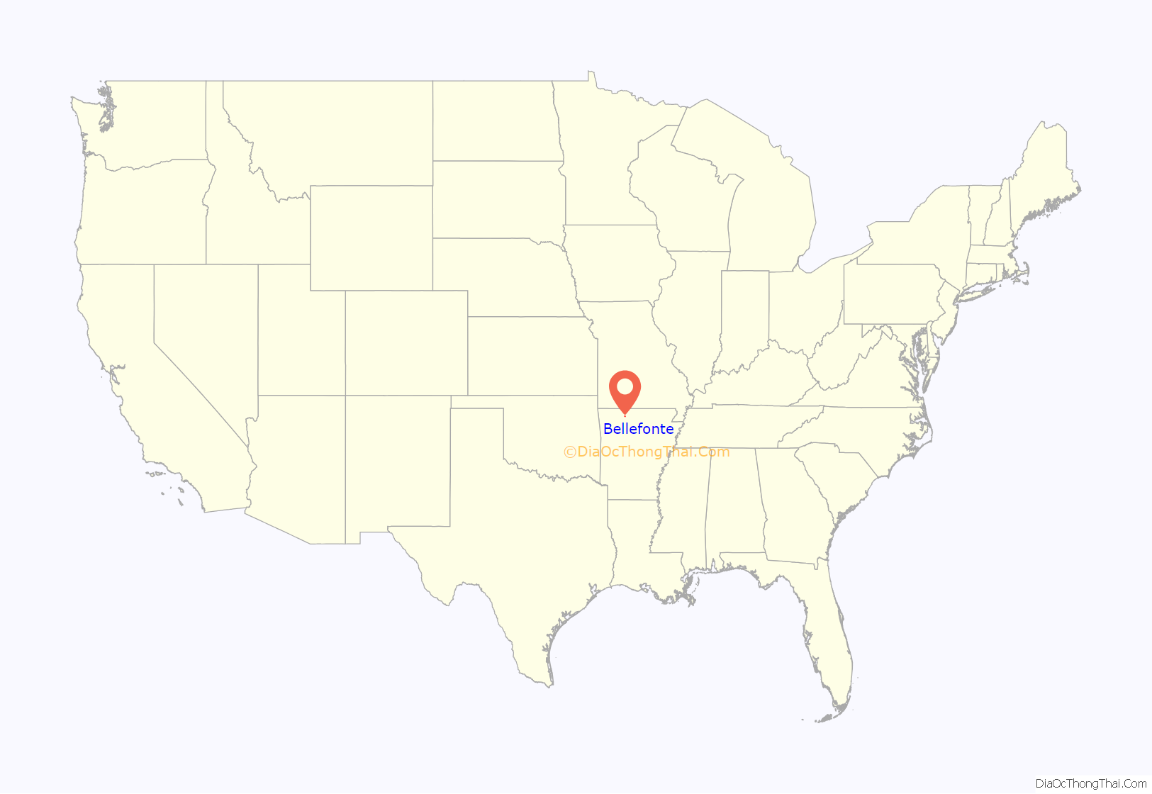
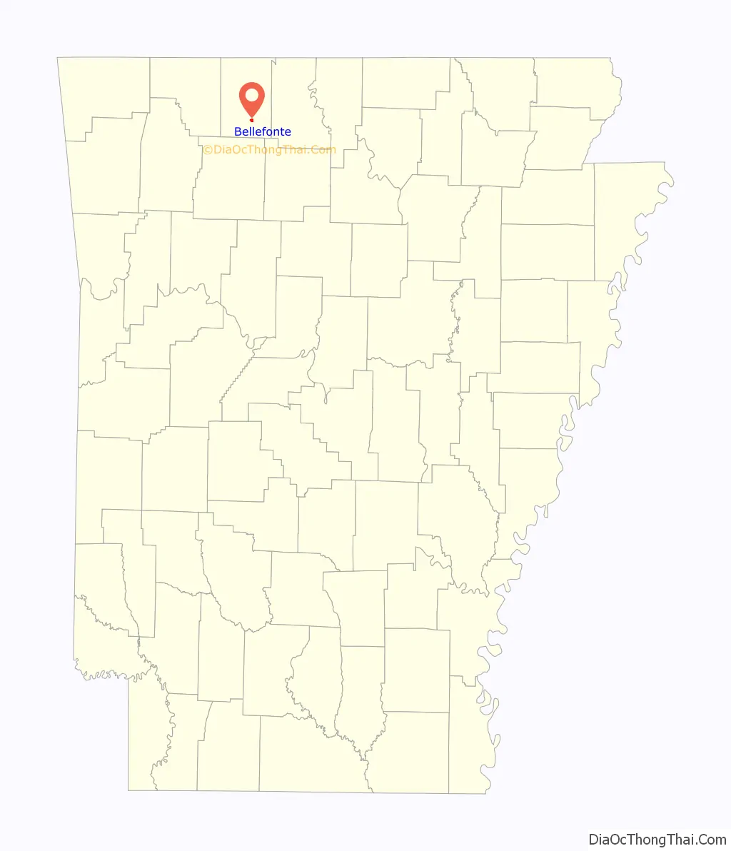
Bellefonte location map. Where is Bellefonte town?
History
The area known as Bellefonte was originally settled by a few families. The community expanded when two stores were established. The community got its name as campers noted the beautiful springs. It was suggested the area be called “Bellefonte”, French for “beautiful fountains.”
As there were no church organizations in the settlement, services were originally held in private homes. Circuit riders generally provided the services.
Bellefonte grew rapidly by the second half of the 1860s. A post office was established.
By the early 1870s, what was referred to as “North Arkansas College” (not to be confused with the modern community college by the same name in Harrison, Arkansas) was founded and students from all over the state attended. In modern times, this would be considered a high school. A grade school was also established in Bellefonte around the same time.
Bellefonte continued to grow, becoming a large town. A number of businesses developed and a town square was built. (By 1939, the town square was gone.) Businesses included doctors’ offices, drugstores, a livery stable, various general stores, a leather factory, saloons, a cotton gin and a flour mill.
When Boone County was formed, Bellefonte was the largest town, larger than relatively new Harrison. Bellefonte expected it should have the county seat. After arguing and a vote, Harrison ultimately won.
Bellefonte became an incorporated town in 1882. In that year it was also damaged by a significant fire due to buildings being close together. In the same year, the North Arkansas College building burned. Bellefonte stopped being an incorporated town after this great fire, not re-incorporating until 1963.
By 1898 things had gotten better. Around 1901, the Missouri and North Arkansas Railroad ran through Bellefonte. This temporarily brought in business. There were various fires in 1912, which stifled Bellefonte until 1929 when things began to pick up a bit.
The Depression was directly felt in Bellefonte from 1930 to 1933. It took until 1935 for signs of relief.
Bellefonte Road Map
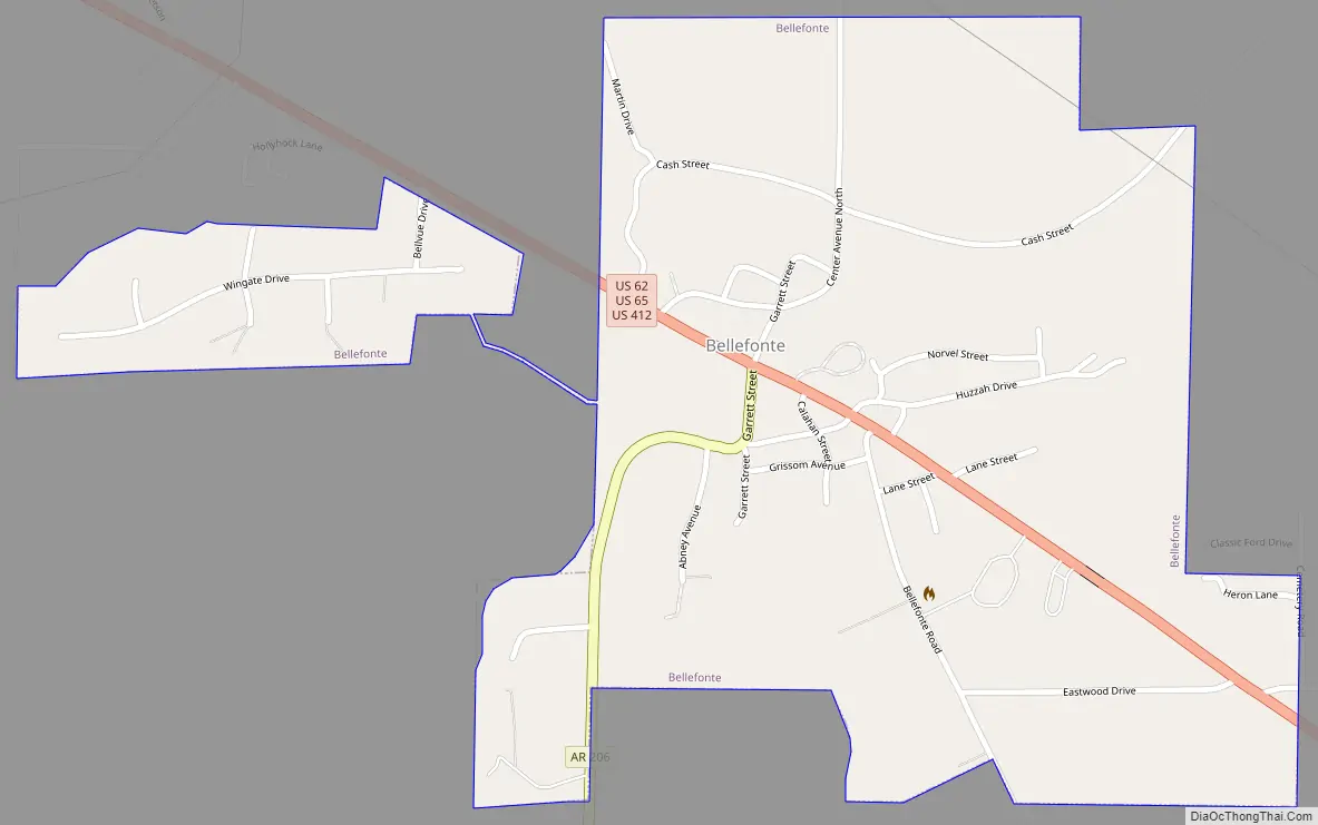
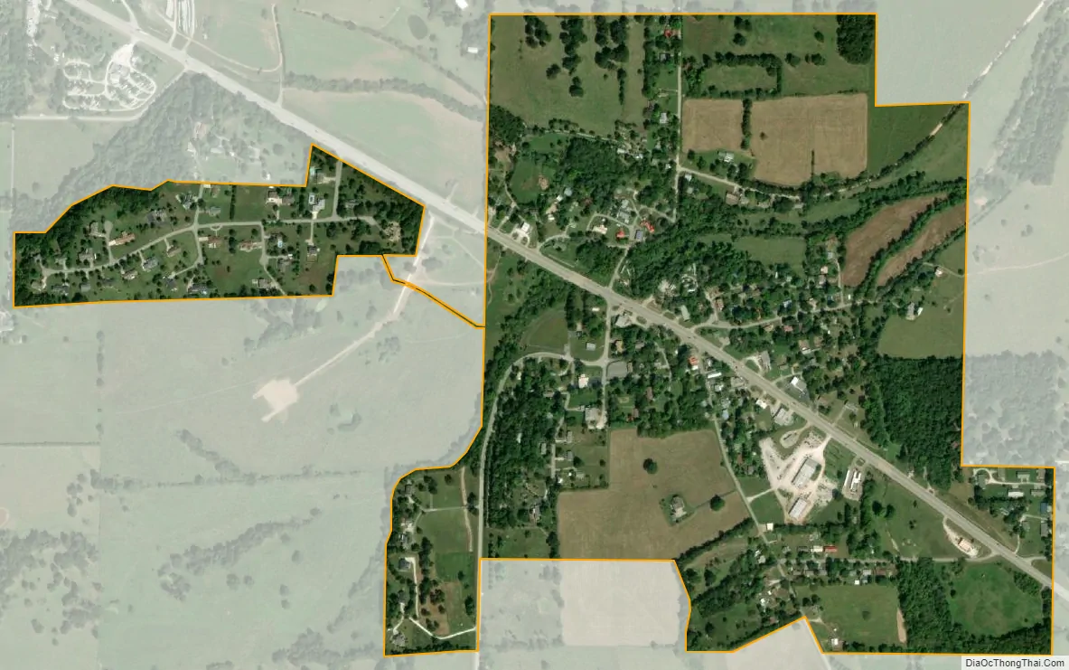
Bellefonte city Satellite Map
Geography
Bellefonte is located at 36°12′0″N 93°2′49″W / 36.20000°N 93.04694°W / 36.20000; -93.04694 (36.199865, -93.046975).
According to the United States Census Bureau, the town has a total area of 1.5 km (0.6 mi), all land.
List of highways
- US 62/US 412
- U.S. Highway 65
- Arkansas Highway 206
See also
Map of Arkansas State and its subdivision:- Arkansas
- Ashley
- Baxter
- Benton
- Boone
- Bradley
- Calhoun
- Carroll
- Chicot
- Clark
- Clay
- Cleburne
- Cleveland
- Columbia
- Conway
- Craighead
- Crawford
- Crittenden
- Cross
- Dallas
- Desha
- Drew
- Faulkner
- Franklin
- Fulton
- Garland
- Grant
- Greene
- Hempstead
- Hot Spring
- Howard
- Independence
- Izard
- Jackson
- Jefferson
- Johnson
- Lafayette
- Lawrence
- Lee
- Lincoln
- Little River
- Logan
- Lonoke
- Madison
- Marion
- Miller
- Mississippi
- Monroe
- Montgomery
- Nevada
- Newton
- Ouachita
- Perry
- Phillips
- Pike
- Poinsett
- Polk
- Pope
- Prairie
- Pulaski
- Randolph
- Saint Francis
- Saline
- Scott
- Searcy
- Sebastian
- Sevier
- Sharp
- Stone
- Union
- Van Buren
- Washington
- White
- Woodruff
- Yell
- Alabama
- Alaska
- Arizona
- Arkansas
- California
- Colorado
- Connecticut
- Delaware
- District of Columbia
- Florida
- Georgia
- Hawaii
- Idaho
- Illinois
- Indiana
- Iowa
- Kansas
- Kentucky
- Louisiana
- Maine
- Maryland
- Massachusetts
- Michigan
- Minnesota
- Mississippi
- Missouri
- Montana
- Nebraska
- Nevada
- New Hampshire
- New Jersey
- New Mexico
- New York
- North Carolina
- North Dakota
- Ohio
- Oklahoma
- Oregon
- Pennsylvania
- Rhode Island
- South Carolina
- South Dakota
- Tennessee
- Texas
- Utah
- Vermont
- Virginia
- Washington
- West Virginia
- Wisconsin
- Wyoming