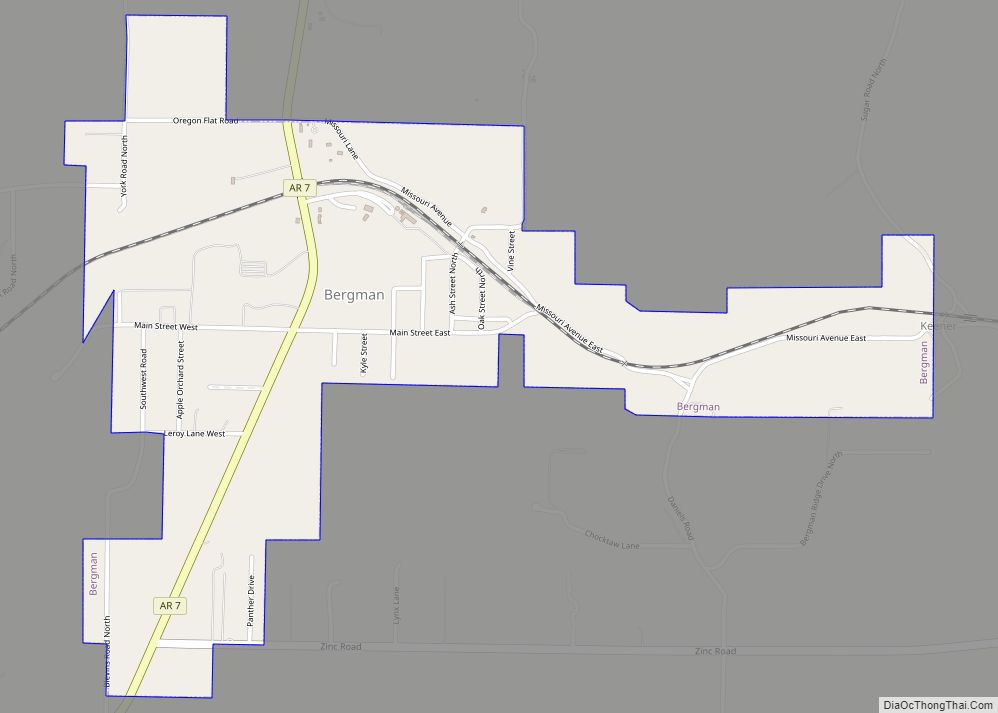
Bergman is a town in Boone County, Arkansas, United States. The population was 439 at the 2010 census. It is part of the Harrison Micropolitan Statistical Area.
| Name: | Bergman town |
|---|---|
| LSAD Code: | 43 |
| LSAD Description: | town (suffix) |
| State: | Arkansas |
| County: | Boone County |
| Elevation: | 1,211 ft (369 m) |
| Total Area: | 1.31 sq mi (3.38 km²) |
| Land Area: | 1.30 sq mi (3.38 km²) |
| Water Area: | 0.00 sq mi (0.00 km²) |
| Total Population: | 426 |
| Population Density: | 326.44/sq mi (126.08/km²) |
| ZIP code: | 72615 |
| Area code: | 870 |
| FIPS code: | 0505440 |
| GNISfeature ID: | 0076306 |
| Website: | townofbergman.com |
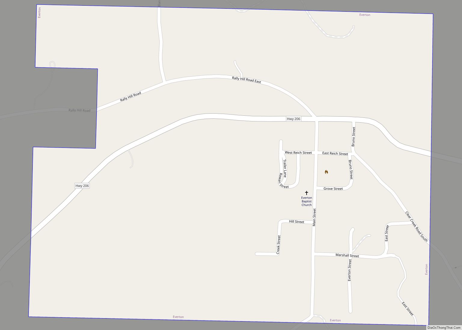
Online Interactive Map
Click on ![]() to view map in "full screen" mode.
to view map in "full screen" mode.
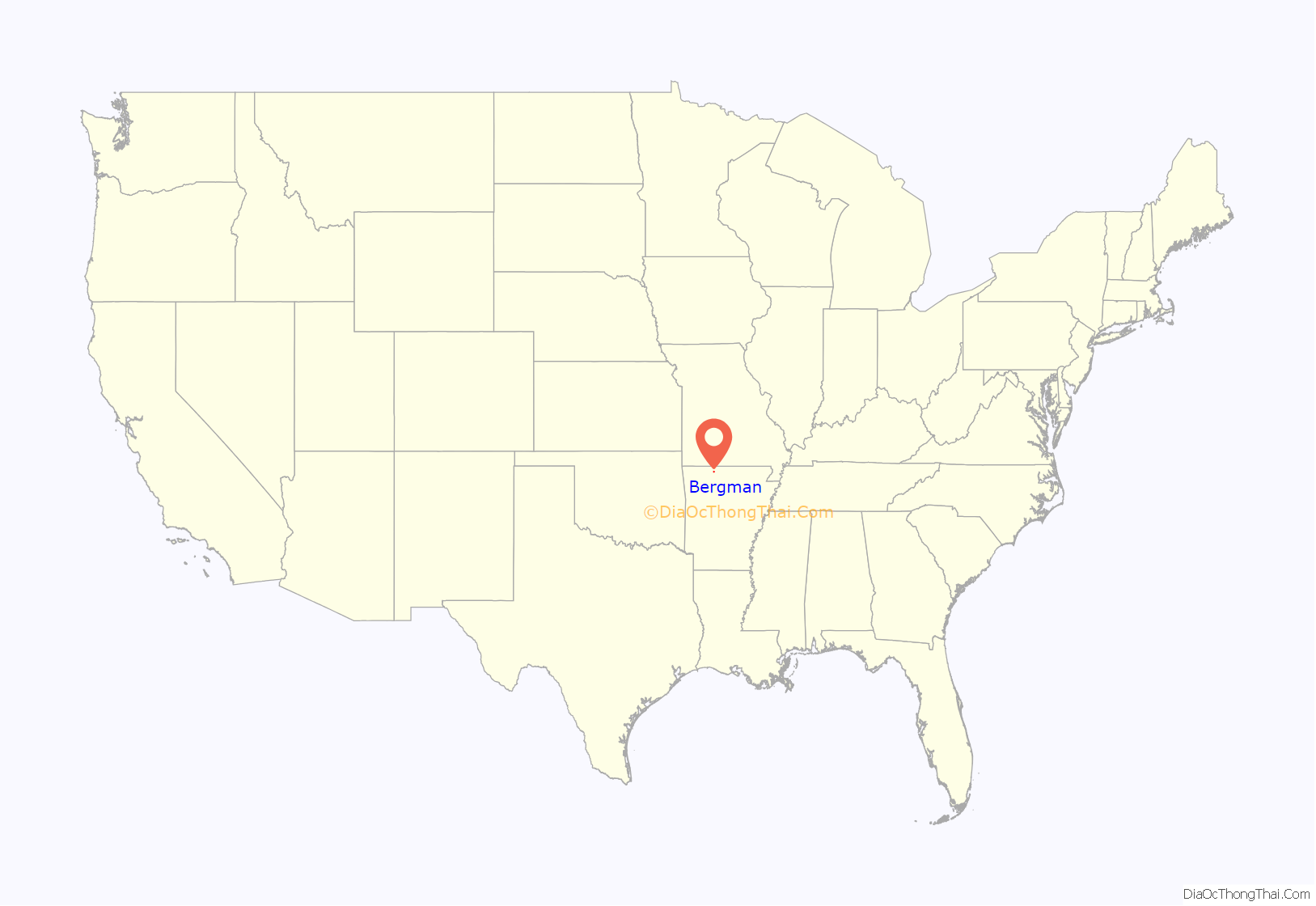
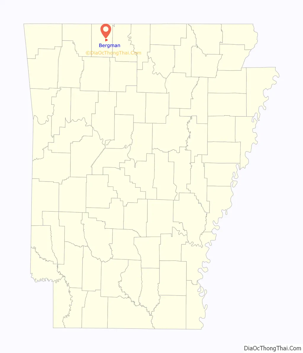
Bergman location map. Where is Bergman town?
History
Areas very close to the current location of Bergman were known as Oregon Flat and Clabbie. There was also a town around one mile south of present-day Bergman called Keener. Keener was strong in the 1880s and had a population of about 1,000 people. But, Keener began to decline fast by 1892.
The town of Bergman was first incorporated on August 4, 1905. The name was derived from a Dr. Bergman, who provided the land and requested that it be named after her daughter. Miss Edith Bergman who was the daughter of Dr. Bergman (and hence the person who the town was named after) was the first postmistress.
Like a number of other towns in Boone County, Bergman was a railroad town. The White River Division Railway, which eventually was part of the Missouri Pacific Line, went through Bergman.
Before the popularity of the automobile and better roads in the area such as Arkansas Highway 43 (which was built in 1927 and had been blacktopped by 1948), Bergman had a number of businesses and flourished as a small town.
The current incorporation took place on March 14, 1968. A new post office was located in Bergman in 1974.
Although Bergman has a school district as part of the Arkansas school consolidation of 1929, it is now largely a residential community.
Bergman Road Map
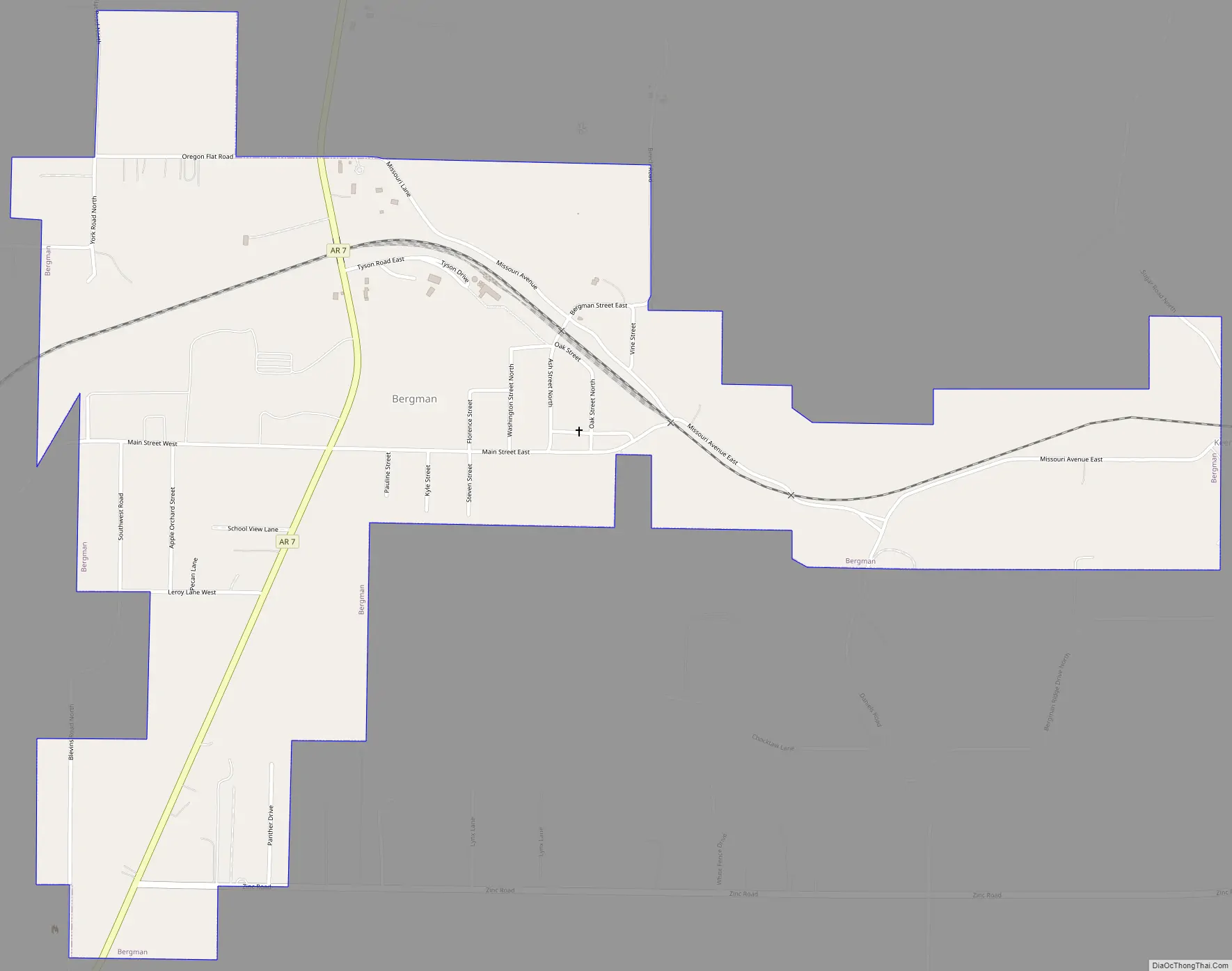
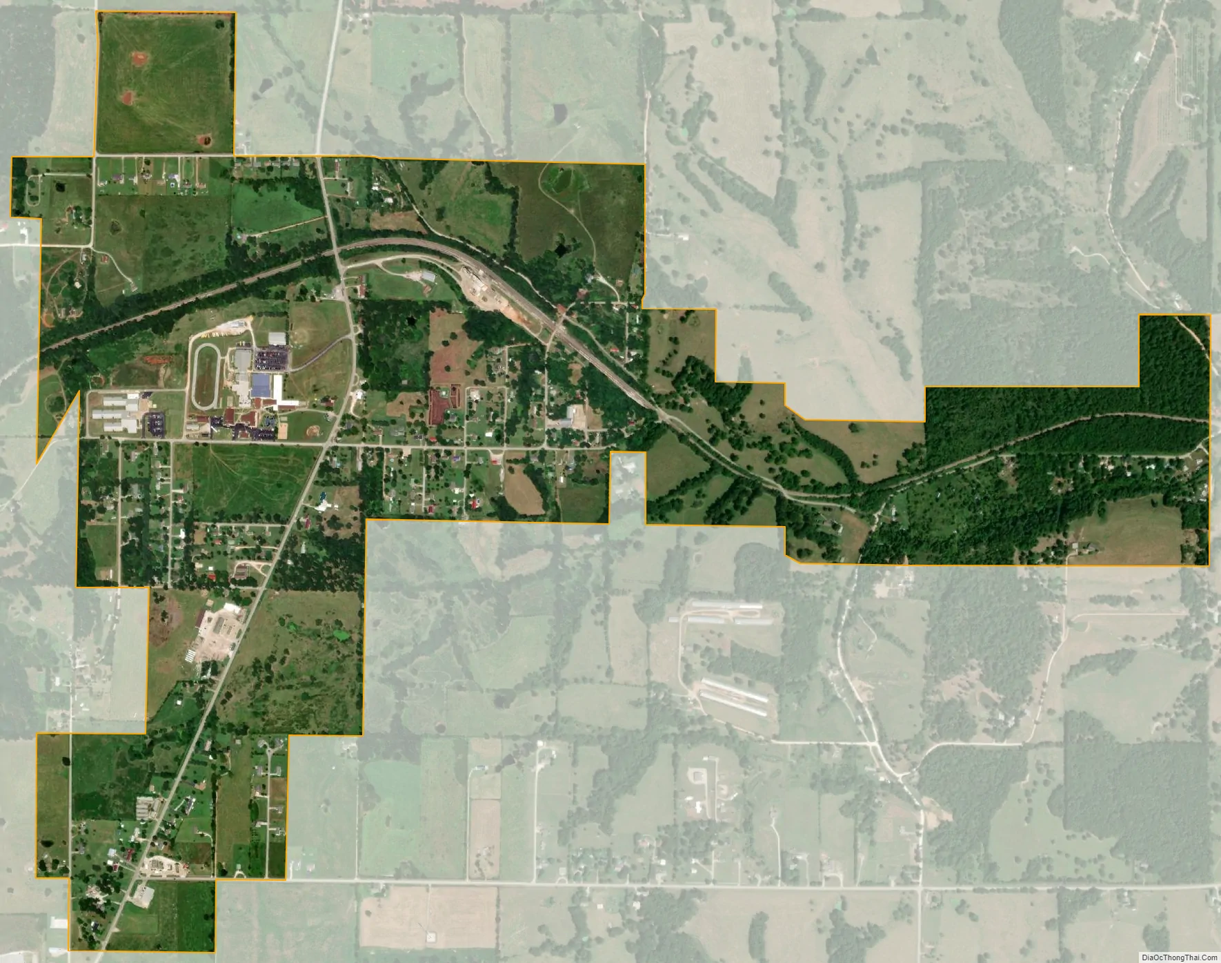
Bergman city Satellite Map
Geography
Bergman is located at 36°18′46″N 93°0′40″W / 36.31278°N 93.01111°W / 36.31278; -93.01111 (36.312794, -93.011194).
According to the United States Census Bureau, the town has a total area of 3.4 km (1.3 mi), all land.
List of highways
- Arkansas Highway 7
- Arkansas Highway 281
See also
Map of Arkansas State and its subdivision:- Arkansas
- Ashley
- Baxter
- Benton
- Boone
- Bradley
- Calhoun
- Carroll
- Chicot
- Clark
- Clay
- Cleburne
- Cleveland
- Columbia
- Conway
- Craighead
- Crawford
- Crittenden
- Cross
- Dallas
- Desha
- Drew
- Faulkner
- Franklin
- Fulton
- Garland
- Grant
- Greene
- Hempstead
- Hot Spring
- Howard
- Independence
- Izard
- Jackson
- Jefferson
- Johnson
- Lafayette
- Lawrence
- Lee
- Lincoln
- Little River
- Logan
- Lonoke
- Madison
- Marion
- Miller
- Mississippi
- Monroe
- Montgomery
- Nevada
- Newton
- Ouachita
- Perry
- Phillips
- Pike
- Poinsett
- Polk
- Pope
- Prairie
- Pulaski
- Randolph
- Saint Francis
- Saline
- Scott
- Searcy
- Sebastian
- Sevier
- Sharp
- Stone
- Union
- Van Buren
- Washington
- White
- Woodruff
- Yell
- Alabama
- Alaska
- Arizona
- Arkansas
- California
- Colorado
- Connecticut
- Delaware
- District of Columbia
- Florida
- Georgia
- Hawaii
- Idaho
- Illinois
- Indiana
- Iowa
- Kansas
- Kentucky
- Louisiana
- Maine
- Maryland
- Massachusetts
- Michigan
- Minnesota
- Mississippi
- Missouri
- Montana
- Nebraska
- Nevada
- New Hampshire
- New Jersey
- New Mexico
- New York
- North Carolina
- North Dakota
- Ohio
- Oklahoma
- Oregon
- Pennsylvania
- Rhode Island
- South Carolina
- South Dakota
- Tennessee
- Texas
- Utah
- Vermont
- Virginia
- Washington
- West Virginia
- Wisconsin
- Wyoming