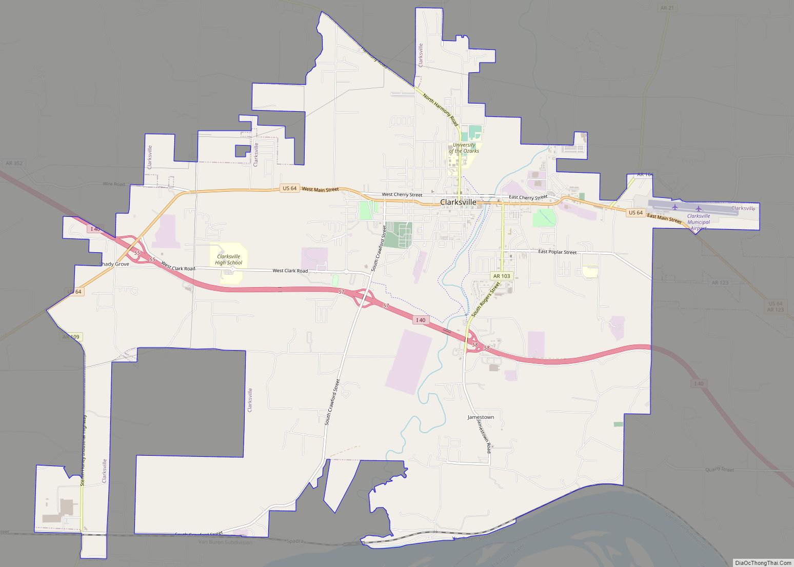
Clarksville is a city in Johnson County, Arkansas, United States. As of the 2010 census the population was 9,178, up from 7,719 in 2000. As of 2018, the estimated population was 9,743. The city is the county seat of Johnson County. It is nestled between the Arkansas River and the foothills of the Ozark Mountains, and Interstate 40 and US Highway 64 intersect within the city limits. Clarksville-Johnson County is widely known for its peaches, scenic byways and abundance of natural outdoor recreational activities.
| Name: | Clarksville city |
|---|---|
| LSAD Code: | 25 |
| LSAD Description: | city (suffix) |
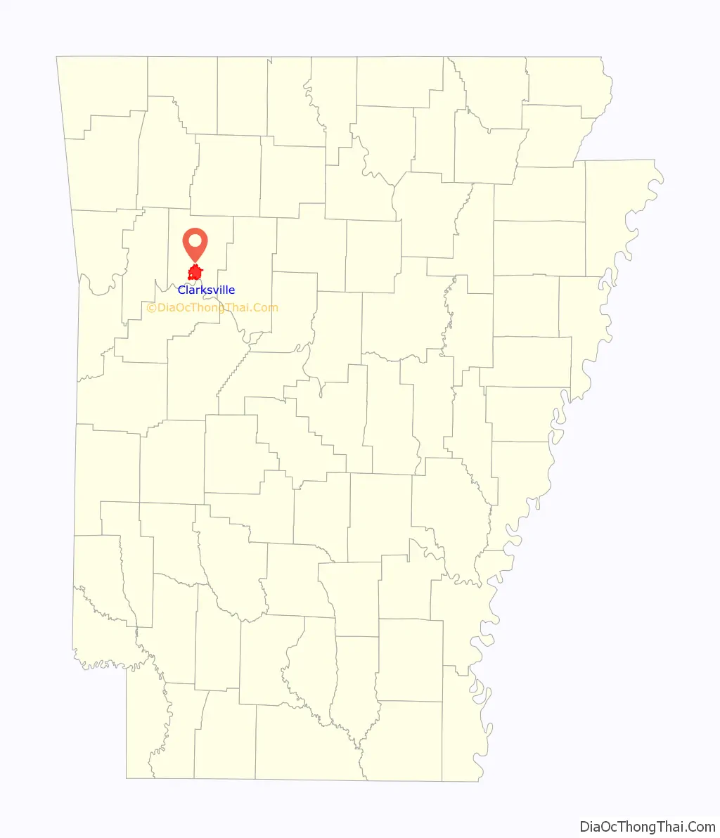
| State: | Arkansas |
| County: | Johnson County |
| Elevation: | 367 ft (112 m) |
| Total Area: | 18.84 sq mi (48.78 km²) |
| Land Area: | 18.22 sq mi (47.18 km²) |
| Water Area: | 0.62 sq mi (1.60 km²) |
| Total Population: | 9,381 |
| Population Density: | 514.99/sq mi (198.83/km²) |
| ZIP code: | 72830 |
| FIPS code: | 0514140 |
| GNISfeature ID: | 2404060 |
| Website: | www.clarksvillear.gov |
Online Interactive Map
Click on ![]() to view map in "full screen" mode.
to view map in "full screen" mode.
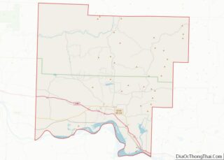
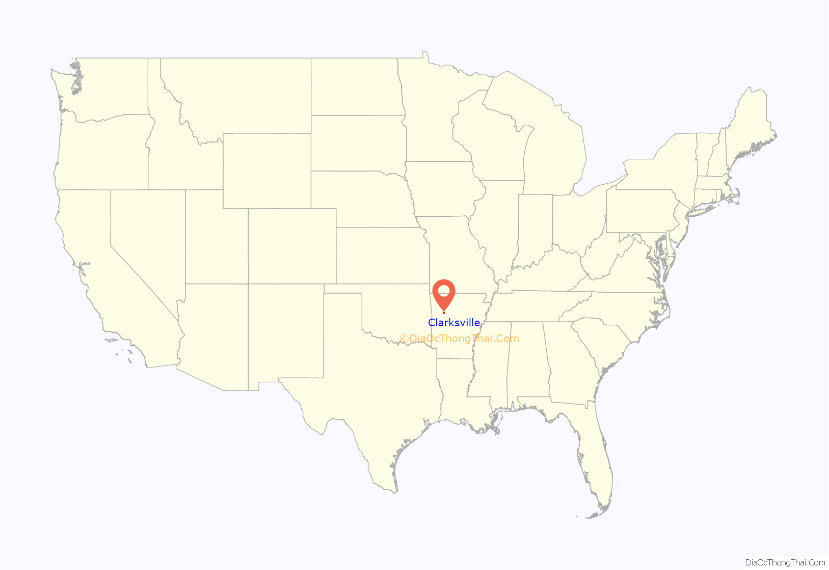
Clarksville location map. Where is Clarksville city?
History
The community began as settlers arrived to the Arkansas Territory. After the Osage tribe was relocated by treaty, Cherokee settlers came to Arkansas by 1800 and primarily lived along the Arkansas River. A federal Indian trading factory under Matthew Lyon was established at Spadra in 1818, now at the west end of Lake Dardanelle on the Arkansas River, a Clarksville location now occupied by Spadra Marina. A historical marker, dedicated in 1984, sits on Spadra Bluff, near the original river town of Spadra. The area was reserved for the Cherokee, so most early settlers of Johnson County did not move into the area until after 1828, the year the Cherokee gave up their land.
Spadra was the first county seat of Johnson County, convenient to steamboat lines. However when stagecoach and train transportation became more common, land routes from Little Rock to Fort Smith were directed along higher elevations through Clarksville. As Clarksville grew, it became the de facto location for the county seat circa 1833, probably due to severe flooding at Spadra. Clarksville was established by survey in November 1836 after Johnson County was formed from part of Pope County. The first court session was held in 1837 in a private building.
By July 1853 the Little Rock and Fort Smith Railroad opted to go through Clarksville instead of Spadra, due to financial incentives provided by the county commissioners based in Clarksville. Almost twenty miles of track toward Spadra were removed during the realignment. Regular rail service began following the Civil War, aiding in Clarksville’s growth, while the hamlet of New Spadra began beside the new tracks. Fewer settlers arrived by river transportation so Spadra was less useful, so its major buildings deteriorated or were moved, while Clarksville became the destination of many new settlers arriving by train.
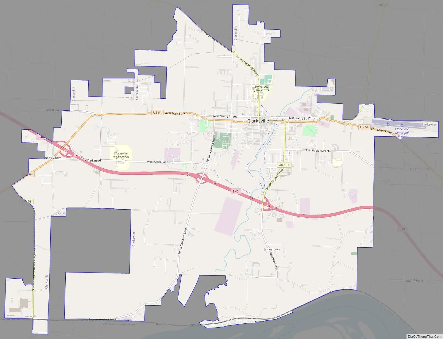
Clarksville Road Map
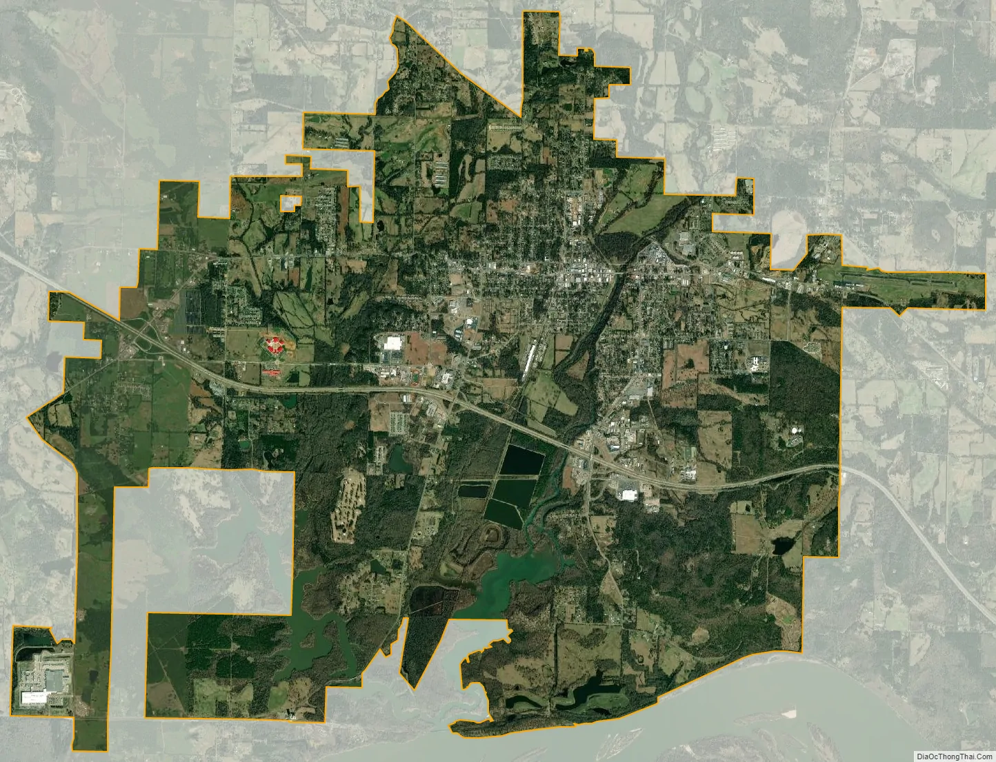
Clarksville city Satellite Map
Geography
Clarksville is located in south-central Johnson County and is bordered to the south by the Arkansas River, although the city center is 3 miles (5 km) north of the river and west of Spadra Creek.
Interstate 40 leads southeast 100 miles (161 km) to Little Rock and west 55 miles (89 km) to Fort Smith.
According to the United States Census Bureau, Clarksville has a total area of 19.2 square miles (49.7 km), of which 18.5 square miles (47.9 km) are land and 0.69 square miles (1.8 km), or 3.66%, are water.
See also
Map of Arkansas State and its subdivision:- Arkansas
- Ashley
- Baxter
- Benton
- Boone
- Bradley
- Calhoun
- Carroll
- Chicot
- Clark
- Clay
- Cleburne
- Cleveland
- Columbia
- Conway
- Craighead
- Crawford
- Crittenden
- Cross
- Dallas
- Desha
- Drew
- Faulkner
- Franklin
- Fulton
- Garland
- Grant
- Greene
- Hempstead
- Hot Spring
- Howard
- Independence
- Izard
- Jackson
- Jefferson
- Johnson
- Lafayette
- Lawrence
- Lee
- Lincoln
- Little River
- Logan
- Lonoke
- Madison
- Marion
- Miller
- Mississippi
- Monroe
- Montgomery
- Nevada
- Newton
- Ouachita
- Perry
- Phillips
- Pike
- Poinsett
- Polk
- Pope
- Prairie
- Pulaski
- Randolph
- Saint Francis
- Saline
- Scott
- Searcy
- Sebastian
- Sevier
- Sharp
- Stone
- Union
- Van Buren
- Washington
- White
- Woodruff
- Yell
- Alabama
- Alaska
- Arizona
- Arkansas
- California
- Colorado
- Connecticut
- Delaware
- District of Columbia
- Florida
- Georgia
- Hawaii
- Idaho
- Illinois
- Indiana
- Iowa
- Kansas
- Kentucky
- Louisiana
- Maine
- Maryland
- Massachusetts
- Michigan
- Minnesota
- Mississippi
- Missouri
- Montana
- Nebraska
- Nevada
- New Hampshire
- New Jersey
- New Mexico
- New York
- North Carolina
- North Dakota
- Ohio
- Oklahoma
- Oregon
- Pennsylvania
- Rhode Island
- South Carolina
- South Dakota
- Tennessee
- Texas
- Utah
- Vermont
- Virginia
- Washington
- West Virginia
- Wisconsin
- Wyoming