Coal Hill is a city in Johnson County, Arkansas, United States. The population was 1,012 at the 2010 census.
| Name: | Coal Hill city |
|---|---|
| LSAD Code: | 25 |
| LSAD Description: | city (suffix) |
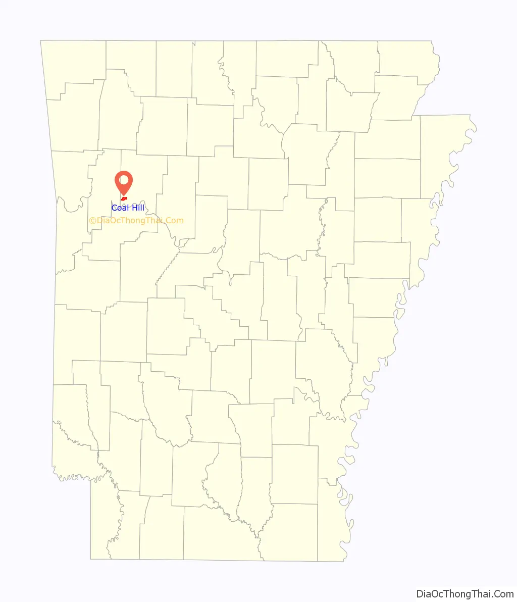
| State: | Arkansas |
| County: | Johnson County |
| Elevation: | 486 ft (148 m) |
| Total Area: | 2.83 sq mi (7.33 km²) |
| Land Area: | 2.80 sq mi (7.26 km²) |
| Water Area: | 0.03 sq mi (0.07 km²) |
| Total Population: | 820 |
| Population Density: | 292.44/sq mi (112.91/km²) |
| ZIP code: | 72832 |
| Area code: | 479 |
| FIPS code: | 0514500 |
| GNISfeature ID: | 2404084 |
| Website: | www.cityofcoalhillar.municipalimpact.com |
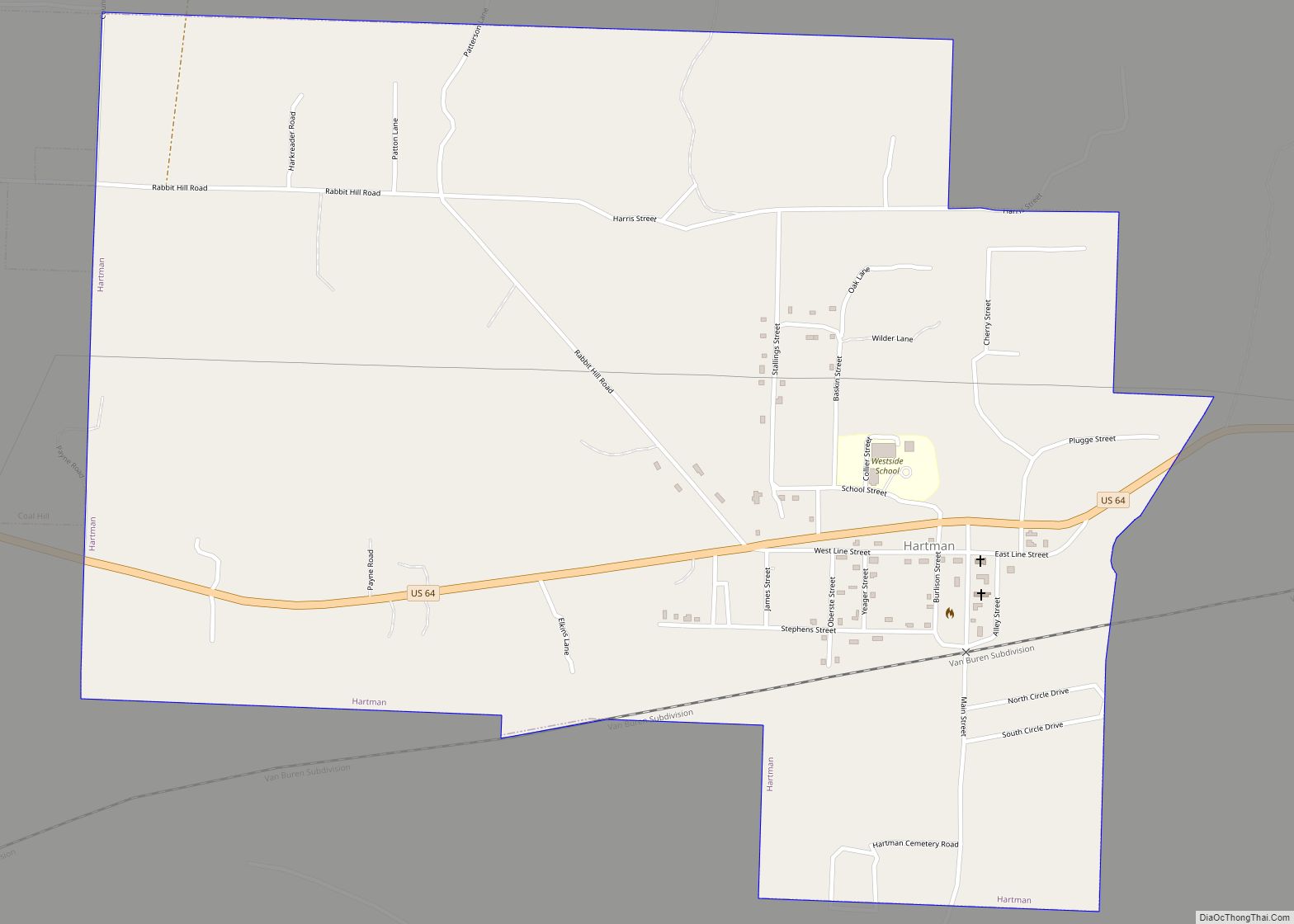
Online Interactive Map
Click on ![]() to view map in "full screen" mode.
to view map in "full screen" mode.
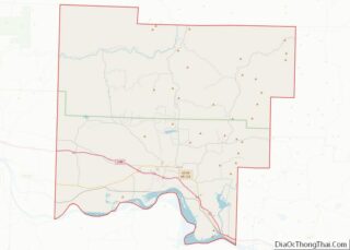
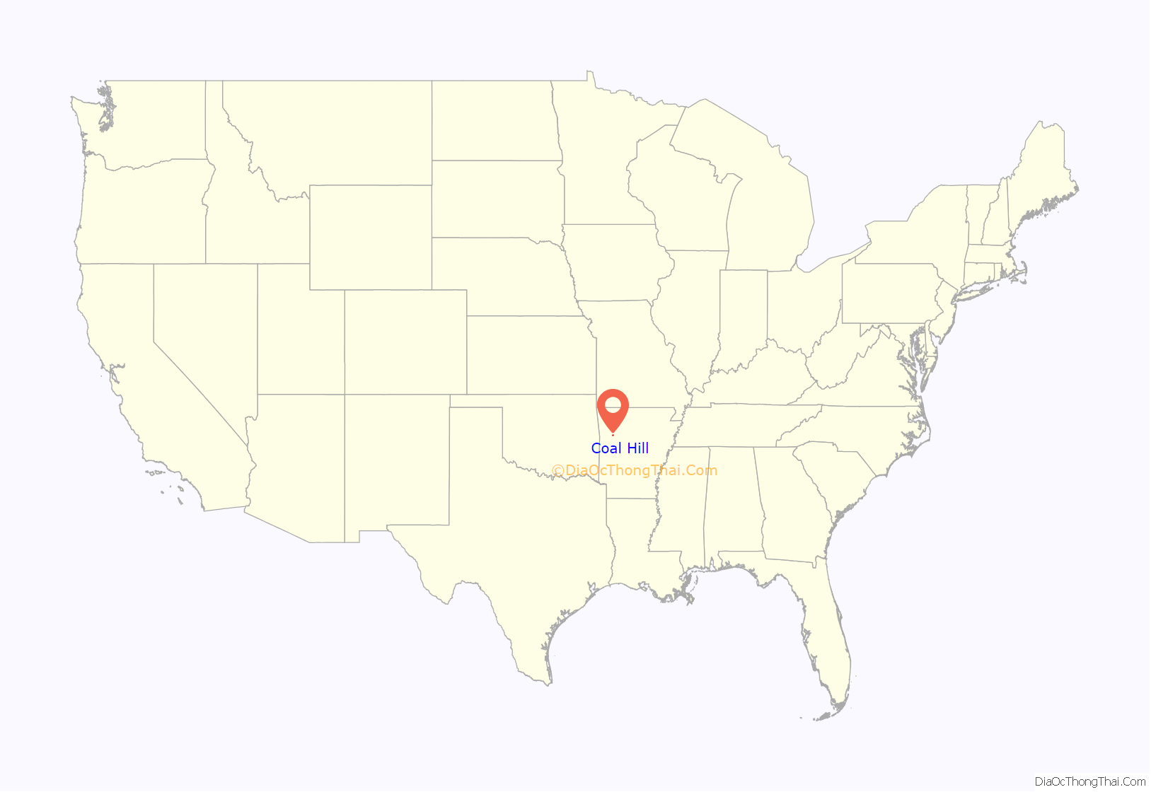
Coal Hill location map. Where is Coal Hill city?
History
The community was named for the presence of a coal mine near the town site.
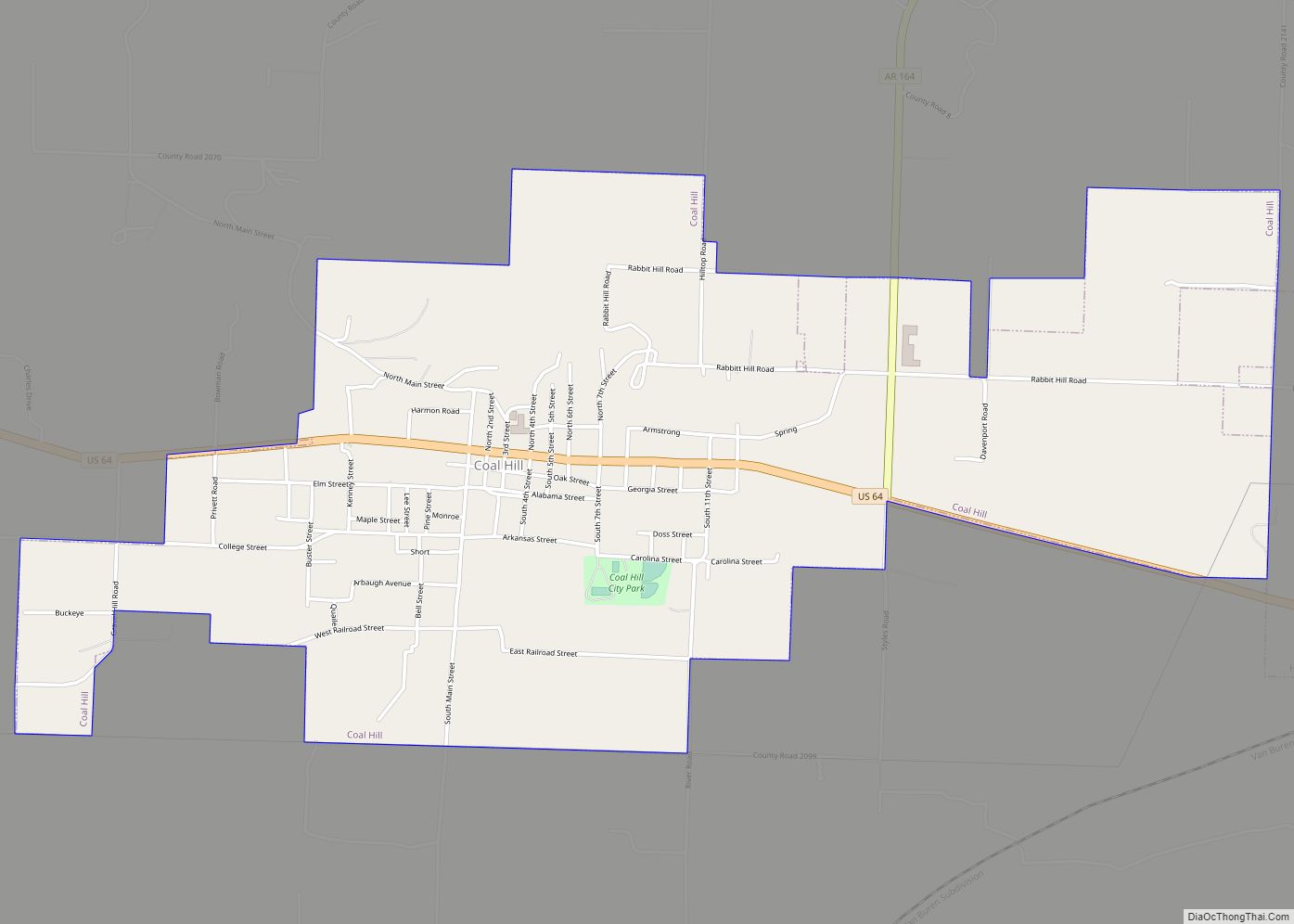
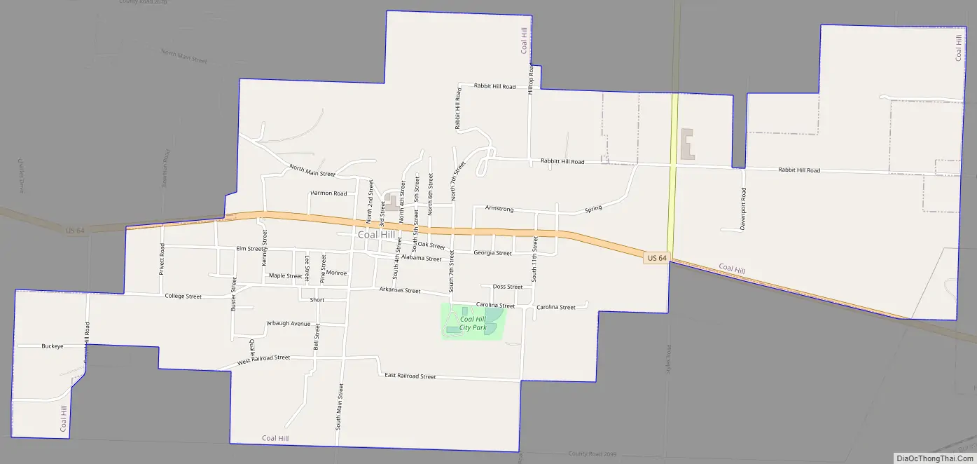
Coal Hill Road Map
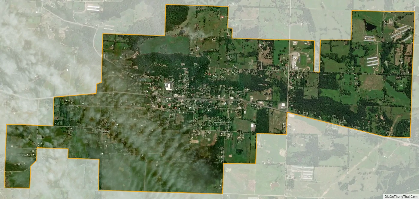
Coal Hill city Satellite Map
Geography
Coal Hill is located in southwestern Johnson County. U.S. Highway 64 passes through the center of town, leading east 12 miles (19 km) to Clarksville, the county seat, and west 10 miles (16 km) to Ozark. Arkansas Highway 164 runs north from the east end of Coal Hill 4 miles (6 km) to Interstate 40 at Exit 47.
According to the United States Census Bureau, the city has a total area of 2.72 square miles (7.05 km), of which 0.02 square miles (0.05 km), or 0.77%, are water. The city is 4 miles (6 km) north of the Arkansas River.
See also
Map of Arkansas State and its subdivision:- Arkansas
- Ashley
- Baxter
- Benton
- Boone
- Bradley
- Calhoun
- Carroll
- Chicot
- Clark
- Clay
- Cleburne
- Cleveland
- Columbia
- Conway
- Craighead
- Crawford
- Crittenden
- Cross
- Dallas
- Desha
- Drew
- Faulkner
- Franklin
- Fulton
- Garland
- Grant
- Greene
- Hempstead
- Hot Spring
- Howard
- Independence
- Izard
- Jackson
- Jefferson
- Johnson
- Lafayette
- Lawrence
- Lee
- Lincoln
- Little River
- Logan
- Lonoke
- Madison
- Marion
- Miller
- Mississippi
- Monroe
- Montgomery
- Nevada
- Newton
- Ouachita
- Perry
- Phillips
- Pike
- Poinsett
- Polk
- Pope
- Prairie
- Pulaski
- Randolph
- Saint Francis
- Saline
- Scott
- Searcy
- Sebastian
- Sevier
- Sharp
- Stone
- Union
- Van Buren
- Washington
- White
- Woodruff
- Yell
- Alabama
- Alaska
- Arizona
- Arkansas
- California
- Colorado
- Connecticut
- Delaware
- District of Columbia
- Florida
- Georgia
- Hawaii
- Idaho
- Illinois
- Indiana
- Iowa
- Kansas
- Kentucky
- Louisiana
- Maine
- Maryland
- Massachusetts
- Michigan
- Minnesota
- Mississippi
- Missouri
- Montana
- Nebraska
- Nevada
- New Hampshire
- New Jersey
- New Mexico
- New York
- North Carolina
- North Dakota
- Ohio
- Oklahoma
- Oregon
- Pennsylvania
- Rhode Island
- South Carolina
- South Dakota
- Tennessee
- Texas
- Utah
- Vermont
- Virginia
- Washington
- West Virginia
- Wisconsin
- Wyoming