Gillett is a city in Arkansas County, Arkansas, United States. Its population was 691 at the 2010 census. Gillett is the home of the annual Gillett Coon Supper. The Arkansas Post National Memorial is located southeast of the town.
The largest alligator ever killed in Arkansas was harpooned near Gillett on September 19, 2010. The 13-ft, 1-in reptile weighed 680 lb.
| Name: | Gillett city |
|---|---|
| LSAD Code: | 25 |
| LSAD Description: | city (suffix) |
| State: | Arkansas |
| County: | Arkansas County |
| Elevation: | 184 ft (56 m) |
| Total Area: | 1.00 sq mi (2.58 km²) |
| Land Area: | 1.00 sq mi (2.58 km²) |
| Water Area: | 0.00 sq mi (0.00 km²) |
| Total Population: | 564 |
| Population Density: | 566.27/sq mi (218.54/km²) |
| ZIP code: | 72055 |
| Area code: | 870 |
| FIPS code: | 0526980 |
| GNISfeature ID: | 0077017 |
| Website: | encyclopediaofarkansas.net/.. |
Online Interactive Map
Click on ![]() to view map in "full screen" mode.
to view map in "full screen" mode.
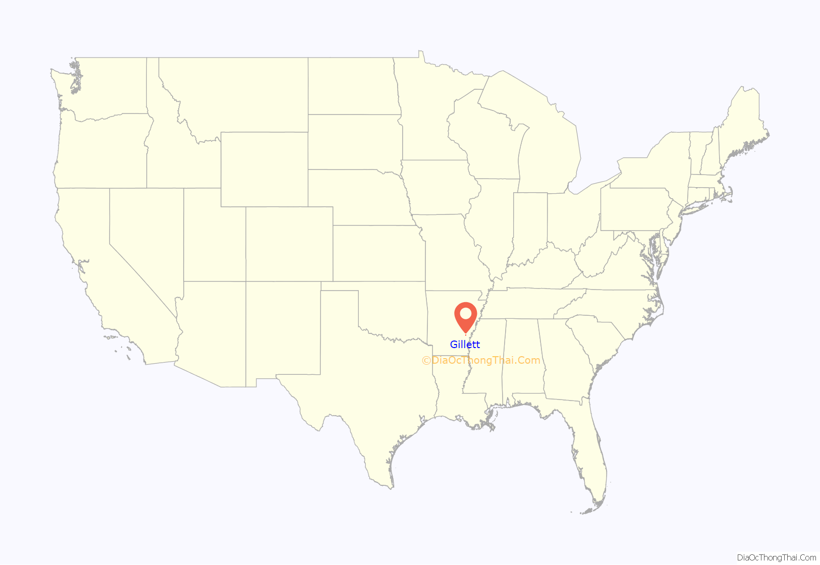
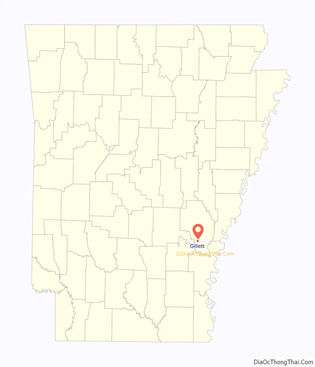
Gillett location map. Where is Gillett city?
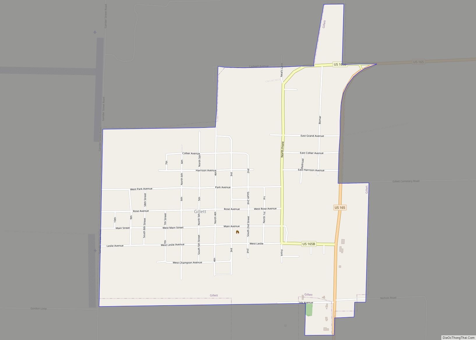
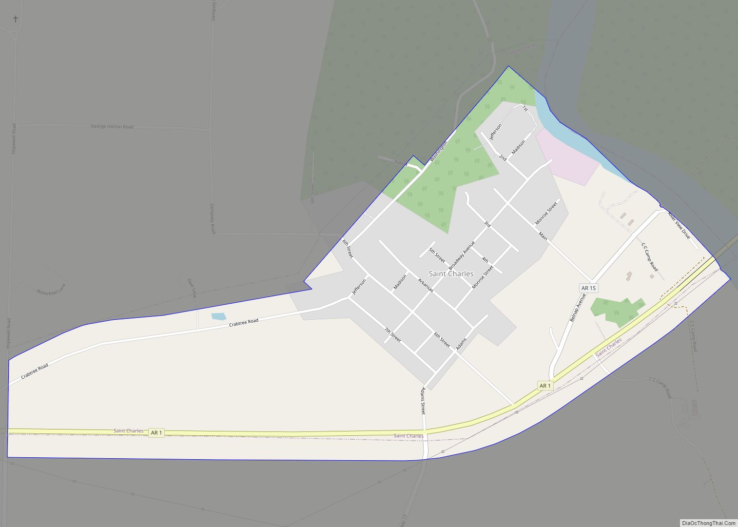
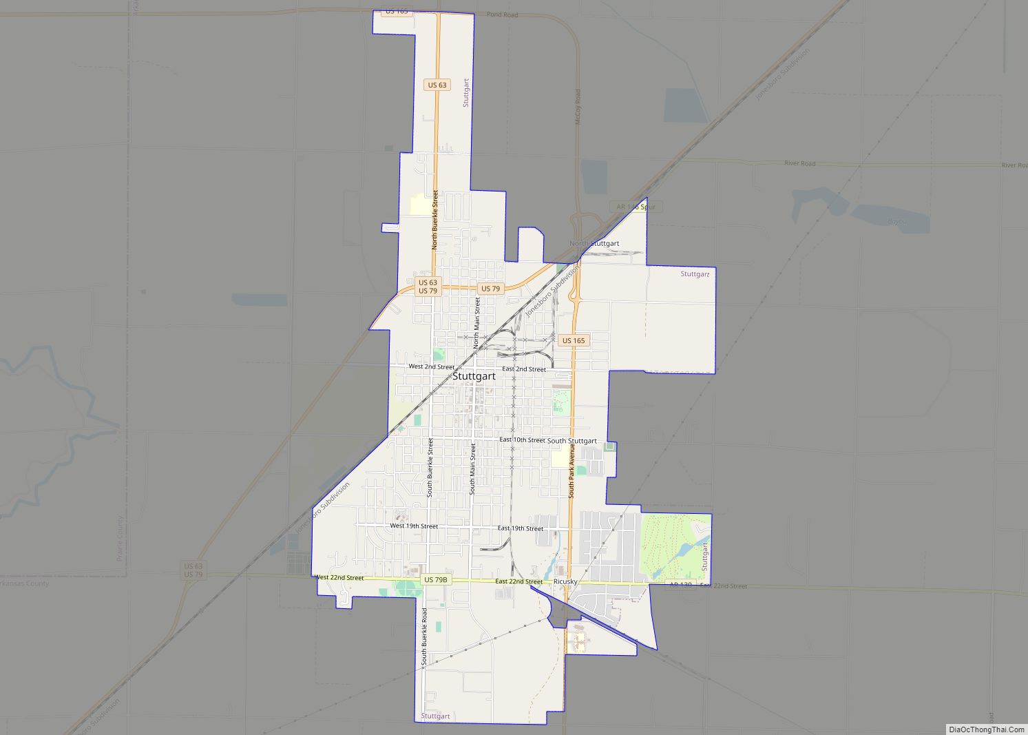
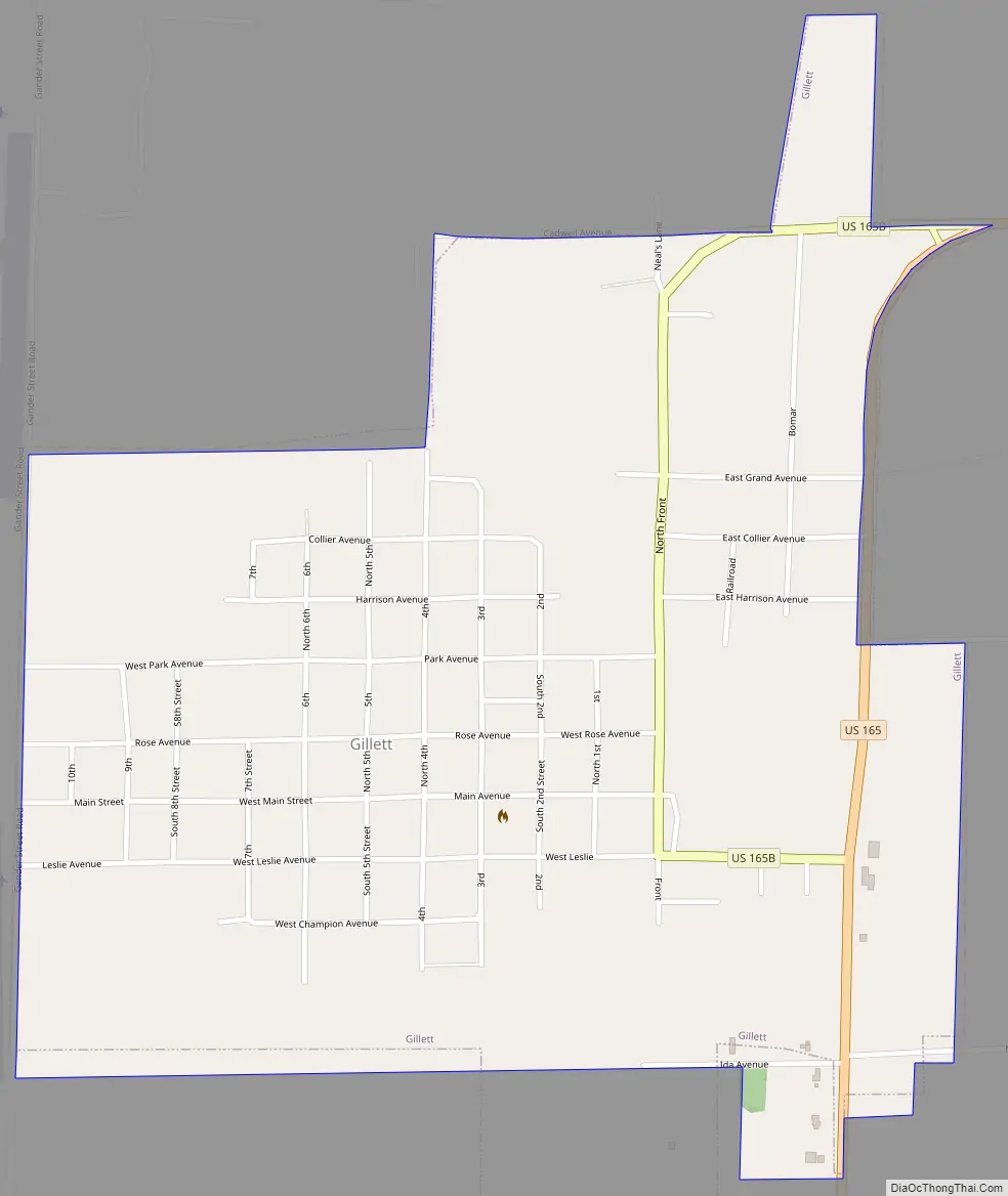
Gillett Road Map
Gillett city Satellite Map

Geography
Gillett is located at 34°7′9″N 91°22′49″W / 34.11917°N 91.38028°W / 34.11917; -91.38028 (34.119216, -91.380323).
According to the United States Census Bureau, the city has a total area of 1.0 square mile (2.6 km), of which almost all 1.0 square mile (2.6 km) is land.
See also
Map of Arkansas State and its subdivision:- Arkansas
- Ashley
- Baxter
- Benton
- Boone
- Bradley
- Calhoun
- Carroll
- Chicot
- Clark
- Clay
- Cleburne
- Cleveland
- Columbia
- Conway
- Craighead
- Crawford
- Crittenden
- Cross
- Dallas
- Desha
- Drew
- Faulkner
- Franklin
- Fulton
- Garland
- Grant
- Greene
- Hempstead
- Hot Spring
- Howard
- Independence
- Izard
- Jackson
- Jefferson
- Johnson
- Lafayette
- Lawrence
- Lee
- Lincoln
- Little River
- Logan
- Lonoke
- Madison
- Marion
- Miller
- Mississippi
- Monroe
- Montgomery
- Nevada
- Newton
- Ouachita
- Perry
- Phillips
- Pike
- Poinsett
- Polk
- Pope
- Prairie
- Pulaski
- Randolph
- Saint Francis
- Saline
- Scott
- Searcy
- Sebastian
- Sevier
- Sharp
- Stone
- Union
- Van Buren
- Washington
- White
- Woodruff
- Yell
- Alabama
- Alaska
- Arizona
- Arkansas
- California
- Colorado
- Connecticut
- Delaware
- District of Columbia
- Florida
- Georgia
- Hawaii
- Idaho
- Illinois
- Indiana
- Iowa
- Kansas
- Kentucky
- Louisiana
- Maine
- Maryland
- Massachusetts
- Michigan
- Minnesota
- Mississippi
- Missouri
- Montana
- Nebraska
- Nevada
- New Hampshire
- New Jersey
- New Mexico
- New York
- North Carolina
- North Dakota
- Ohio
- Oklahoma
- Oregon
- Pennsylvania
- Rhode Island
- South Carolina
- South Dakota
- Tennessee
- Texas
- Utah
- Vermont
- Virginia
- Washington
- West Virginia
- Wisconsin
- Wyoming