Gosnell is a city in northern Mississippi County, Arkansas, United States. The population was 2,910 at the 2020 census, down from 3,548 at the 2010 census.
| Name: | Gosnell city |
|---|---|
| LSAD Code: | 25 |
| LSAD Description: | city (suffix) |
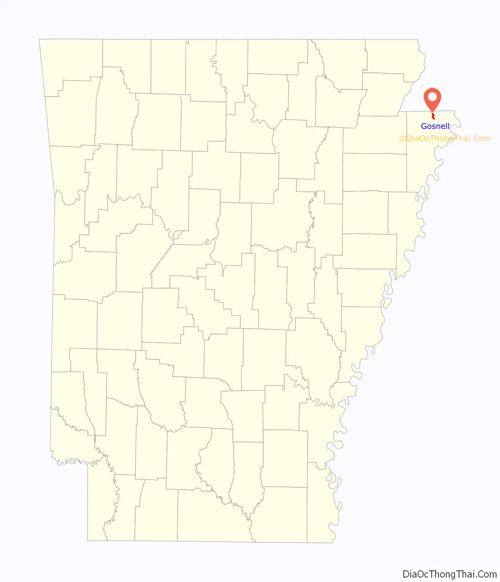
| State: | Arkansas |
| County: | Mississippi County |
| Elevation: | 243 ft (74 m) |
| Total Area: | 1.61 sq mi (4.18 km²) |
| Land Area: | 1.61 sq mi (4.18 km²) |
| Water Area: | 0.00 sq mi (0.00 km²) |
| Total Population: | 2,910 |
| Population Density: | 1,801.86/sq mi (695.84/km²) |
| ZIP code: | 72315, 72319 |
| Area code: | 870 |
| FIPS code: | 0527700 |
| GNISfeature ID: | 2403717 |
| Website: | cityofgosnell.net |
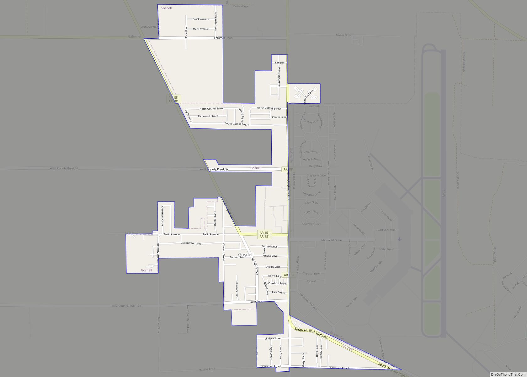
Online Interactive Map
Click on ![]() to view map in "full screen" mode.
to view map in "full screen" mode.
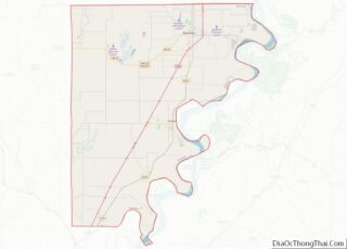
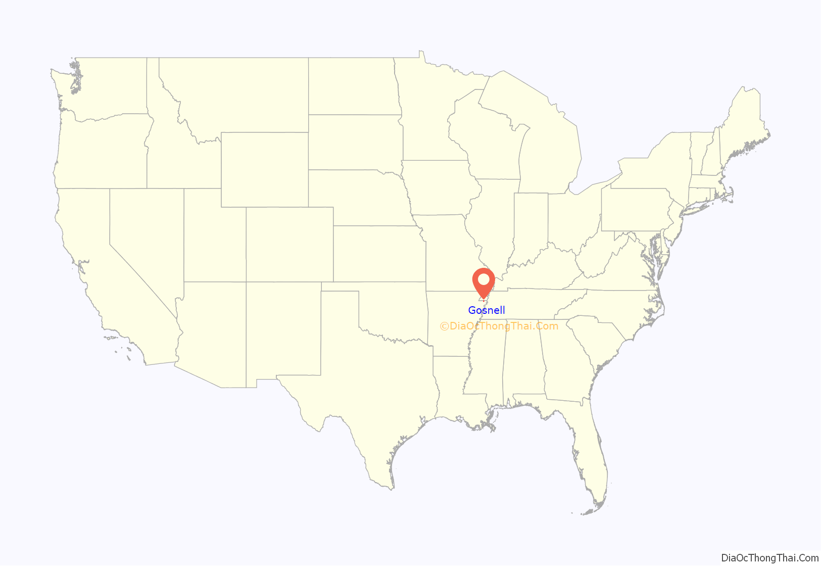
Gosnell location map. Where is Gosnell city?
History
The Gosnell region was surrounded by water in its early days. It is bordered on the west by Big Lake, which in the days before the automobile and railroads was used as a boat transportation route linking the settlement to the larger cities of Arkansas, Missouri, and Tennessee. Landowners along Big Lake took advantage of a thriving commercial hunting and fishing business. Pelts and packed fish could be shipped to market along the lake or by the two bayous to the Mississippi River.
To the east of the settlement is the Pemiscot Bayou. The road from Blytheville passed the Indian mound and store before traveling across the Pemiscot Bayou. Families with land along the Pemiscot traveled in boats into the Lumerate Bayou, which ran through Blytheville’s business district. The road to Gosnell came to be called the Pole Road. When stretches of the road became bad, the community would turn out to cut logs to place across the mud of the road, making it passable again.
Because the land was sparsely settled, it was of little concern to either side during the American Civil War. All of Mississippi County had fewer than 4,000 residents at this time. Men from the area joined Confederate units from other parts of Arkansas. Aside from a few Union raids from Missouri, the county did not suffer much from the war.
Much of the land between Blytheville and Big Lake was purchased in the late 1800s by Lemael Gosnell, a dentist and pioneer farmer. In time, the community came to be named for him.
Gosnell was incorporated as a first-class city on March 12, 1968. Gosnell’s first mayor after incorporation was Andy Bevill. Since then, Gosnell has had only four mayors: Carl Ledbetter, Dick Reams, Don Marshall and currently Teresa Walker.
Historical sites
Leaving Blytheville on Chickasawba Street, one reaches Gosnell Road. Upon traveling 1.3 miles (2.1 km) one comes to the place of the famous Chickasawba Indian Mound 25 feet high and base circumference approximately 130 feet. This mound must have been either a Signal or a Temple Mound as no pottery or skeleton bones have been found here.
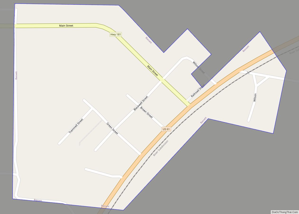
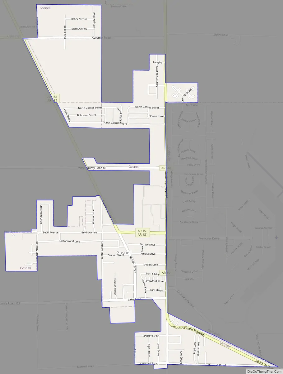
Gosnell Road Map
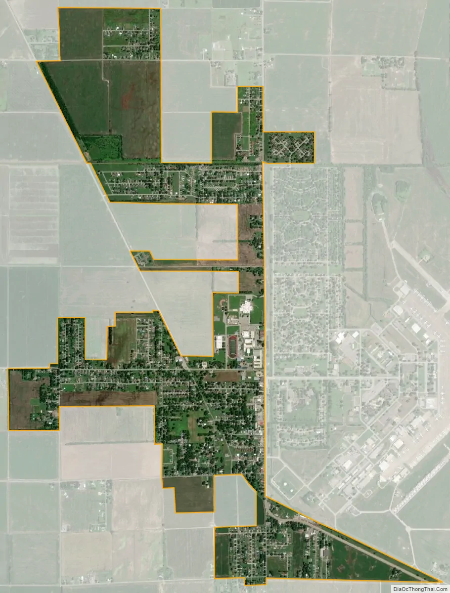
Gosnell city Satellite Map
Geography
Gosnell is located in the Arkansas Delta in northern Mississippi County. It is bordered to the east by the city of Blytheville, the county seat. The Missouri state line is less than 3 miles (5 km) to the north. According to the United States Census Bureau, Gosnell has a total area of 1.6 square miles (4.1 km), all land.
Ecologically, Gosnell is located within the St. Francis Lowlands ecoregion near its border with the Northern Holocene Meander Belts ecoregion; both are subregions of the larger Mississippi Alluvial Plain. The St. Francis Lowlands are a flat region mostly covered with row crop agriculture today, though also containing sand blows and sunken lands remaining from the 1811–12 New Madrid earthquakes. Waterways have mostly been channelized, causing loss of aquatic and riparian wildlife habitat. The Big Lake National Wildlife Refuge, which preserves some of the bottomland hardwood forest typical of this ecoregion prior to development for row agriculture, lies 6 miles (10 km) west of Gosnell.
See also
Map of Arkansas State and its subdivision:- Arkansas
- Ashley
- Baxter
- Benton
- Boone
- Bradley
- Calhoun
- Carroll
- Chicot
- Clark
- Clay
- Cleburne
- Cleveland
- Columbia
- Conway
- Craighead
- Crawford
- Crittenden
- Cross
- Dallas
- Desha
- Drew
- Faulkner
- Franklin
- Fulton
- Garland
- Grant
- Greene
- Hempstead
- Hot Spring
- Howard
- Independence
- Izard
- Jackson
- Jefferson
- Johnson
- Lafayette
- Lawrence
- Lee
- Lincoln
- Little River
- Logan
- Lonoke
- Madison
- Marion
- Miller
- Mississippi
- Monroe
- Montgomery
- Nevada
- Newton
- Ouachita
- Perry
- Phillips
- Pike
- Poinsett
- Polk
- Pope
- Prairie
- Pulaski
- Randolph
- Saint Francis
- Saline
- Scott
- Searcy
- Sebastian
- Sevier
- Sharp
- Stone
- Union
- Van Buren
- Washington
- White
- Woodruff
- Yell
- Alabama
- Alaska
- Arizona
- Arkansas
- California
- Colorado
- Connecticut
- Delaware
- District of Columbia
- Florida
- Georgia
- Hawaii
- Idaho
- Illinois
- Indiana
- Iowa
- Kansas
- Kentucky
- Louisiana
- Maine
- Maryland
- Massachusetts
- Michigan
- Minnesota
- Mississippi
- Missouri
- Montana
- Nebraska
- Nevada
- New Hampshire
- New Jersey
- New Mexico
- New York
- North Carolina
- North Dakota
- Ohio
- Oklahoma
- Oregon
- Pennsylvania
- Rhode Island
- South Carolina
- South Dakota
- Tennessee
- Texas
- Utah
- Vermont
- Virginia
- Washington
- West Virginia
- Wisconsin
- Wyoming