Holland is a city in Faulkner County, Arkansas, United States. The population was 557 at the 2010 census. It is part of the Little Rock–North Little Rock–Conway Metropolitan Statistical Area.
Holland gained media attention after 13-year-old Kacie Woody was reported missing from her home in this area in 2002; an investigation revealed that she was abducted by a California man she befriended online while he had pretended to be a teen boy. The next day their bodies were found inside a storage unit in Conway, after he had fatally shot her and later himself. Woody’s father then founded the Kacie Woody Foundation in order to educate parents and children about Internet safety.
| Name: | Holland city |
|---|---|
| LSAD Code: | 25 |
| LSAD Description: | city (suffix) |
| State: | Arkansas |
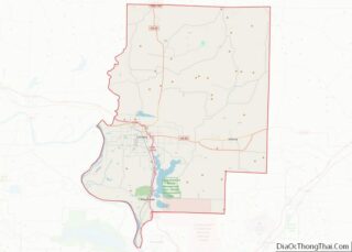
| County: | Faulkner County |
| Elevation: | 361 ft (110 m) |
| Total Area: | 6.73 sq mi (17.43 km²) |
| Land Area: | 6.73 sq mi (17.43 km²) |
| Water Area: | 0.00 sq mi (0.00 km²) |
| Total Population: | 586 |
| Population Density: | 87.06/sq mi (33.61/km²) |
| ZIP code: | 72173 |
| Area code: | 501 |
| FIPS code: | 0532710 |
| GNISfeature ID: | 2404711 |
| Website: | hollandar.com |
Online Interactive Map
Click on ![]() to view map in "full screen" mode.
to view map in "full screen" mode.
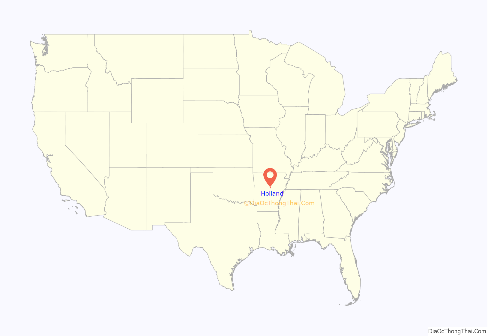
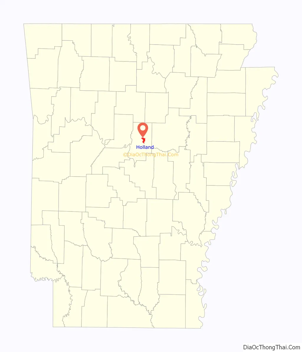
Holland location map. Where is Holland city?
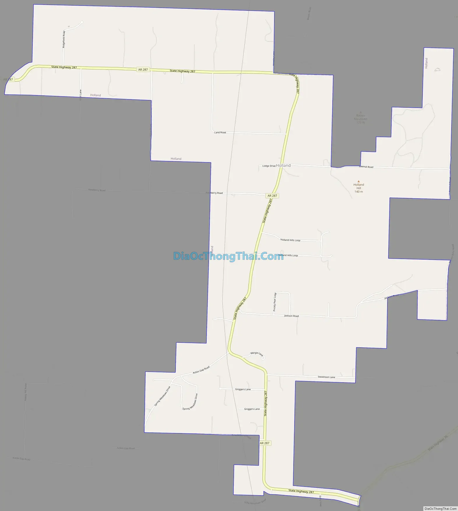
Holland Road Map
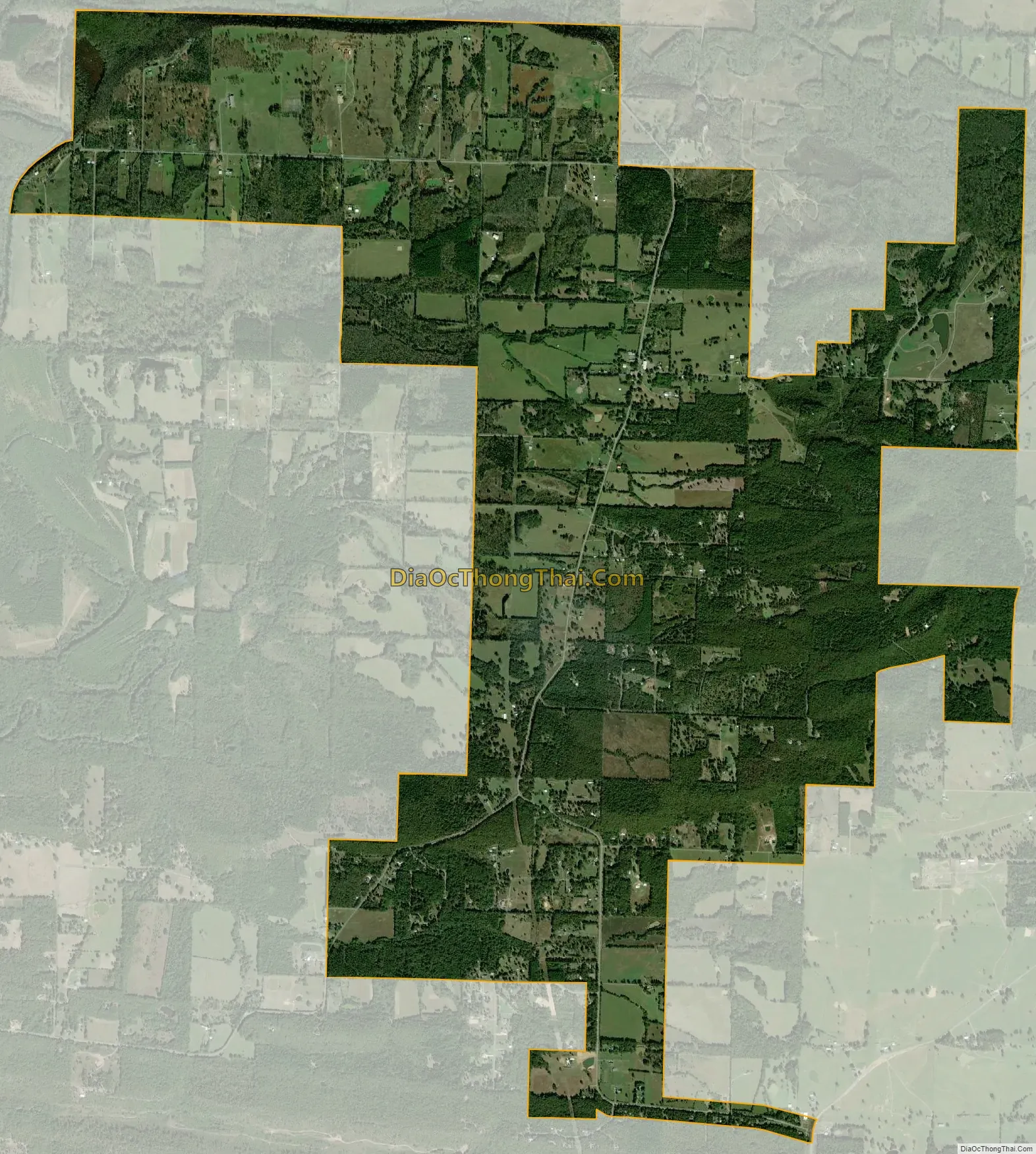
Holland city Satellite Map
Geography
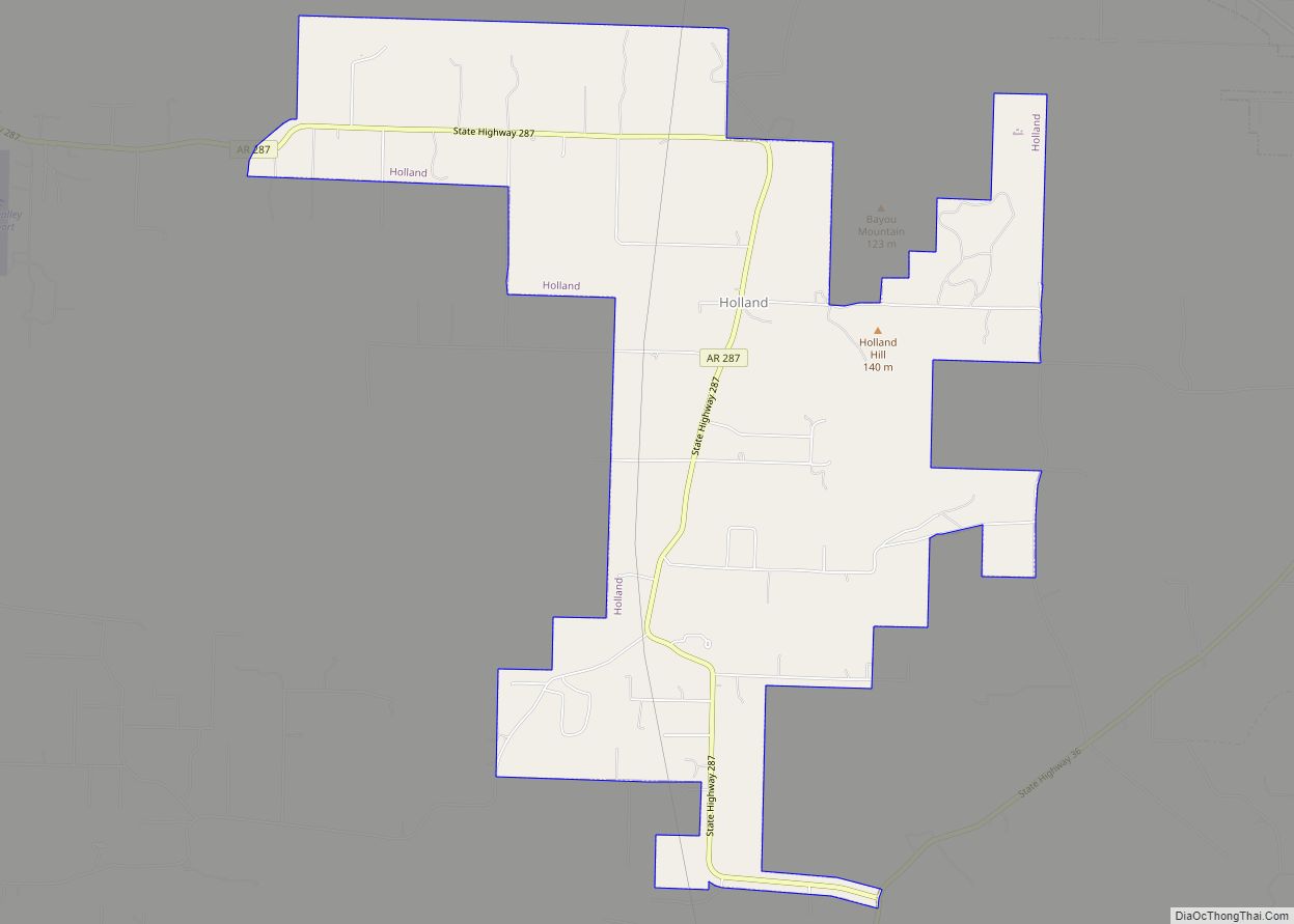
Holland is located just east of the center of Faulkner County at 35°9′28″N 92°16′50″W / 35.15778°N 92.28056°W / 35.15778; -92.28056 (35.157643, -92.280637). Holland Hill, a low ridge, forms a rough semi-circle around the northern, eastern, and southern sides of town. Arkansas Highway 287 passes through the town, leading west 8 miles (13 km) to U.S. Route 65 at Springhill and south 3 miles (5 km) to Arkansas Highway 36. Conway, the county seat, is 14 miles (23 km) to the southwest of Holland.
According to the United States Census Bureau, Holland has a total area of 6.9 square miles (17.9 km), all land.
See also
Map of Arkansas State and its subdivision:- Arkansas
- Ashley
- Baxter
- Benton
- Boone
- Bradley
- Calhoun
- Carroll
- Chicot
- Clark
- Clay
- Cleburne
- Cleveland
- Columbia
- Conway
- Craighead
- Crawford
- Crittenden
- Cross
- Dallas
- Desha
- Drew
- Faulkner
- Franklin
- Fulton
- Garland
- Grant
- Greene
- Hempstead
- Hot Spring
- Howard
- Independence
- Izard
- Jackson
- Jefferson
- Johnson
- Lafayette
- Lawrence
- Lee
- Lincoln
- Little River
- Logan
- Lonoke
- Madison
- Marion
- Miller
- Mississippi
- Monroe
- Montgomery
- Nevada
- Newton
- Ouachita
- Perry
- Phillips
- Pike
- Poinsett
- Polk
- Pope
- Prairie
- Pulaski
- Randolph
- Saint Francis
- Saline
- Scott
- Searcy
- Sebastian
- Sevier
- Sharp
- Stone
- Union
- Van Buren
- Washington
- White
- Woodruff
- Yell
- Alabama
- Alaska
- Arizona
- Arkansas
- California
- Colorado
- Connecticut
- Delaware
- District of Columbia
- Florida
- Georgia
- Hawaii
- Idaho
- Illinois
- Indiana
- Iowa
- Kansas
- Kentucky
- Louisiana
- Maine
- Maryland
- Massachusetts
- Michigan
- Minnesota
- Mississippi
- Missouri
- Montana
- Nebraska
- Nevada
- New Hampshire
- New Jersey
- New Mexico
- New York
- North Carolina
- North Dakota
- Ohio
- Oklahoma
- Oregon
- Pennsylvania
- Rhode Island
- South Carolina
- South Dakota
- Tennessee
- Texas
- Utah
- Vermont
- Virginia
- Washington
- West Virginia
- Wisconsin
- Wyoming