Jacksonport is a town in Jackson County, Arkansas, United States, along the White River at its confluence with the Black River. The population was 212 at the 2010 census.
| Name: | Jacksonport town |
|---|---|
| LSAD Code: | 43 |
| LSAD Description: | town (suffix) |
| State: | Arkansas |
| County: | Jackson County |
| Elevation: | 223 ft (68 m) |
| Total Area: | 0.38 sq mi (0.97 km²) |
| Land Area: | 0.38 sq mi (0.97 km²) |
| Water Area: | 0.00 sq mi (0.00 km²) |
| Total Population: | 150 |
| Population Density: | 398.94/sq mi (153.97/km²) |
| ZIP code: | 72075 |
| Area code: | 870 |
| FIPS code: | 0534720 |
| GNISfeature ID: | 2405901 |
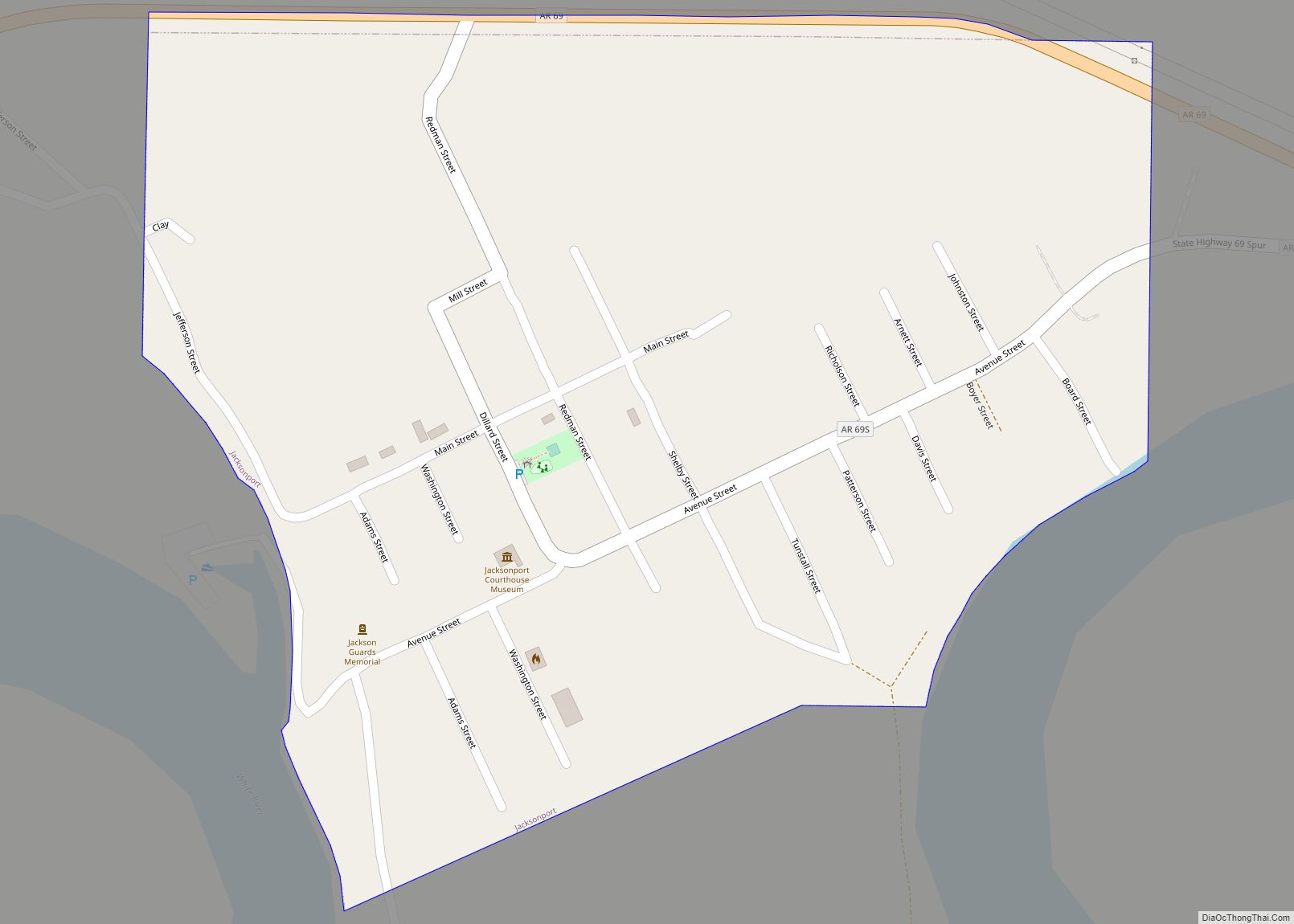
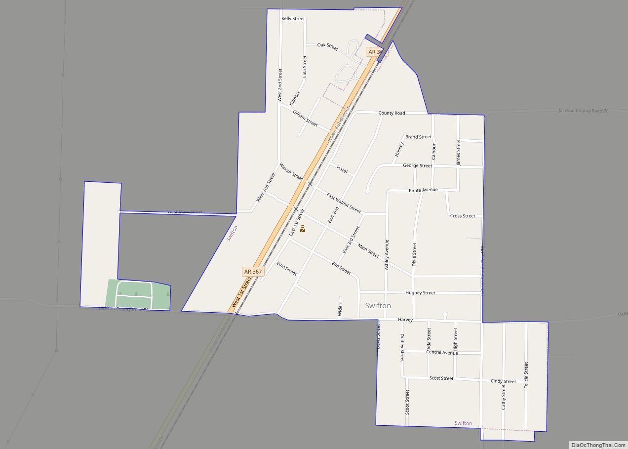
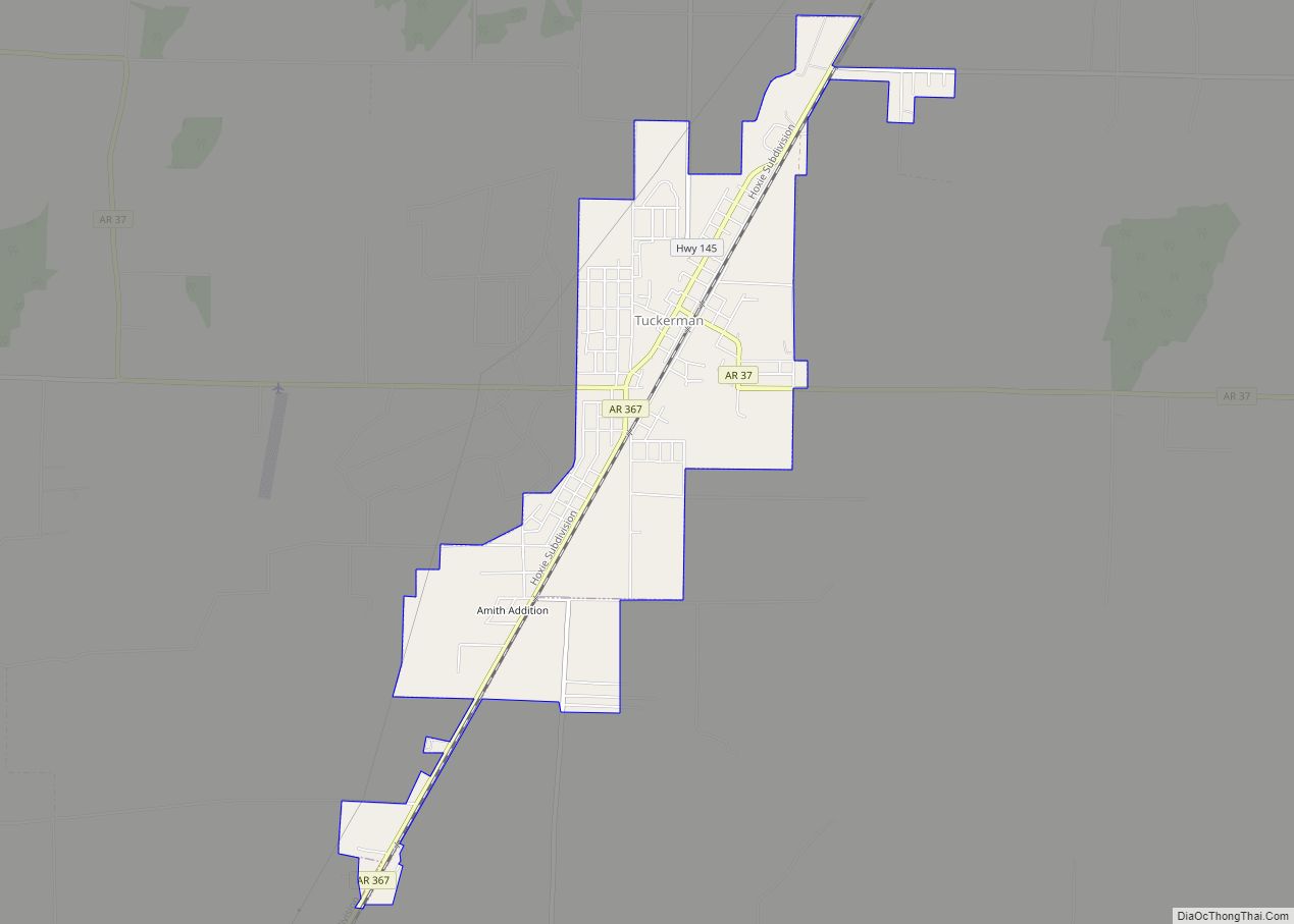
Online Interactive Map
Click on ![]() to view map in "full screen" mode.
to view map in "full screen" mode.
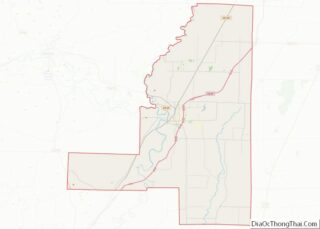
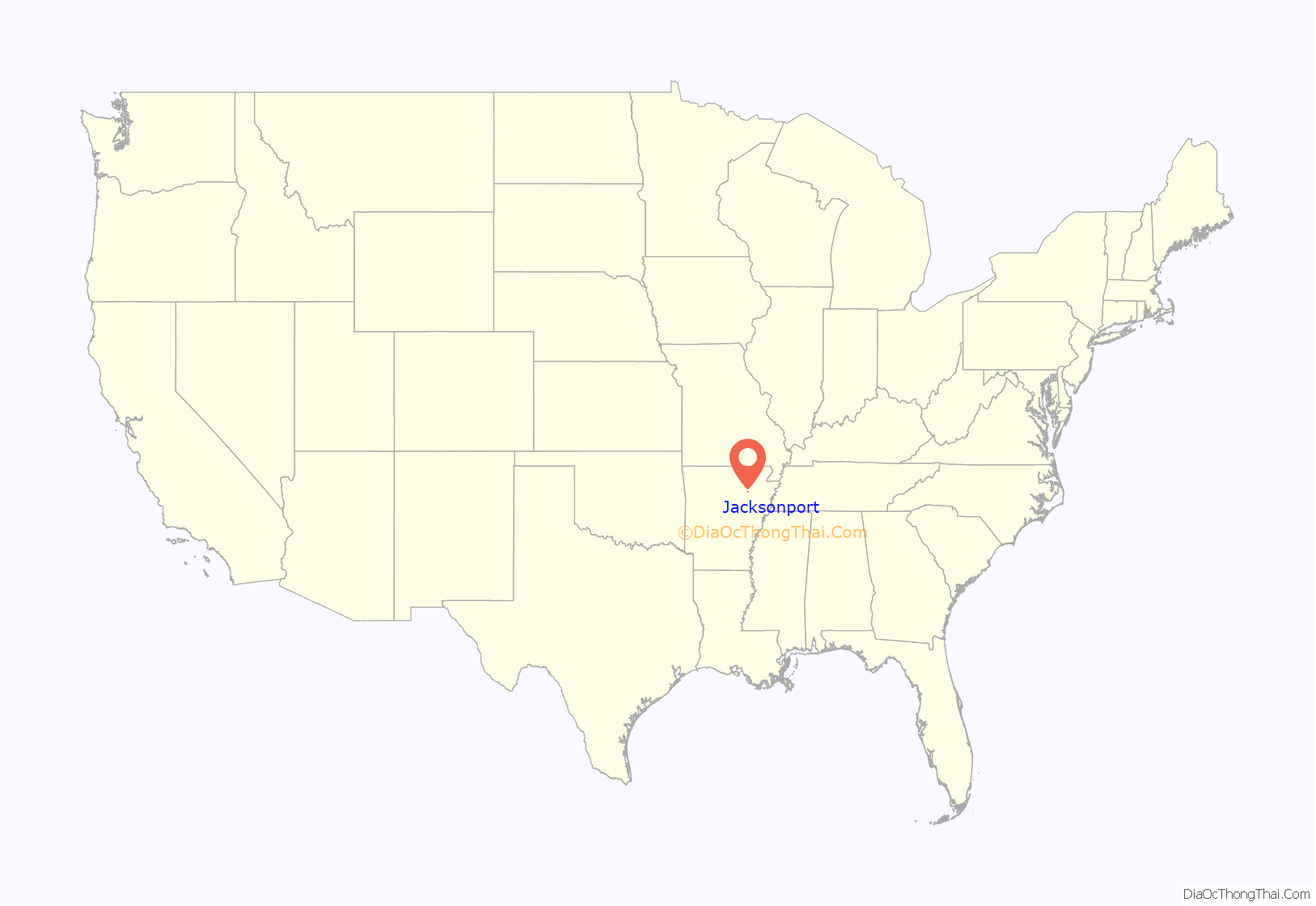
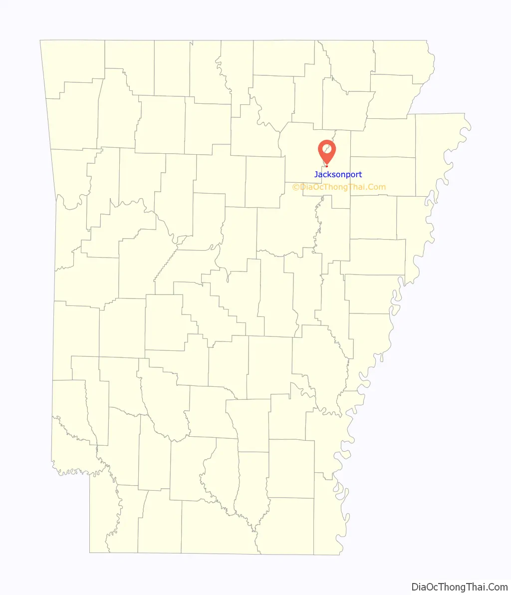
Jacksonport location map. Where is Jacksonport town?
History
Jacksonport was once an important steamboat stop on the White River. During the Civil War the town served as a transportation hub for Confederate forces.
Jacksonport was the terminus of the Batesville and Brinkley Railroad, later called the White and Black River Valley Railway, which reached the town from Brinkley, Arkansas in November of 1886. The line was subsequently operated by the Chicago, Rock Island and Pacific Railway until closed in 1940.
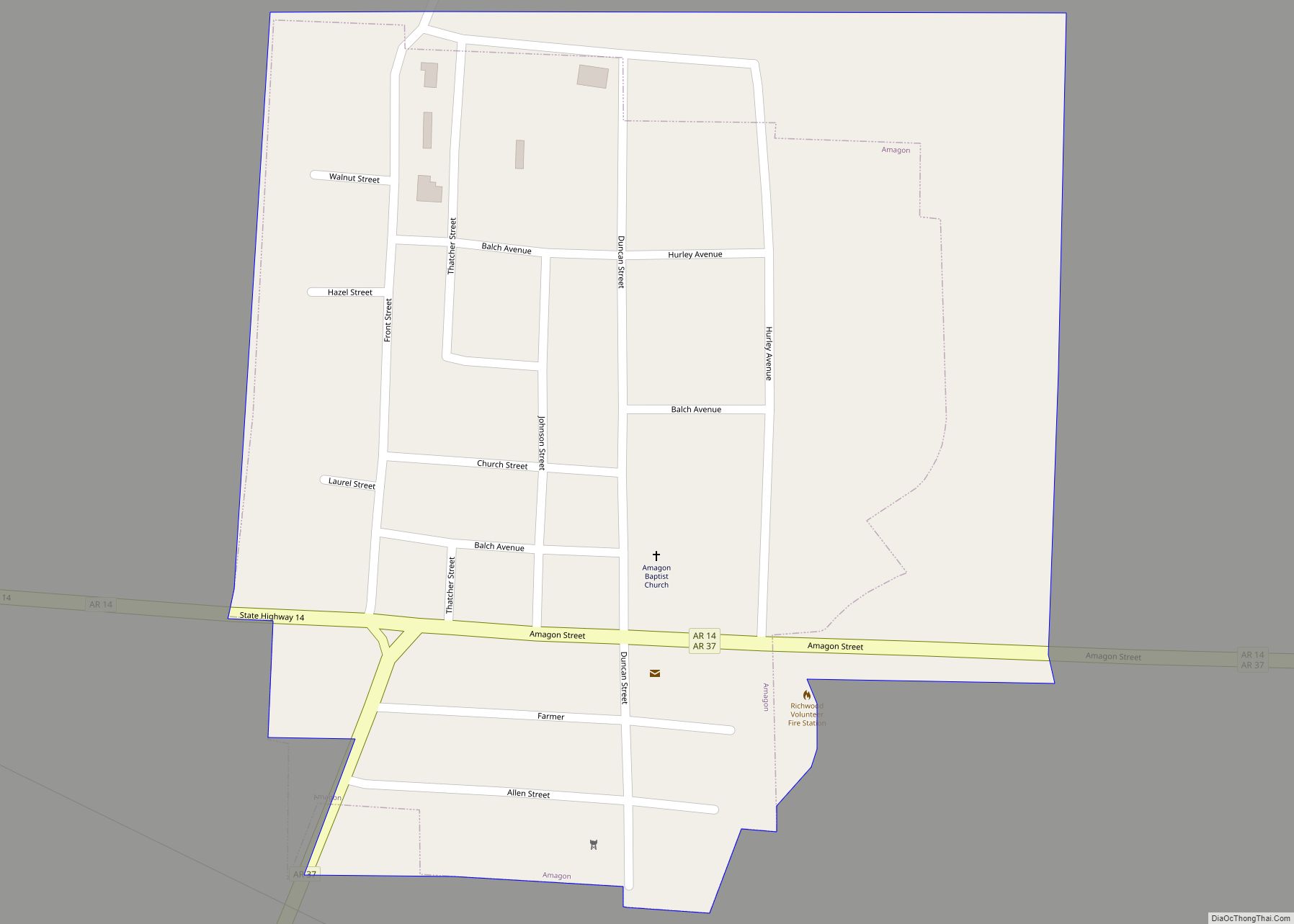
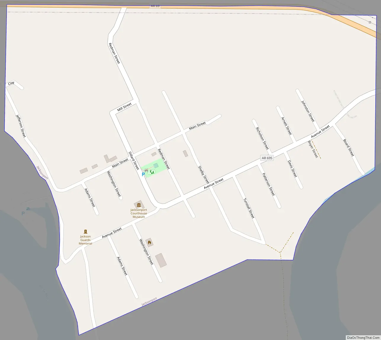
Jacksonport Road Map
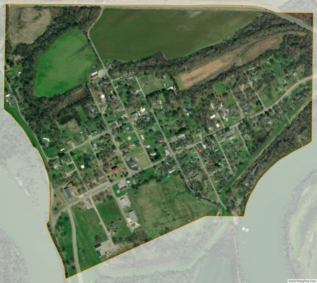
Jacksonport city Satellite Map
Geography
Jacksonport is located at 35°38′28″N 91°18′32″W / 35.64111°N 91.30889°W / 35.64111; -91.30889 (35.640990, -91.308860).
According to the United States Census Bureau, the town has a total area of 0.35 square miles (0.9 km), all land.
See also
Map of Arkansas State and its subdivision:- Arkansas
- Ashley
- Baxter
- Benton
- Boone
- Bradley
- Calhoun
- Carroll
- Chicot
- Clark
- Clay
- Cleburne
- Cleveland
- Columbia
- Conway
- Craighead
- Crawford
- Crittenden
- Cross
- Dallas
- Desha
- Drew
- Faulkner
- Franklin
- Fulton
- Garland
- Grant
- Greene
- Hempstead
- Hot Spring
- Howard
- Independence
- Izard
- Jackson
- Jefferson
- Johnson
- Lafayette
- Lawrence
- Lee
- Lincoln
- Little River
- Logan
- Lonoke
- Madison
- Marion
- Miller
- Mississippi
- Monroe
- Montgomery
- Nevada
- Newton
- Ouachita
- Perry
- Phillips
- Pike
- Poinsett
- Polk
- Pope
- Prairie
- Pulaski
- Randolph
- Saint Francis
- Saline
- Scott
- Searcy
- Sebastian
- Sevier
- Sharp
- Stone
- Union
- Van Buren
- Washington
- White
- Woodruff
- Yell
- Alabama
- Alaska
- Arizona
- Arkansas
- California
- Colorado
- Connecticut
- Delaware
- District of Columbia
- Florida
- Georgia
- Hawaii
- Idaho
- Illinois
- Indiana
- Iowa
- Kansas
- Kentucky
- Louisiana
- Maine
- Maryland
- Massachusetts
- Michigan
- Minnesota
- Mississippi
- Missouri
- Montana
- Nebraska
- Nevada
- New Hampshire
- New Jersey
- New Mexico
- New York
- North Carolina
- North Dakota
- Ohio
- Oklahoma
- Oregon
- Pennsylvania
- Rhode Island
- South Carolina
- South Dakota
- Tennessee
- Texas
- Utah
- Vermont
- Virginia
- Washington
- West Virginia
- Wisconsin
- Wyoming