Jonesboro is a city located on Crowley’s Ridge in the northeastern corner of the U.S. State of Arkansas. Jonesboro is one of two county seats of Craighead County. In 2023, the city had a population of 81,969 and was the fifth-largest city in Arkansas at the time. In 2023, the Jonesboro metropolitan area had a population of 135,287 and a population of 179,932 in the Jonesboro-Paragould Combined Statistical Area.
Jonesboro is the home of Arkansas State University and is the cultural and economic center of Northeast Arkansas.
| Name: | Jonesboro city |
|---|---|
| LSAD Code: | 25 |
| LSAD Description: | city (suffix) |
| State: | Arkansas |
| County: | Craighead County |
| Incorporated: | February 19, 1859 |
| Elevation: | 259 ft (79 m) |
| Land Area: | 80.18 sq mi (207.66 km²) |
| Water Area: | 0.55 sq mi (1.43 km²) |
| Population Density: | 1,022.40/sq mi (393.41/km²) |
| Area code: | 870 |
| FIPS code: | 0535710 |
| GNISfeature ID: | 0077389 |
| Website: | jonesboro.org |
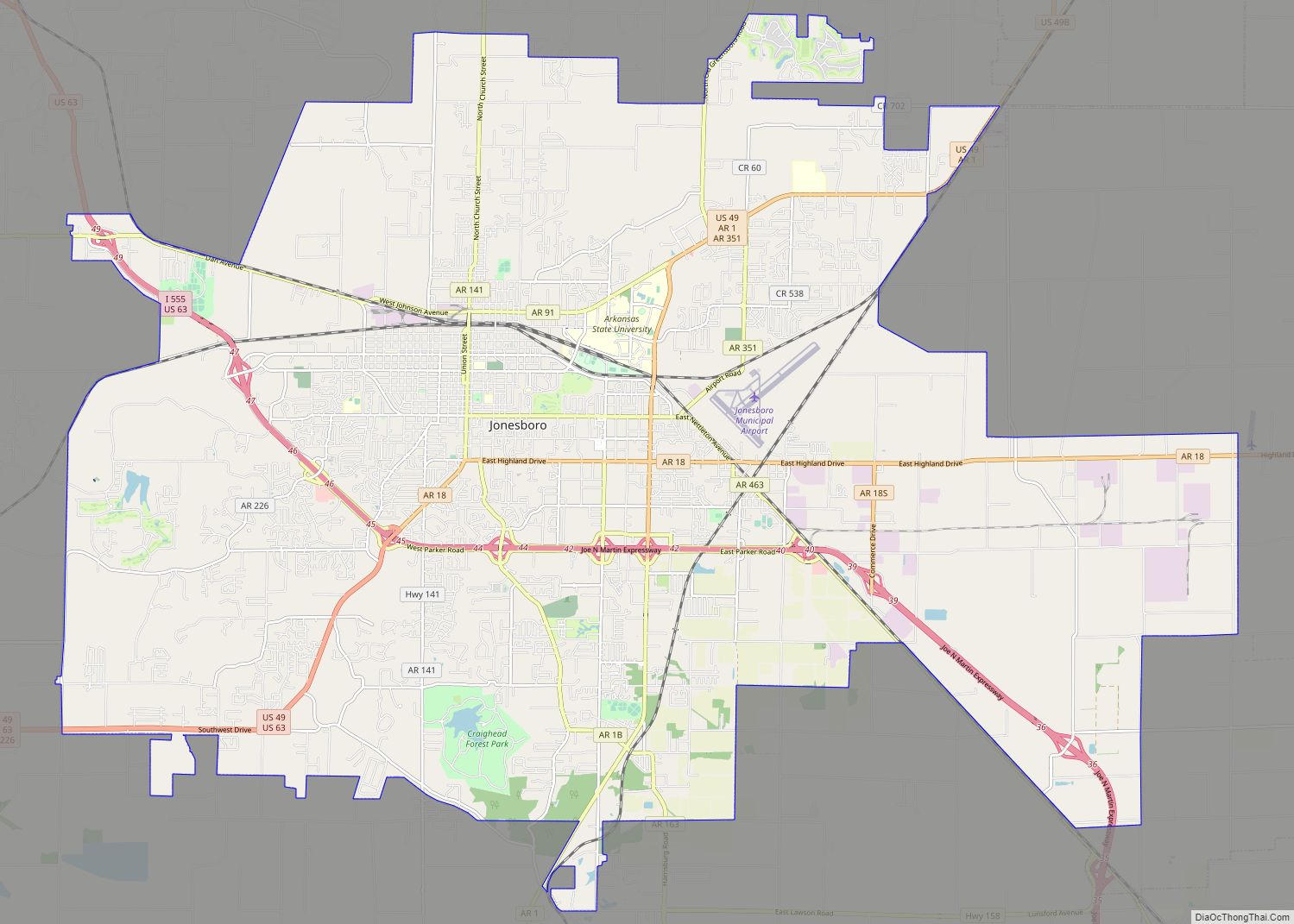
Online Interactive Map
Click on ![]() to view map in "full screen" mode.
to view map in "full screen" mode.
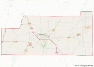
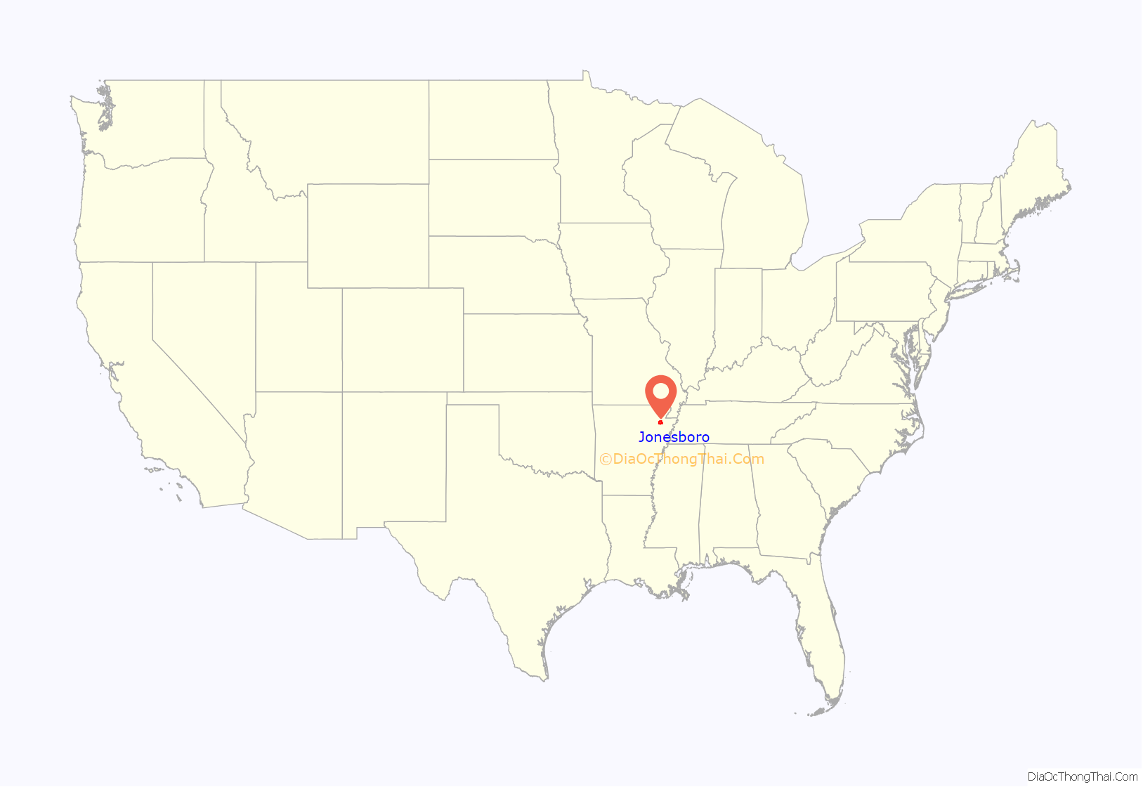
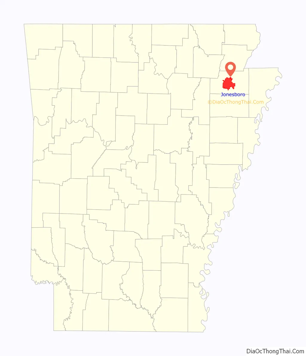
Jonesboro location map. Where is Jonesboro city?
History
The Jonesboro area was first inhabited for thousands of years by indigenous peoples. At the time of European encounter, historic tribes included the Osage, the Caddo, and the Quapaw. The name of the state of Arkansas comes from the Quapaw language. French and Spanish traders and trappers had relations with these groups.
After the United States acquired this territory in the Louisiana Purchase of 1803, American settlers eventually made their way to the area where Jonesboro is located. They began exploring, hunting, trapping, and trading with the local Indian tribes. A permanent settlement of Jonesboro was set up shortly after 1859. When Craighead County was established.
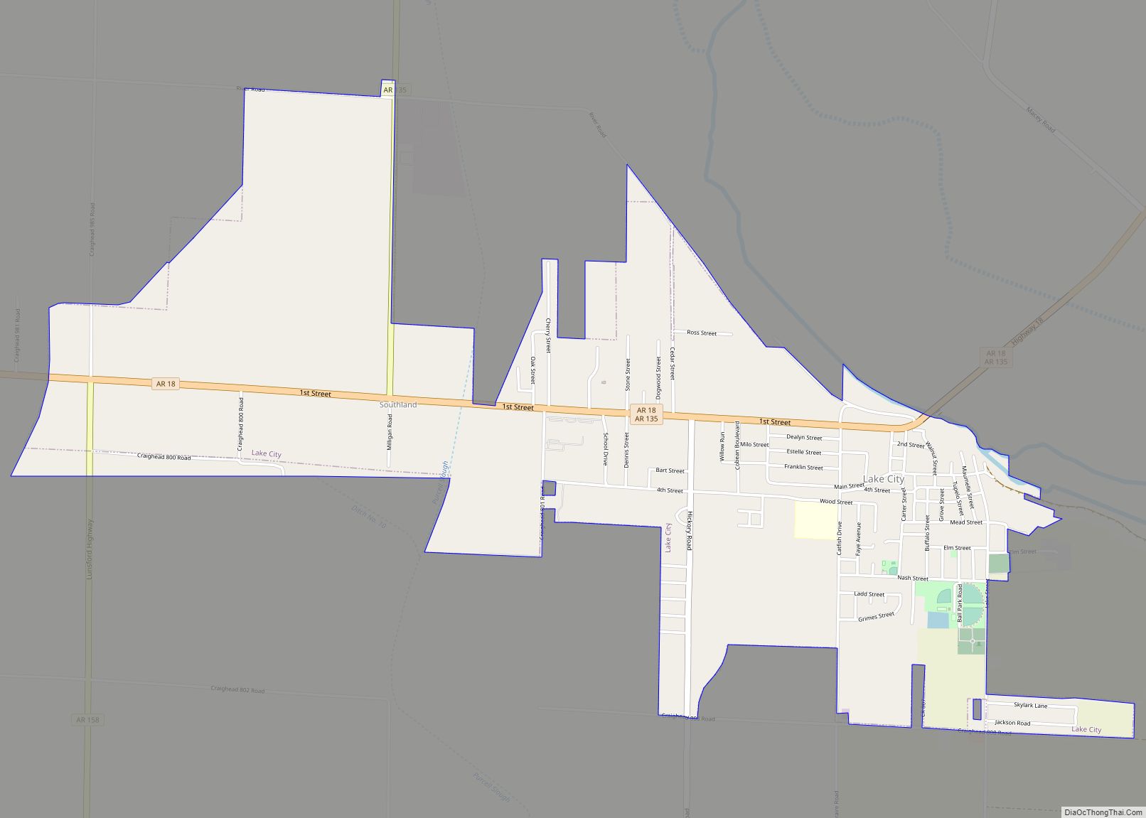
In 1859, land was taken from nearby Greene, Mississippi, and Poinsett counties and was used to form Craighead County. Jonesboro was designated as the original county seat. As the population increased in the west of the county, Lake City was named as the second seat. Jonesboro had 150 residents in 1859. It was named after State Senator William A. Jones in recognition of his support for the formation of Craighead County. Originally spelled Jonesborough, the city name was later shortened to its present-day spelling.
In 1881, a young woman was brutally murdered in an apparent robbery. Her father had left their farm for a short while and returned to find her in a pool of her own blood. Four black men were arrested in conjunction with the crime, and after their trial, The Jonesboro Lynching of 1881 took place at midnight on March 12. The Decatur Daily Republican reported that the four men, called Green Harris (sometimes referred to as Hawes), Giles Peck, John Woods (sometimes referred to as Jud Woods), and Burt Hoskins (sometimes referred to as Haskins)—had been arrested and tried before magistrates Jackson and Akers at New Haven Church, eight miles north of Jonesboro. The hearing, which found that the men were guilty, was attended by several hundred people. According to this and several other reports, the accused made a complete confession. The magistrates bound them over to the grand jury, and they were ordered taken to the jail in Jonesboro. The hour being late, however, it was decided to hold them overnight in the church under a strong guard. The large crowd gradually dispersed, “muttering threats of vengeance.” Around midnight, between 200 and 300 masked men surrounded the church, overpowered the guards, and broke in the doors and windows. They seized the accused, dragged them to a tree about 200 yards away, and hanged them. Once again, the crowd dispersed, “leaving the bodies of their victims dangling in the air and presenting a horrible spectacle in the moonlight.” According to the Republican, “The crime and punishment form one of the blackest pages in the annals of the state.”
During the late 19th century, the city tried to develop its court system and downtown infrastructure. Shortly after the city was named county seat, the highest point in Jonesboro was identified and a courthouse was planned for construction. This was delayed for several years, for the locals did not want to ruin their deer hunting. The first courthouse was finally completed but was destroyed by a fire in 1869. A store across from this site was rented and used as a courthouse. It was destroyed in an 1876 fire. Another building was constructed on the same site, but it fell to a fire in 1878, a major one that destroyed most of downtown Jonesboro. Soon afterward, another courthouse was constructed; it was replaced by the present courthouse in 1934.
The St. Louis Southwestern Railway, known as the Cotton Belt Railroad was constructed through Jonesboro, with its tracks passing just north of the center of the city. During the first train’s journey, it became stuck and supplies had to be carried into town. It connected St. Louis to points in Arkansas and Texas. Other major railways began to construct tracks to and from Jonesboro, including the St. Louis–San Francisco Railway and Missouri Pacific Railroad. Some of the rail companies still own and use the tracks that run through Jonesboro.
The city set up the Jonesboro School District in 1899. In 1900, St. Bernard’s Regional Medical Center was established by the Olivetan Benedictine Sisters. The Grand Leader Department Store, the first department store in the city, was opened in 1900. Woodland College and two schools within the Jonesboro School District were opened in 1904. Arkansas State College (now Arkansas State University) was established in 1909, a year in which the first horseless carriages were driven in the city. There is a recording on a Sanborn Fire Insurance Map dating back to March 1897 of a Presbyterian Church existing at the corner of Church St. and Monroe, and a Christian church located at the corner of Union and Huntington Ave. Other early churches of the city were started in the 1910s. First Baptist Church was founded in 1911, and First Methodist Church in 1916.
Wade Thomas was lynched on December 26, 1920, in downtown Jonesboro. A large white mob seized Thomas after he allegedly shot local Patrolman Elmer Ragland during a Christmas Day raid on a local dice game. He was paraded through the town and then hanged and his body riddled with bullets.
On September 10, 1931, Governor Harvey Parnell authorized the Arkansas National Guard to be deployed in Jonesboro to quell the Church War, a clash between the followers of Joe Jeffers and Dow H. Heard, the pastor of the First Baptist Church of Jonesboro. Jeffers’ supporters also attacked the mayor and police chief, resulting in front-page coverage of the incident in The New York Times.
On May 15, 1968 an F4 tornado struck Jonesboro, destroying 164 homes. At least 34 people died and more than 350 people were injured as a result of the tornado which struck the town without warning at 10:00pm that night.
On May 27, 1973, shortly after midnight, an F4 tornado struck Jonesboro, killing 3 and injuring 289. Damage was estimated at 60 million in 1973 dollars.
The 1998 Westside Middle School shooting occurred on March 24. Two young boys (aged 11 and 13 years) fired upon students at Westside Middle School while hidden in woodlands near the school. They killed four students and one teacher, and injured 10 persons.
In the 2007–2008 school year the Jonesboro Public School District elementary schools were reclassified as magnet schools.
2020 tornado
A “large, destructive” EF3 tornado struck Jonesboro on March 28, 2020, causing severe damage to The Mall at Turtle Creek and at least twenty minor injuries, and two severe injuries.
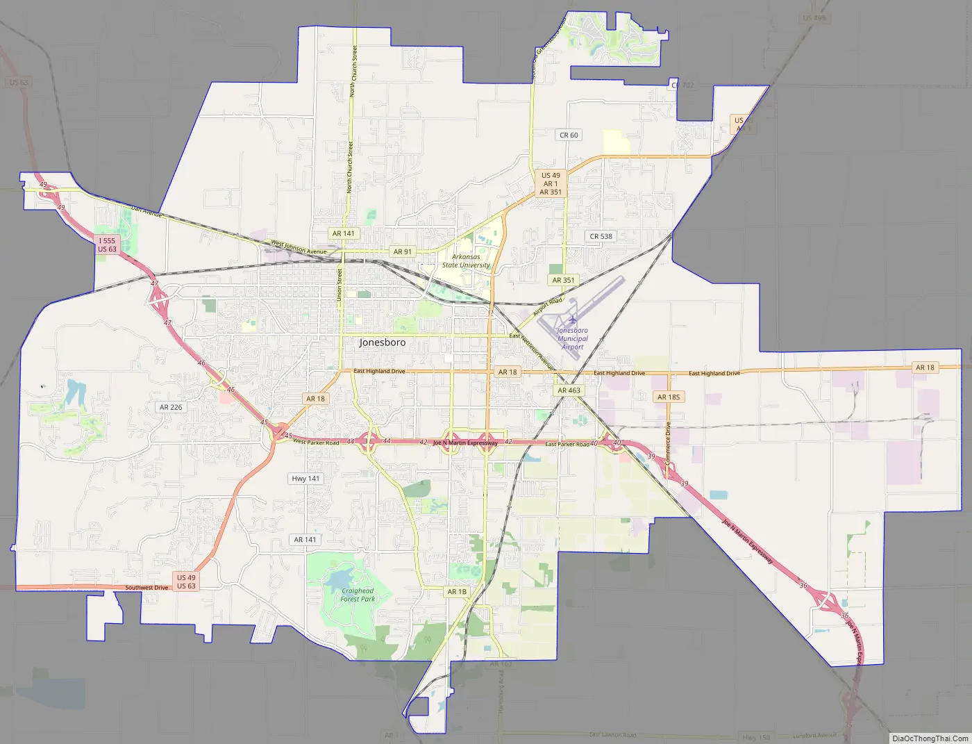
Jonesboro Road Map
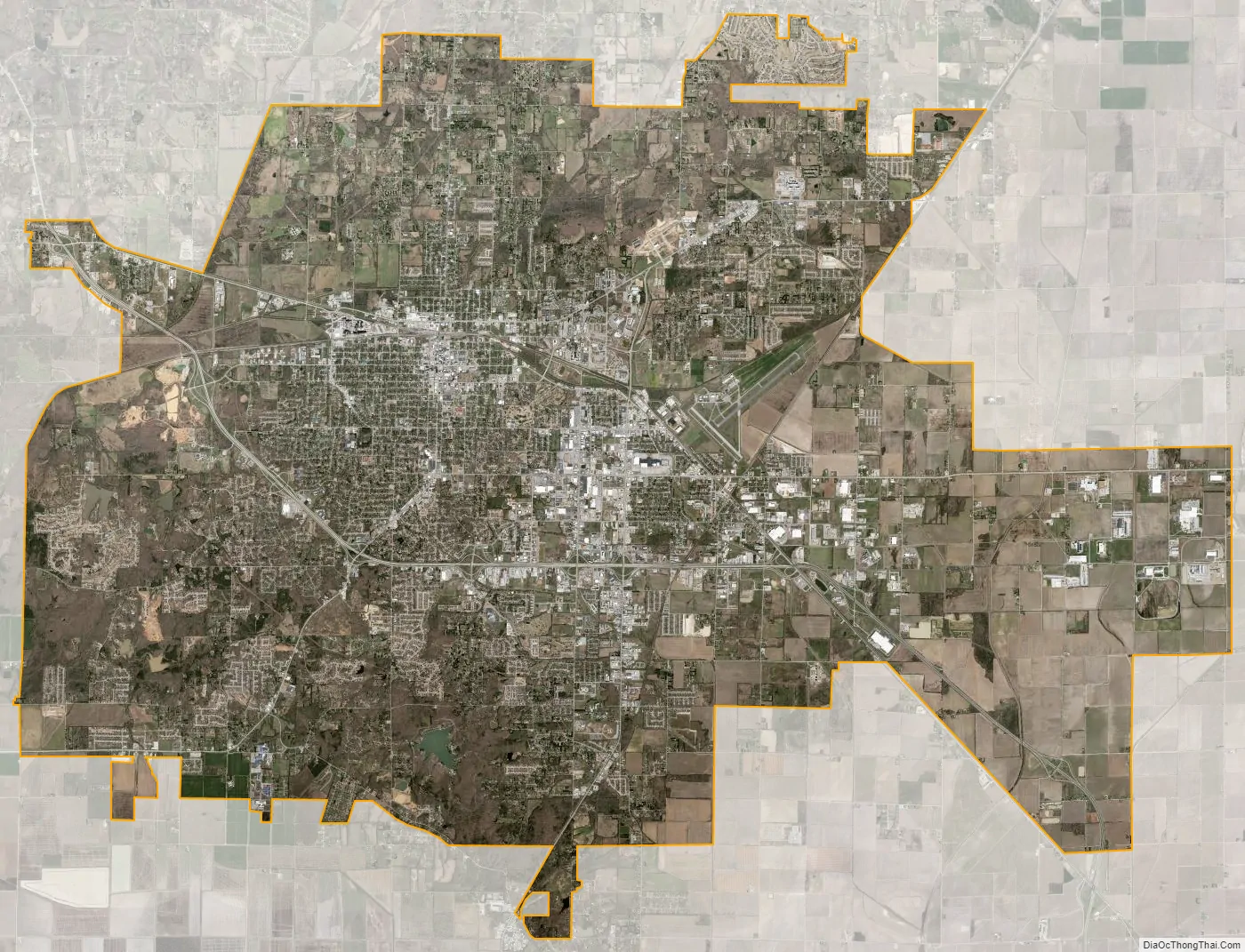
Jonesboro city Satellite Map
Geography
Jonesboro is located at 35°49′41″N 90°41′39″W / 35.82806°N 90.69417°W / 35.82806; -90.69417 (35.828067, -90.694048) atop Crowley’s Ridge in northeastern Arkansas.
According to the United States Census Bureau, the city has a total area of 80.5 square miles (208.4 km), of which 79.9 square miles (206.9 km) is land and 0.58 square miles (1.5 km), or 0.72%, is water.
Climate
Jonesboro has a humid subtropical climate (Köppen climate classification Cfa).
See also
Map of Arkansas State and its subdivision:- Arkansas
- Ashley
- Baxter
- Benton
- Boone
- Bradley
- Calhoun
- Carroll
- Chicot
- Clark
- Clay
- Cleburne
- Cleveland
- Columbia
- Conway
- Craighead
- Crawford
- Crittenden
- Cross
- Dallas
- Desha
- Drew
- Faulkner
- Franklin
- Fulton
- Garland
- Grant
- Greene
- Hempstead
- Hot Spring
- Howard
- Independence
- Izard
- Jackson
- Jefferson
- Johnson
- Lafayette
- Lawrence
- Lee
- Lincoln
- Little River
- Logan
- Lonoke
- Madison
- Marion
- Miller
- Mississippi
- Monroe
- Montgomery
- Nevada
- Newton
- Ouachita
- Perry
- Phillips
- Pike
- Poinsett
- Polk
- Pope
- Prairie
- Pulaski
- Randolph
- Saint Francis
- Saline
- Scott
- Searcy
- Sebastian
- Sevier
- Sharp
- Stone
- Union
- Van Buren
- Washington
- White
- Woodruff
- Yell
- Alabama
- Alaska
- Arizona
- Arkansas
- California
- Colorado
- Connecticut
- Delaware
- District of Columbia
- Florida
- Georgia
- Hawaii
- Idaho
- Illinois
- Indiana
- Iowa
- Kansas
- Kentucky
- Louisiana
- Maine
- Maryland
- Massachusetts
- Michigan
- Minnesota
- Mississippi
- Missouri
- Montana
- Nebraska
- Nevada
- New Hampshire
- New Jersey
- New Mexico
- New York
- North Carolina
- North Dakota
- Ohio
- Oklahoma
- Oregon
- Pennsylvania
- Rhode Island
- South Carolina
- South Dakota
- Tennessee
- Texas
- Utah
- Vermont
- Virginia
- Washington
- West Virginia
- Wisconsin
- Wyoming