Judsonia is a city in White County, Arkansas, United States. Stan Robinson is the current mayor. The population was 2,019 at the 2010 census.
| Name: | Judsonia city |
|---|---|
| LSAD Code: | 25 |
| LSAD Description: | city (suffix) |
| State: | Arkansas |
| County: | White County |
| Elevation: | 213 ft (65 m) |
| Total Area: | 2.90 sq mi (7.52 km²) |
| Land Area: | 2.89 sq mi (7.48 km²) |
| Water Area: | 0.02 sq mi (0.04 km²) |
| Total Population: | 1,854 |
| Population Density: | 642.19/sq mi (247.95/km²) |
| ZIP code: | 72081 |
| Area code: | 501 |
| FIPS code: | 0536040 |
| GNISfeature ID: | 0077392 |
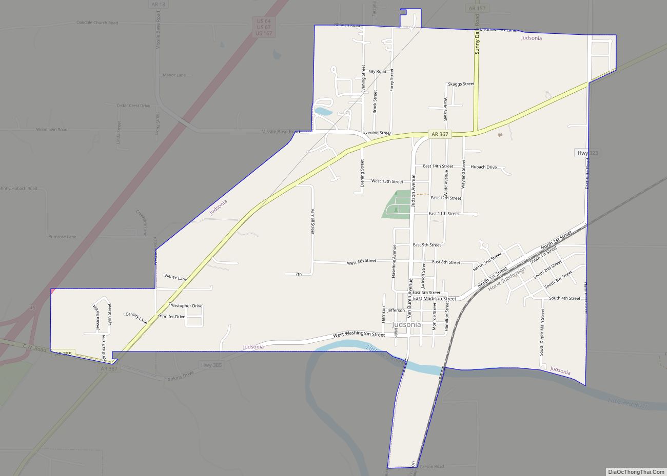
Online Interactive Map
Click on ![]() to view map in "full screen" mode.
to view map in "full screen" mode.
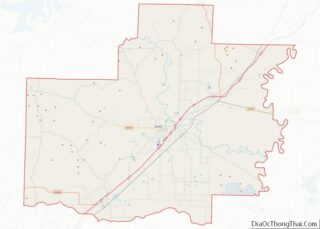
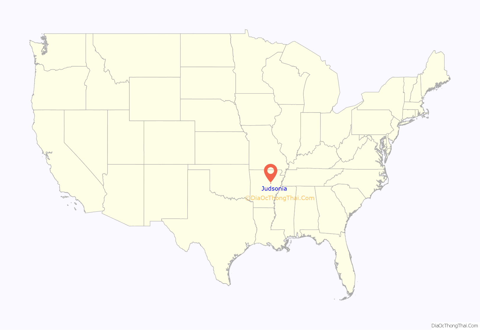
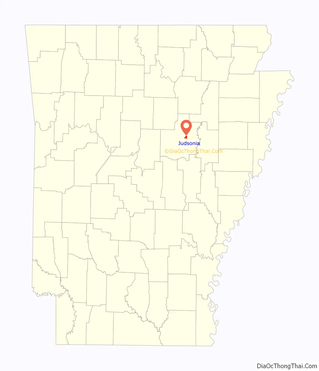
Judsonia location map. Where is Judsonia city?
History
Originally known as Prospect Bluff, the town was founded in 1840 by Erastus Gregory. In 1871, a Baptist school, Judson University, was established in the area. A few months later, the name Prospect Bluff was changed to Judsonia, after the Baptist missionary Adoniram Judson, to help promote the school, which drew many northerners to the area.
Though the school closed in 1883, the town streets still bear the names of several well-known 19th-century Baptists: Judson and Hasseltine (after Adoniram Judson and his wife, Ann Hasseltine Judson), Wayland (after Francis Wayland, president of Brown University in Rhode Island), Wade (after the missionary Jonathan Wade) and Boardman (after the missionary George Boardman, whose widow, Sarah Hall Boardman became Judson’s second wife).
On the evening of March 21, 1952, tornadoes swept Arkansas leaving 111 dead. Fifty of those fatalities were in Judsonia and the near vicinity. It was reported that the only building in the town not damaged was the Methodist church, which is in the city’s downtown area along Van Buren Street.
That’s Judsonia by William Ewing Orr (1957, White County Printing Company) is a history of the community. Judsonia has a yearly festival called Prospect Bluff Days in honor of the towns origins.
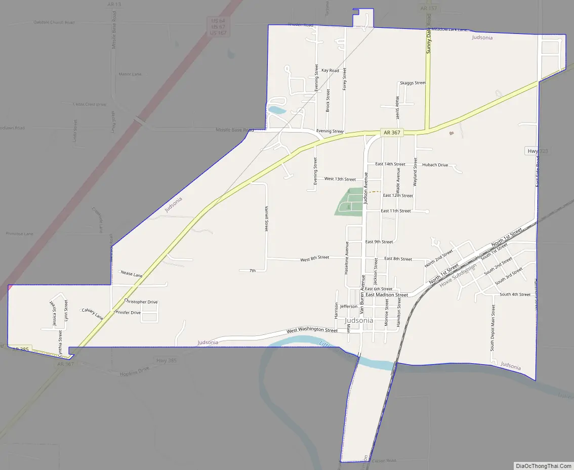
Judsonia Road Map
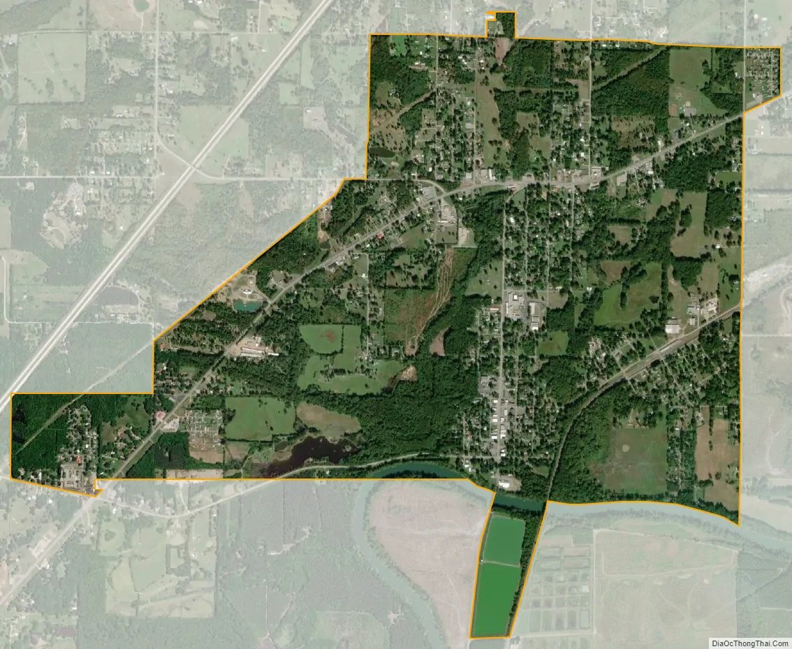
Judsonia city Satellite Map
Geography
According to the United States Census Bureau, the city has a total area of 3.0 square miles (7.8 km), of which 3.0 square miles (7.8 km) is land and 0.04 square miles (0.10 km) (1.31%) is water.
See also
Map of Arkansas State and its subdivision:- Arkansas
- Ashley
- Baxter
- Benton
- Boone
- Bradley
- Calhoun
- Carroll
- Chicot
- Clark
- Clay
- Cleburne
- Cleveland
- Columbia
- Conway
- Craighead
- Crawford
- Crittenden
- Cross
- Dallas
- Desha
- Drew
- Faulkner
- Franklin
- Fulton
- Garland
- Grant
- Greene
- Hempstead
- Hot Spring
- Howard
- Independence
- Izard
- Jackson
- Jefferson
- Johnson
- Lafayette
- Lawrence
- Lee
- Lincoln
- Little River
- Logan
- Lonoke
- Madison
- Marion
- Miller
- Mississippi
- Monroe
- Montgomery
- Nevada
- Newton
- Ouachita
- Perry
- Phillips
- Pike
- Poinsett
- Polk
- Pope
- Prairie
- Pulaski
- Randolph
- Saint Francis
- Saline
- Scott
- Searcy
- Sebastian
- Sevier
- Sharp
- Stone
- Union
- Van Buren
- Washington
- White
- Woodruff
- Yell
- Alabama
- Alaska
- Arizona
- Arkansas
- California
- Colorado
- Connecticut
- Delaware
- District of Columbia
- Florida
- Georgia
- Hawaii
- Idaho
- Illinois
- Indiana
- Iowa
- Kansas
- Kentucky
- Louisiana
- Maine
- Maryland
- Massachusetts
- Michigan
- Minnesota
- Mississippi
- Missouri
- Montana
- Nebraska
- Nevada
- New Hampshire
- New Jersey
- New Mexico
- New York
- North Carolina
- North Dakota
- Ohio
- Oklahoma
- Oregon
- Pennsylvania
- Rhode Island
- South Carolina
- South Dakota
- Tennessee
- Texas
- Utah
- Vermont
- Virginia
- Washington
- West Virginia
- Wisconsin
- Wyoming