Mayflower is a city in Faulkner County, Arkansas, United States. The population was 2,234 at the 2010 census, up from 1,631 at the 2000 census.
| Name: | Mayflower city |
|---|---|
| LSAD Code: | 25 |
| LSAD Description: | city (suffix) |
| State: | Arkansas |
| County: | Faulkner County |
| Elevation: | 282 ft (86 m) |
| Total Area: | 4.05 sq mi (10.50 km²) |
| Land Area: | 3.94 sq mi (10.20 km²) |
| Water Area: | 0.12 sq mi (0.30 km²) |
| Total Population: | 1,984 |
| Population Density: | 503.55/sq mi (194.44/km²) |
| ZIP code: | 72106 |
| Area code: | 501 |
| FIPS code: | 0544750 |
| GNISfeature ID: | 2405041 |
| Website: | cityofmayflower.com |
Online Interactive Map
Click on ![]() to view map in "full screen" mode.
to view map in "full screen" mode.
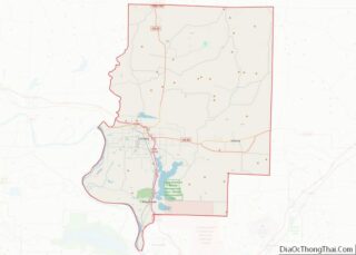
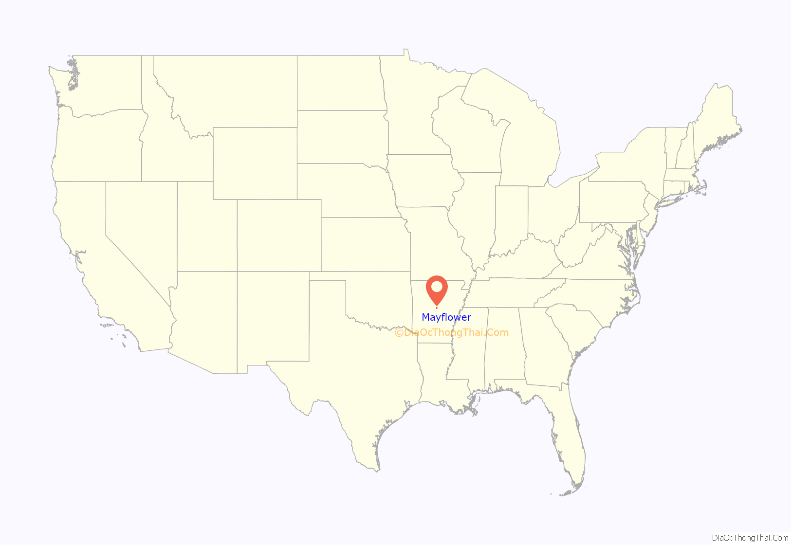
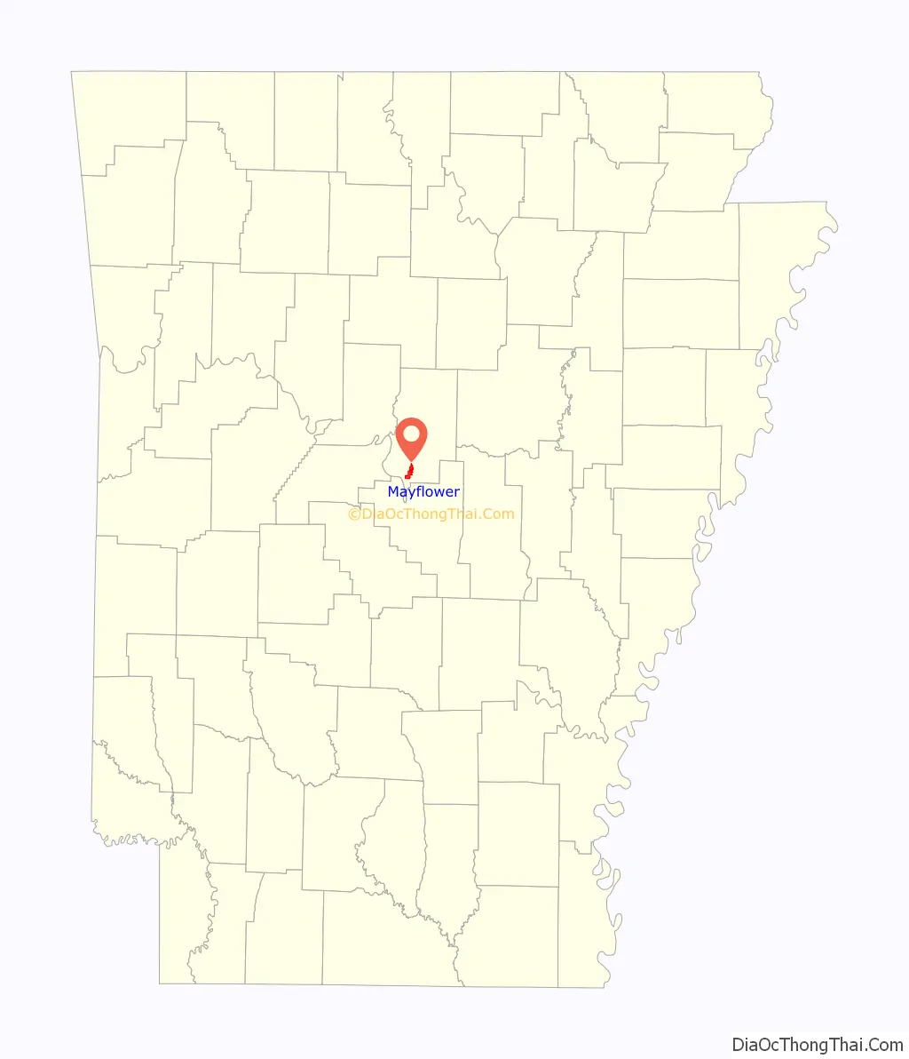
Mayflower location map. Where is Mayflower city?
History
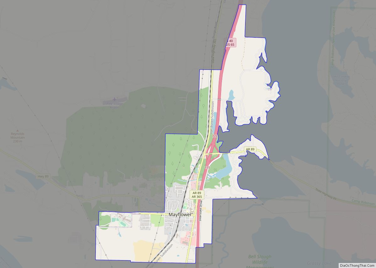
Mayflower is a small town located along Interstate 40 southeast of Conway (Faulkner County) and northwest of Little Rock (Pulaski County). Located on the southwestern edge of Lake Conway, Mayflower is particularly known for its fishing. Like many of the smaller towns of Faulkner County, such as Vilonia and Greenbrier, Mayflower offers a rural lifestyle within a short drive of Conway and Little Rock, where many of its residents commute to work. It was incorporated as a town in Arkansas on March 6, 1928.
The area’s earliest European settlers were Loyalists, known then as Tories, who moved westward in order to flee the Revolutionary War. Families such as the Flannagins and Massengills arrived around 1778 and settled near the mouth of Palarm Creek. However, local tribes of Native Americans had inhabited this region for centuries, principally the Quapaw. Yet, other indigenous groups were in this area now known as part of the Great Plains Cultural Area.
Like most of Arkansas, the land was heavily wooded and was therefore logged extensively until the turn of the twentieth century. Cotton plantations existed during the American Civil War owing to the river bottom’s fertile soil. This would later give way to sharecroppers and modern farming. This presents the largest source of the local economy today, although some small businesses exist in the town.
The 2013 Mayflower oil spill occurred on March 29, 2013, when an Exxon Mobil pipeline carrying heavy crude oil ruptured near Mayflower, spilling thousands of barrels of oil. This caused the evacuation of 22 homes as well as extensive damage to other local properties and the local ecosystem.
2014 tornado
Mayflower was hit by a violent EF4 tornado before 8:00 p.m. on April 27, 2014.
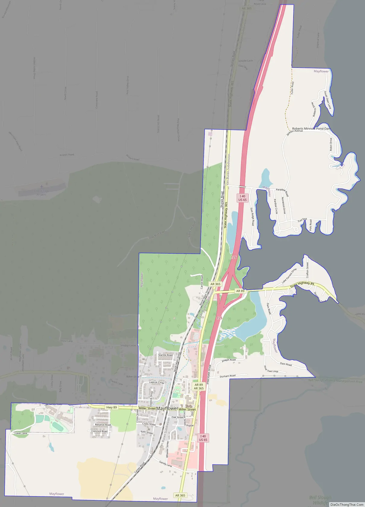
Mayflower Road Map
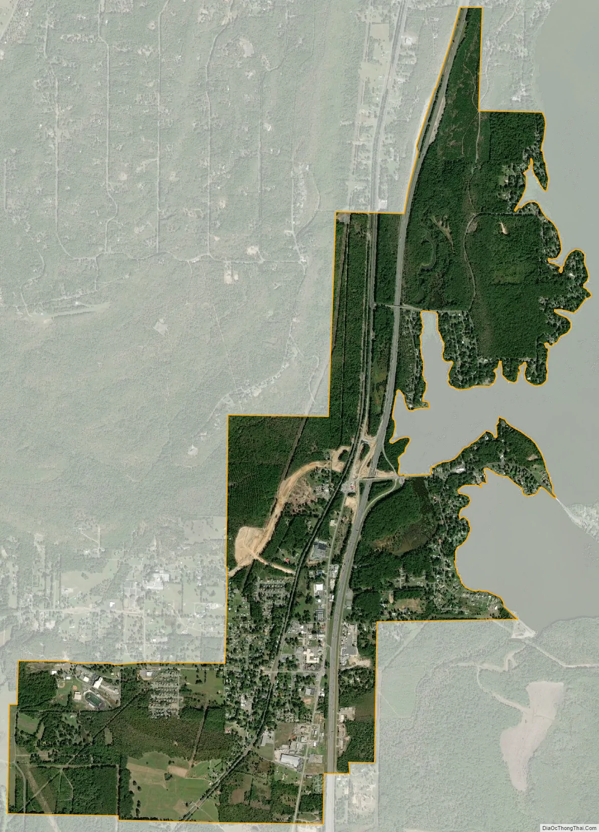
Mayflower city Satellite Map
Geography
Mayflower is located in southern Faulkner County at 34°58′5″N 92°25′11″W / 34.96806°N 92.41972°W / 34.96806; -92.41972 (34.968118, -92.419603). The Interstate 40/US 65 freeway passes along the eastern edge of the city, with access from Exit 135 (Arkansas Highway 89). I-40 leads southeast 20 miles (32 km) to Little Rock, the state capital, and north 10 miles (16 km) to Conway, the Faulkner County seat.
Mayflower has a total area of 4.0 square miles (10.4 km), of which 4.0 square miles (10.3 km) is land and 0.04 square miles (0.1 km), or 1.18%, is water.
See also
Map of Arkansas State and its subdivision:- Arkansas
- Ashley
- Baxter
- Benton
- Boone
- Bradley
- Calhoun
- Carroll
- Chicot
- Clark
- Clay
- Cleburne
- Cleveland
- Columbia
- Conway
- Craighead
- Crawford
- Crittenden
- Cross
- Dallas
- Desha
- Drew
- Faulkner
- Franklin
- Fulton
- Garland
- Grant
- Greene
- Hempstead
- Hot Spring
- Howard
- Independence
- Izard
- Jackson
- Jefferson
- Johnson
- Lafayette
- Lawrence
- Lee
- Lincoln
- Little River
- Logan
- Lonoke
- Madison
- Marion
- Miller
- Mississippi
- Monroe
- Montgomery
- Nevada
- Newton
- Ouachita
- Perry
- Phillips
- Pike
- Poinsett
- Polk
- Pope
- Prairie
- Pulaski
- Randolph
- Saint Francis
- Saline
- Scott
- Searcy
- Sebastian
- Sevier
- Sharp
- Stone
- Union
- Van Buren
- Washington
- White
- Woodruff
- Yell
- Alabama
- Alaska
- Arizona
- Arkansas
- California
- Colorado
- Connecticut
- Delaware
- District of Columbia
- Florida
- Georgia
- Hawaii
- Idaho
- Illinois
- Indiana
- Iowa
- Kansas
- Kentucky
- Louisiana
- Maine
- Maryland
- Massachusetts
- Michigan
- Minnesota
- Mississippi
- Missouri
- Montana
- Nebraska
- Nevada
- New Hampshire
- New Jersey
- New Mexico
- New York
- North Carolina
- North Dakota
- Ohio
- Oklahoma
- Oregon
- Pennsylvania
- Rhode Island
- South Carolina
- South Dakota
- Tennessee
- Texas
- Utah
- Vermont
- Virginia
- Washington
- West Virginia
- Wisconsin
- Wyoming