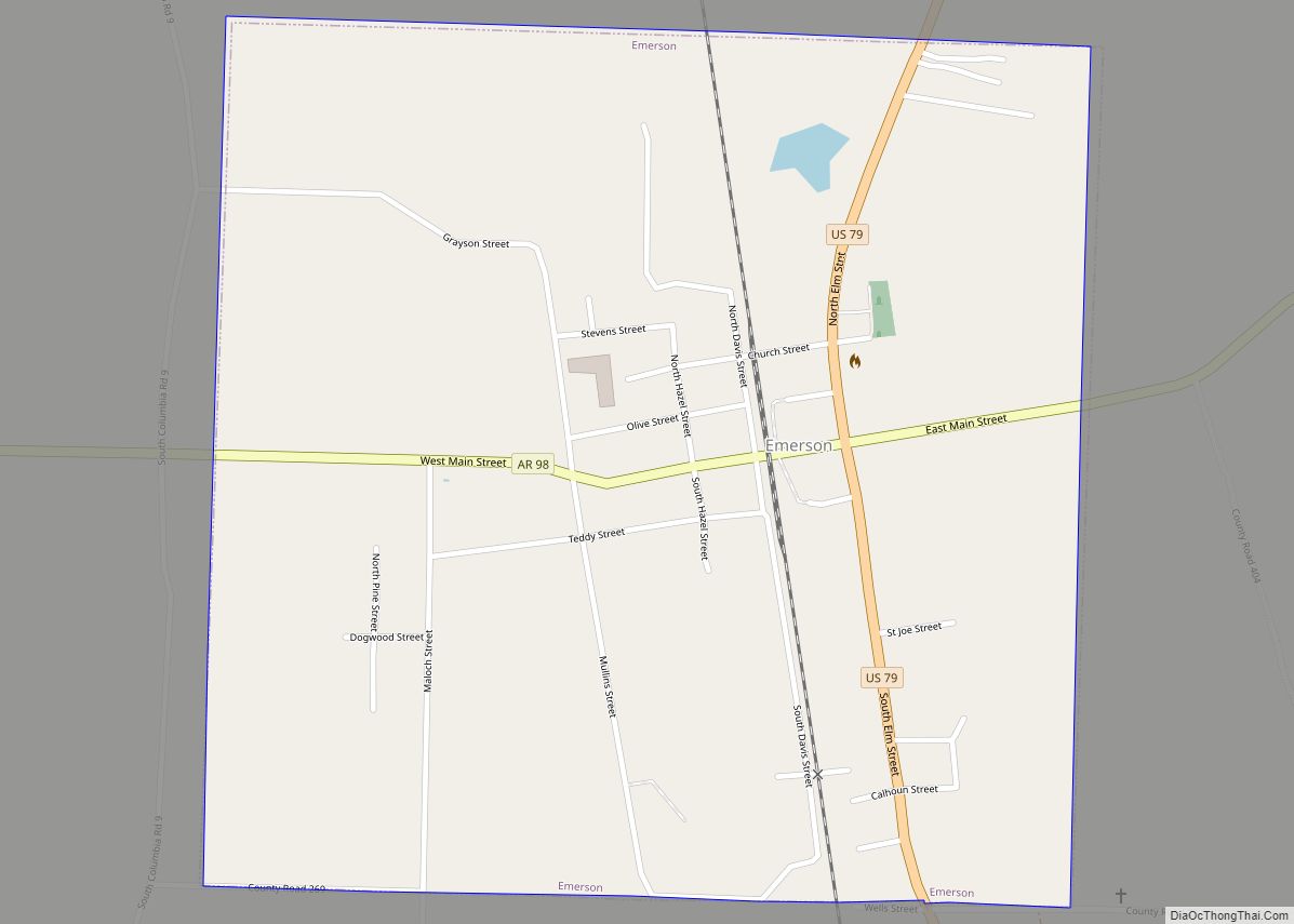
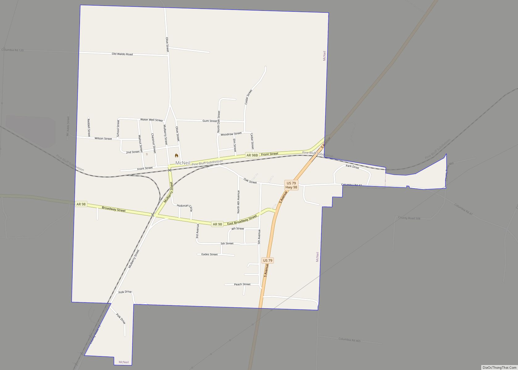
McNeil is a town in Columbia County, Arkansas, United States. The population was 516 at the 2010 census, down from 662 in 2000. The community was named after William B. McNeil, founder of the College Hill Academy.
| Name: | McNeil city |
|---|---|
| LSAD Code: | 25 |
| LSAD Description: | city (suffix) |
| State: | Arkansas |
| County: | Columbia County |
| Elevation: | 331 ft (101 m) |
| Total Area: | 1.27 sq mi (3.28 km²) |
| Land Area: | 1.27 sq mi (3.28 km²) |
| Water Area: | 0.00 sq mi (0.00 km²) |
| Total Population: | 381 |
| Population Density: | 300.47/sq mi (116.02/km²) |
| ZIP code: | 71752 |
| Area code: | 870 |
| FIPS code: | 0543100 |
| GNISfeature ID: | 0058155 |
Online Interactive Map
Click on ![]() to view map in "full screen" mode.
to view map in "full screen" mode.
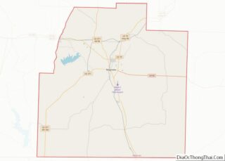
McNeil location map. Where is McNeil city?
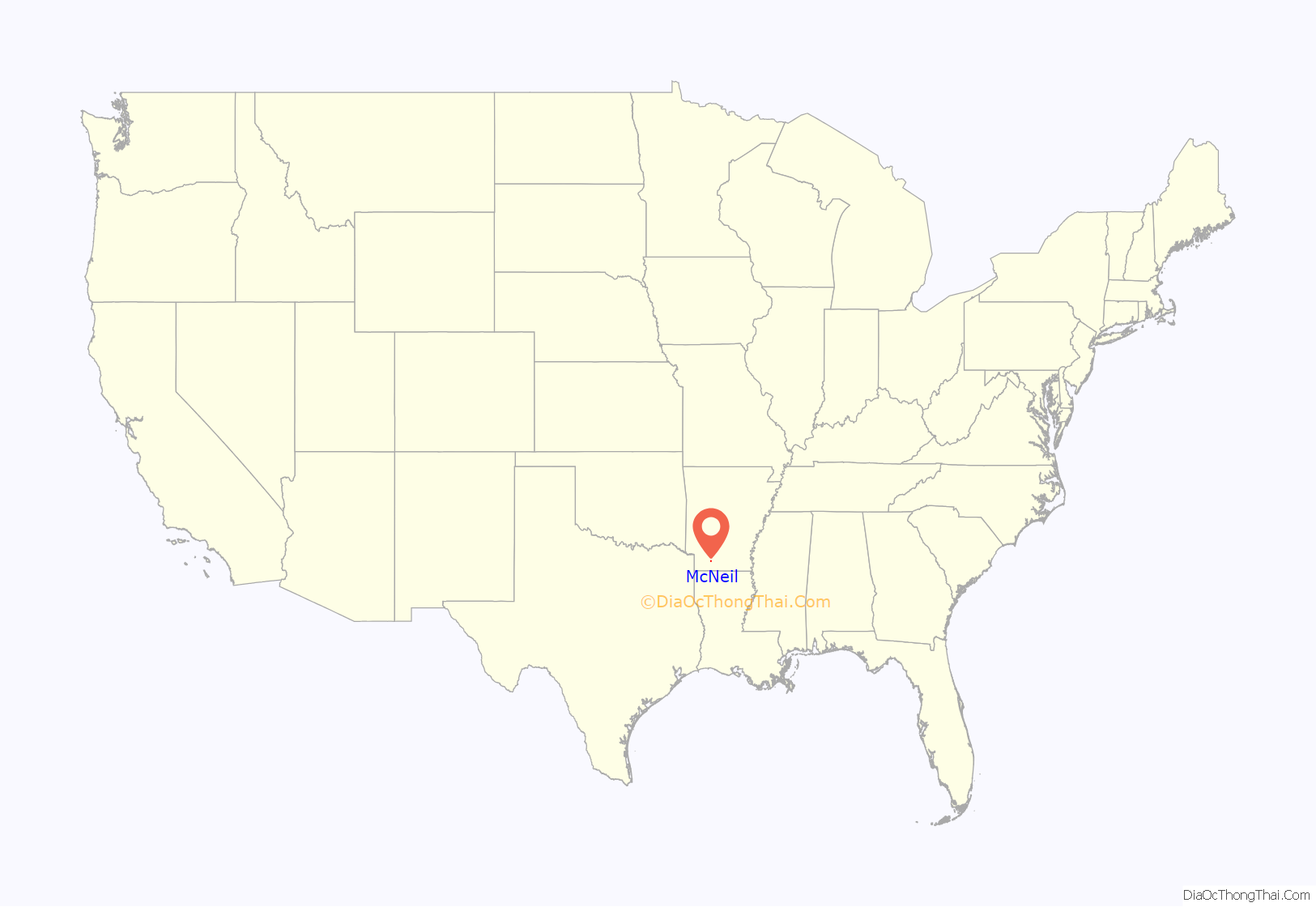
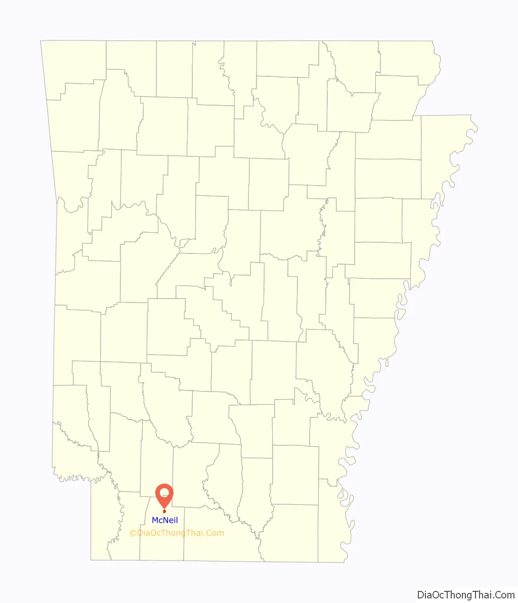
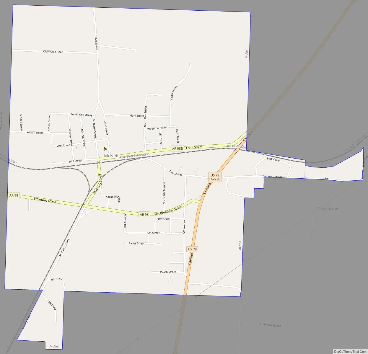
McNeil Road Map
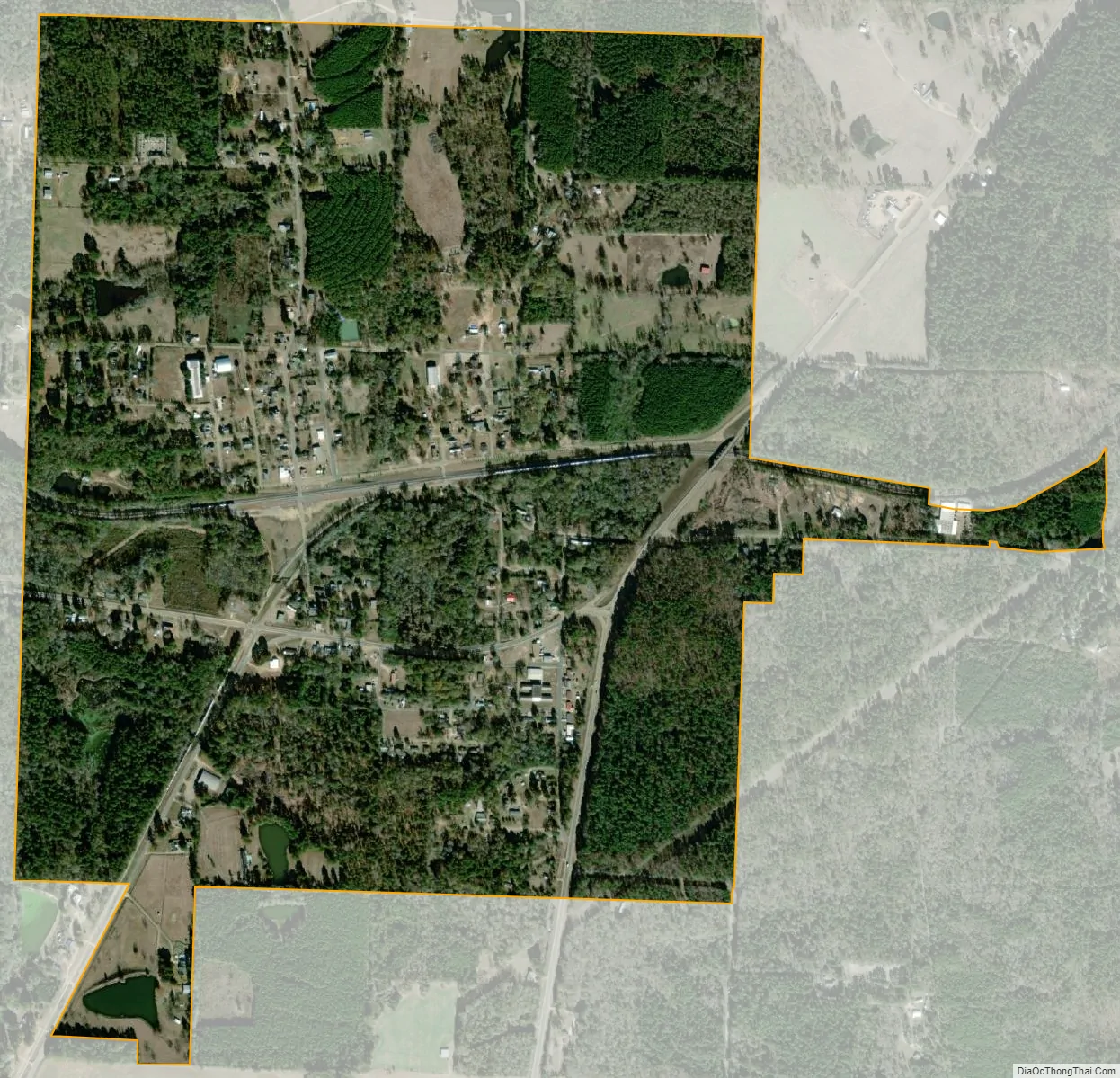
McNeil city Satellite Map
Geography
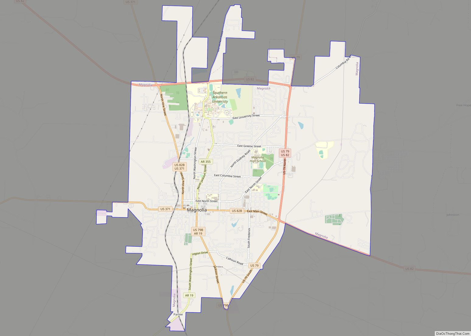
McNeil is located in northern Columbia County at 33°20′46″N 93°12′30″W / 33.34611°N 93.20833°W / 33.34611; -93.20833 (33.346030, -93.208276). It is 6 miles (10 km) north of downtown Magnolia, the county seat.
According to the United States Census Bureau, the town has a total area of 1.4 square miles (3.5 km), all land.
Logoly State Park, part of the Arkansas State Parks System, is located just east of McNeil, off Highway 79. Most of Logoly’s 368 acres (1.49 km) comprise a State Natural Area that includes unique plant species and mineral springs.
See also
Map of Arkansas State and its subdivision:- Arkansas
- Ashley
- Baxter
- Benton
- Boone
- Bradley
- Calhoun
- Carroll
- Chicot
- Clark
- Clay
- Cleburne
- Cleveland
- Columbia
- Conway
- Craighead
- Crawford
- Crittenden
- Cross
- Dallas
- Desha
- Drew
- Faulkner
- Franklin
- Fulton
- Garland
- Grant
- Greene
- Hempstead
- Hot Spring
- Howard
- Independence
- Izard
- Jackson
- Jefferson
- Johnson
- Lafayette
- Lawrence
- Lee
- Lincoln
- Little River
- Logan
- Lonoke
- Madison
- Marion
- Miller
- Mississippi
- Monroe
- Montgomery
- Nevada
- Newton
- Ouachita
- Perry
- Phillips
- Pike
- Poinsett
- Polk
- Pope
- Prairie
- Pulaski
- Randolph
- Saint Francis
- Saline
- Scott
- Searcy
- Sebastian
- Sevier
- Sharp
- Stone
- Union
- Van Buren
- Washington
- White
- Woodruff
- Yell
- Alabama
- Alaska
- Arizona
- Arkansas
- California
- Colorado
- Connecticut
- Delaware
- District of Columbia
- Florida
- Georgia
- Hawaii
- Idaho
- Illinois
- Indiana
- Iowa
- Kansas
- Kentucky
- Louisiana
- Maine
- Maryland
- Massachusetts
- Michigan
- Minnesota
- Mississippi
- Missouri
- Montana
- Nebraska
- Nevada
- New Hampshire
- New Jersey
- New Mexico
- New York
- North Carolina
- North Dakota
- Ohio
- Oklahoma
- Oregon
- Pennsylvania
- Rhode Island
- South Carolina
- South Dakota
- Tennessee
- Texas
- Utah
- Vermont
- Virginia
- Washington
- West Virginia
- Wisconsin
- Wyoming