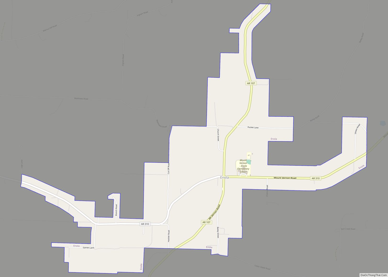
Mount Vernon is a town in Faulkner County, Arkansas, United States. The population was 145 at the 2010 census. It is part of the Little Rock–North Little Rock–Conway Metropolitan Statistical Area.
| Name: | Mount Vernon town |
|---|---|
| LSAD Code: | 43 |
| LSAD Description: | town (suffix) |
| State: | Arkansas |
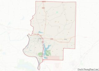
| County: | Faulkner County |
| Elevation: | 423 ft (129 m) |
| Total Area: | 1.01 sq mi (2.62 km²) |
| Land Area: | 1.01 sq mi (2.62 km²) |
| Water Area: | 0.00 sq mi (0.00 km²) |
| Total Population: | 144 |
| Population Density: | 142.43/sq mi (54.99/km²) |
| ZIP code: | 72111 |
| Area code: | 501 |
| FIPS code: | 0548020 |
| GNISfeature ID: | 2406214 |
Online Interactive Map
Click on ![]() to view map in "full screen" mode.
to view map in "full screen" mode.
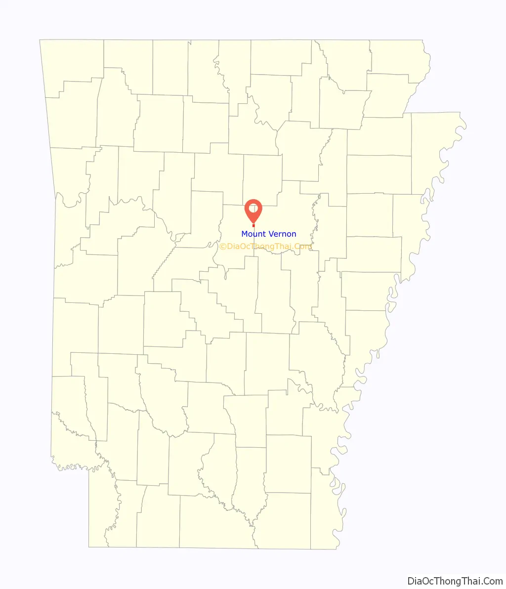
Mount Vernon location map. Where is Mount Vernon town?

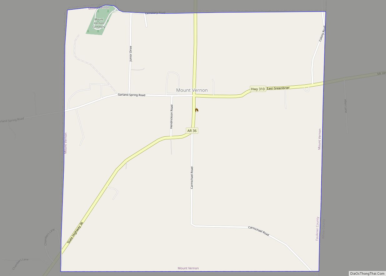
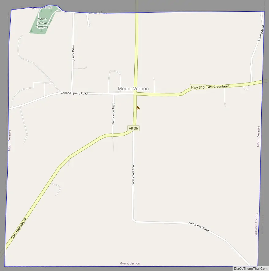
Mount Vernon Road Map
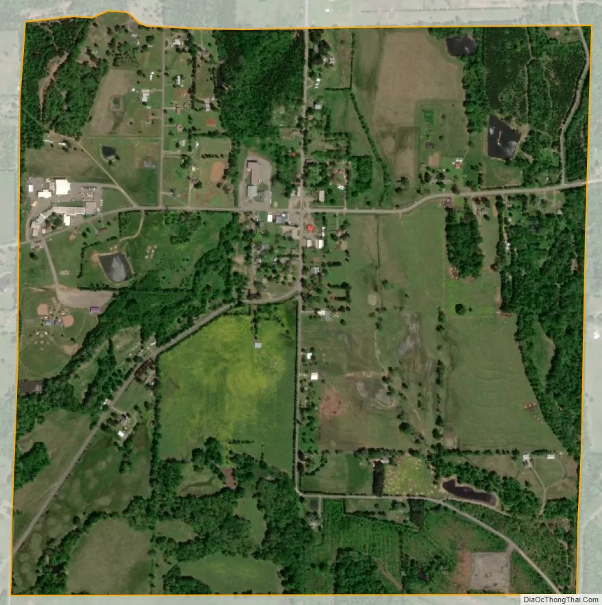
Mount Vernon city Satellite Map
Geography
Mount Vernon is located along the eastern edge of Faulkner County at 35°13′30″N 92°7′29″W / 35.22500°N 92.12472°W / 35.22500; -92.12472 (35.224891, -92.124808). The eastern border of the town follows the White County line.
Arkansas Highway 36 passes through Mount Vernon, leading north 9 miles (14 km) to Rose Bud, and southwest 17 miles (27 km) to U.S. Route 64 at Hamlet. Conway, the Faulkner County seat, is 25 miles (40 km) southwest of Mount Vernon via AR-36 and US-64.
According to the United States Census Bureau, the town of Mount Vernon has a total area of 0.39 square miles (1.0 km), all land.
See also
Map of Arkansas State and its subdivision:- Arkansas
- Ashley
- Baxter
- Benton
- Boone
- Bradley
- Calhoun
- Carroll
- Chicot
- Clark
- Clay
- Cleburne
- Cleveland
- Columbia
- Conway
- Craighead
- Crawford
- Crittenden
- Cross
- Dallas
- Desha
- Drew
- Faulkner
- Franklin
- Fulton
- Garland
- Grant
- Greene
- Hempstead
- Hot Spring
- Howard
- Independence
- Izard
- Jackson
- Jefferson
- Johnson
- Lafayette
- Lawrence
- Lee
- Lincoln
- Little River
- Logan
- Lonoke
- Madison
- Marion
- Miller
- Mississippi
- Monroe
- Montgomery
- Nevada
- Newton
- Ouachita
- Perry
- Phillips
- Pike
- Poinsett
- Polk
- Pope
- Prairie
- Pulaski
- Randolph
- Saint Francis
- Saline
- Scott
- Searcy
- Sebastian
- Sevier
- Sharp
- Stone
- Union
- Van Buren
- Washington
- White
- Woodruff
- Yell
- Alabama
- Alaska
- Arizona
- Arkansas
- California
- Colorado
- Connecticut
- Delaware
- District of Columbia
- Florida
- Georgia
- Hawaii
- Idaho
- Illinois
- Indiana
- Iowa
- Kansas
- Kentucky
- Louisiana
- Maine
- Maryland
- Massachusetts
- Michigan
- Minnesota
- Mississippi
- Missouri
- Montana
- Nebraska
- Nevada
- New Hampshire
- New Jersey
- New Mexico
- New York
- North Carolina
- North Dakota
- Ohio
- Oklahoma
- Oregon
- Pennsylvania
- Rhode Island
- South Carolina
- South Dakota
- Tennessee
- Texas
- Utah
- Vermont
- Virginia
- Washington
- West Virginia
- Wisconsin
- Wyoming