Mountain View is the largest city in and the county seat of Stone County, Arkansas, United States, located in the Ozarks. The city’s economy is largely based on tourism related to its title as the “Folk Music Capital of the World”. The city is also known for outdoors recreation opportunities, including Blanchard Springs Caverns, trout fishing on the White River and the Ozark National Forest.
| Name: | Mountain View city |
|---|---|
| LSAD Code: | 25 |
| LSAD Description: | city (suffix) |
| State: | Arkansas |
| County: | Stone County |
| Elevation: | 755 ft (230 m) |
| Total Area: | 7.30 sq mi (18.91 km²) |
| Land Area: | 7.30 sq mi (18.90 km²) |
| Water Area: | 0.00 sq mi (0.01 km²) |
| Total Population: | 2,877 |
| Population Density: | 394.33/sq mi (152.25/km²) |
| ZIP code: | 72533, 72560 |
| Area code: | 870 |
| FIPS code: | 0547540 |
| GNISfeature ID: | 2404333 |
| Website: | www.cityofmtnview.org |
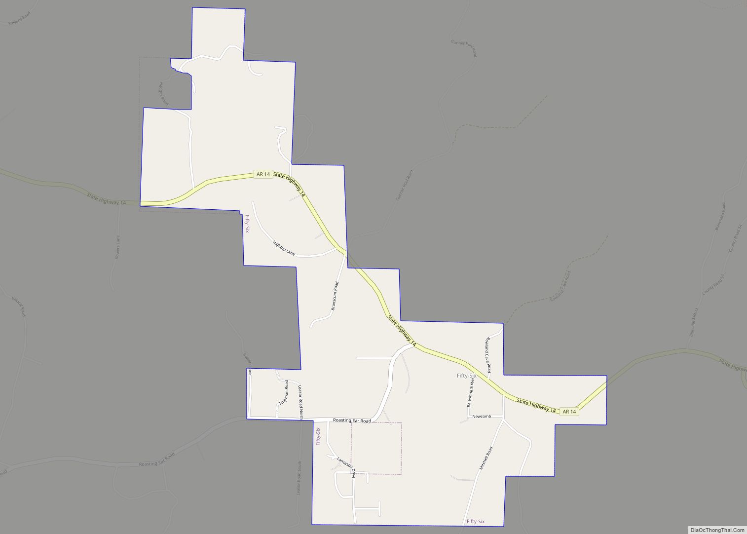
Online Interactive Map
Click on ![]() to view map in "full screen" mode.
to view map in "full screen" mode.
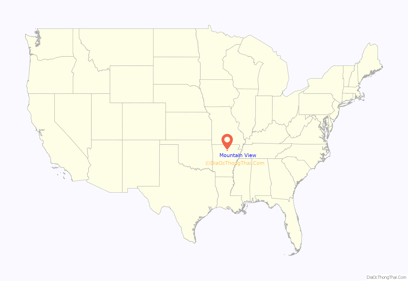
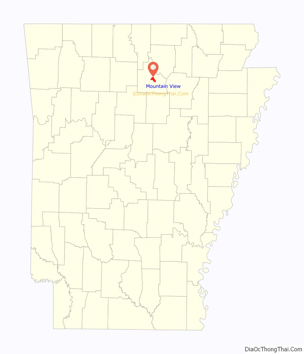
Mountain View location map. Where is Mountain View city?
History
The town’s name is derived from its location in a valley bordered by the Blue Mountain Range of the Ozark Mountains. Prior to the founding of Mountain View in 1890, the town of Riggsville, established in 1819 by Thomas Augustus Riggs, existed immediately to the east remaining until after the Civil War, when towns with southern sympathies were to be renamed or moved altogether.
Mountain View was incorporated on August 14, 1890.
A tornado on April 14, 1996, rated F4 on the Fujita scale killed NFL quarterback Kurt Warner’s mother-in-law and father in-law. Another EF4 tornado caused major damage to the town on February 5, 2008 in the 2008 Super Tuesday tornado outbreak, the deadliest tornado outbreak in two decades.
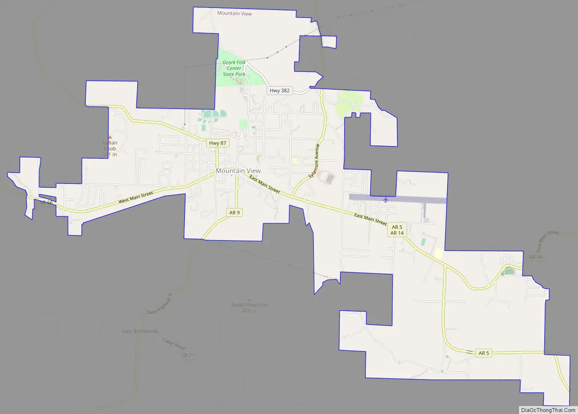
Mountain View Road Map
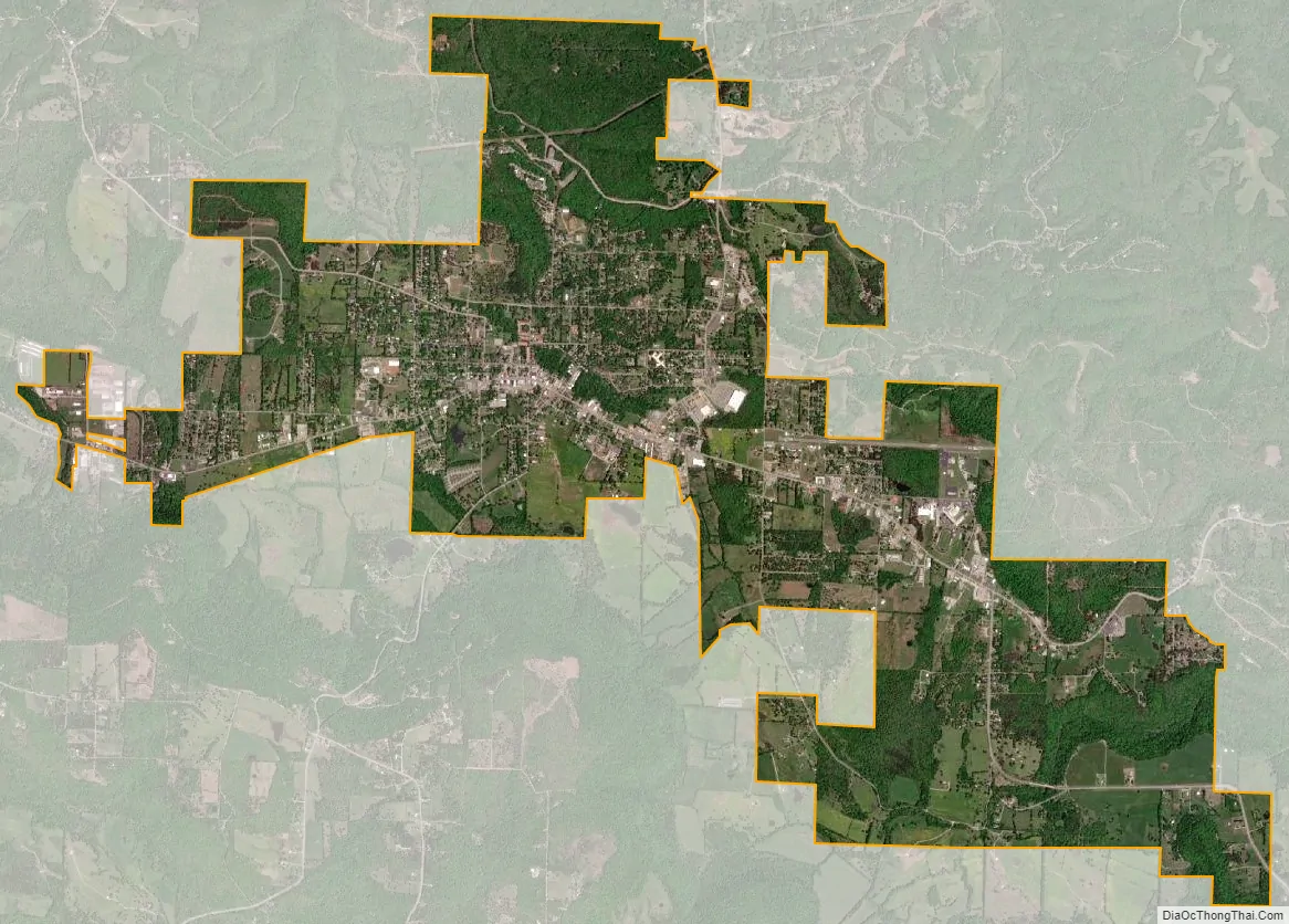
Mountain View city Satellite Map
Geography
Mountain View is located at 35°51′54″N 92°6′31″W / 35.86500°N 92.10861°W / 35.86500; -92.10861 (35.864886, −92.108497).
According to the United States Census Bureau, the city has a total area of 6.8 square miles (17.7 km), of which 6.8 square miles (17.7 km) is land and 0.15% is water.
Climate
The climate in this area is characterized by hot, humid summers and generally mild to cool winters. According to the Köppen Climate Classification system, Mountain View has a humid subtropical climate, abbreviated “Cfa” on climate maps.
See also
Map of Arkansas State and its subdivision:- Arkansas
- Ashley
- Baxter
- Benton
- Boone
- Bradley
- Calhoun
- Carroll
- Chicot
- Clark
- Clay
- Cleburne
- Cleveland
- Columbia
- Conway
- Craighead
- Crawford
- Crittenden
- Cross
- Dallas
- Desha
- Drew
- Faulkner
- Franklin
- Fulton
- Garland
- Grant
- Greene
- Hempstead
- Hot Spring
- Howard
- Independence
- Izard
- Jackson
- Jefferson
- Johnson
- Lafayette
- Lawrence
- Lee
- Lincoln
- Little River
- Logan
- Lonoke
- Madison
- Marion
- Miller
- Mississippi
- Monroe
- Montgomery
- Nevada
- Newton
- Ouachita
- Perry
- Phillips
- Pike
- Poinsett
- Polk
- Pope
- Prairie
- Pulaski
- Randolph
- Saint Francis
- Saline
- Scott
- Searcy
- Sebastian
- Sevier
- Sharp
- Stone
- Union
- Van Buren
- Washington
- White
- Woodruff
- Yell
- Alabama
- Alaska
- Arizona
- Arkansas
- California
- Colorado
- Connecticut
- Delaware
- District of Columbia
- Florida
- Georgia
- Hawaii
- Idaho
- Illinois
- Indiana
- Iowa
- Kansas
- Kentucky
- Louisiana
- Maine
- Maryland
- Massachusetts
- Michigan
- Minnesota
- Mississippi
- Missouri
- Montana
- Nebraska
- Nevada
- New Hampshire
- New Jersey
- New Mexico
- New York
- North Carolina
- North Dakota
- Ohio
- Oklahoma
- Oregon
- Pennsylvania
- Rhode Island
- South Carolina
- South Dakota
- Tennessee
- Texas
- Utah
- Vermont
- Virginia
- Washington
- West Virginia
- Wisconsin
- Wyoming