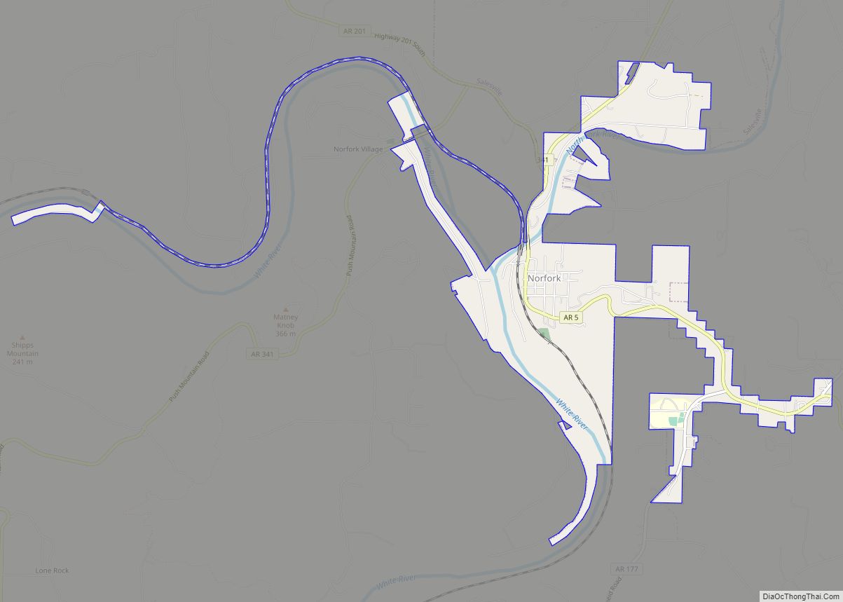
Norfork is a city in Baxter County, Arkansas, United States. The population was 550 at the 2010 census.
| Name: | Norfork city |
|---|---|
| LSAD Code: | 25 |
| LSAD Description: | city (suffix) |
| State: | Arkansas |
| County: | Baxter County |
| Elevation: | 479 ft (146 m) |
| Total Area: | 2.41 sq mi (6.24 km²) |
| Land Area: | 2.23 sq mi (5.76 km²) |
| Water Area: | 0.18 sq mi (0.48 km²) |
| Total Population: | 465 |
| Population Density: | 208.99/sq mi (80.68/km²) |
| ZIP code: | 72658-72659 |
| Area code: | 870 |
| FIPS code: | 0550000 |
| GNISfeature ID: | 2404385 |
| Website: | cityofnorfork.org |
Online Interactive Map
Click on ![]() to view map in "full screen" mode.
to view map in "full screen" mode.
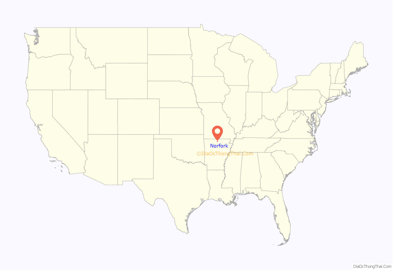
Norfork location map. Where is Norfork city?
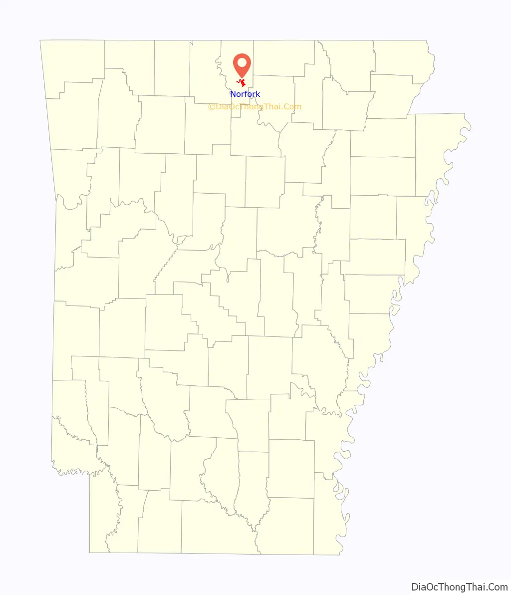
Norfork Road Map
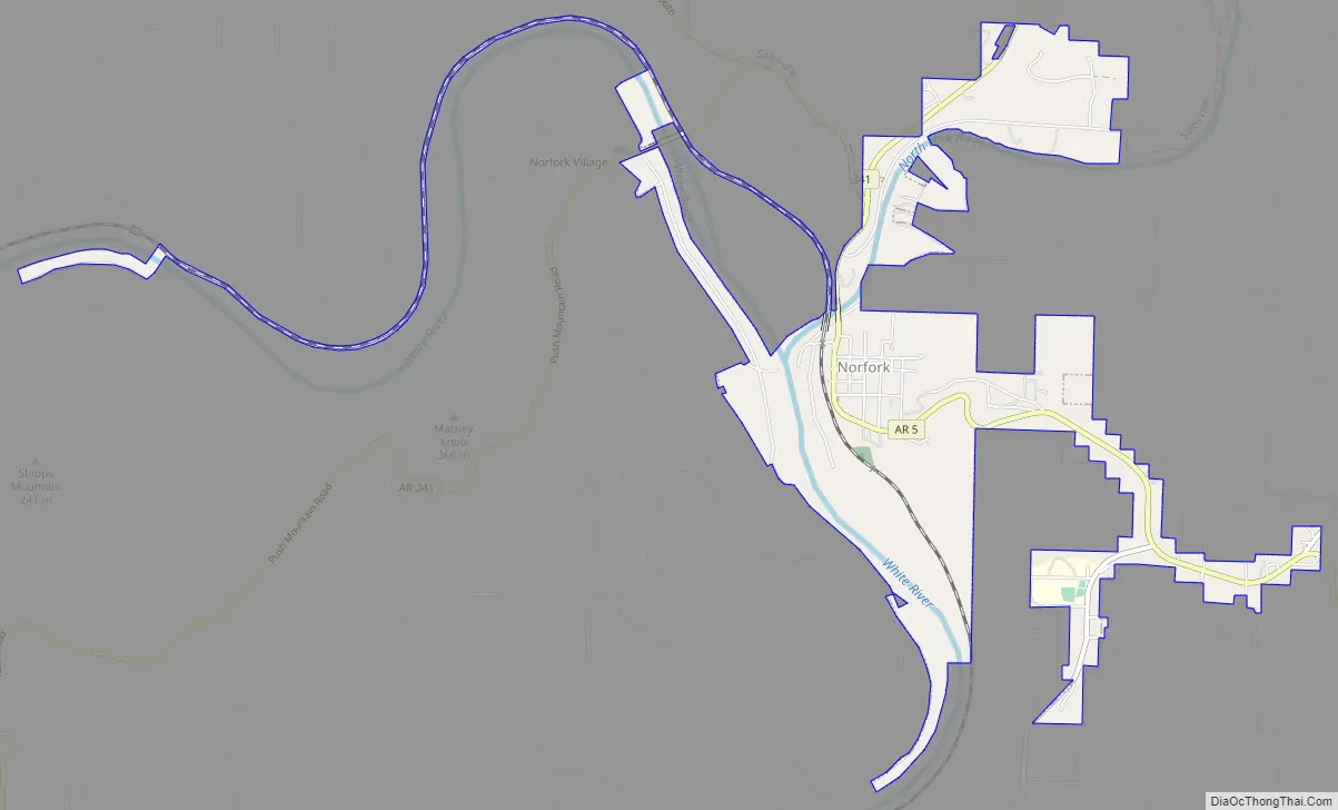
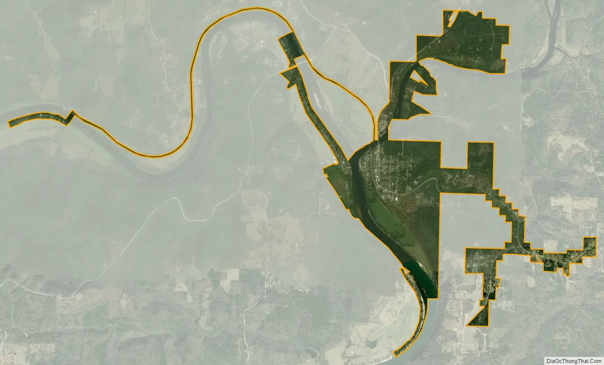
Norfork city Satellite Map
Geography
According to the United States Census Bureau, the city has a total area of 2.5 square miles (6.5 km), of which 2.2 square miles (5.7 km) is land and 0.3 square miles (0.78 km) (11.74%) is water.
The White River flows 44 miles from Bull Shoals Dam to its confluence with the North Fork River’s tailwater at Norfork.
List Of Highways
- Arkansas Highway 5
- Arkansas Highway 177
See also
Map of Arkansas State and its subdivision:- Arkansas
- Ashley
- Baxter
- Benton
- Boone
- Bradley
- Calhoun
- Carroll
- Chicot
- Clark
- Clay
- Cleburne
- Cleveland
- Columbia
- Conway
- Craighead
- Crawford
- Crittenden
- Cross
- Dallas
- Desha
- Drew
- Faulkner
- Franklin
- Fulton
- Garland
- Grant
- Greene
- Hempstead
- Hot Spring
- Howard
- Independence
- Izard
- Jackson
- Jefferson
- Johnson
- Lafayette
- Lawrence
- Lee
- Lincoln
- Little River
- Logan
- Lonoke
- Madison
- Marion
- Miller
- Mississippi
- Monroe
- Montgomery
- Nevada
- Newton
- Ouachita
- Perry
- Phillips
- Pike
- Poinsett
- Polk
- Pope
- Prairie
- Pulaski
- Randolph
- Saint Francis
- Saline
- Scott
- Searcy
- Sebastian
- Sevier
- Sharp
- Stone
- Union
- Van Buren
- Washington
- White
- Woodruff
- Yell
- Alabama
- Alaska
- Arizona
- Arkansas
- California
- Colorado
- Connecticut
- Delaware
- District of Columbia
- Florida
- Georgia
- Hawaii
- Idaho
- Illinois
- Indiana
- Iowa
- Kansas
- Kentucky
- Louisiana
- Maine
- Maryland
- Massachusetts
- Michigan
- Minnesota
- Mississippi
- Missouri
- Montana
- Nebraska
- Nevada
- New Hampshire
- New Jersey
- New Mexico
- New York
- North Carolina
- North Dakota
- Ohio
- Oklahoma
- Oregon
- Pennsylvania
- Rhode Island
- South Carolina
- South Dakota
- Tennessee
- Texas
- Utah
- Vermont
- Virginia
- Washington
- West Virginia
- Wisconsin
- Wyoming