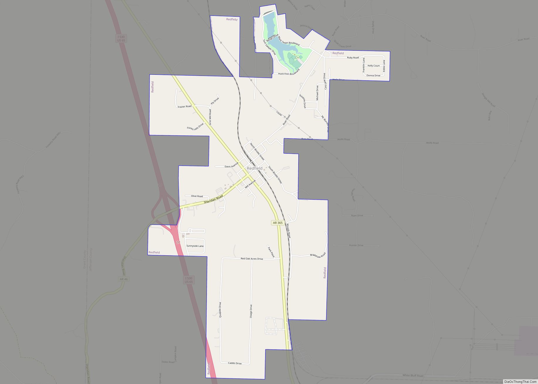
Redfield is a small city in the Pine Bluff metropolitan area of northwestern Jefferson County in the U.S. state of Arkansas. It is situated on the Union Pacific Railway (UP) and is approximately 23 miles (37 km) south of Little Rock, the state capital. As of the 2020 census, Redfield has a population of 1,505.
| Name: | Redfield city |
|---|---|
| LSAD Code: | 25 |
| LSAD Description: | city (suffix) |
| State: | Arkansas |
| County: | Jefferson County |
| Founded: | December 20, 1880 (1880-12-20) |
| Incorporated: | October 18, 1898 (1898-10-18) |
| Elevation: | 302 ft (92 m) |
| Total Area: | 3.148 sq mi (8.15 km²) |
| Land Area: | 3.094 sq mi (8.01 km²) |
| Water Area: | 0.054 sq mi (0.14 km²) |
| Total Population: | 1,505 |
| Population Density: | 486.43/sq mi (187.84/km²) |
| ZIP code: | 72132 |
| Area code: | 501 |
| FIPS code: | 0558580 |
| GNISfeature ID: | 58477 |
| Website: | redfieldar.com |
Online Interactive Map
Click on ![]() to view map in "full screen" mode.
to view map in "full screen" mode.
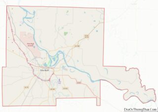
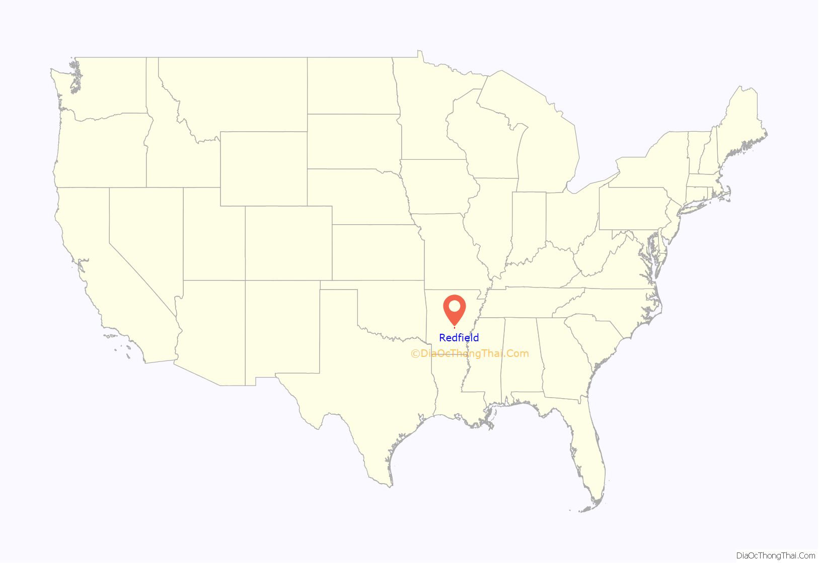
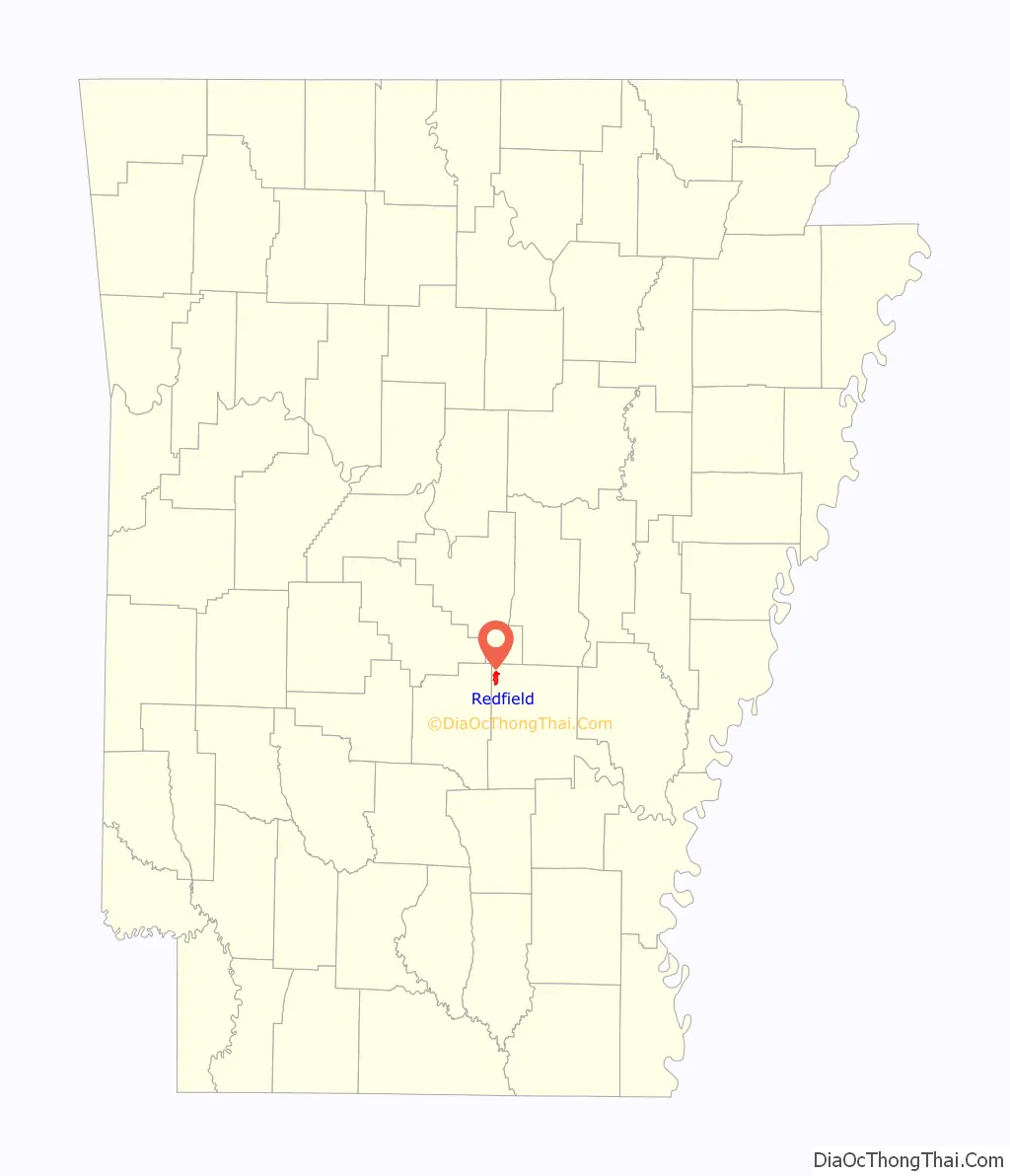
Redfield location map. Where is Redfield city?
History
Following the arrival of the Little Rock, Mississippi River and Texas Railway (L. R., M. R. & T.),, also known as the Arkansas Valley Route, a settlement grew up around the new station named for company president Jared E. Redfield of Essex, Connecticut. The municipality was incorporated by the Jefferson county court on October 18, 1898. Four local properties have been added to the National Register of Historic Places (NRHP): Dollarway Road (1974), West James Street Overpass (1995), Lone Star Baptist Church (2005), and Redfield School Historic District (2014).
Redfield Road Map
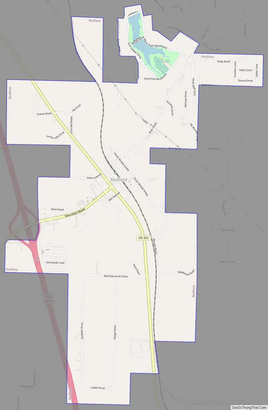
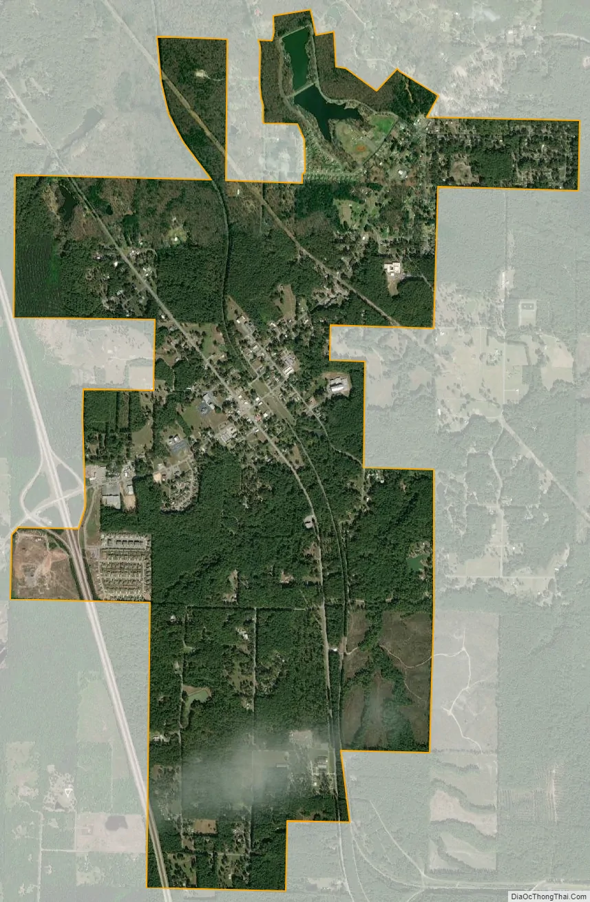
Redfield city Satellite Map
Geography
Redfield is located at 34°26′42″N 92°10′58″W / 34.44500°N 92.18278°W / 34.44500; -92.18278 (34.445119, -92.182870). According to the United States Census Bureau, the city has a total area of 3.148 square miles (8.15 km), of which, 3.094 square miles (8.01 km) of it is land and 0.37% is water.
See also
Map of Arkansas State and its subdivision:- Arkansas
- Ashley
- Baxter
- Benton
- Boone
- Bradley
- Calhoun
- Carroll
- Chicot
- Clark
- Clay
- Cleburne
- Cleveland
- Columbia
- Conway
- Craighead
- Crawford
- Crittenden
- Cross
- Dallas
- Desha
- Drew
- Faulkner
- Franklin
- Fulton
- Garland
- Grant
- Greene
- Hempstead
- Hot Spring
- Howard
- Independence
- Izard
- Jackson
- Jefferson
- Johnson
- Lafayette
- Lawrence
- Lee
- Lincoln
- Little River
- Logan
- Lonoke
- Madison
- Marion
- Miller
- Mississippi
- Monroe
- Montgomery
- Nevada
- Newton
- Ouachita
- Perry
- Phillips
- Pike
- Poinsett
- Polk
- Pope
- Prairie
- Pulaski
- Randolph
- Saint Francis
- Saline
- Scott
- Searcy
- Sebastian
- Sevier
- Sharp
- Stone
- Union
- Van Buren
- Washington
- White
- Woodruff
- Yell
- Alabama
- Alaska
- Arizona
- Arkansas
- California
- Colorado
- Connecticut
- Delaware
- District of Columbia
- Florida
- Georgia
- Hawaii
- Idaho
- Illinois
- Indiana
- Iowa
- Kansas
- Kentucky
- Louisiana
- Maine
- Maryland
- Massachusetts
- Michigan
- Minnesota
- Mississippi
- Missouri
- Montana
- Nebraska
- Nevada
- New Hampshire
- New Jersey
- New Mexico
- New York
- North Carolina
- North Dakota
- Ohio
- Oklahoma
- Oregon
- Pennsylvania
- Rhode Island
- South Carolina
- South Dakota
- Tennessee
- Texas
- Utah
- Vermont
- Virginia
- Washington
- West Virginia
- Wisconsin
- Wyoming