| Name: | Rose Bud town |
|---|---|
| LSAD Code: | 43 |
| LSAD Description: | town (suffix) |
| State: | Arkansas |
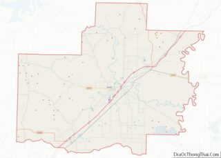
| County: | White County |
| Elevation: | 630 ft (192 m) |
| Total Area: | 6.07 sq mi (15.71 km²) |
| Land Area: | 6.04 sq mi (15.64 km²) |
| Water Area: | 0.03 sq mi (0.07 km²) |
| Total Population: | 494 |
| Population Density: | 81.80/sq mi (31.59/km²) |
| ZIP code: | 72137 |
| Area code: | 501 |
| FIPS code: | 0560770 |
| GNISfeature ID: | 0054191 |
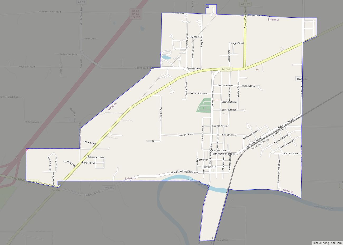
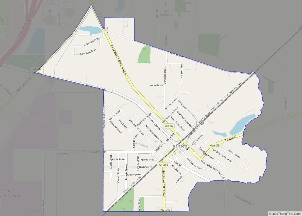
Online Interactive Map
Click on ![]() to view map in "full screen" mode.
to view map in "full screen" mode.
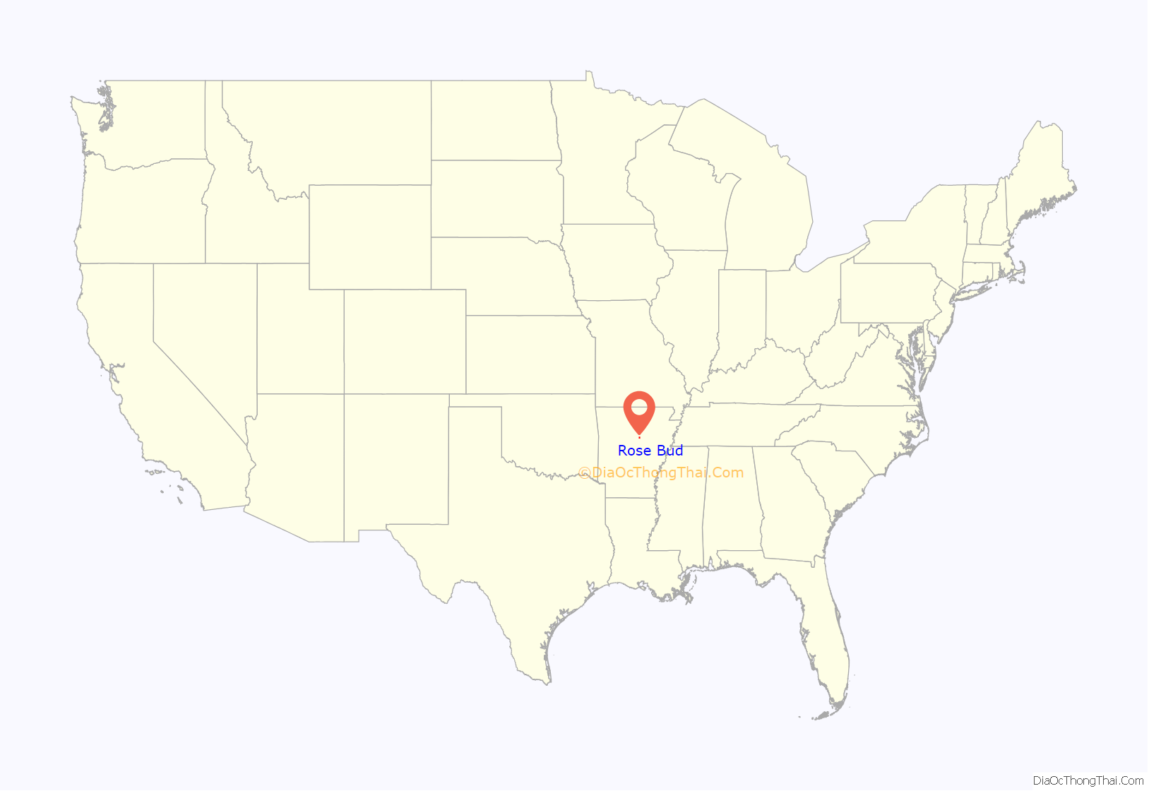
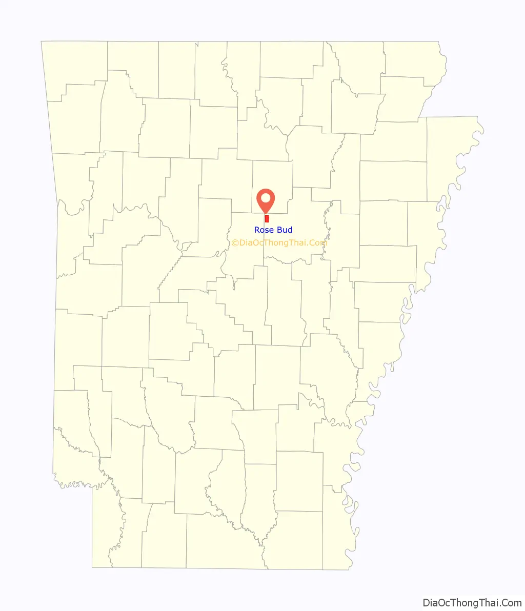
Rose Bud location map. Where is Rose Bud town?
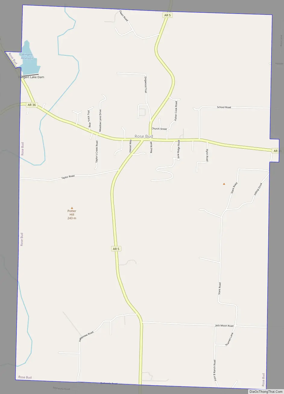
Rose Bud Road Map
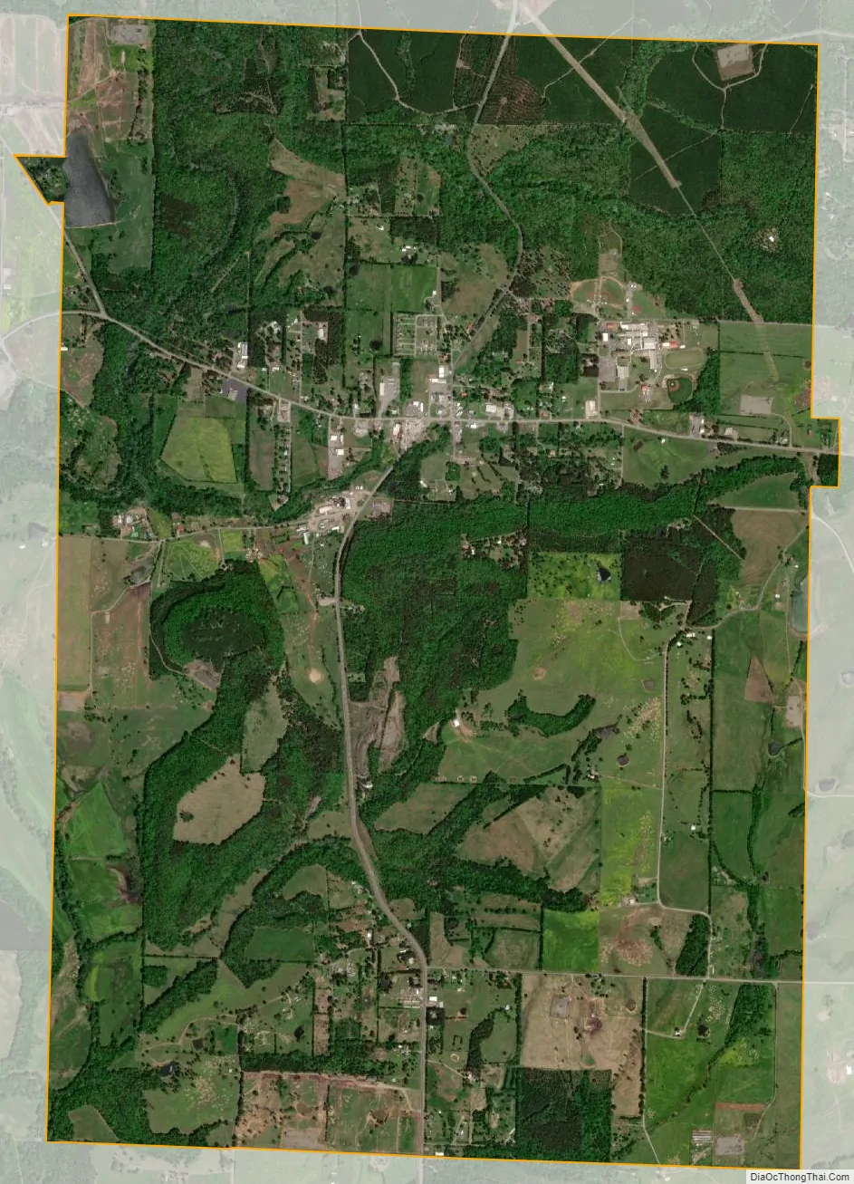
Rose Bud city Satellite Map
Geography
Rose Bud is located at 35°19′56″N 92°04′45″W / 35.332200°N 92.079205°W / 35.332200; -92.079205.
According to the United States Census Bureau, the town has a total area of 15.2 km (5.9 mi), of which 15.2 km (5.9 mi) is land and 0.17% is water.
Rose Bud is the third largest town in the county by area. Composed of mainly wooded area and cattle land.
See also
Map of Arkansas State and its subdivision:- Arkansas
- Ashley
- Baxter
- Benton
- Boone
- Bradley
- Calhoun
- Carroll
- Chicot
- Clark
- Clay
- Cleburne
- Cleveland
- Columbia
- Conway
- Craighead
- Crawford
- Crittenden
- Cross
- Dallas
- Desha
- Drew
- Faulkner
- Franklin
- Fulton
- Garland
- Grant
- Greene
- Hempstead
- Hot Spring
- Howard
- Independence
- Izard
- Jackson
- Jefferson
- Johnson
- Lafayette
- Lawrence
- Lee
- Lincoln
- Little River
- Logan
- Lonoke
- Madison
- Marion
- Miller
- Mississippi
- Monroe
- Montgomery
- Nevada
- Newton
- Ouachita
- Perry
- Phillips
- Pike
- Poinsett
- Polk
- Pope
- Prairie
- Pulaski
- Randolph
- Saint Francis
- Saline
- Scott
- Searcy
- Sebastian
- Sevier
- Sharp
- Stone
- Union
- Van Buren
- Washington
- White
- Woodruff
- Yell
- Alabama
- Alaska
- Arizona
- Arkansas
- California
- Colorado
- Connecticut
- Delaware
- District of Columbia
- Florida
- Georgia
- Hawaii
- Idaho
- Illinois
- Indiana
- Iowa
- Kansas
- Kentucky
- Louisiana
- Maine
- Maryland
- Massachusetts
- Michigan
- Minnesota
- Mississippi
- Missouri
- Montana
- Nebraska
- Nevada
- New Hampshire
- New Jersey
- New Mexico
- New York
- North Carolina
- North Dakota
- Ohio
- Oklahoma
- Oregon
- Pennsylvania
- Rhode Island
- South Carolina
- South Dakota
- Tennessee
- Texas
- Utah
- Vermont
- Virginia
- Washington
- West Virginia
- Wisconsin
- Wyoming